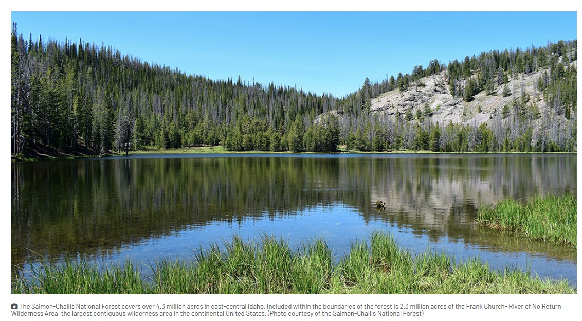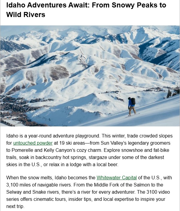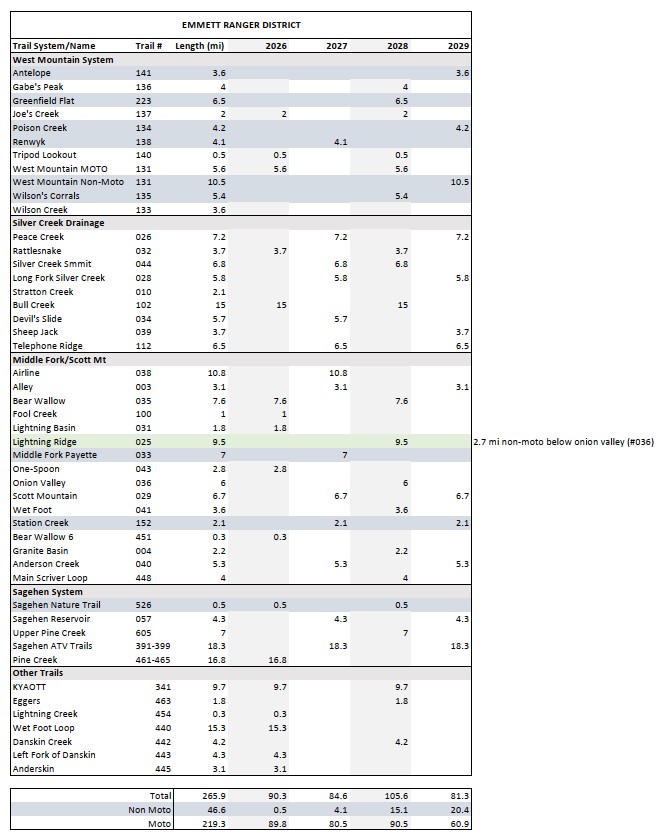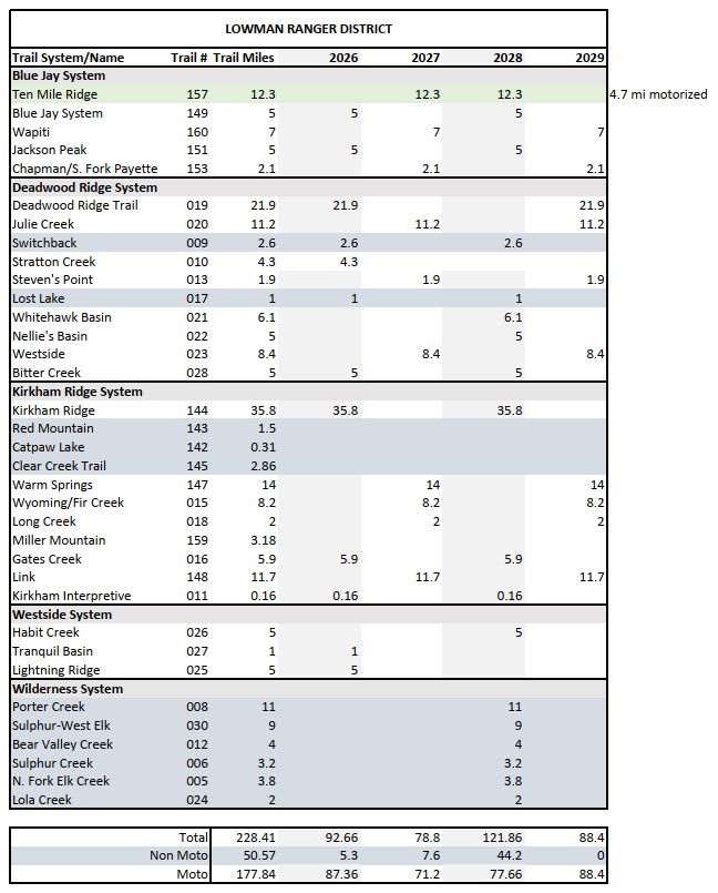
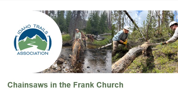
In May of this year, the Salmon-Challis National Forest (SCNF) authorized limited use of gas-powered chainsaws to clear 542 miles of specifically designated trails in the Frank Church-River of No Return Wilderness. Use is limited to the next three years, starting this summer, from January 1 to August 1 of each year, and is limited to users approved by the Forest Service. This work was authorized through a document called the Minimum Requirements Analysis, which you can read about here. Right now, this work is mainly being done by permitted outfitters operating on the Forest.
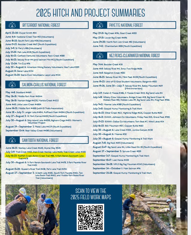
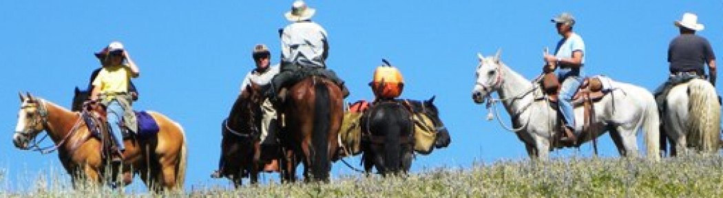
As a boots-on-the-ground, volunteer-based organization, ITA’s primary focus is on getting trail maintenance done on the ground. When we learned of the chainsaw authorization, our first thought was of our twelve planned projects on the Salmon-Challis National Forest in 2026, and which trails approved for chainsaw use overlapped with our schedule.
This means we need to coordinate closely with outfitters to ensure we know where they are operating saws. Our number one priority is well-organized projects with meaningful, safe, and fun work for volunteers, work that contributes to making trails more accessible for the public. It’s more important than ever to communicate with both SCNF personnel and outfitters as we tackle the projects planned in that area this year. ITA will continue to use non-motorized/non-mechanized tools to accomplish this work in designated wilderness areas.
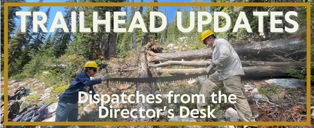
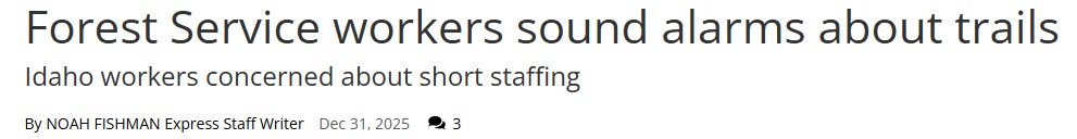
ITA is focusing on being proactive and communicating up front with the Forest Service and outfitters. Where a trail is planned for clearing by chainsaw, as was the recent case with the Marsh Creek Trail, ITA will assess the site to determine if it is still suitable for a good volunteer project. In the case of our recent Marsh Creek project, the answer was “yes”. The Forest Service trail program lead met our crew on the trail for a weekend of removing large boulders and root wads, brushing and improving tread, all work vital to keeping this trail navigable. We will follow this process for future projects and determine if the work remaining is meaningful and suited to volunteers or if the project is best moved somewhere else.
In the short term, as trail season winds down and after hunting season is over and outfitters are out of the backcountry, we plan to participate in Forest Service and partner meetings to review the first year of this program and identify successes, ask questions, raise concerns and discuss challenges and opportunities to improve coordination between partners and the FS and implementation of the MRA itself with its present requirements and allowances.
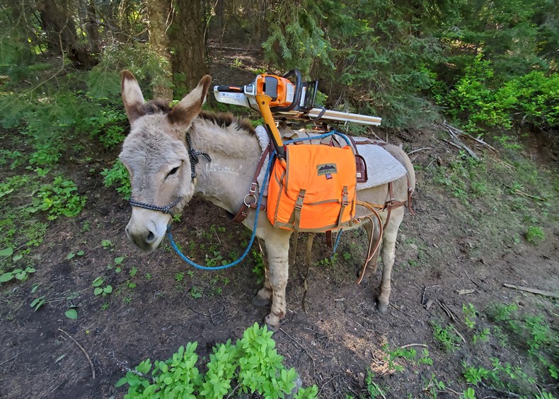
Over the longer term- the next three years- ITA will advocate for a long-term solution that recommits to the use of traditional tools as the way to keep trails open in the wilderness.
We will urge Congress to pass adequate funding for both Forest Service staff and partners. The Forest Service needs to restore the right positions in the right places to coordinate and support work by partners like ITA, conservation corps, and outfitters working in their respective areas.
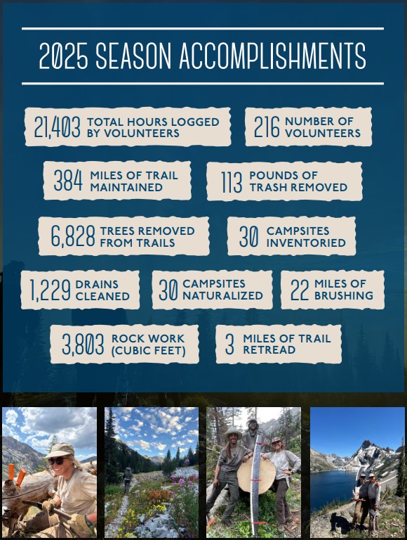
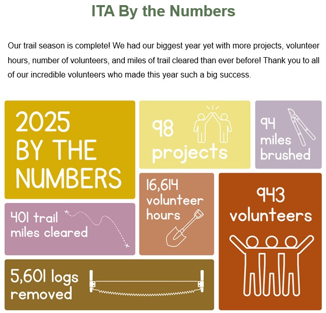
Paid, full-season trail crews are needed. The public land trail system is a national treasure, with tremendous recreational value in today’s times. Recreational value translates to economic value for communities as well. We need trail crews to do all the work – cutting, brushing, tread work, bridges. ITA has proved people value trails; our volunteers worked 16,614 hours on trails in 2025. We are able and willing to learn the wilderness skills to maintain trails. But at the core, we need full-time, skilled Forest Service crews with years of experience to fully utilize volunteers and fully support less experienced paid crews. Over the long term, we need crews on horses and mules or with backpacks, carrying axes and crosscut saws – not chainsaws.
This decision has sparked intense debate. We feel use of mechanized equipment should be the exception to standard wilderness tools and should only be used in emergency situations. Yet, while we look ahead to a future where trails can be maintained using traditional tools, we also must focus on a present where there are hundreds of miles of trails in desperate need of work, from log out to tread repair. We must focus on our role as an on-the-ground organization, dedicated to working with other partners and the Forest Service to get vital work done this season. We care deeply about wilderness and about the traditional tools and skills that have been part of maintaining backcountry trails for decades, and we value our relationships with partners because this will always be a team effort. We will continue to speak for wilderness values while maintaining relationships with our partners, for the good of trails.
Sincerely, Melanie Vining, ITA Executive Director