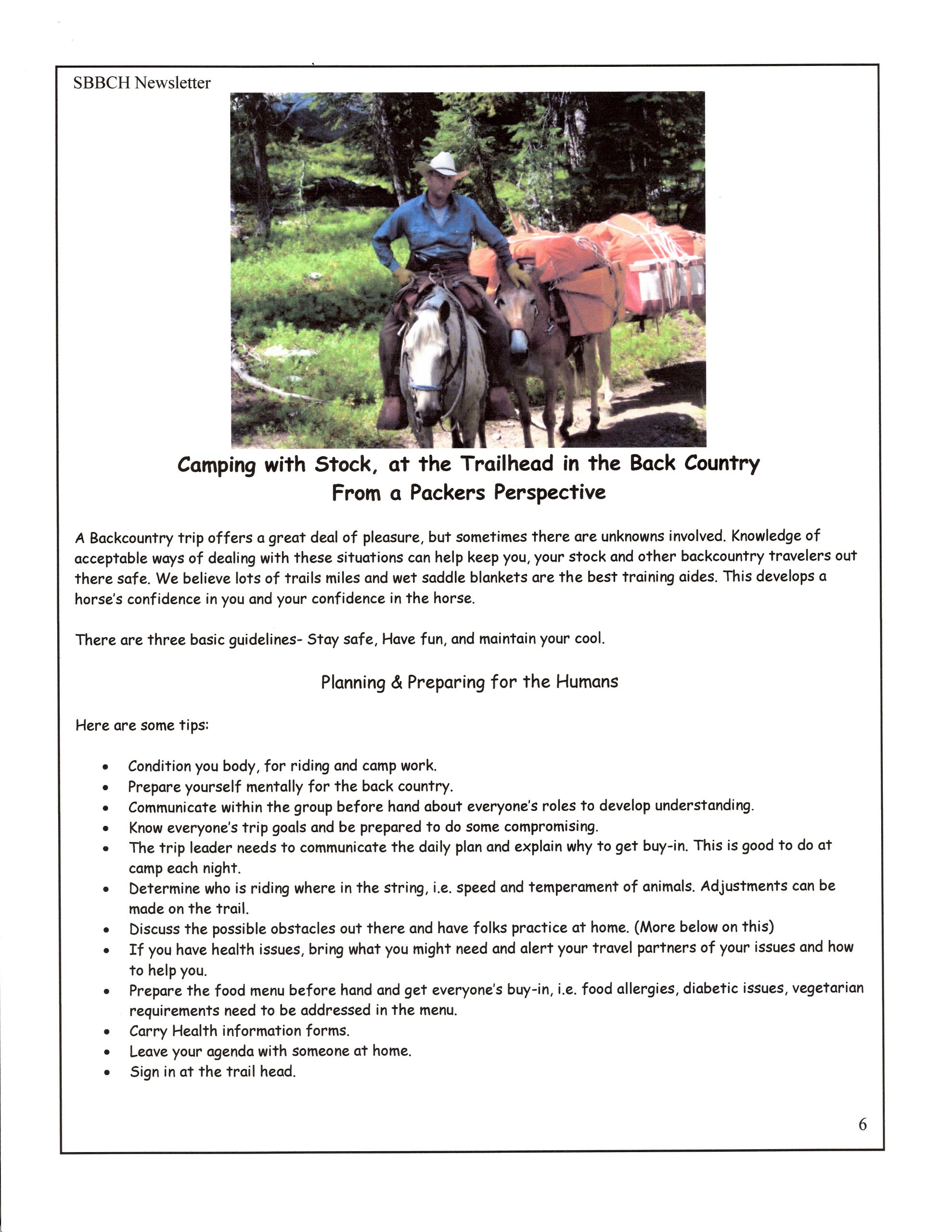
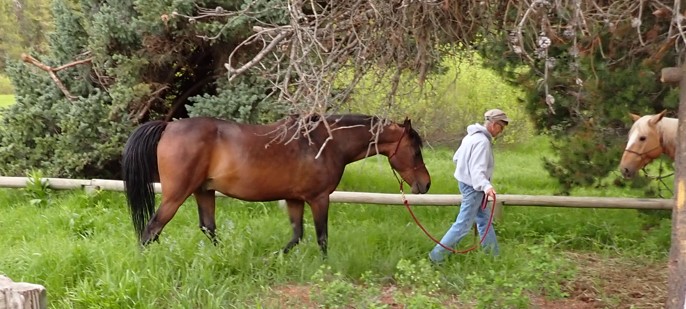
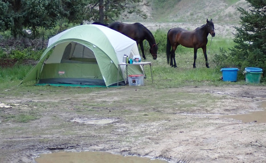
READ MORE: Planning a horse camping trip-TrailMeister
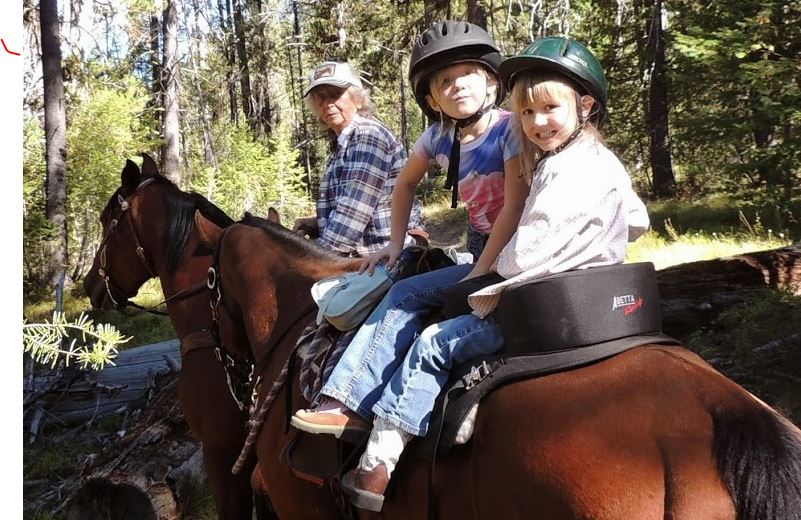
Pictures from the 2023 Project
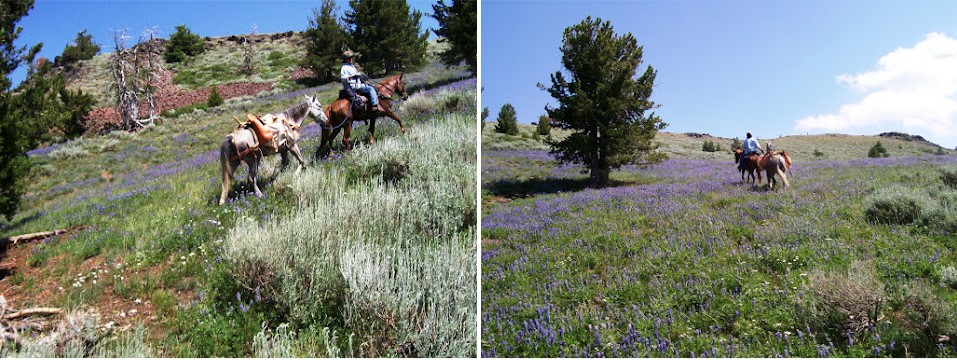
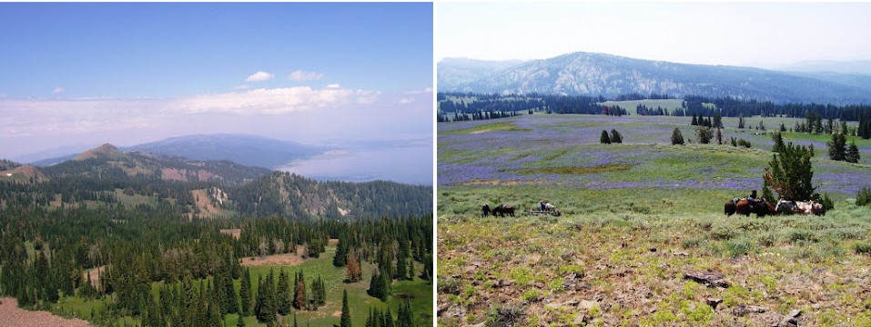
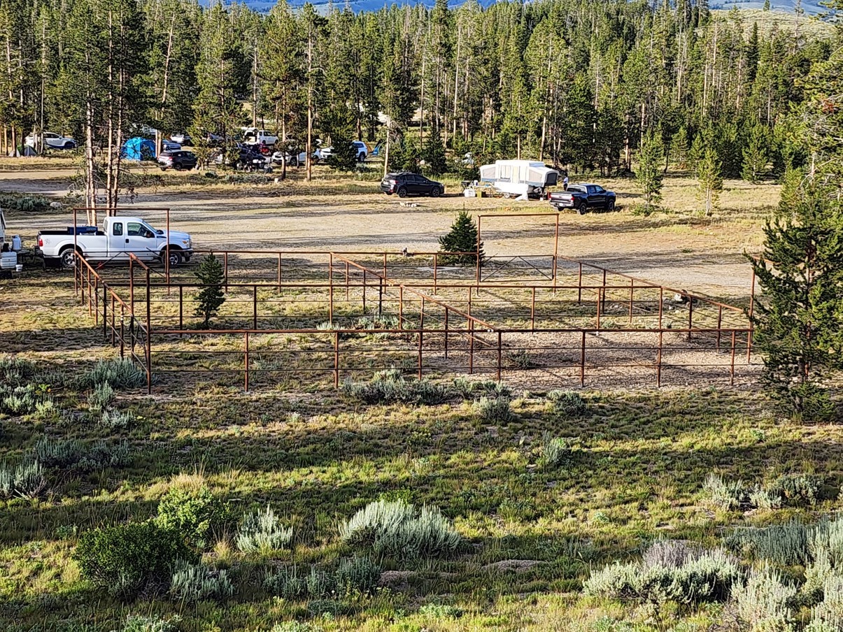
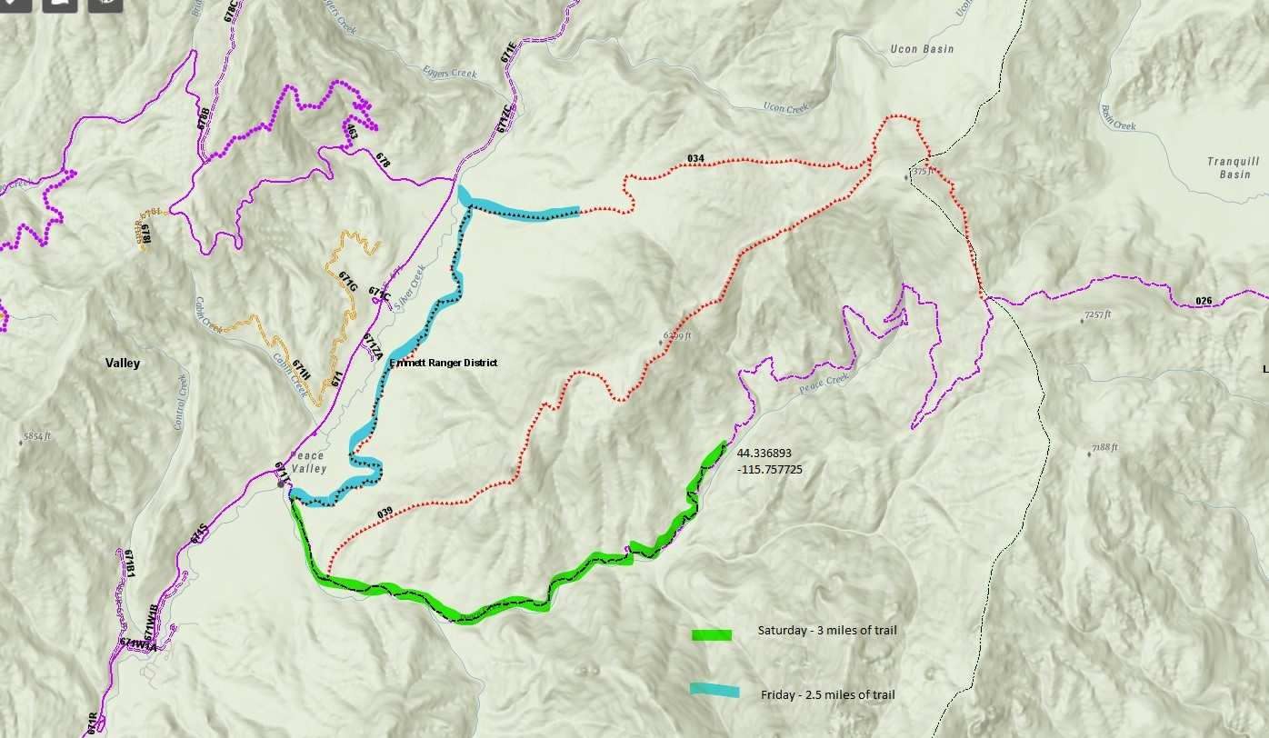
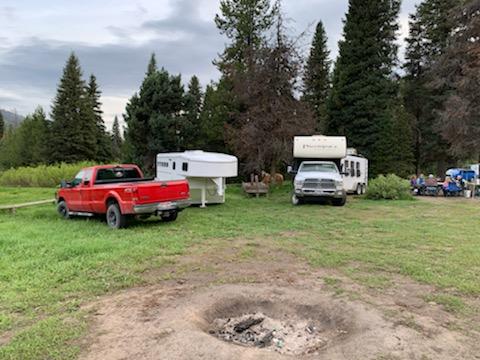
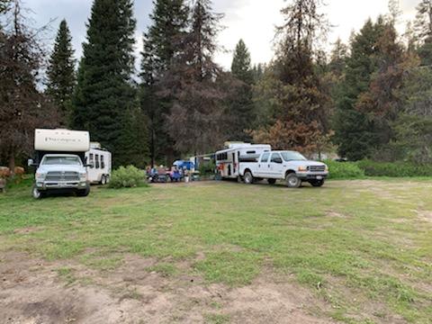
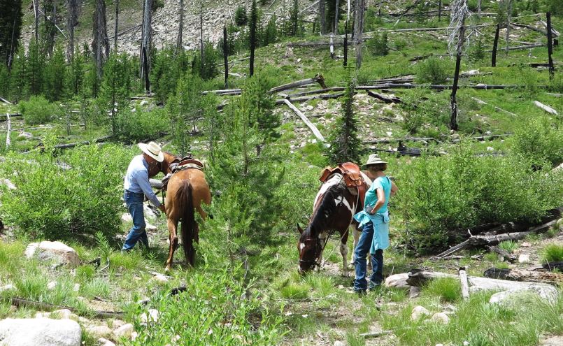
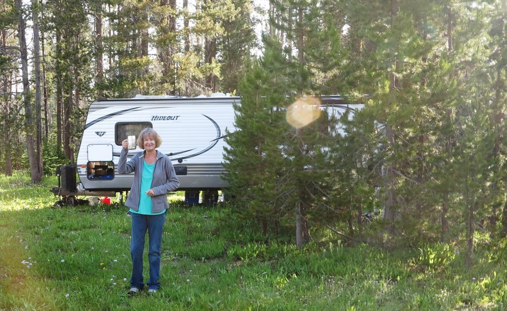
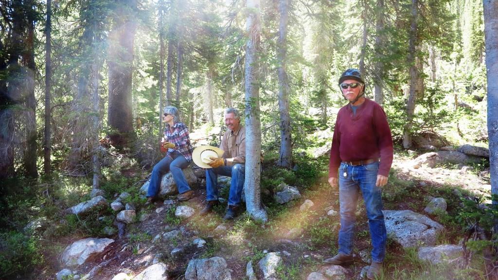
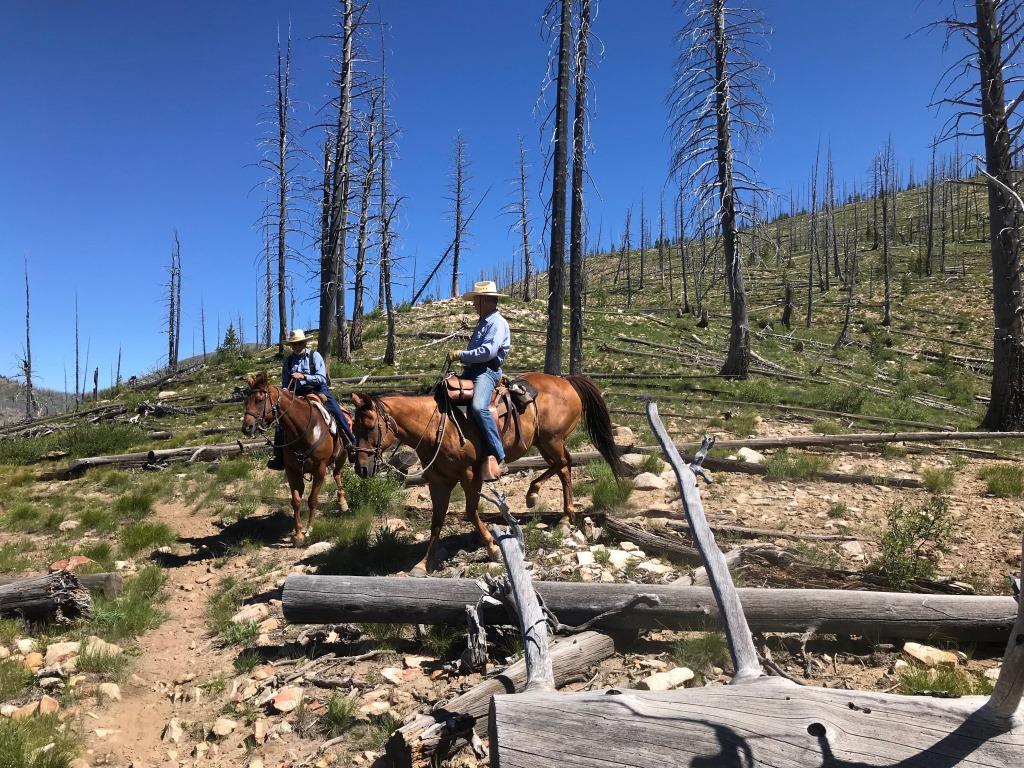
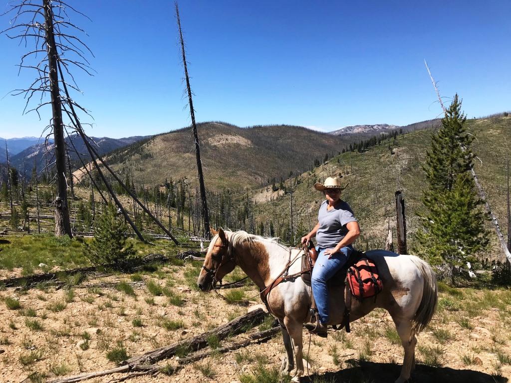
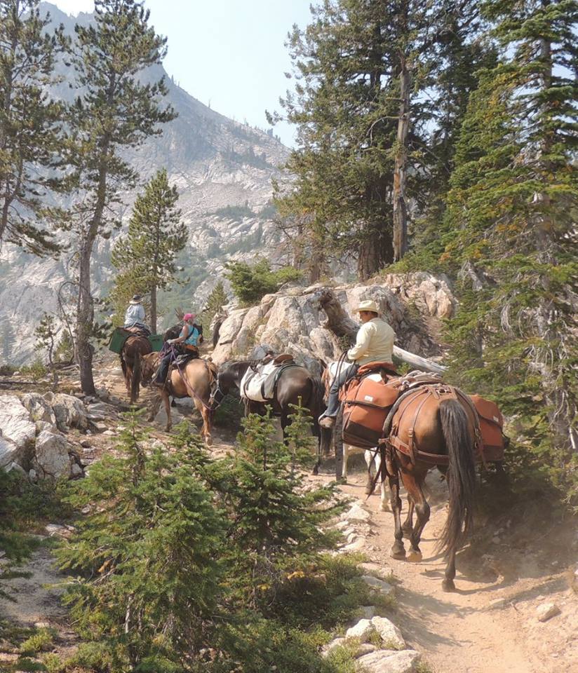
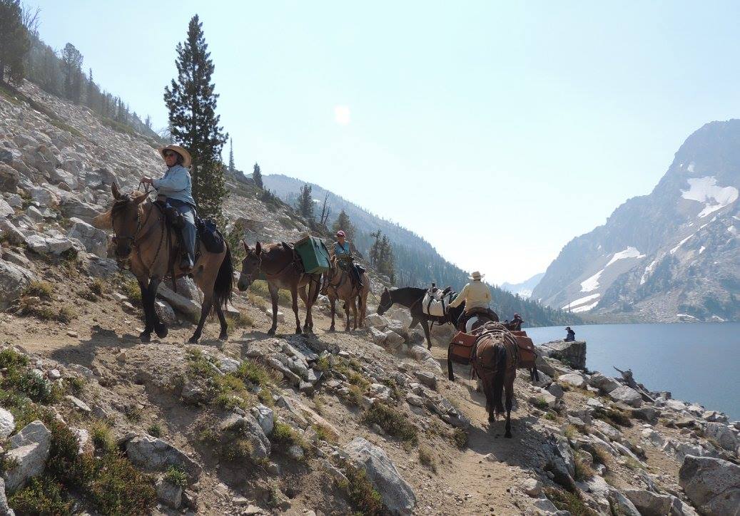
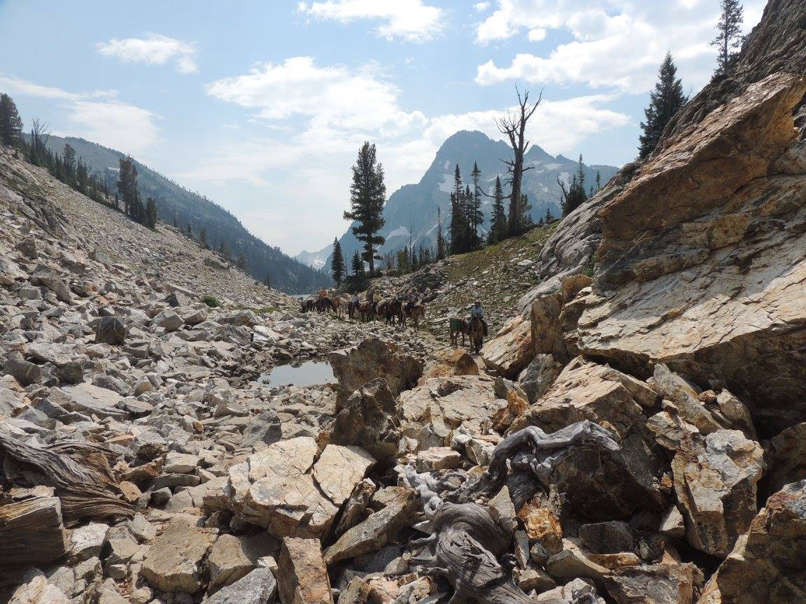
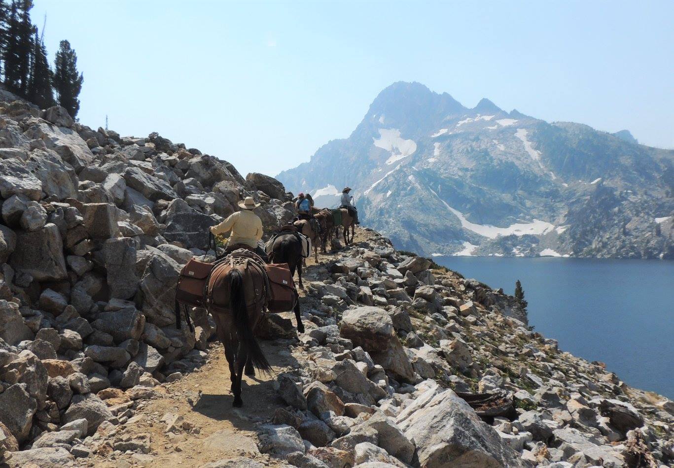
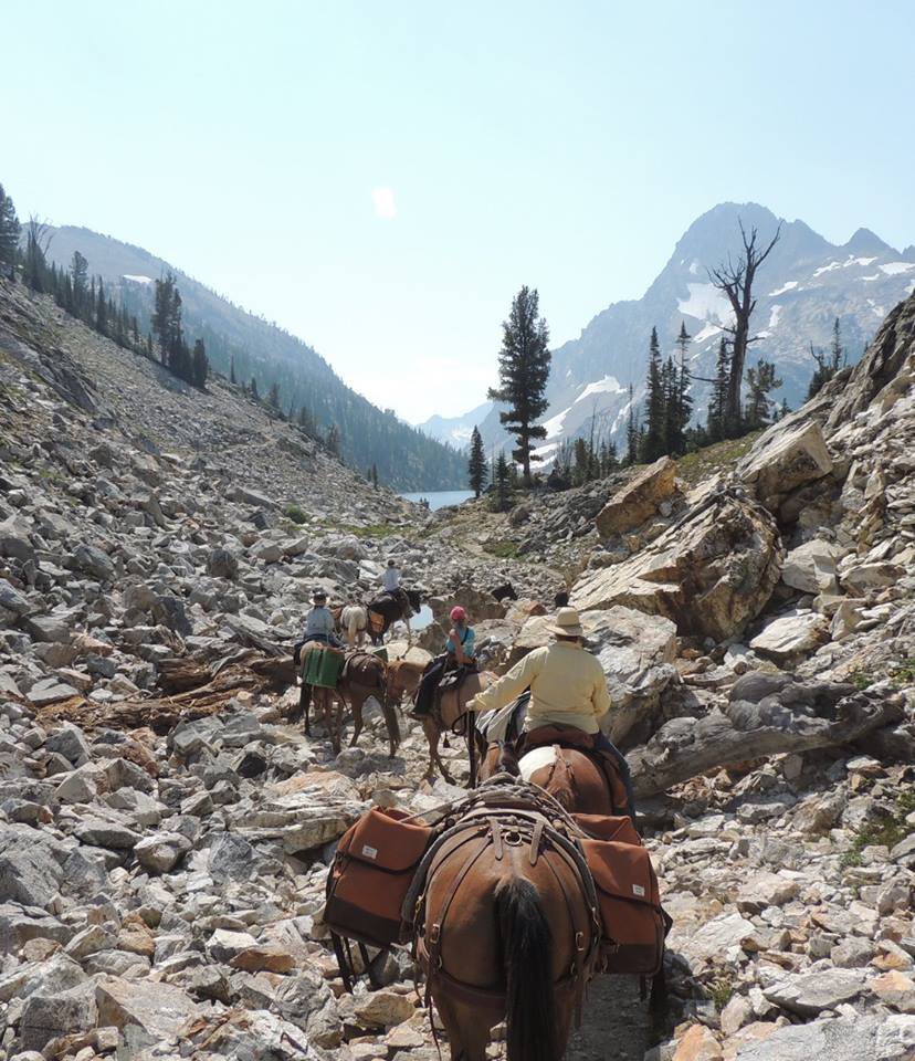
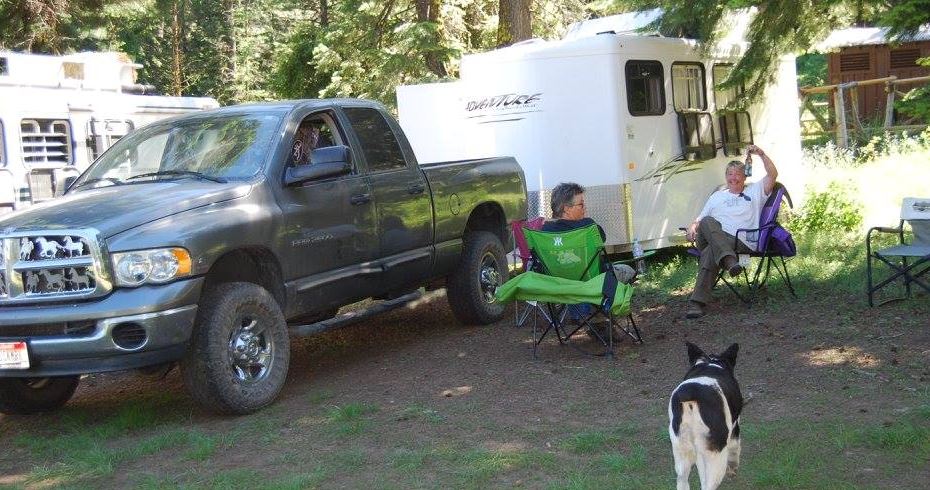
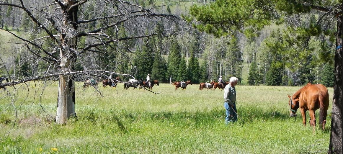
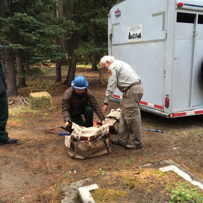
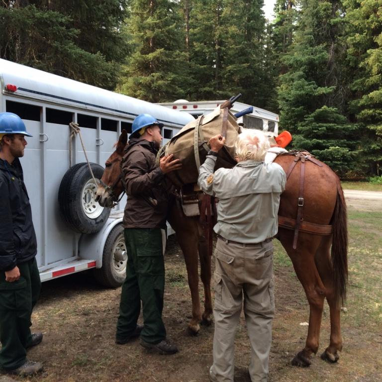
Trail Project – Saturday & Sunday August 19-20, 2023 ( Trail Project & Horse Camping)
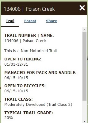
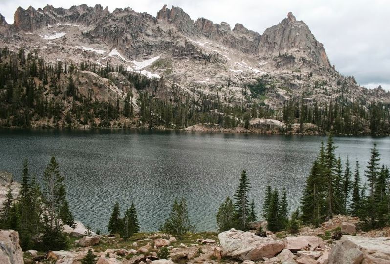
Location: Chief Eagle Eye Creek (west mountain north), & Poison Creek West Mountain, North of Ola, ID
GPS USFS[131] USFS[134] MAP Pictures 2021 SC-2020 PC-2020
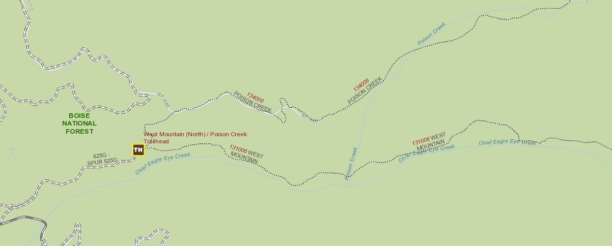
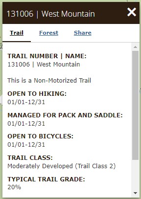
Work will concentrate on Poison Creek Trail – which needs extensive brushing)
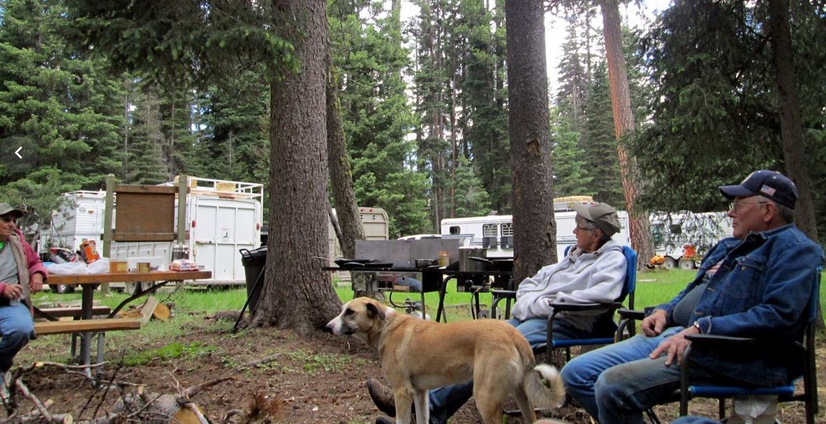
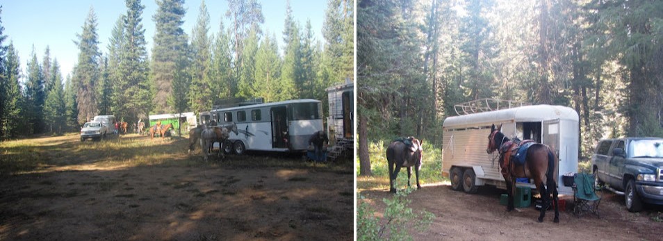
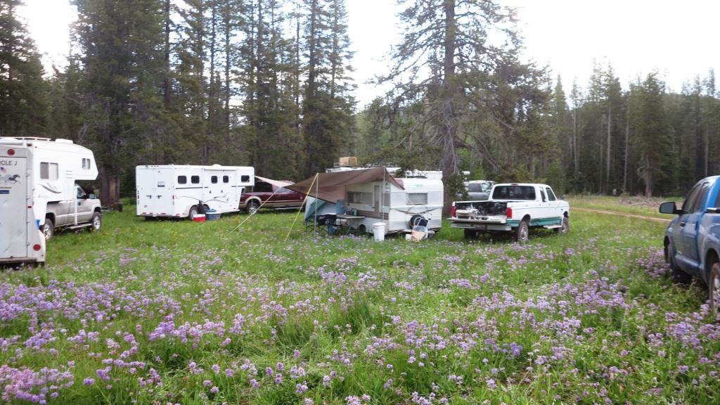
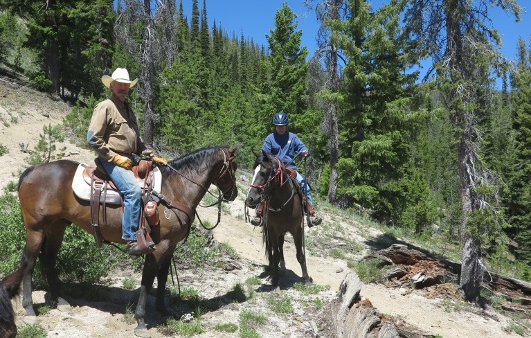
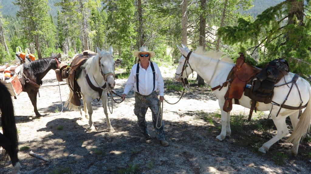
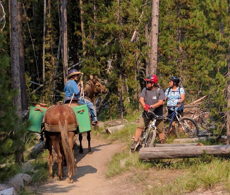
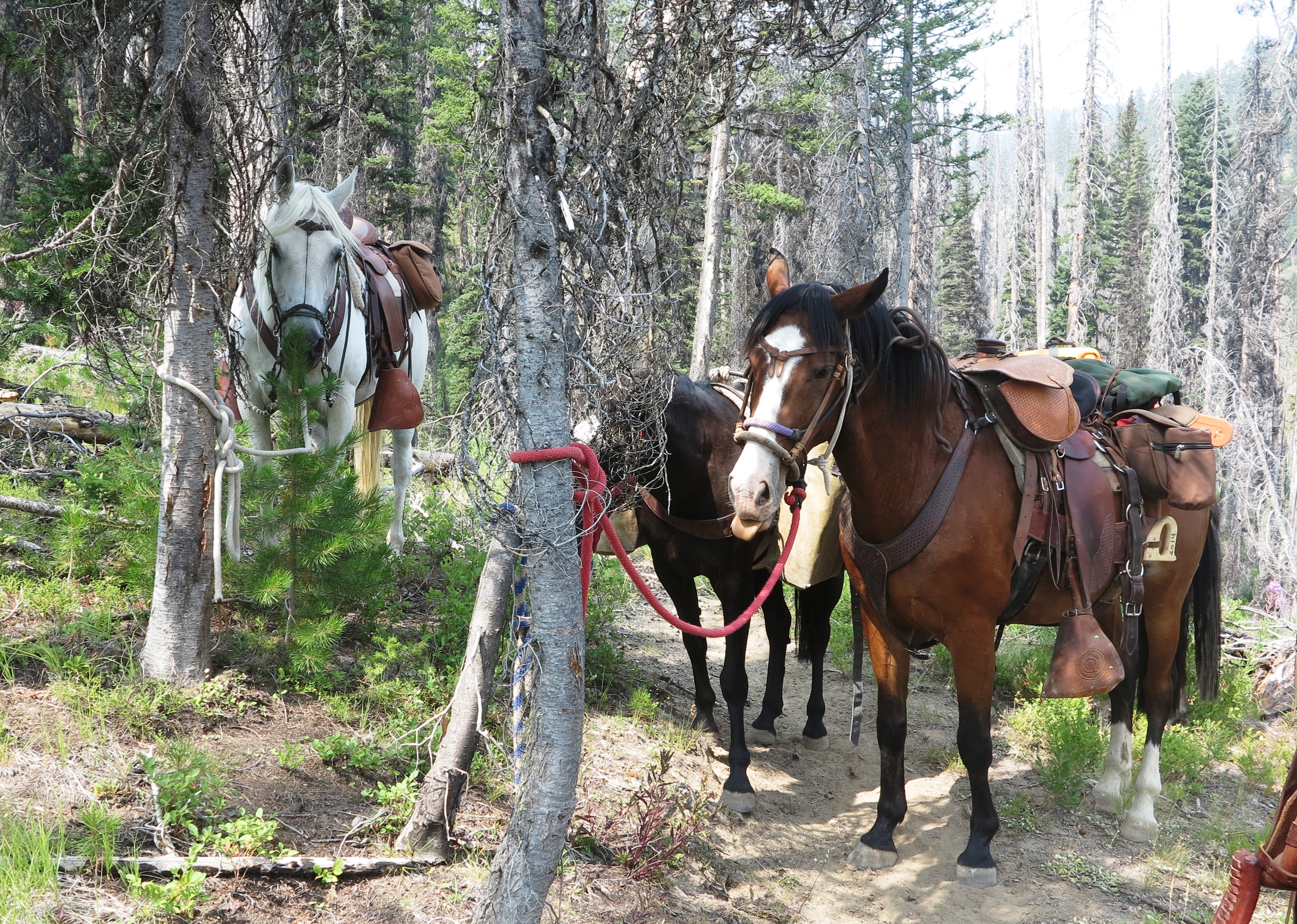
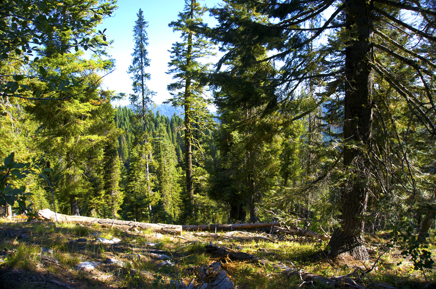
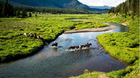
Great horse camping area with some fun but challenging trails. Most people arrive at the camp site on Friday night.
Potluck meals Breakfast (Sat & Sun), Dinner (Sat) – Bring lunches, We will be working on Saturday with a short fun ride on Sunday!
Contact: Rob Adams 208-781-0548 projects@sbbchidaho.org
SIGN UP: https://www.supersaas.com/schedule/sbbchidaho/Squaw_Butte_Events
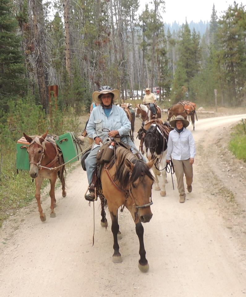
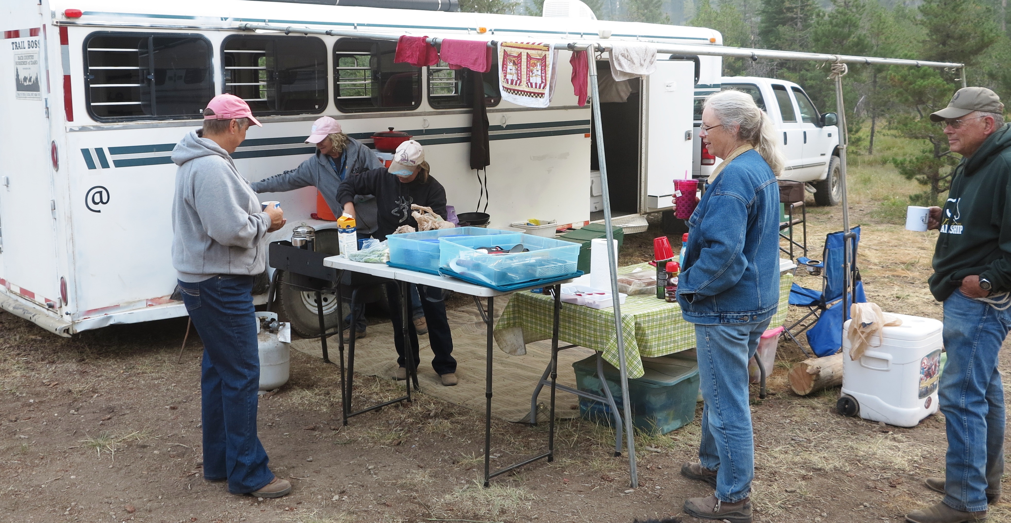
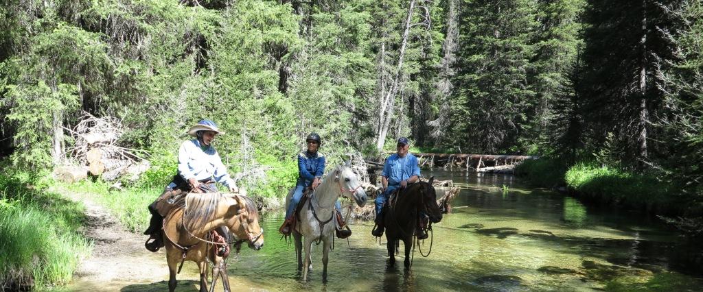
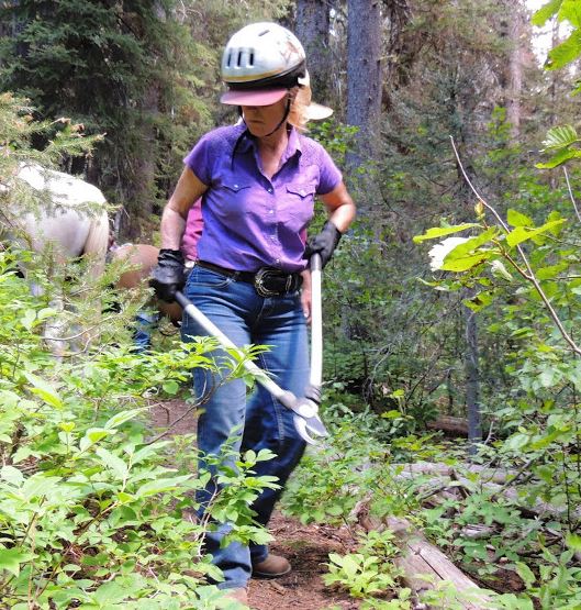
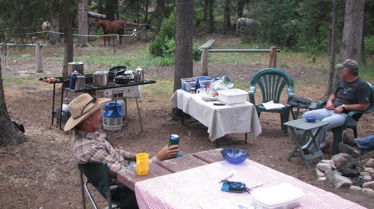
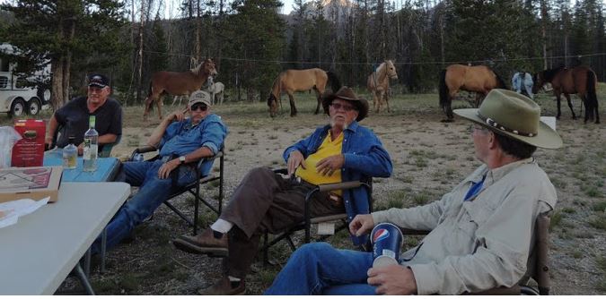
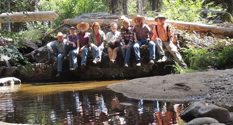
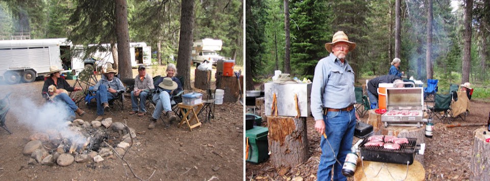
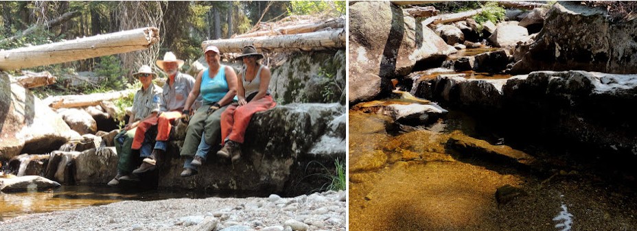
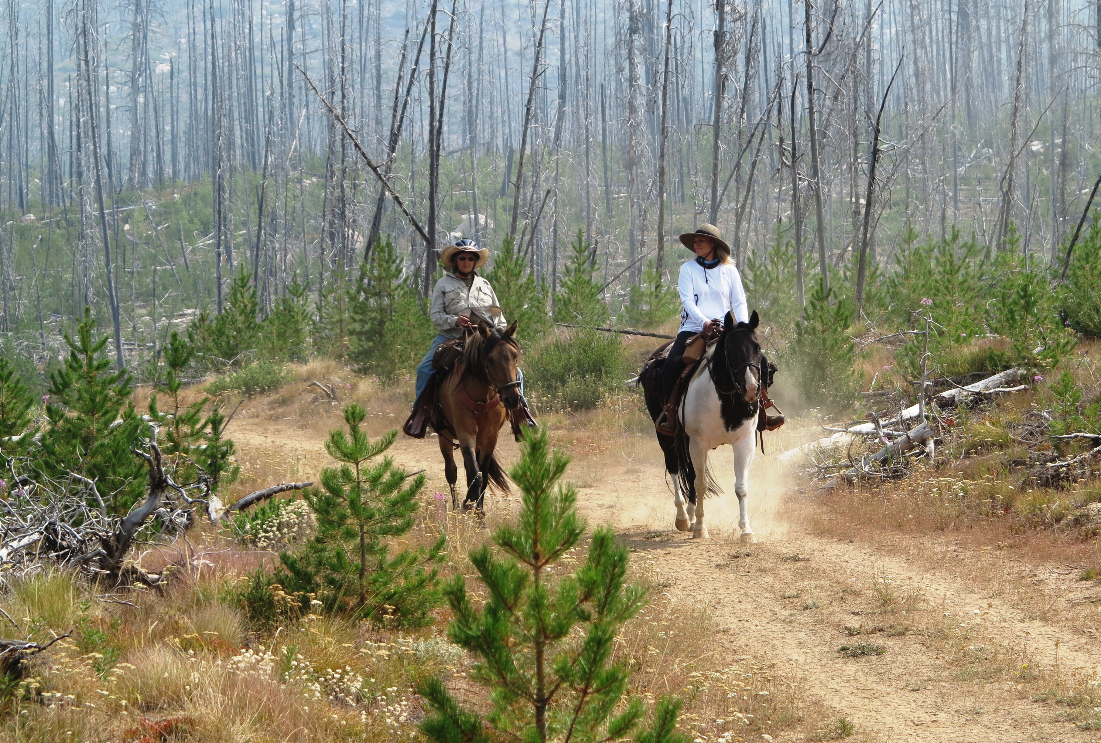
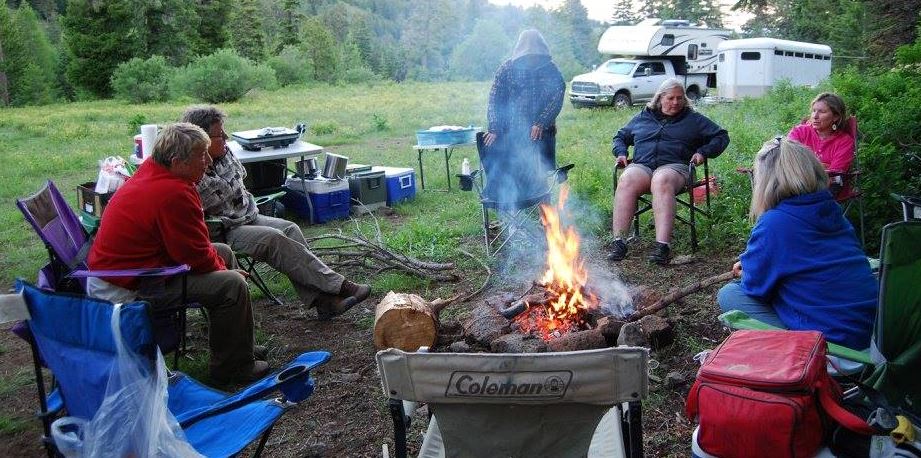
 The weatherman indicated it would likely be a wet weekend, better than the holiday weekend last week, but rain was likely. Friday was cloudy but dry so travel up to the trailhead was uneventful unless you got caught in the backup caused by a multi-car wreck between Horseshoe Bend and Banks. If you were it could add an hour or so to your travel time. By 18:45 everyone who signed up had arrived and set up their camps. An improvised dinner was shared and Jenelle Weeks asked if we still had a set of dominoes in one of the chapter camp boxes. A quick search turned up a double set.

One of the tables was set-up and members gathered to play or watch. Play continued until it was getting to hard to see the dots on the dies. Smiles and laughter were common and all enjoy the time together. By 21:30 the camp settled down for the night.
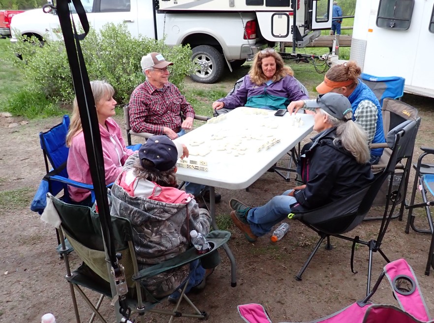
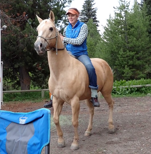
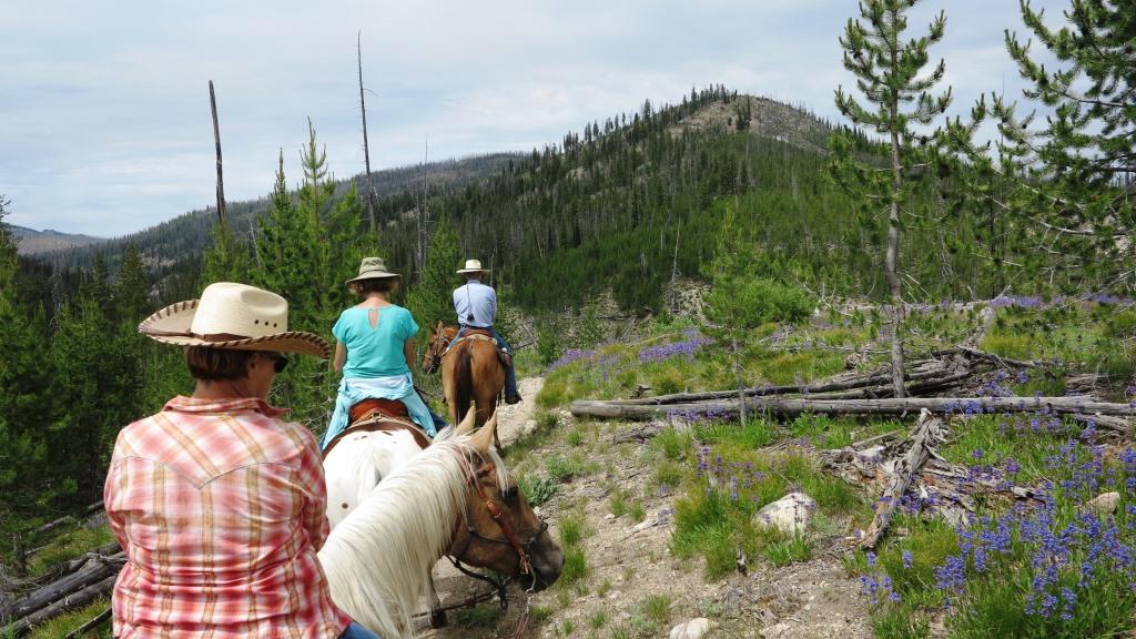
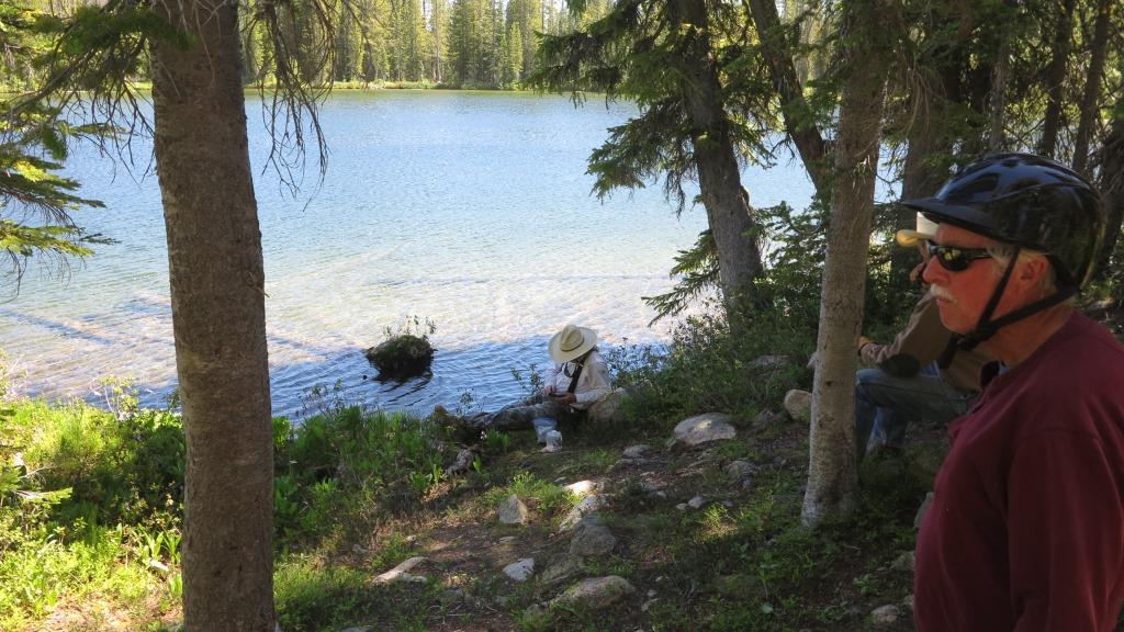
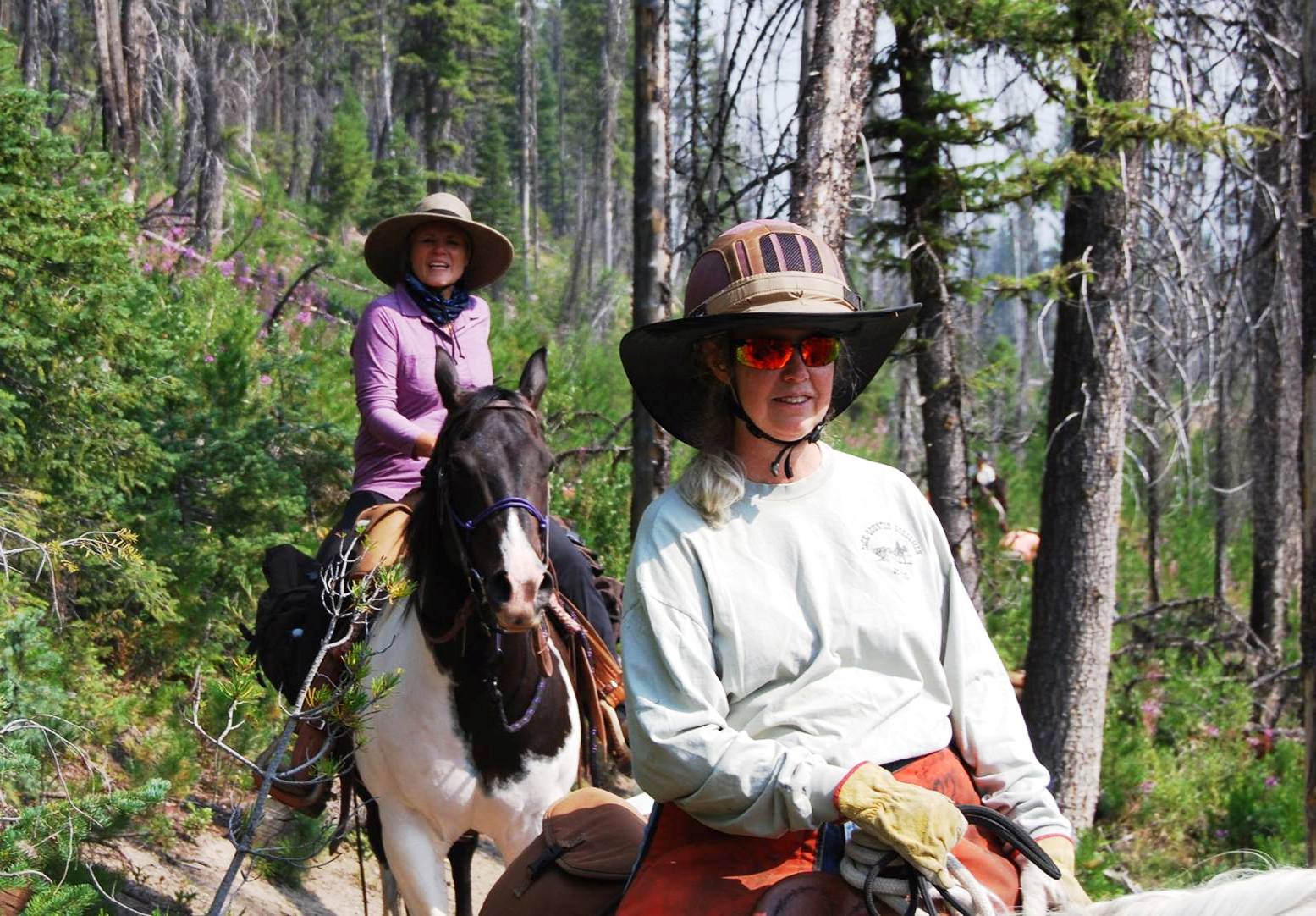
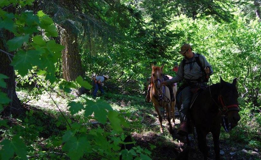
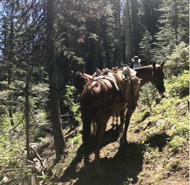
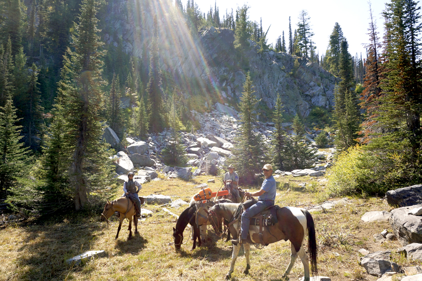
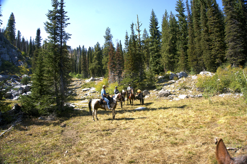
At 06:30 the camp started to stir. As stock were being given breakfast those who’s humans were a bit slow where protesting that they had to wait. By 07:15 the tables were filling with items for breakfast and the smell of coffee and hot chocolate filled the air. As we were washing up, a few rain drops fell so people pulled on their rain gear as they saddled up.
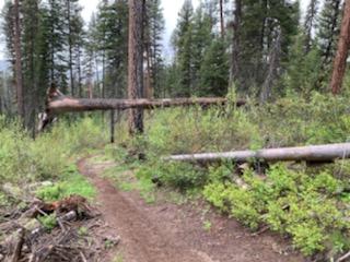
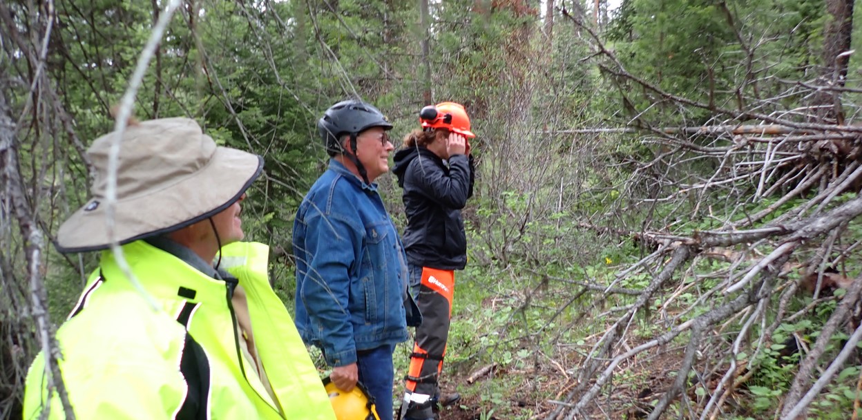

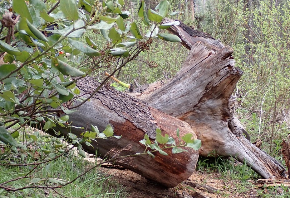
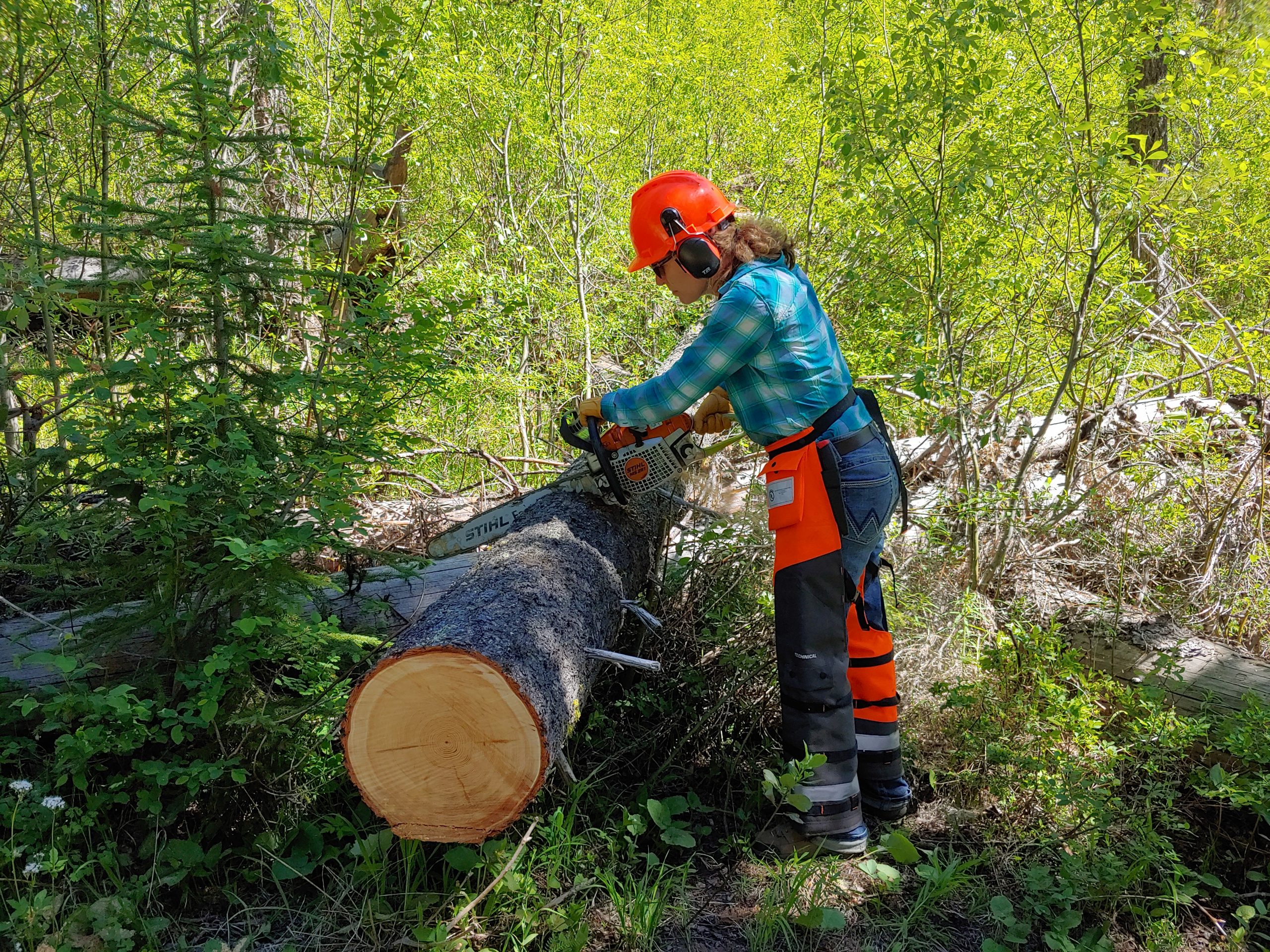
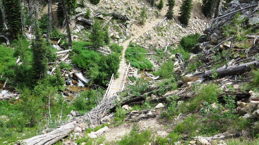
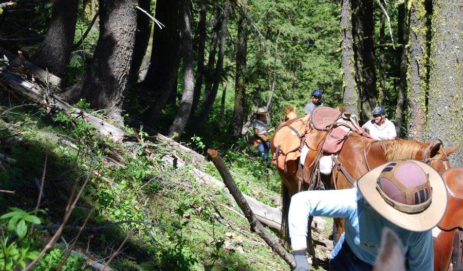
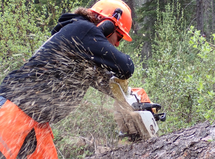 A short distance up the trail was a large log suspended in the air above the trail, that just lit up Charles Chick and Rob Adams eyes. What a great training opportunity! Saw gear was unloaded and PPE was put on and the log was evaluated for binds and other hazards. A cut plan was developed and Rob and Tracy Zamzow did the saw work.
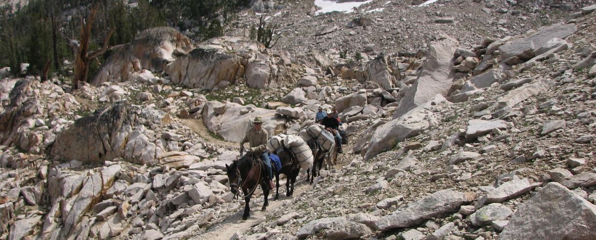
The rain steadily increased throughout the day and by 12:30, four miles up the trail the team found a place to stop, have a snack and head back to the trailers. So this is what it is like to ride alone the pacific coast! After reaching the trailers, the group consensus was that hot showers and our own beds were what we wanted next so we packed up and made the trek back to highway 55 and home. All the rigs were covered with mud by the end of the drive. The rain was a factor on this project but didn’t in any way diminish the enjoyment of the weekend.

At the prompting of BCHA and allies that include the American Horse Council, last month the Forest Service national office circulated a memo to all national forests and national grasslands titled “Recommended Best Practices for Managing Stock Use Sites at Developed Campgrounds.” A copy of that memo can be found here.
We encourage BCHA chapters and volunteers to review this memo and, importantly, to use it as a reason to schedule a meeting with personnel at your local national forest to assist you to achieve the following objectives:
Background
Last year, BCHA approached the Forest Service regarding what options exist to minimize the extent to which parties without stock were occupying designated equestrian campsites throughout the National Forest System. We pointed out that agency policy for developed campgrounds prohibits parties from “Bringing in or possessing a saddle, pack or draft animal except as authorized by posted instructions” (Code of Federal Regulations, Section 36, subsection 261.16(l)). That is, parties with stock are prohibited by law from occupying Forest Service campsites that are not designated for equestrian use.
Yet, there is no corresponding regulation that prevents parties without stock from occupying developed equestrian campsites. The problem of occupied horse camps escalated across the nation during the COVID pandemic, when many families and others chose close-to-home vacations in favor of long-distance travel. The Forest Service memo describes well the implications to stock users of this growing problem.
Horse Camp Incident Report Form
BCHA and its allies developed a Horse Camp Incident Report form for members to capture and record incidents where parties without stock are occupying Forest Service equestrian campsites. The form can be found here. An online version of the form can be downloaded to your smart phone; it can be accessed here.
The purpose of the form is to support BCHA should we need to make the case for new regulations to prevent parties without stock from occupying equestrian campsites. BCHA is pleased that the Forest Service issued the aforementioned memo to field staff; it represents a logical first step to apply education to help lessen the problem.
We don’t know that education alone will prove sufficient to solve the horse camping problem. By collecting your accounts of incidents in the field, we might better document the magnitude and geographic extent of the problem. Consequently, BCHA is relying on its members to provide data from the field of your observations, should we need to promote further solutions.
Special notes:
PRINT INCIDENT FORM // ONLINE INCIDENT FORM
Managing Horse Camp Sites_whitepaper_FINAL
 Aug 2019 – Marybeth Conger
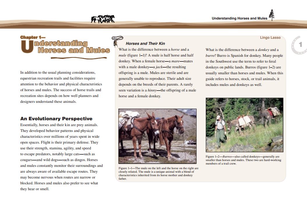
“There is nothing better than having one of your favorite trail friends get that itch!” says Marybeth Conger. Cherokee and Scout are showing us how to get the job done.
Just got home from an amazing backcountry trip. Four great days near the Warm Springs trail head, ID with Bill Conger along with Lynn and Peggy Garner. Our four-legged animals all got along, the weather was absolutely great, we saw some breathtaking backcountry views, and the food/meals got an average 4.5 star rating. All of us had fun even when we cleared trails on two of the riding days. Just need to log our volunteer trail clearing hours since they give the BCH organization leverage in terms of the financial impact they have.
This trip is why I joined the Backcountry organization some 30 years ago. Great riding adventures with friends as we put our mighty muscles to work clearing trails. One difference I did notice between then and now is how I only have so many “get on and offs” before I start groaning!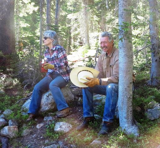

Pictures & Story by Laurie Bryan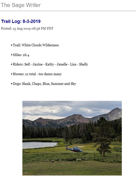 Read the whole story / Link to Pictures
We visited Washington’s Haney Meadow horse camp and ran into a BCHW Work Crew. They’re a hard working group of dedicated group of people who are making the horse camp even better. Here’s a great conversation that we had with a few of the folks in the Back Country Horsemen of Washington making the Haney Meadow horse camp great again.
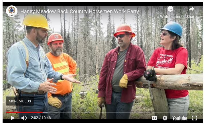
For more info on Haney Meadow and the Ken Wilcox horse camp here’s the link! – https://www.trailmeister.com/trails/haney-meadow-ken-wilcox-horse-camp/

 On June 22, 2019 members Rob Adams, Janine Townsend, Janelle & Troy Weeks, were joined by Treasure Valley members Justin & Shauna Stucker and BNF northern trail crew members Nikki & Anthony. Anthony had ridden with us at this location in 2018 when we had removed over 50 downed trees, and expected to do the same this time.
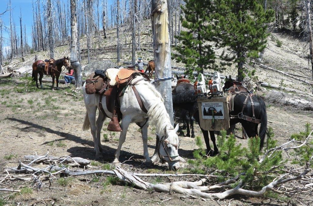
 READ MORE
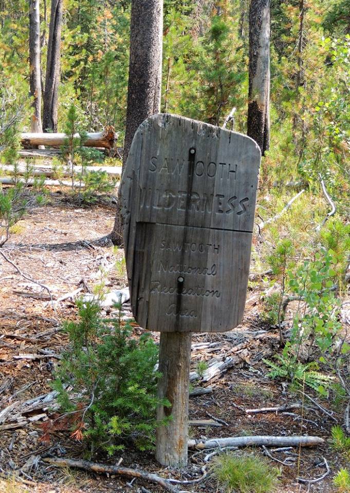
The Middle Fork Ranger District (MFRD) office is located in Challis, Idaho, and is one of six districts on the Salmon-Challis National Forest. The Middle Fork District administers and oversees over one million acres of land, including over 900,000 acres of the Frank Church River of No Return Wilderness (FC-RONRW) area, one of the last intact wild places in the lower 48 states.
A land of steep mountains, deep canyons, and wild rivers, the Frank Church – River of No Return Wilderness is the second largest Wilderness in the lower 48 states at 2.4 million acres. The FC-RONRW provides outstanding opportunities for primitive recreation experiences, with over 2600 miles of trails linking the various airfields, rivers, trailheads and perimeter access roads. The condition of these access roads varies significantly; some are not suitable for trailers, others are passable only to high-clearance, 4-wheel-drive vehicles or ATVs. The best opportunities for solitude are in the trailless areas, which total 1.5 million acres in the Wilderness. Maintenance of this large, remote wilderness trail system is challenging. Large fires, short field seasons, limited access, and Mother Nature (wind, rain, slides, etc.) all contribute to the difficulties of keeping these trails open. Most of the trails were built before 1930; many are steep, rocky, eroded, poorly located and poorly drained. Numerous trails are in primitive condition.
The Middle Fork also manages the newly designated Jim McClure-Jerry Peak Wilderness.
Visit the Special Places section for more information about these two Wilderness areas. READ MORE
 Link to District Information

Turn off highway 21, just past Banner summit on a gravel road, look for the Bench Creek camp ground sign.


More Pictures Three trails ridden, fishing, amazing food, and interesting conversations around the camp fire, a totally awesome weekend!


About Wilderness Volunteers: https://www.wildernessvolunteers.org/about-wv.html
The Project:
Central Idaho’s Sawtooth National Recreation Area and Sawtooth Wilderness are known for the rugged grandeur of their soaring 10,000 foot peaks, flowery mountain meadows, crystal clear lakes, towering alpine forests, and abundant wildlife, including elk, mountain goats, black bear, wolves, wolverines and pikas! Backpacking and hiking are spectacular in this country, and trout fishing is exceptional in backcountry lakes and streams. Our journey will begin at the beautiful Stanley Lake – just a few miles outside of the alluring mountain community of Stanley, Idaho. The area has several accessible hot springs, historic sites and other great places to play in and explore.
Our service project will be heavy trail maintenance in the remarkable Sawtooth Wilderness. We’ll set up a base camp at McGown Lakes at 8505’elevation after a backpack of 6.5 miles with pack support for tools, food and commissary supplies. Crew will camp at McGown Lakes and hike about a mile to project location on other side of 8,800’ pass. Most of the work will be focused on heavy trail maintenance and tread repair (Iron Creek – Stanley Lake Trail 640) above Sawtooth Lake, where the trail has sloughed in and become narrow and hazardous. Tread will need to be regraded to standard width with hand tools, rocks removed with hand tools and some rock wall constructed. If time permits Observation Peak Trail 614 which has not been maintained in several years will need heavy maintenance using a crosscut saw to clear downed trees, digging new trail tread, moving rocks, dirt and vegetation. Free time can be spent exploring the ever beautiful Sawtooth Wilderness – relaxing, fishing in alpine lakes, taking pictures, or setting off on a more strenuous hike to the secluded Trail Creek Lakes.
Additional Information: Crew will hike in about 6.5 miles from Stanley Lake Trailhead, or about the same distance from Iron Creek Trailhead. Pack stock will transport gear from Stanley Lake (6,500’) to the campsite at McGown Lakes (8,505’). This area was burned in 2003 by the Trailhead Fire. Iron Creek Trailhead (6.700’) and trail to Sawtooth Lake are the most heavily used access in the Sawtooth Wilderness, and for good reason – the spectacular alpine scenery is unparalleled! Expect hot temperatures and strenuous work on exposed mountain side with world class views. Water for the full day will need to be packed from camp.
This project is rated as a challenging project.
Challenging+
– Strenuous with longer backpacks, off-trail backpacks, sometimes with significant elevation changes. Also trips with camping and work at elevation, or canoeing with portages. These trips are very challenging and require excellent aerobic conditioning, past experience in outdoor settings and familiarity with backcountry camping. Challenging projects are not for beginners.
We highly recommend that those coming from low elevation (anything below about 5,000 feet) plan an extra couple days in the area before the trip to acclimate to the elevation for your own safety. Altitude sickness is a concern when traveling from low elevation to high elevation and getting acclimatized before the trip is one of the easiest ways to prevent it. If you need ideas on things to do/see before the trip contact your leaders.
Who can Volunteer? https://www.wildernessvolunteers.org/who-can-volunteer.html
WV Leaders for this Project
Aidalicia Swertfeger
is vying for that “life less ordinary” as she attempts to merge her zest for the outdoors with her technical education in communication design. Growing up in the foothills of the Sierras, Aidalicia lived for winters snowboarding in Tahoe, something she misses greatly. Having moved to Austin, Texas to complete her degree, she has realized she needs texture and pitch in her horizon. Planning on a Pacific Northwest relocation, she’ll continue on as a runner, an IPA girl, an avid solo traveler, a thru-hiker and a practitioner of minimalism.
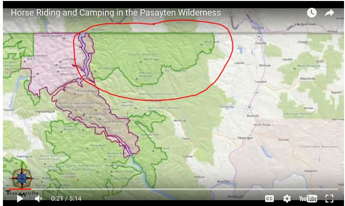
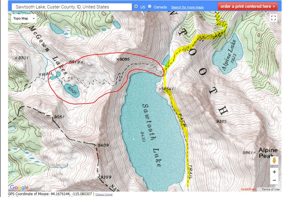 The project trail is indicated by the area circled in red.
 The Trail to the camping and work area was from the Iron Creek Trail-head, to Sawtooth’s lakes southern end. This is the second most popular trail in the Sawtooth area and is utilized by hikers, back packers and their pets!
Back Country Horsemen of Idaho – Squaw Butte Chapter volunteered to provide packing support for this project working with the Wilderness Volunteer leaders and the Sawtooth Ranger District.
From: Dorr, Jay -FS
Sent: Friday, August 25, 2017 09:06
To: Zoe Putter ; Rob Adams
Cc: Caitlin Frawley -FS; Dean, Liese -FS
Subject: RE: McGown Peak – Pack Support Project – August 26 – September 2
Stanley Lake drainage is still closed for fire and crew did not finish cutting out trail to McGown from that side.
Plan to go in from Iron Creek and camp at Sawtooth Lake.
I would rather not send pack string up that trail with all of the foot traffic it gets or have crew camp at Sawtooth Lake with all of the other use it gets. There is usually lots of traffic on Labor day weekend.
That is our best alternative with the fire in Stanley Lake drainage. Crew can work on original project. If they finish and have time, they can work around Sawtooth Lake and down North Fork Baron a ways. They can make some repairs in narrow spots along Sawtooth Lake. There are a lot of rock to remove from trail going that way.
If there are not campsites at Iron Creek Campground, there are undeveloped sites back down road.
Horse trailer parking may be difficult when Rob comes back to pack out camp. He may have to park a ways back down road.
I have been away working on other parts of forest and have not had email access until this morning. Caitlin is working on fire for a few days.
Please get word out to crew on change of meeting location and access. Sorry for short notice but fires are never convenient.
Have a great trip,
Jay
 BCHI
BCHI
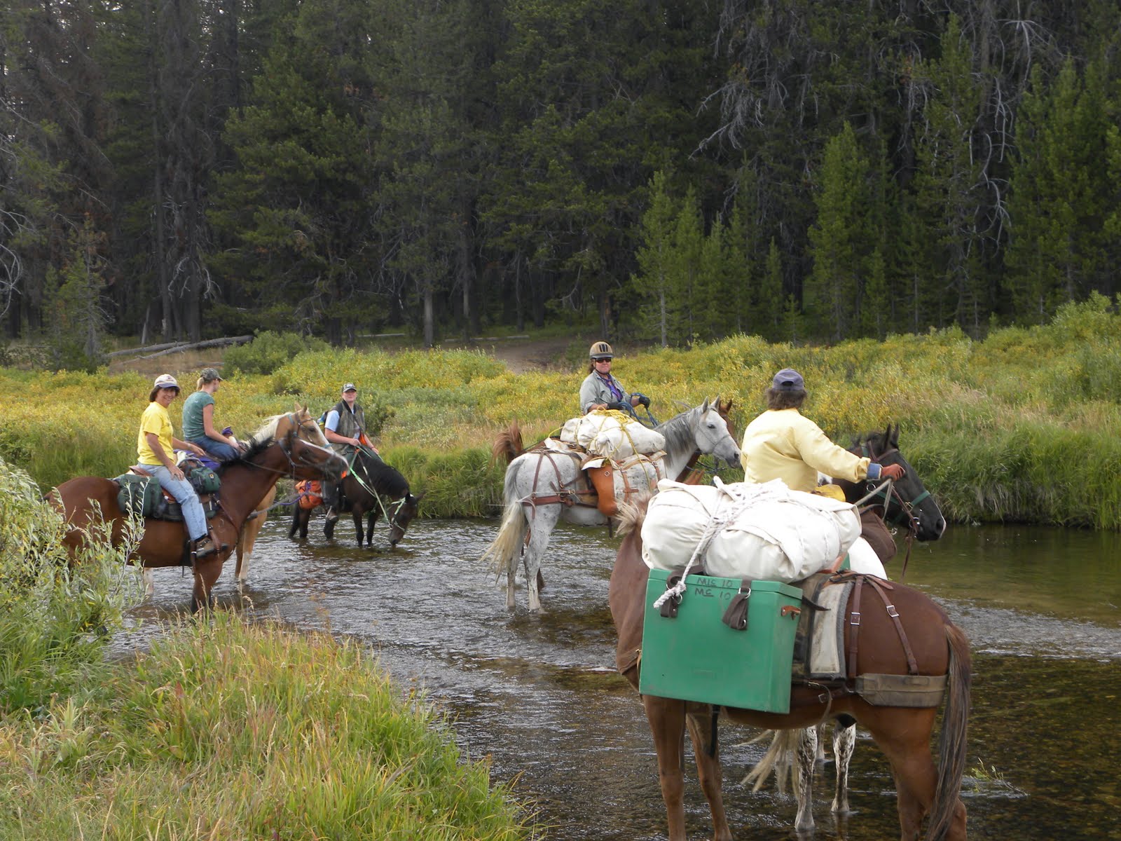
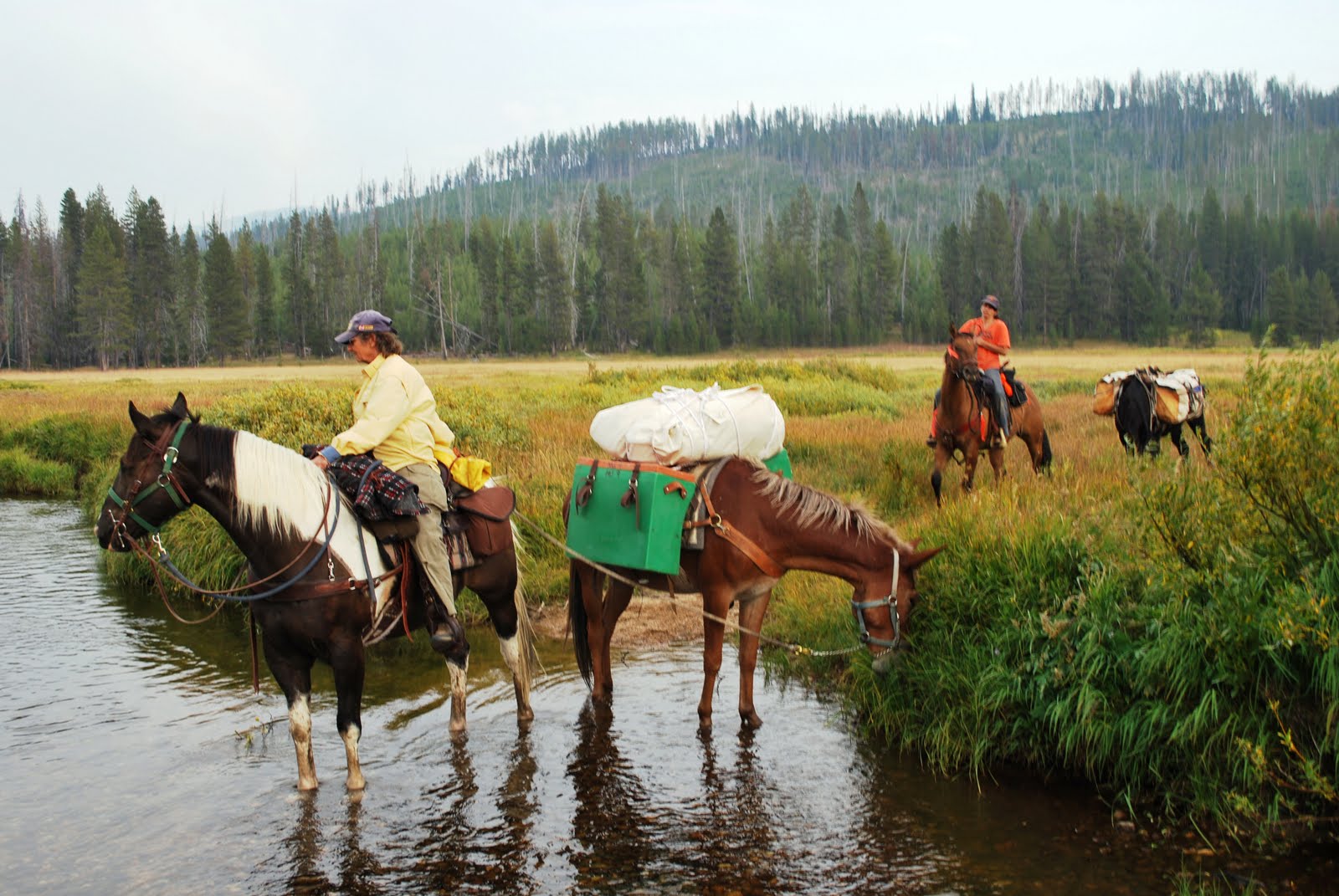
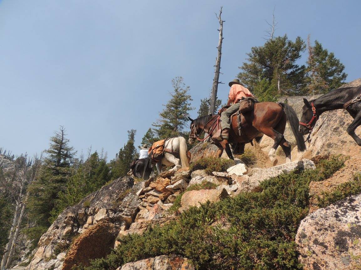
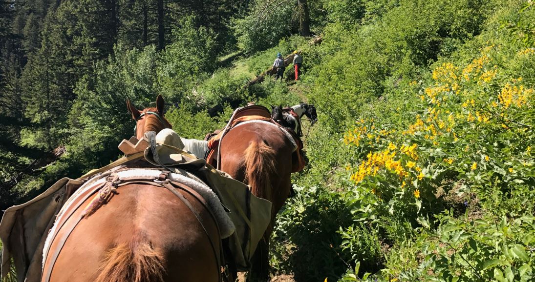
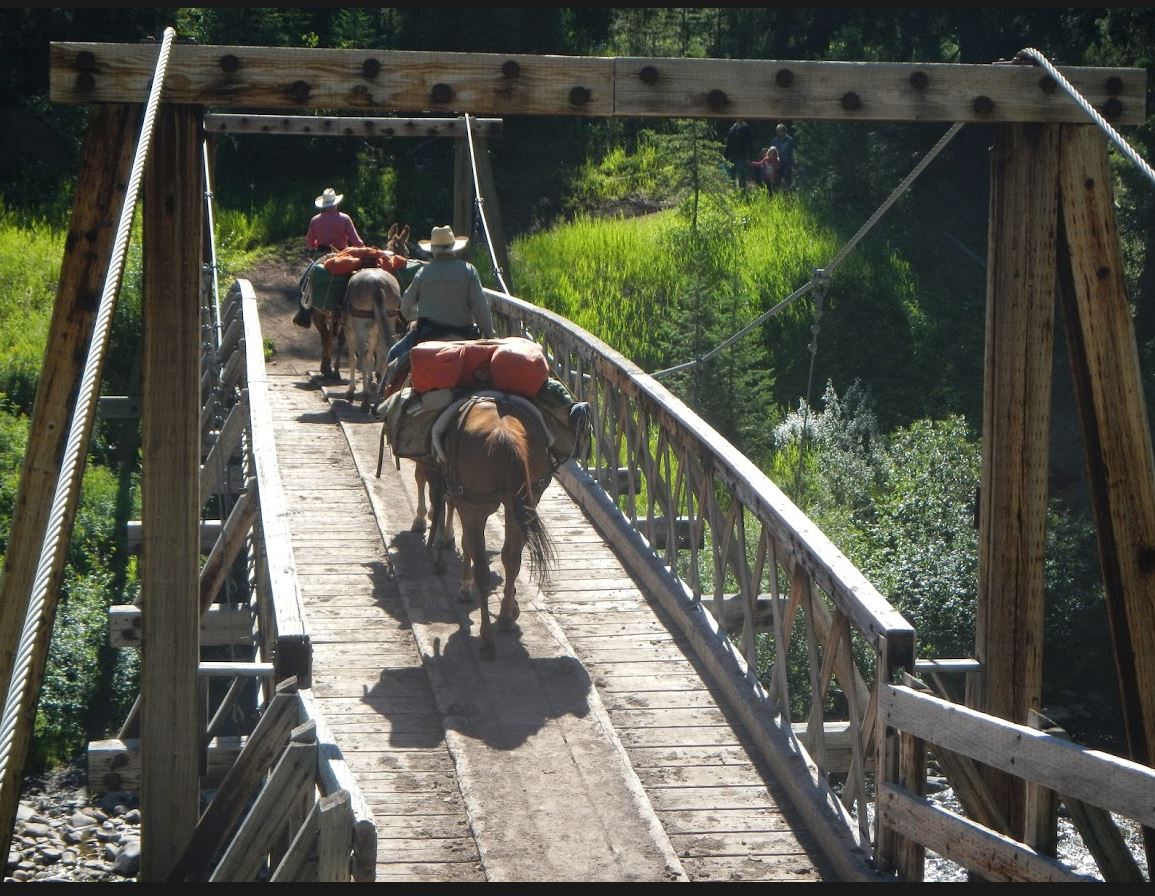
On Saturday August 26, members Terry & Gail MacDonald, Jon & Dianne Seel, Laurie Bryan, Janelle Weeks, Lisa Griffith, Shelly Duff, Janine Townsend and Rob Adams meet at Stanley lake camp ground to work with the rangers and WV volunteers getting their 130 pounds of tools and their food and kitchen up to the work site at Sawtooth Lake. Caitlin Frawley was the ranger who would be working along side the WV volunteers and was our contact for this effort. On Sunday morning Caitlin delivered the tools, food, kitchen and other equipment to our camp site.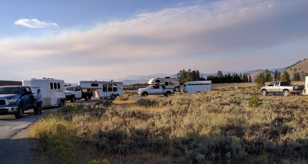 We had scouted the Iron Creek trail head and determined we didn’t have suitable parking for all the trailers so choose to take the Alpine Way trail from Stanley lake over to Iron Creek, making the ride to the camp site and back 22 miles. After getting packed up we started out from Stanley lake and made pretty good time up the steep and little traveled trail. At mile 6.5 we started encountering downfall and at mile 7 two dangerous creek crossings. At this point it was getting late and we turned around to give it a try the next day from the Iron Creek Trail-head.
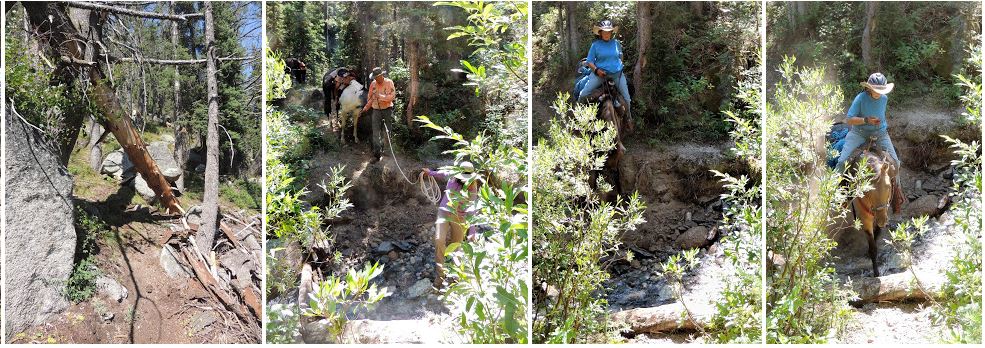
Laurie Bryan August 28
Packing supplies in to a wilderness trail crew at Sawtooth Lake. The first day got a little rough and two of the guys had to bailed on us. Regrouped the next day minus the two. The next day and a different route, five women, 11 horses, 1 mule and Rob made it to the lake without incident. The “G” in Girl Power now stands for “Get ‘er done.” Laurie took most of the pictures on this project

 Janelle, Decaf and Tucker
Laurie Bryan August 28 ·
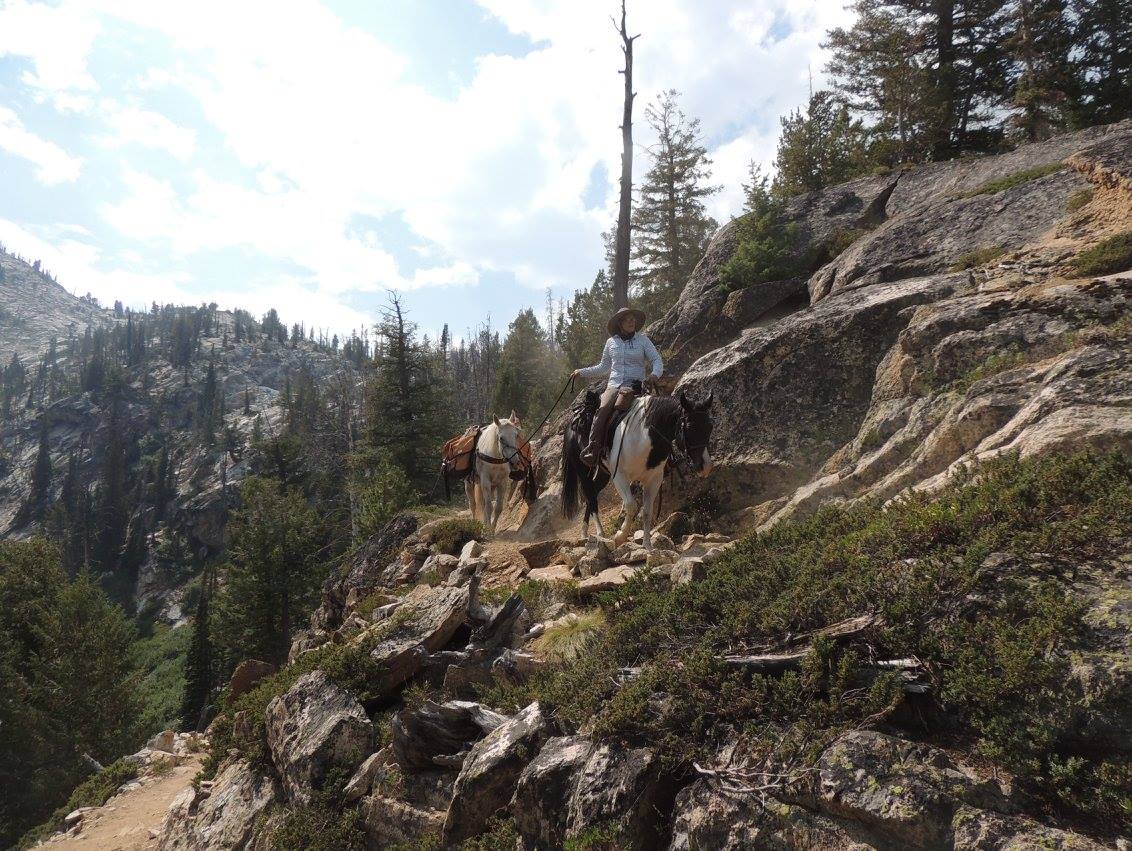
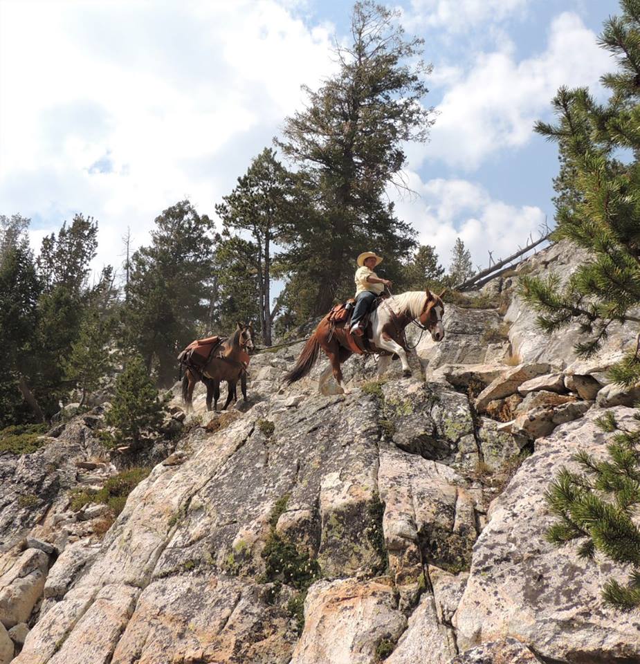
Shelly rounding “Oh Shit Drop.” I have no idea what’s it’s called – but that’s what I’m calling it. Pictures do not do this section justice – besides – I’m trying to shoot pictures and trust that Jack isn’t going to plumet to our death off these sheer faces. The most wicked trails I’ve been on I think. Absolutely beautiful. I would love to take some of the folks who scoff at “trail horses” for a little hike on these trails. I think their opinion of “just a trail horse” might change.

 Janine talking to some of the many trail users we met while packing for this project, with very few exceptions each encounter went well, with the other users very interested in what we were doing and the stock. Lots of pictures of us were taken.
On September 2nd, Janelle Weeks, Lisa Griffith, Shelly Duff and Rob Adams returned to Sawtooth lake with five pack stock and packed out the crew.
 Nancy Smith
Yellow Jacket trail,Cascade Idaho,was very smokey but we had a great time and saw lots of wildlife and cut lots of trees . I hope, I got my sawyers certification. We’ll see what the FS says ,,
Yippie.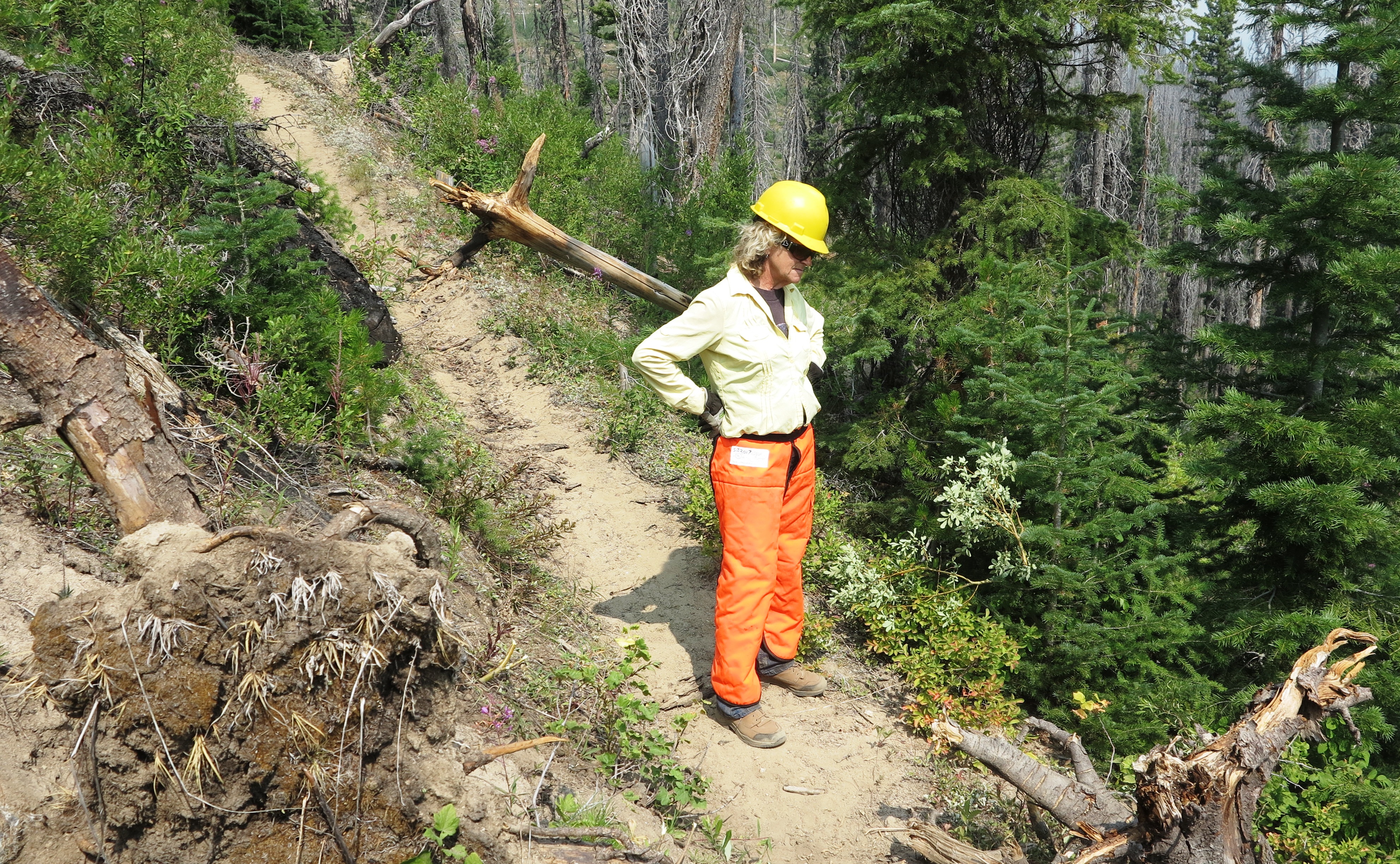
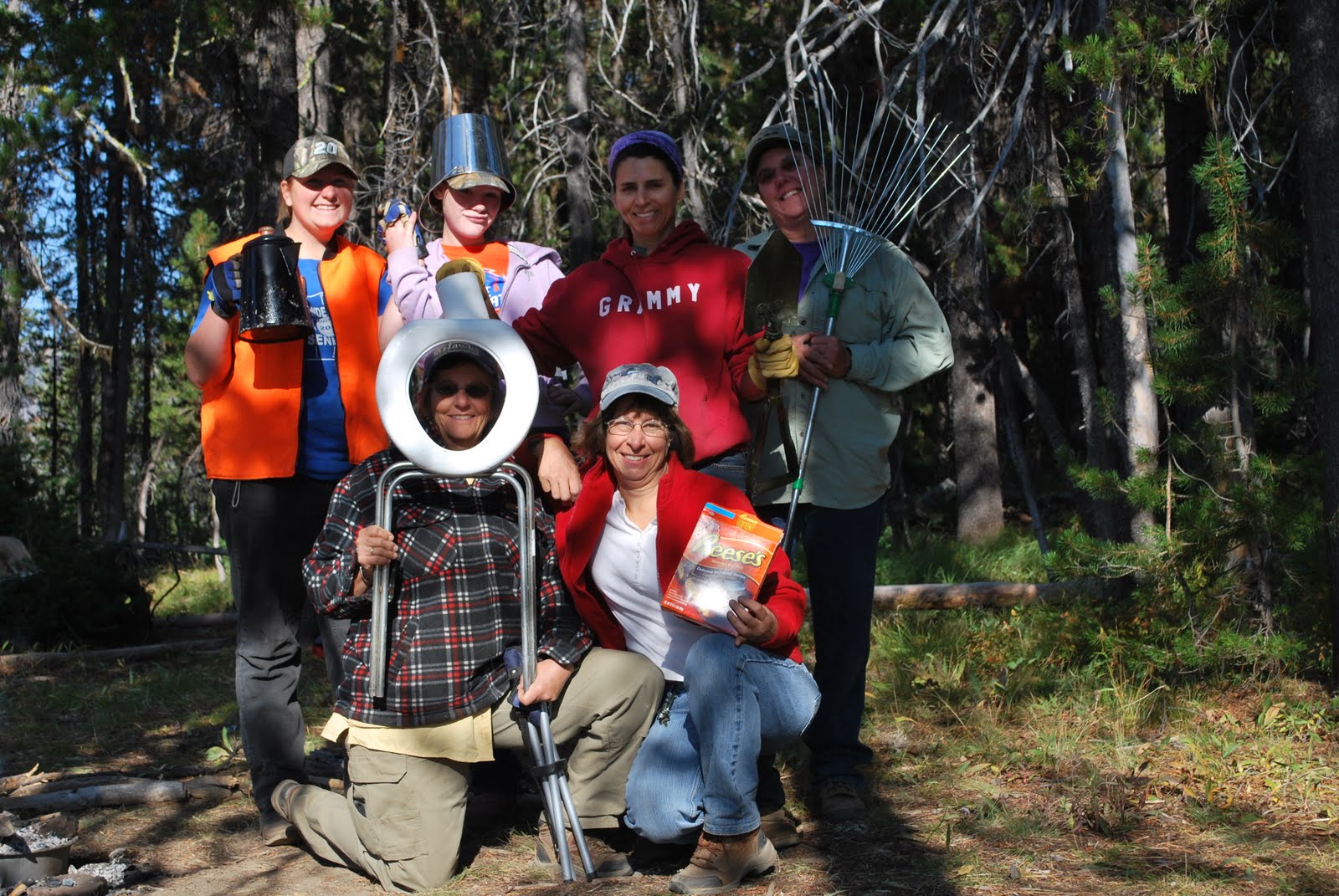
 Some very stylish head gear worn by our members
 Janelle Weeks
Some work had already been done on the Yellow Jacket Trail, however, we cleared out several downed trees and other trees and brush that will make for safer travel along the trail. It was a warm day w/ a good layer of smoke from nearby fires – which made for sweaty, smoky, dirty days…with great food and conversation from all at the end. It was a busy weekend in the Boise National Forest; campers, motorcyclists, equine enthusiasts, bicyclists, fishermen, etc. Good to see that our work is enjoyed appropriately. Also good to see wildlife so prevalent! We had several visits from the resident deer.
Janelle Weeks
Great food and conversations.
There were more downed trees than what we thought there would be. The terrain was steep which didn’t allow us to tie up horses so more of us could help with the trail clearing. The ranger was great to work with.
A few of us were able to take a short trail ride on Sunday before heading back. Great views!
Nancy Smith
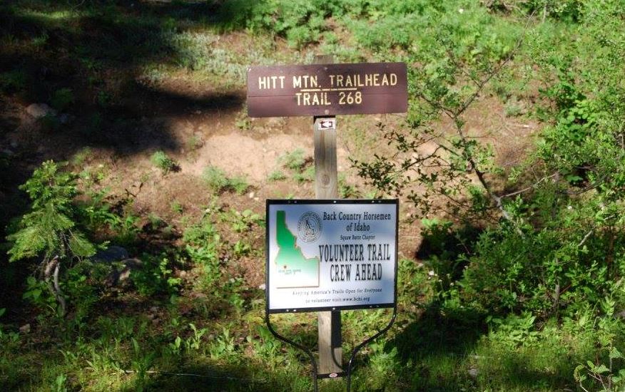
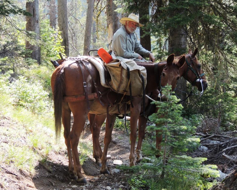
My trip to Hitt Mtn. was great,the weather was cooler than the valley and we met a nice Ranger by the name of Jascha Zeitlin. He was so glad to have a group to help with the trail clearing even though he had to sharpen our chains he never complained. I would help him with a trail anytime. He was very knowledgeable and could ride a horse as well . We took Robs horse Kestrel for Jascha,I think he enjoyed the ride. On Sunday just us girls went riding to the north west of Hitt Mtn. And found some very interesting sites along with lots of really nice photo ops. There’s lots of parking and water across the rode from camp for the horses.


 50 Survival Tips and Tricks for the Outdoors


LID HOLDER & SERVING STAND
– Patented Grab and Hold Design Removes Dutch Oven Lid keeping coals in place & keeps it off the ground out of the dirt!
Removes lid and keeps it off the ground!
Use as a serving stand and pot holder!
Flip it over and use the lid as a skillet!
Keeps food warm
Lid lift and removal is easy, safe, and secure
Turn stand upside down for cooking on lid
Fits all dutch oven sizes 8′ 10′ 12′ 14′ 16′
Steel frame construction
Weighs only 3 lbs!
Easily stored inside of a 12′ or larger Dutch oven
Handle is designed to not get hot (when used properly)

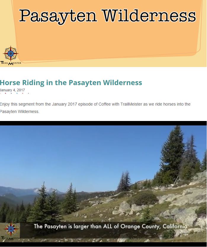 Over 600 miles of trails in this lightly used wilderness in Northern Washington State with many lakes and rivers teaming with trout. Enjoy the video and start dreaming about a trip!

The History of the Ultimate Dutch Oven
Wondering how the Ultimate Dutch Oven became the affordable, high-quality Dutch oven it is today? It all started in 1991 with Dent Sorensen. Born and raised in Salina, Utah, Dent was tired of the old method of Dutch oven cooking, which necessitated sitting by the fire to watch the Dutch oven and stir the food every few minutes. He also needed an oven that wouldn’t require any oil or grease, as his wife had MS and couldn’t have that in her diet.
To solve both problems, Dent found a 15-inch tire rim, cut the lugs out, and welded a cone made out of iron, strapping it to the bottom of the tire rim. He added a fry pan, used the other half of the rim for a lid, and began experimenting with recipes. Because of the cone, his creation worked just like a convection oven – and he didn’t have to stir or use any oil! He also found that he could cook several dishes, like chicken, vegetables, and biscuits, on different layers of the same oven using very little heat. The clever little invention worked well on a stove top or as a convection oven, surprising hungry guests at every turn with its performance. Understanding that he had something special, Dent patented the oven, and the Ultimate Dutch Oven was born.
The business is now run by Dent’s three children, Craig, Eddit, and Denene Sorensen, who purchased the company in 1996. They regularly give demonstrations at retail stores and special events, earning awards and accolades along the way. The Ultimate Dutch Oven now has fans all over the country, from a catering business in Provo, Utah to a Chuck-a-Rama restaurant! Their latest adventure is a partnership with Camp Chef, the largest manufacturer of high-end outdoor cooking products in the country. With Camp Chef’s help, Ultimate Dutch Oven, Inc has been able to significantly lower the oven’s price and increase its availability, leading to one of the most powerful, affordable Dutch ovens on the market. Now, anyone can own one. Try it for yourself today!
 Camping with horses & mules
Marybeth Conger, BACK COUNTRY HORSEMAN OF IDAHO Education Chair
IN THE BACK COUNTRY HILLS, THE CHARACTER OF US ALL COMES OUT.
It is important to remember that LNT principles are guidelines, not rules. Consider your surroundings, local regulations, weather concerns, and your skill level when choosing the best way to Leave No Trace. Anything we do is better the nothing. Read More:BCHI LEAVE NO TRACE PRINCIPLES ARTICLE

 Please share this information with others!

The Manty
Posted by Sydney Paine on October 26, 2016
What is a manty? Well to start with depending who’s book you read or what seminar you went to maybe even the last pack clinic you attended the spelling is probably different. (manty, mantie, manty tarp, etc) The spelling of the word isn’t the only thing that changes, the size changes as well, along with the country or origin. Those of you who run sawbucks like 7’ x 7’ manties, the guys that run decker pack saddles run 7’ x 8’ manties and there are still a handful living in the dream world looking for the almost no existent 8’ x 8’. Why the difference? Sawbuck guys like that seven foot square canvas for a rain fly. They can throw that perfect canvas square right over their saddle and it covers both sides. Decker folks like, and need, that extra foot of canvas to wrap everything up and hold everything in place while they sling it onto the side of the pack saddle and head down that long and winding trail. READ MORE
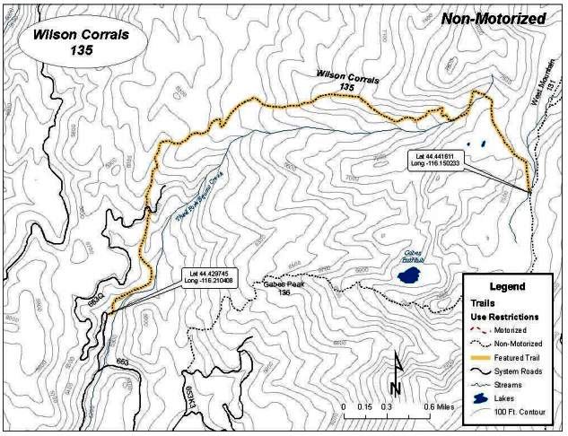
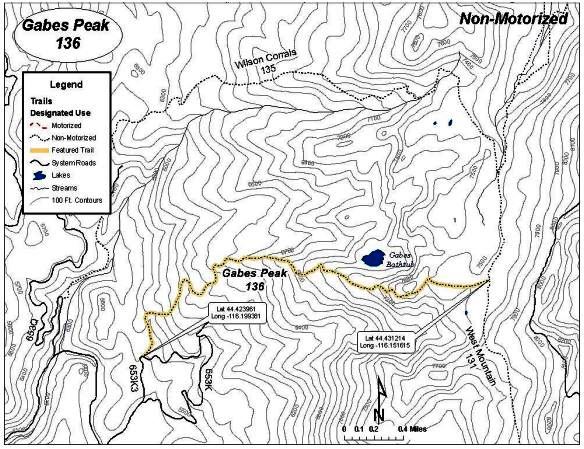
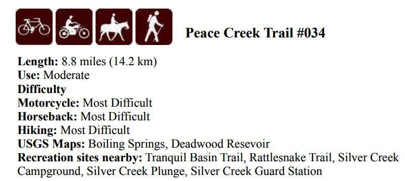
Project dates: August 20/21, 2016
National forest: Boise
Ranger District: Emmett
Trail Head Road: FR 653
Trail Miles worked: Completed TR135 / Complete Trail TR 136 (cleared to upper meadow on each trail)
TR135 Down Fall Encountered: 45
TR135 Down Fall Cleared: 45
TR135 Trail Brushed: where needed
TR136 Down Fall Encountered: 15
TR136 Down Fall Cleared: 15
TR136 Trail Brushed: Where needed
Wilson corral pictures
https://goo.gl/photos/KEeALQwoD6QtzE8w9
We encountered a lot of large downfall, much of it up-rooting’s of otherwise healthy trees on the Wilson Corral trail. A number of work arounds are no longer necessary as we reestablished the original trail bed. West mountain is the driest I have ever seen it in the 16 years I have been riding there. Creeks are dry and the grass in the upper meadow is brown.
On Gabe’s Peak trail many of the downfall were from previous years, and had work arounds, we reestablished the original trail bed, unless erosion made the work around a better option. A re-routing of this trail up to the ridge should be considered, with a number of switch backs replacing the 10 to 20 degree climb almost straight up. With the mostly dirt trail bed a lot of erosion is a problem as well as an almost un-hike-able trail.
Squaw Butte Members on the Project
Rob Adams
Lisa & Tom Griffith

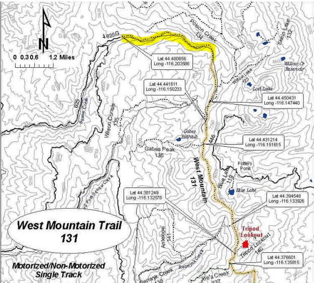
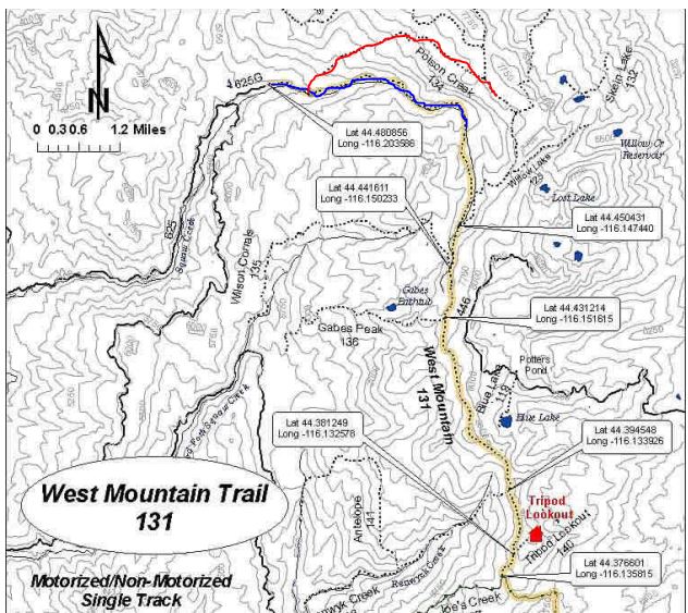
Blue trail Saturday / Red on Sunday
Project dates: August 6/7, 2016
National forest: Boise
Ranger District: Emmett
Trail Head Road: FR 625
Trail Miles worked: 5 TR131 / Complete Trail TR 134
TR131 Down Fall Encountered: 45 (about 2/3 of the trail was worked)
TR131 Down Fall Cleared: 45
TR131 Trail Brushed: First Mile (This trail need a lot of brush removed, it would make a great Boy Scout project)
TR134 Down Fall Encountered: 1
TR134 Down Fall Cleared: 1
TR134 This trail need to be remarked. Game and cattle trails make it very difficult to follow in many places, from the trail head to bridge needs brushing.
Sign at junction for TR131 & TR 134 is missing, just two nails in the tree it was attached to. Unless you know where to turn, you will miss the TR134 turn off.
We re-routed a section of the 131 trail that ran along squaw creek, a very large tree up-rooted right next to the creek and fell a crossed it. The large tree well is now part of the creek bed and with the next high water will completely wash out. See included pictures. We move the trail about 30 foot up the hill side which was protected by a rock and trees. There is a short 25 degree climb from old to new trail, the horses had no problem doing it.
We saw two back packers on TR131, a first, we ran into a number of cows and saw a lot of bear sign, but no wildlife. Huckleberry were very tasty.
We plan to go back to Squaw Creek the weekend of September 10 to complete the upper third of the trail.
Squaw Butte Members on the Project
Rob Adams
Leah Osborn
Travis (last name unknown)
Lisa & Tom Griffith
Shelly Duff
Kelley Ragland
Nancy Smith
Shannon Schantz
Blog Post by Linda Paul
As the trip winds down, euphoria and melancholy gather like the Muses’ faces on stage. Euphoria is nourished by new friendships, great stories, rides, scenery, and food, not to mention a week spent offline and blissfully ignorant of the latest grim headlines. Melancholy stems from the reality that all joyful adventures must come to an end, and soon granite peaks will give way to shrieking red and blue loyalists.
The trip began inauspiciously. Nearly half of the original participants were missing thanks to a shit storm of bad luck, including a car wreck. My adventures began, as a guest of Janine Townsend, with a short (how short, I had no idea) scouting trip from our campsite to Stanley Lake. First to arrive and set up camp, we were eager to explore. This was my maiden voyage aboard Bubba the Mule. We rode alongside a road that was far too busy, then worked our way down to the lake, scouting future swimming sites. Transcending a ridiculously steep embankment, we offered the animals a drink, but they were more interested in grass than in water. On the way back up that embankment, Bubba the Mule and I encountered a parting of the ways. Despite my grand efforts to hang onto at least one rein, I ended up holding a hank of leather attached to nothing but air. Injured pride aside, I tied the remaining rein into a very short roping rein, remounted Bubba and we headed back to camp just in time to greet the newest arrivals.
Hancock, Jan ; Vander Hoek, Kim K. Jones; Bradshaw, Sunni ; Coffman, James D.; Engelmann, Jeffrey . 2007.
Equestrian Design Guidebook for Trails, Trailheads, and Campgrounds. 0723 2816. Missoula, MT: U.S. Department of Agriculture, Forest Service, Missoula Technology and Development Center. 312 p.
This guidebook provides information for developing trails, trailheads, and campgrounds that are sensitive to the needs of riders and their animals. The emphasis is on highly developed facilities and programs such as those in urban, rural, and some wildland areas. The information presented can be adapted for a variety of settings and levels of development, as well as jurisdictional requirements.
Keywords: Accessibility, arenas, bridges, bridle paths, campgrounds, corrals, Equidae, equines, facilities, Federal Highway Administration, fences, fencing, FHWA, fords, gates, highlines, hitch rails, horse camps, horse riders, horses, latches, master plans, mules, multiple use, pack stock, parking areas, parks, picket lines, planning, recreation, recreational facilities, round pens, shared use, staging areas, surface treatments, tethering rails
 July 25, 2015 Rob Adams
Eight members of the Squaw Butte Chapter signed up for a trail project on TR-131 North (West Mountain Trail, or Squaw Creek as it is also known). New members Madison Seamans and his wife Annette had not been to West Mountain yet, and were a bit unsure of the driving directions. I needed to make this a day ride with other commitments on Sunday, so we planned to meet at the triangle at 08:00. Janine and Lou Ann also planned to go up Saturday morning, planned to meet up and go together. By 08:30 three trailers were cruising up the newly chip sealed Sweet Ola highway. All went well until we got to the hwy 618 turn off. Another truck and trailer had gotten between me and the group and was heading to Sage Hen. Janine and Lou Ann were talking and not navigating and followed him through the intersection.  Janine quickly figured out they were on the wrong road, so they got their and Madison’s rigs turned around and we were off again. By 10:15 we were pulling up to the turn off to the trail head and Jon Seel flagged us down. He said the parking lot was pretty full up there. Janine and Lou Ann planned to camp so turned off into the camp ground and hooked up the Linda and Devon. Jon got his stock together and rode to the trail head, while Madison and I drove to the trail head and found a spot for our trailers.
 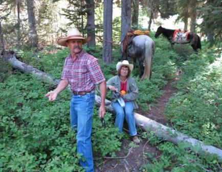 By 11:00 we were saddled and Jon had joined us, but no sign of the others. I expected quite a bit of work to do, so the four of us with the equipment started down the trail. It was not long before we hit the first of eighteen logs we removed from the trail. They ranged in size from six inches in diameter to one that was over twenty-eight inches. We were working on our sixth set of down fall when we heard Janine and Lou Ann talking as the rode up the trail. Devon said they could hear the saw running so knew we were not far ahead, and just took their time catching up. They caught up just in time as that is where we starting running into the bigger stuff. For the next three hours we kept three saws working steadily as the nipper crew cleared brush. The huckleberries are starting to ripen and there were a good number along the trail. Linda picked some so I expect they made it into Sunday breakfast.
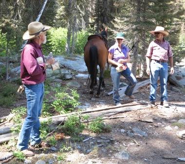 At 13:00 we stopped for lunch at one of the big granite out cropping and give the stock and ourselves a bit of a rest. We than continued up the trail until 15:30. We were where the trail crosses the creek from north to south where we give the stock a much deserved drink. We also stopped at Lou Ann’s waterfall, for a group picture, which has become a tradition when riding this trail. The trip back to the trail head was quicker than the ride up had been. The lead horse changed a number of times on the way down, often precipitated by a wrong turn, or a horse unsure about the section of trail to be crossed. By 18:00 the group was back at the camp ground, horses feed or in trailers for the trip back. Most of the group stayed for the night and planned to ride Poison Creek on Sunday. It was a successful project, that was enjoyed by all!
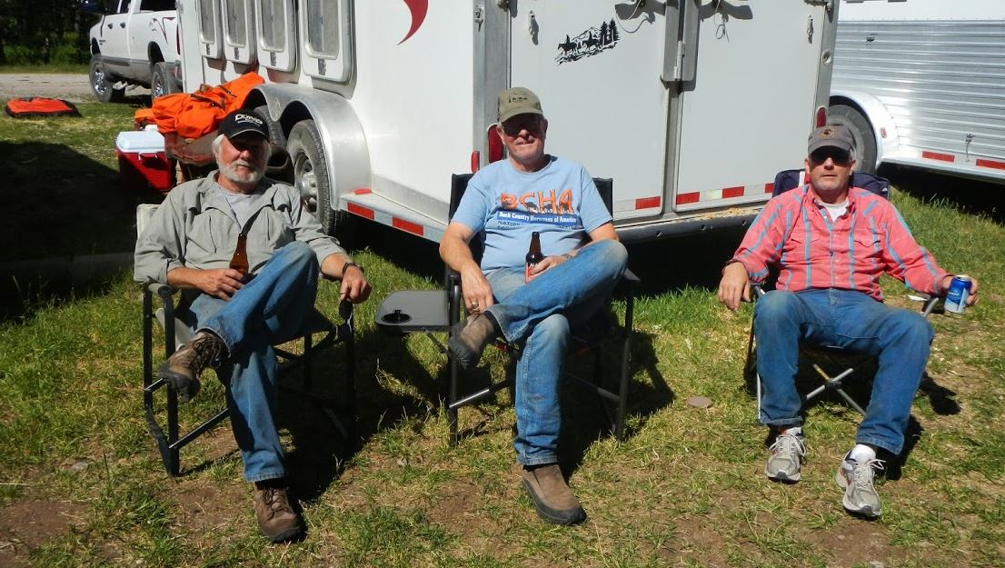
Rob, Phil, Terry, Jon & Shannon
By Rob Adams
It is Friday; I am sitting at my desk at the Simplot data-center trying to finish stuff up so I might get away from the office by 15:00. My cell phone starts buzzing in my pocket. I answer and it is Phil Ryan. Phil asks” if I carry a tow chain in my truck”, which I do. I said “yes”, and he said “good, because Jon doesn’t have one” and hung up.
Great, I knew they were on their way to the North Fork of the Owyhee wilderness and Phil felt we might need a tow chain. Another thing to fret over! We already didn’t have a clue if we could or even should try and pack the old barb wire out that had been rolled up the year before, now there was concern that we would get our rigs stuck also.
Read More / Pictures / Project Map
The Story of a Forest Ranger 1954 USDA-US Forest Service
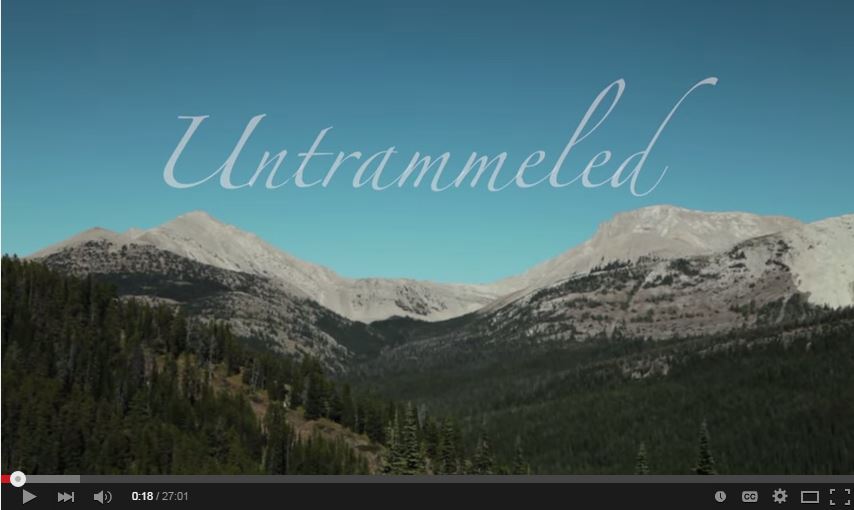
Watch “Untrammeled“. This is a movie about getting youth out in the wilderness, some for the very first time, and passing the baton of wilderness stewardship to this younger generation. Bob Marshall Wilderness Outfitters had a huge role in making this movie a success. We hope you enjoy it.
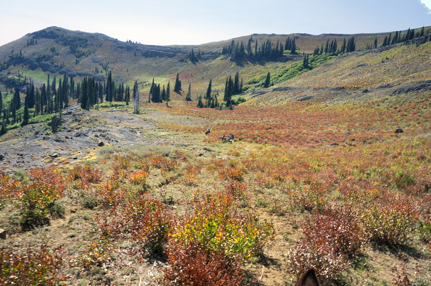
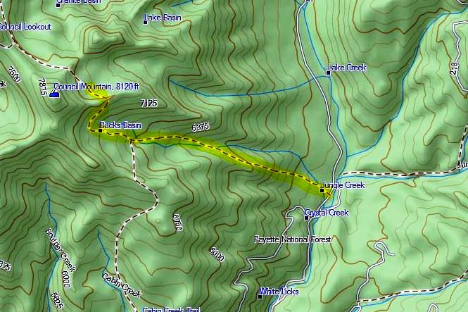
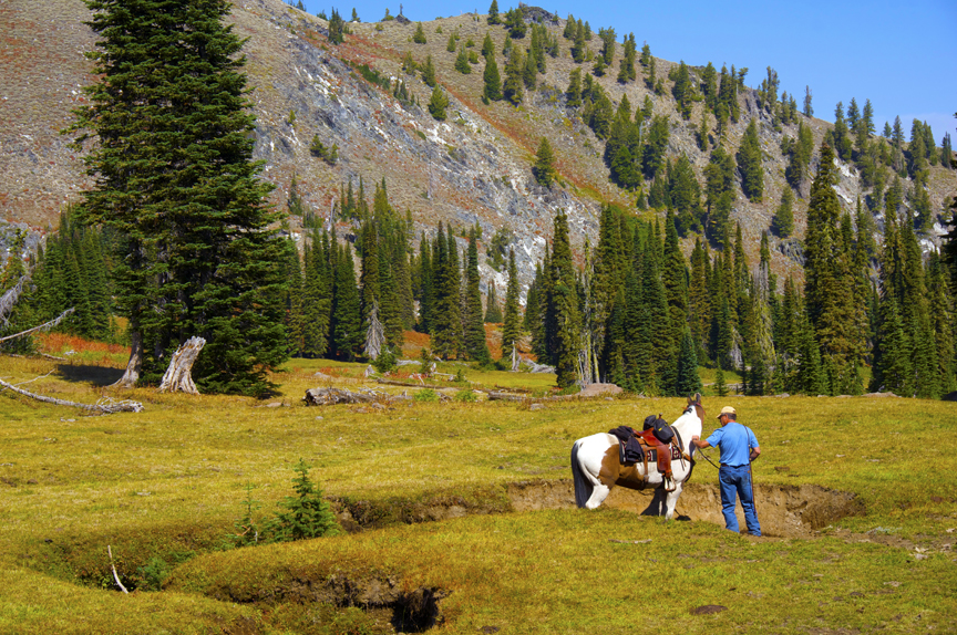
On September 14 a small but enthusiastic group of 4 riders set out into the Payette National Forest to clear trail and explore the Bucks Basin area. Once at the trail head, the lower trail was well defined and in good shape. There were only two areas that required some minor deadfall cleanup. Further up the trail the path became less defined as it passed through a meadow and cattle loafing area. Due to the lack of a visible trail, the group did a bit of “bush whacking” up a rocky slope in search of the trail. Once above the meadow, a few scattered cairn and trial markers guided us to the summit above Lake Basin. The views were fantastic and we spotted a small group of mule deer near the top. After a relaxing lunch in Lake Basin, the group struck back for camp. The weather was dry and pleasant and all rider and mount performed well.
MATTHEW DOPERALSKI
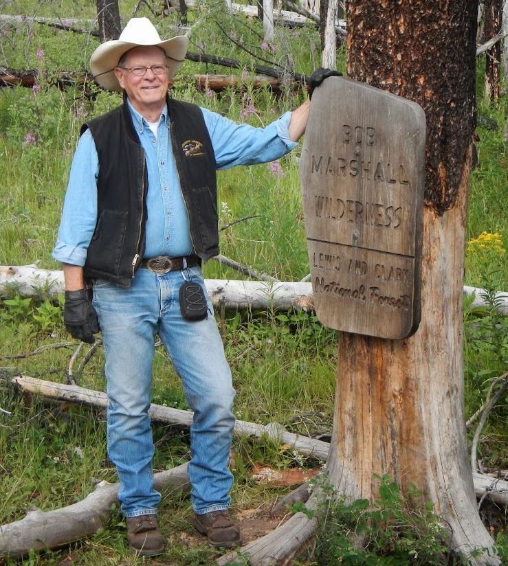
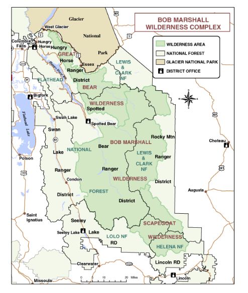
Mike McGlenn, past chairman of BCHA (2011-2013), Bill Conger and Phil Ryan spent a week in late July riding in Montana’s horseman’s paradise the Bob Marshall Wilderness.

One of the Bob’s great trail heads – a model for how all horse trail heads should be setup!
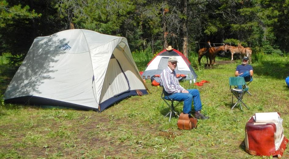 Bill and Phil in camp
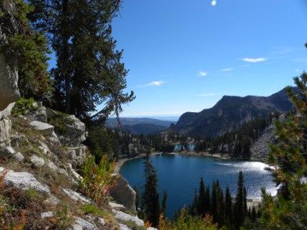
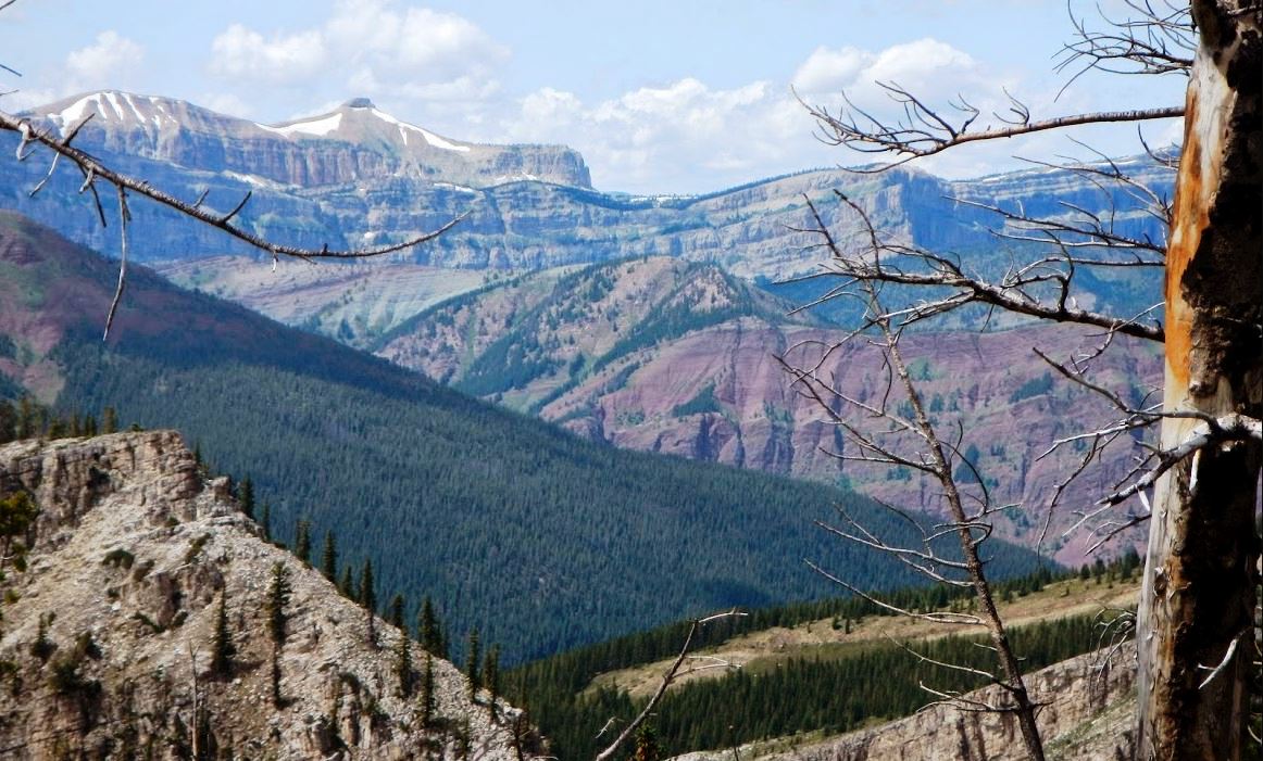 View’s like this make the Bob special and popular with horseman all over the west
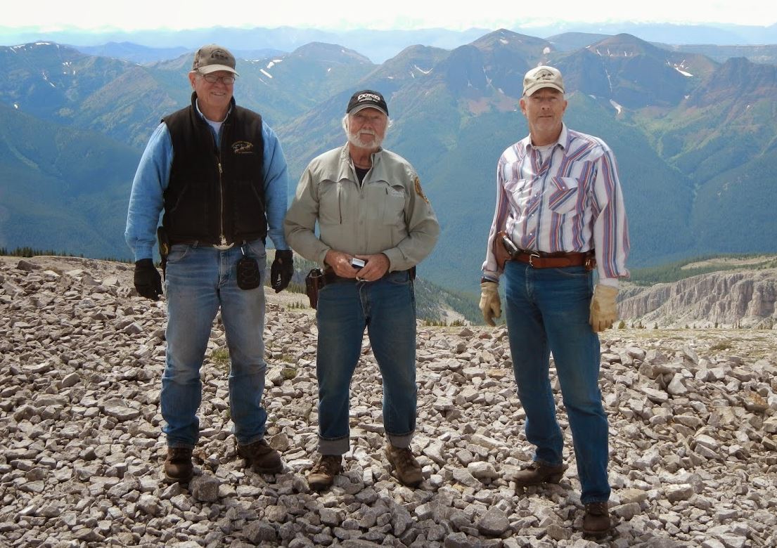 Mike, Phil and Bill
 Phil spending some quality time with his horse as another pack string passes.
 One of the many bridges in the Bob Marshall
Back at the trail head after a great trip. To view more picture, CLICK HERE!
Susan Jenkins – McCall Trail ranger on the weekend – I felt terrible that we didn’t have a project! But it was a good weekend, nonetheless. I only learned late last week that someone else had cleared the trail. I didn’t have a backup trail that would have included a place for folks to camp with stock. You are right, though, about the time spent with Laurie, Lou Ann and Phil. We had a great time with them. Phil was gracious enough to provide the trail folks with a short packing lesson Saturday morning. It certainly raised their interest in using stock for trails work. It was all they talked about this morning at the office. (Which makes me extremely happy, given that the trail crew is comprised of a lot of kids that ride motorcycle dirt bikes on our trails.) See Pictures of the project
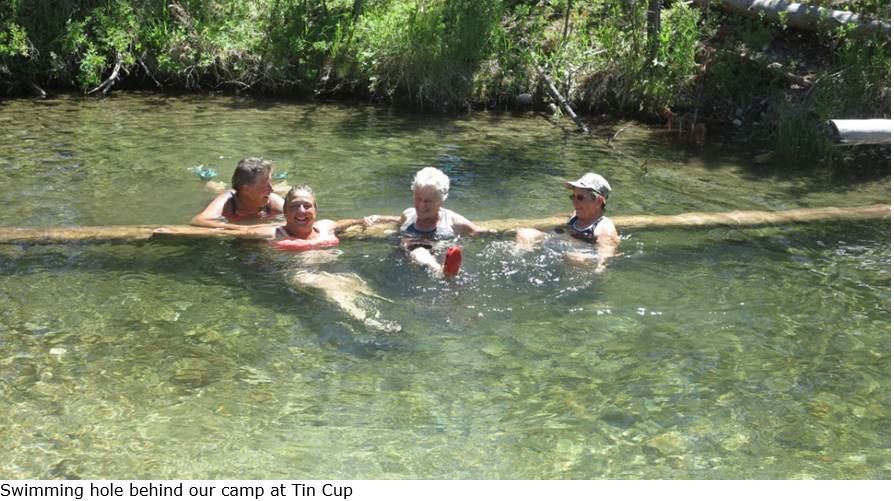
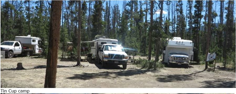
Five members of Squaw Butte spend seven day exploring the Sawtooth wilderness. Pictures of the trip are available on the website.
Rob’s account of the trip The Chicks Pack Trip Account
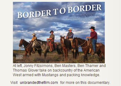
3000 miles, 12 horses, 5 states, 4 men, 1 goal: to complete a 6-‐month journey that was once a reality for the western frontiersman and still stirs in the human spirit. UNBRANDED follows four young men as they take on a monumental challenge that will change them forever.
Having recently graduated from Texas A&M, Ben Masters, Jonny Fitzsimons, Ben Thamer and Thomas Glover are delaying their entry into the job market to embark on the adventure of a lifetime. Ben Masters’ dream is to ride horses through the great American west from Mexico to Canada. It took no time to convince his college buddies to go along with him. Each one begins the adventure with his own dreams to fulfill, knowing full well that hardships and hazards come with the territory. They’ll face unrelenting heat, freezing temperatures, hail and lightning storms, rattlesnakes, Grizzly bears, raging river crossings and high mountain passes buried in snow. We will travel with them as they blaze a trail through Arizona, Utah, Idaho, Wyoming and Montana. The backdrop for this incredible journey will be our majestic public lands, including the Grand Canyon, Yellowstone, and the Bob Marshall Wilderness Complex.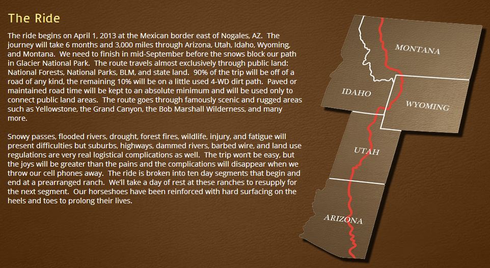 (Blog Entry) It has been a relatively smooth trip so far, and we have covered 2,000 miles of our planned 3,000 mile-plus trip. Currently, we are bedding down at Red Rock Ranch, a guest ranch on the Gros Ventre River just east of Jackson Hole, Wyoming. The sun sets over the Grand Teton Mountains here. Looking north, we’re about to go through one of the largest expanses of Wilderness in the lower 48. For the next 300 miles we will cross only two roads, see no power lines, very few people and go through some of the most incredible landscapes in the world.
Our route will take us through the Bridger-Teton National Forests, the Teton Wilderness, Yellowstone National Park, Gallatin National Forest and the Absaroka-Beartooth Wilderness. We’ll pass Hawk’s Rest—the furthest point from a road in the lower 48 at 33 miles—Yellowstone Lake, dozens of thermal hotspots, hundreds of bison, Two Ocean Pass—the only place where water splits to go to the Pacific and to the Atlantic—and arguably the best Cutthroat Trout fly fishing in North America. Excited is an understatement, this is the jewel of the trip! Read the Blog
 Between June 1st and September 30th 2012 Squaw Butte supported eight trail maintenance and packing projects. These projects covered a large section of south western Idaho, taking place in the Boise & Payette National Forests. They were in partnership with the Emmett, Cascade and Weiser Ranger Districts.
The work covered a large spectrum of activities, from packing, to rock rolling, but mostly entailed the removal of a very large amount of blow down and pruning. While these are “work” project, members attending also have a great deal of fun. If you didn’t make a project this season, plan on attending one in 2014.
In September Laurie Bryan, Rob Adams and Bob Hamlin drove to Halfway, OR to spent four days doing a loop from Cornucopia an old mining ghost town to Crater lake exploring 26 miles around Red Mountain of the south-eastern section of the wilderness. We parked near the pack station in Cornucopia and rode north-west on Jim Fisk Creek trail which is steep and rocky to Snyders Cabin. Read Story View pictures
Jon Seel and I had the opportunity to ride the Eagle Caps Wilderness in Eastern Oregon last week. We spent four days riding the Minum River area. We Left Emmett on a Friday afternoon and headed west to the little town of Cover Oregon. There is a great little tavern and food place there, Great Steaks!. We ended up at the Moss Springs Trailhead. (Idaho should have such trailheads.)
Saturday morning we packed our animals and headed down the seven miles to Reds Horse Ranch, and Minum Lodge. These are areas set aside as private when it became a wilderness much like the airstrips in the Frank Church Wilderness. We spent the night next to a Fish and Game cabin by the airstrip, good feed for the horses. Next day we fished the Minum River and had a great supper that evening. We packed up the next morning and headed up stream trying to find our trail so we could make a loop and eventually get back to the Moss Springs Trailhead. Lucky for us we met two Oregon Fish and Game Wardens who informed us that the trail we were looking for had been washed out for years and was nonexistent. We made a great camp next to the river, decided that a return trip the way we had come was in order for the next day, fixed dinner, finished off the whiskey, and crashed for the night.

I am finding out that the trail systems in all our area wildernesses have major trail problems and we really need to have the Forest Service make a better effort to clear those trail for everyone. We made it back to the Trailhead the next morning and headed home. If you plan to ride in any of the wildernesses please contact the district ranger office to find out the condition of the trails first.
By Phil Ryan
Phil Ryan – July 2013
If you ever get a chance to ride the Bob Marshall Wilderness in Montana don’t pass up the opportunity. Bill Conger and I have ridden the “BOB” for the past two summers and each time it has been a great trip. Bill and MB have ridden that wilderness for years before they moved to sunny (hot) Idaho so he knew the trails and trail heads quite well. This year we decided to go into the wilderness from the East side out of The Benchmark trail head. That is out of the town of Augusta. That way we would ride up the South Fork of the Sun River, make a ride up to Prairie Reef and along the edge of the China Wall and come back down the North Fork of the Sun and back to the trail head, a total of seven days.
A wonderful twelve hour truck ride got us there and we spent the evening having a steak dinner, beans and beer. The next morning we loaded Bill’s two mules, our horses and set off down the trail. The first thing you come to is a swinging bridge over the river. Bill’s new horse “scout” wanted no part of that so my old horse “Sam” took the lead. We did this two times and his horse got the idea and away we went. As you go down the trail there are Forest Service signs saying “Alert” bear in the area, STAY ON THE TRAIL” so we did. Further down the Trail is another Forest Service sign “BE ALERT” BEARS (plural) eating on a mule carcass. Now that gets your attention and you make the horse move faster and you scan both sides of the trail wondering which outfitter scarified a mule so he could get down the trail and out of harm’s way. Anyway we made it and saw no bear (that day).
We traveled on and came to the South Fork of the Sun River and another swinging Bridge, no problem. Three hours of riding got us to our first campsite where the trail takes off to Prairie reef. We ford the river and set up a nice camp. Good grass and water for the stock. After a meal of MB’s ready made goodies, I went fishing, caught a Bull Trout, first time for that. The next morning after a breakfast burrito and coffee we saddled the horses and up we went. Now the trails in the “BOB” are well laid out with great switchbacks, but it was up and up and up, but the trip was well worth it. At the top of the mountain “Prairie Reef” is a fire lookout, and you can see the rest of the world, or at least most of Montana. One side is sheer cliffs for thousands of feet down. You can see all the way to Montana’s flat prairies on one side and the China Wall and snow covered mountains on the other side. We saw eight Mountain Goats on the cliffs below us and one crashed airplane (from the 1980’s) Bill told me. When we returned to camp it was a six hour ride and the horses were spent.
The next day we loaded up and made the ride under the China Wall, over the pass and down Moose Creek looking for a good campsite. We wanted to go down Rock Creek, but there was a really big fire there and the Rangers had closed all trails leading into that area. I spotted a really nice bear as we rode, don’t know if it was a Grizzly or not, but it was bigger than any bears I have seen here in Idaho so we continued further down the trail to find a camp. Seven hot dusty, horse fly infested hours later we made camp in a nice shaded glade, good food and water for the horses and a well-deserved drink of whisky for me and Bill. Next morning off we went down the canyon and to the North Fork of the Sun River. Wonderful meadows, lots of grass for the animals, good fishing. We laid over for a day there giving the animals lots to eat and time to play cribbage and me to catch some fish to eat. We decided to ride out on the sixth day because we couldn’t get up rock Creek or the Gates Park Ranger station so we headed out in dense smoke from the fire. We met an outfitter who had just been in the Rock Creek area and was only six hundred yards from the fire when it topped over the ridge above his camp, he said it was hot for a time while he got his equipment and stock to a much safer location. The Forest Service had sent a helicopter in searching for him to warn him to get out of that area.
On the ride down the North Fork of the Sun River we saw a gray wolf. We made it out in about four and a half hours to the trail head, loaded the stock, went to Augusta for cold drinks and chips and headed the truck south and made it home about twelve thirty Sunday morning.
Another great trip, I may never get to see that area again in my life, but the memories are ones that will last a lifetime.
P.S Watch out for the BEARS!!!!!
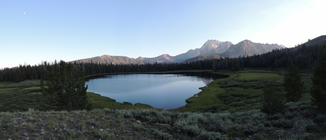
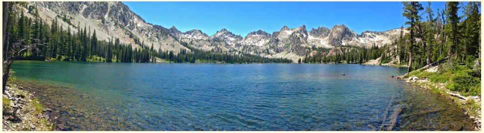
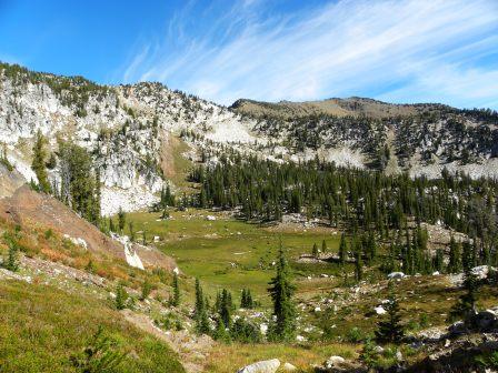
Panoramic view of Frog Lake.
“Sawtooth’s or BUST!”
Eleven horses, nine humans, five mules and a dog pulled out of Rob and Linda Adam’s place in Sweet Idaho, Wednesday, July 17. The five rig caravan loaded with enough provisions for five days in the White Cloud recreational area looked like a modern day migration of homesteaders. Plans laid by our particular group of backcountry horseman are seldom strictly adhered to, but we try to make them anyway. Ours loosely consisted of driving to Livingston Mill trailhead two hours outside of Stanly Idaho, spend the night at the TH and be geared up and mounted early Thursday morning for the ride into Frog Lake. Rob Adams, organizer, project coordinator, self proclaimed “Trail Boss” and all around nice guy – doled out the individual responsibilities for the trip well in advance. Rob would plan and execute the evening meals. Janine Townsend would take care of breakfasts. Robbin Schindele would do lunches. The Chicks, Bob and Lorraine, were responsible for the wine. Bill Selkirk and Kate Miller would be our entertainment directors for the week. I would do desserts. I don’t know if I’m becoming famous for my Dutch Oven desserts or everyone’s afraid they will get Beanee Weenees three times a day if given anything but desserts. My bet is on the latter. We arrived in Stanley shortly after 12:00 PM for fuel and a bite for lunch. What happened next was to unfold into every horseman’s worst nightmare. Willow, Rob’s trail horse of more than a dozen years, went down in the trailer with severe colic. The events leading to the tragic loss of a beloved trail partner and friend can be found by following this link written by Rob. I will not hash out the heart wrenching details of Willow’s passing further except to say that he will be sorely missed. Without Willow, the Squaw Butte Backcountry Horsemen are less than what we were. Though he cannot physically be with us, I know we will carry Willow within our hearts until the very last backcountry horseman draws their final breath. Willow will not be forgotten. We could quit and go home or figure out a way to continue on with one less animal. Backcountry horsemen don’t quit. I offered up my new pack horse, König, as a riding horse for Bill Selkirk. I’d recently acquired König and although he had all the potential for a great little pack horse, I had no idea how versatile he would turn out to be. This made us short one pack horse. The wheels turning in Rob’s head were all but audible. He could make this work. We’d cut down on the gear and take only what was necessary. Heck, we had twice as much as we needed anyway. I chuckle at what we chose to take and what we left behind. Left behind were fire starter, duplicate first aid-kits, extra tarps, rope, high-lines, various cooking utensils, solar showers and duct tape – but damn it – we didn’t leave behind dessert or the wine. There is a limit to adaptability and ours ended with the peach cobbler and boxed Cabernet.
For those of you who live in the west, the term The Bob is probably very familiar. The Bob Marshall Wilderness in western Montana is a very popular riding area. My friend Bill Conger of the Squaw Butte Chapter of the Back Country Horsemen of Idaho and his wife Marybeth have ridden the Bob for many years but for me it was my first pack trip there. Ive spent a great deal of time in Idahos Frank Church River of No Return Wilderness and was excited to see the famous China Wall in the Bob of which I had only seen pictures. Read More
Shoot from the hip and hope you dont blow off a toe in the draw. That pretty much sums up my approach to most things in life. Excursions into the wilderness seldom veer from this philosophy. Toss in a five pound bag of potatoes and a pound of bacon and head for the mountains with my dog. This year would see a change in that methodology.
At least once a year I try to make an annual pilgrimage into the Eagle Cap Wilderness specifically Pine Lakes. When a few members of the Squaw Butte Back Country Horseman expressed an interest in packing into the Eagle Caps, It was with conflicting emotions that I agreed to guide them in. Pine Lakes is filled with personal memories mostly great, some sad and a few as spectacular as the lakes pristine azure waters. I dont mind sharing in the good and even a few of the spectacular moments, but the poignant memories are my own and likely not to be understood by others. I assured myself that it would be alright. Any such emotional episode could remain privately concealed behind dark sunglasses.
Kennally Creek Campground
Travel 10 miles south of McCall on Hwy 55 then 19 miles east on Paddy Flat Road (#388). There are eleven units/nine trailer units with drinking water from one centrally located hand pump, tables, fire pits, charcoal grills, handicapped accessible toilet, hitching rails and unloading ramp, pack in/pack out. Good trail access with no trailhead fee. There is a host at Paddy Flat Guard Station. Contact the McCall Ranger District at (208) 634-0400 for the most current information. There is a designated horse camping area, and a great overflow (no fee) area about 300 yards up the road from the campground. Three trails are available from this trailhead. Kennally Creek trail is a mostly level ride through big trees with a number of creek crossing that takes you to some small lakes if your willing to ride nine miles one way. The needles trail is a pretty steady climb with some loose rocky sections but is rewarded with some great views at the summit. The Black Mare trail starts with a short climb, followed by a very nice ride through big trees to Bill’s Lake. From the lake the trail climbs quickly up the end of the canyon to a saddle. The trail head is at 5600 feet, the saddle is at 7,900 feet and the last 1,500 is in less than a mile. The view when you get to the top is of the South Fork of the salmon river canyon, and it is spectacular. This is an end of the road trail head and camp ground, with very little traffic and very nice facilities. Loop pack trips are possible from this trail head, with a number of lakes and creeks to camp by. We saw very little sign of game, it had rained a couple of days before we started riding and the only tracks we saw on the trails were our horses.