PDF: organizational-realignment-factsheet
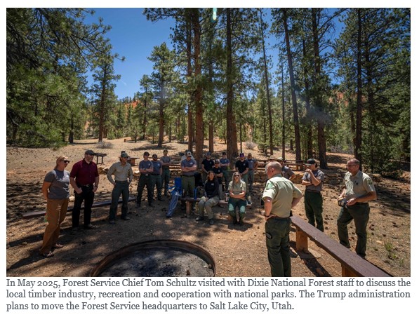 On March 31, the U.S. Forest Service announced plans to move its headquarters from Washington, D.C., to Salt Lake City, Utah. It will also close or repurpose all nine of its regional offices, create 15 state offices, and shutter research and development facilities in more than 30 states. According to a news release, the plan is intended to make the agency more “nimble, efficient [and] effective.” Forest Service leaders told staff on a call after the announcement that no changes will be made to fire and aviation management programs or field-based operational firefighters.
Since first announcing its intent to reorganize the agency last July, the Trump administration has marketed the plan as a way to streamline Forest Service operations, with a focus on boosting timber production and communicating more closely with local communities. But during a congressional hearing and public comment period on the subject last summer, more than 80% of the 14,000 public comments submitted were negative, with many tribal representatives, conservation groups and former Forest Service staffers opposing the move. A U.S. Department of Agriculture summary of public comments included concerns that relocating Forest Service staff and further cuts to its budgets “could compromise ecological management, public access, and employee morale.” The current plan incorporates many elements of the original proposal, including the move to Salt Lake City and the closure of regional offices.
“Nobody is asking for this,” said Robert Bonnie, who oversaw the Forest Service as a Department of Agriculture undersecretary during the Obama administration. “None of the farm groups want this. No one in conservation wants this. Nobody.” To Bonnie and other former Forest Service staff, the plan, which will uproot thousands of employees, looks like it will only make the agency’s existing troubles worse, especially given the past year of deep cuts and chaos.
“This is not going to strengthen the Forest Service, it is going to weaken it,” Bonnie said. “It’s not about solving problems, it’s about blowing things up.”
MARY ERICKSON, a retired Custer Gallatin National Forest supervisor, had more questions than answers after the announcement. “I’m not going to say if it’s good or bad at this point,” she said. “It’s just such a sweeping change with no real analysis about if there would be cost savings.”
Under the new proposal, some states will have their own offices and others will be lumped together, similar to the organization of the Bureau of Land Management. This will be a new approach for the country’s 154 national forests, which have long been managed by the nine regional offices that will be shuttered or repurposed. Now, forests in Washington, Oregon, Montana, Alaska and Idaho will each be managed by their own state office. Forests in Nevada and Utah, however, will be managed together, as will forests in Colorado and Kansas.
Some Forest Service research facilities, including the Rocky Mountain Research Station in Fort Collins, Colorado, will stay open. Others, including the research station in Portland, Oregon, which is responsible for critical work on species like spotted owls, will be closed. Losing local leadership “is not going to improve the programs,” said former Forest Service wildlife biologist Eric Forsman. Forsman, who retired in 2016, studied spotted owls and red tree voles at the agency’s Forestry Sciences Laboratory in Corvallis, Oregon, which will remain in operation. “It may help budgets,” he added, “but it won’t improve the quality of the research or the amount of research that gets done.”
Erickson and others were also concerned about the plan to move high-level bureaucrats out of D.C., where the nation’s law- and policymakers reside. “I would push back on this idea that moving out of D.C. is moving closer to the people you serve. That’s not the role of the national office,” Erickson said. The national office, she added, is supposed to coordinate and create guidance based on national policy. “Forests and districts have always been the heart of local communities and local delivery.”
After talking with current and former Forest Service staffers following Tuesday’s announcement, she also worries that, at least in the short term, disarray created by the reorganization will hamstring the agency’s ability to address the complex and worsening challenges that modern forests face. Those include tree disease outbreaks, the growing wildland-urban interface and climate change-induced drought. The Forest Service is already reeling from the loss of thousands of employees during the last year, through the terminations and deferred resignations effected by the now-defunct Department of Government Efficiency, or DOGE.
The reorganization may also lead to states playing an even bigger role in forest management, said Kevin Hood, executive director of Forest Service Employees for Environmental Ethics, who retired in 2025 after decades working in the Forest Service throughout the West. While local coordination isn’t bad in theory, he said, he’s concerned the new structure will be a step toward ceding the management of national forests and other public lands to states.
Tribal representatives, several of whom declined to comment for this story, voiced concerns during the July public comment process that the reorganization would lead to losses of expertise and fractured relationships. Mass staff relocations, one representative wrote, would “destroy irreplaceable knowledge about Treaty rights, forest conditions, and working relationships built over decades, and new staff unfamiliar with the land will make mistakes.”
FOR MANY PEOPLE in conservation, the Forest Service reorganization feels like déjà vu, or even a recurring nightmare.
In 2019, during Trump’s first term, his administration announced a plan to move nearly all Bureau of Land Management staff out of the agency’s D.C. headquarters to Grand Junction, Colorado — then a 66,000-person city located hundreds of miles from a major airport. As with the March 31 Forest Service announcement, the administration said the change would put high-level staff closer to the mostly-Western lands they manage. Instead, many of those staff left the agency altogether, said Tracy Stone-Manning, who directed the BLM under President Joe Biden and is now president of The Wilderness Society.
In fact, by the time the Grand Junction office opened in 2020, only 41 of the 328 BLM employees expected to move West chose to do so, according to a High Country News investigation. For many, moving meant uprooting their entire family, and required a spouse to find a new job in a much smaller market.
The reorganization cost taxpayers $28 million. And the Biden administration ended up moving many high-level positions back to D.C., though it did keep some agency leaders in the Grand Junction office, which it renamed the agency’s “Western Headquarters.” John Gale, who headed the office for two years under Biden, sees merit in searching for ways to improve public-lands management. But restructuring and relocation need to be done thoughtfully and carefully to be effective, he said.
That’s because agencies lose irreplaceable institutional knowledge when people with decades of experience are forced out the door, said Stone-Manning. And while that may not have been the first Trump administration’s intention, it was indeed the outcome of the BLM reorganization. She and others expect the Forest Service to suffer the same fate, with even more dire results for the public.
“Our public lands are not being cared for the way they need to be,” she said. “And what that means is ultimately people will throw up their hands and say the federal government can’t manage them, let’s sell them off.”