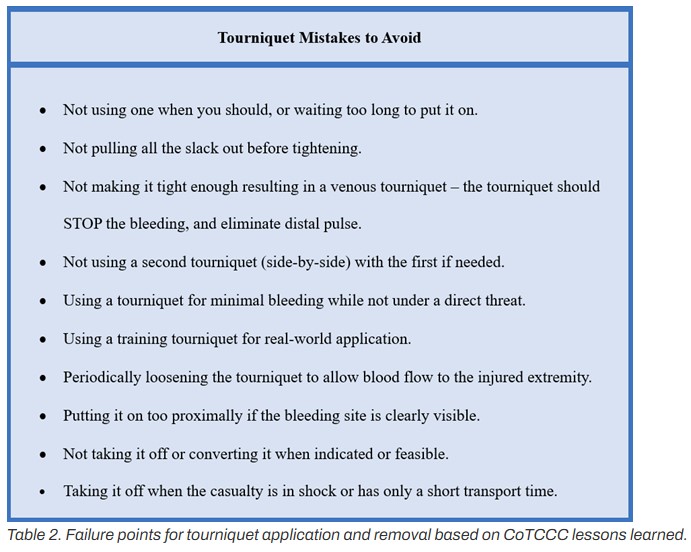
Interior Dept blazes ahead on unified wildland firefighting agency, without Congress endorsing plans
The Wildland Fire Service also stops short of folding in wildland fire personnel or programs from the USDA’s Forest Service.
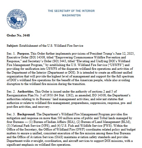
The Interior Department is blazing ahead with a reorganization plan that will bring all of its wildland firefighting operations into a single agency.
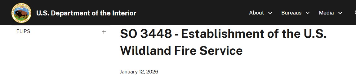
Starting next week, the department’s wildland fire employees and programs will be moved into a new Wildland Fire Service.
Congress did not approve funds for the consolidation of federal firefighting programs into a single agency. The Wildland Fire Service also stops short of merging wildland fire personnel or programs from the USDA’s Forest Service with those same resources at the Interior Department.
An internal memo sent to staff on Monday states the Wildland Fire Service “will unify wildland fire management within DOI only.”
According to the memo, obtained by Federal News Network, the Wildland Fire Service will “align operations” with USDA through shared procurement, predictive services, research, and policy reforms.
“The success of these efforts will rely on ongoing support from Congress to secure the necessary funding and authorities needed to implement and sustain these important reforms,” the memo states.
President Donald Trump signed an executive order last summer requiring the Interior Department and USDA to consolidate their wildland fire programs “to the maximum degree practicable and consistent with applicable law.” The Trump administration’s fiscal 2026 budget request noted that wildland fire response has been split across five agencies in two departments.
A comprehensive spending deal to fund the Interior Department through the end of fiscal 2026 did not endorse the Trump administration’s plans to consolidate federal wildland firefighting operations into a single agency.
Democrats on the Senate Appropriations Committee wrote in a summary of the Interior spending bill last month that the spending package “specifically provides funding to continue wildland firefighting using the longstanding practice of funding both the U.S. Forest Service and the Department of the Interior to allow Congress to consider legislative proposals for such a major change.”
Most of Interior’s wildland fire personnel will move over to the Wildland Fire Service starting Feb. 8. Last month, Brian Fennessy, former chief of the San Diego Fire-Rescue Department and former fire chief of the Orange County Fire Authority, was tapped to serve as the new chief of the Wildland Fire Service.
The Wildland Fire Service will merge the wildland fire operations of the Bureau of Indian Affairs, the Bureau of Land Management, the Fish and Wildlife Service, the National Park Service, the Office of Aviation Services and the Office of Wildland Fire.
By unifying wildland fire programs spread across four DOI bureaus and two offices, the Interior Department expects to “eliminate redundancies and build a more cohesive workforce.”
“This integration paves the way for streamlined training, stronger recruitment, and greater career growth for Interior wildland fire personnel,” the memo states.
Last fall, an employee group called Grassroots Wildland Firefighters applauded greater coordination between the Interior Department and the Forest Service but said these actions “do not yet go far enough.”
“We know the limits of what can be done through executive action alone. At the same time, we know the limits of what can be done through executive action alone. Lasting reform — true consolidation of our nation’s wildfire workforce under experienced fire leaders in a single, mission-driven organization — will ultimately require congressional action,” the group said in a press release.
Interior said the next steps to stand up the Wildland Fire Service will “occur in deliberative phases to ensure continuity of operations and readiness for wildfire activity in 2026.”
Interior Secretary Burgum issued a departmentwide order last month calling for the unification of the disparate wildland fire operations and activities.
An earlier order from Burgum specified that the Wildland Fire Service would function more as a “strategic alignment of resources” between Interior and the Forest Service, including early fire detection technology, planes and vehicles and modernized communication tools, to ensure “cross-team coordination when jointly fighting wildland fires.”
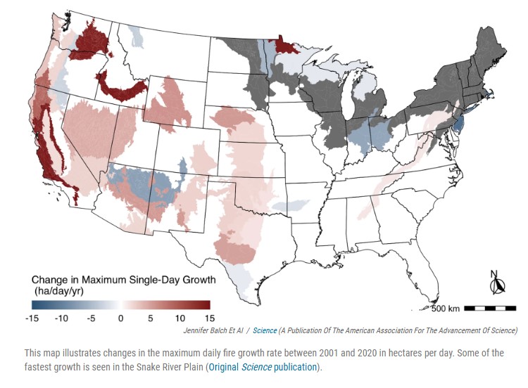
Wildfires cost the United States hundreds of billions of dollars, posing a risk to national security, public health, energy infrastructure and water sources.
Monday’s memo states that the Wildland Fire Service “positions DOI to harness cutting-edge technology more efficiently,” and invest in advanced wildland firefighting tools.
“By streamlining the chain of command from the firefighter on the ground straight up to the chief, the USWFS will eliminate bureaucratic hurdles and ensure decisive, timely action during wildfire incidents. This clarity in decision-making will strengthen coordination and accelerate response efforts when every second counts,” the memo states.
Tribal wildland fire programs will also be included in the new Wildland Fire Service. The memo states the Interior Department will continue to “honor and administer” current contracts and agreements with tribal wildland fire authorities, and that its Bureau of Indian Affairs will help transfer existing contracts and agreements over to the Wildland Fire Service.