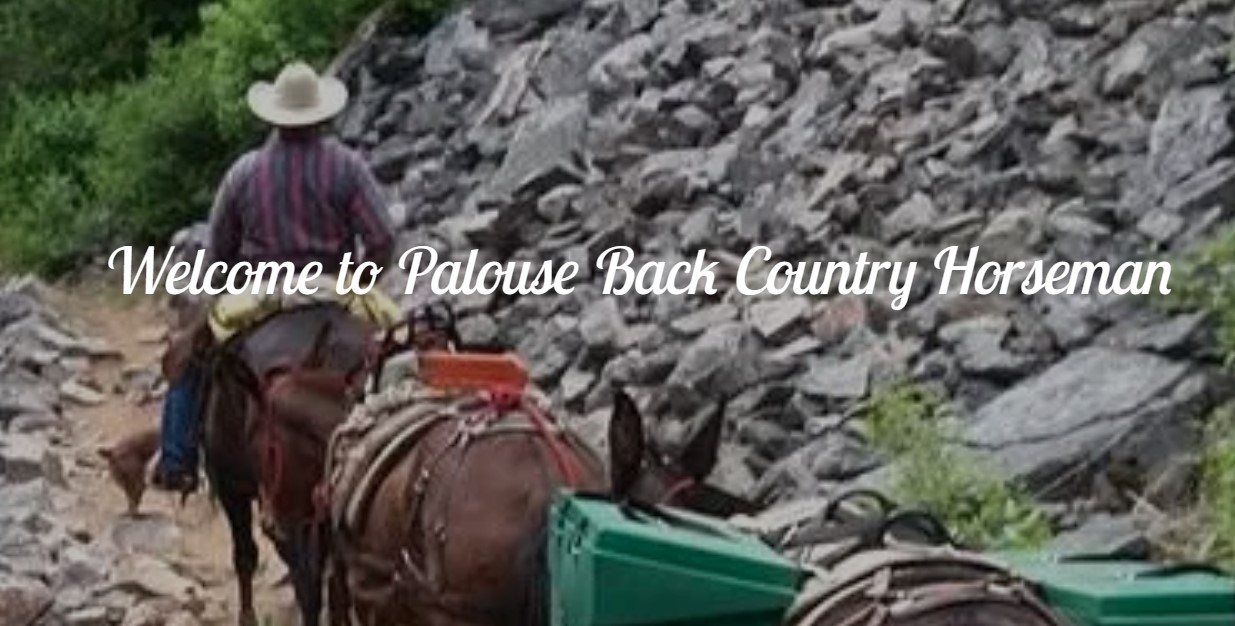
 Region #1 – North of the Salmon River
Region #4 – South of the Salmon River
Region #1 – North of the Salmon River
Region #4 – South of the Salmon River
Be a “Professional Beginner”
Always be learning, always striving to approach the process with the wide openness of someone starting fresh and fighting the natural tendencies to Narrow one’s mind and calcify one’s conceptual model.
New Information should be welcomed despite its demands for flexibility and ongoing adaptation. With this approach, learning is also exhilarating, a journey of endless discovery and self-Improvement!
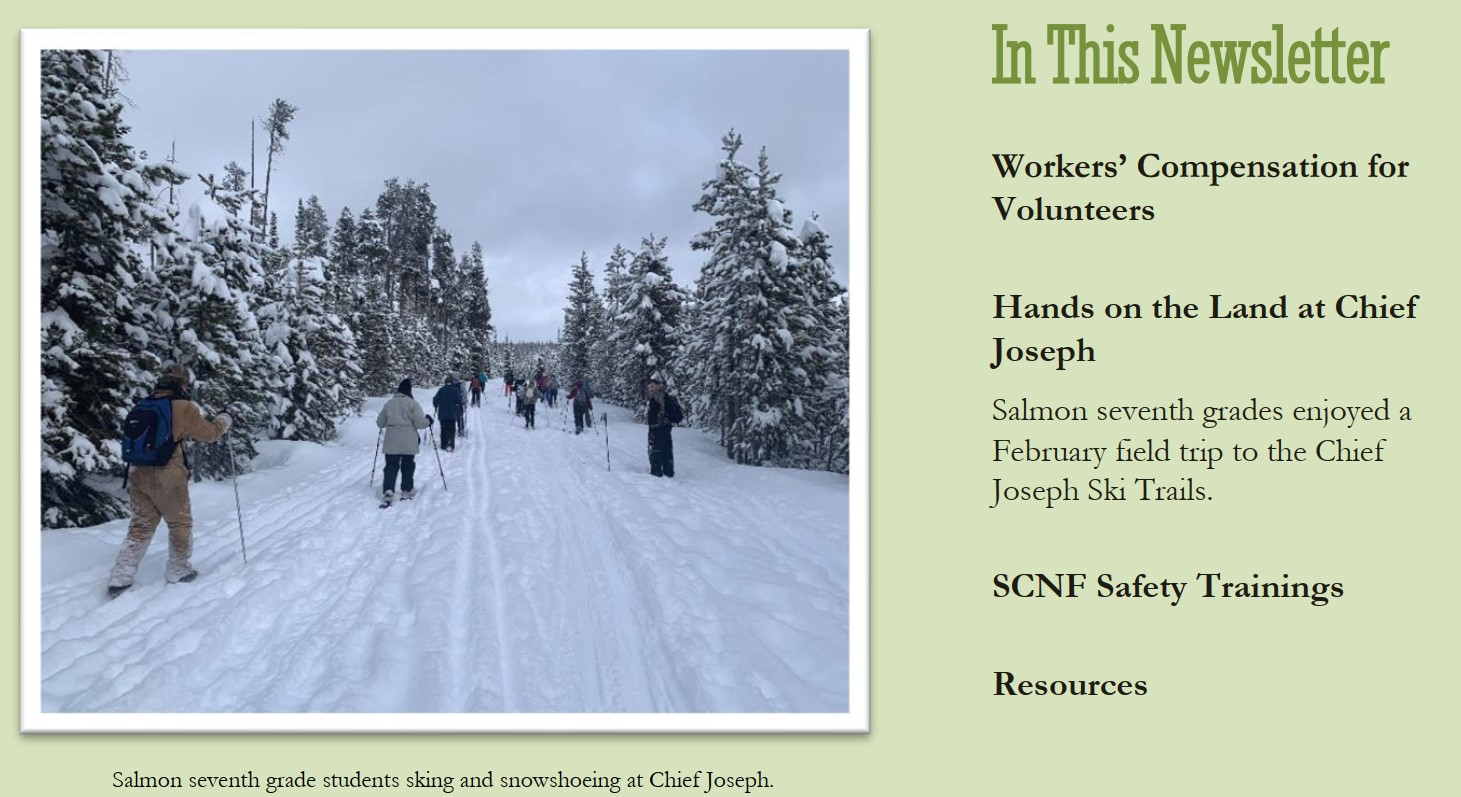
 READ Complete report: 2023 YEAR IN REVIEW
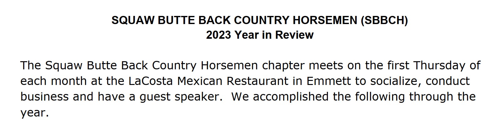
From hikers on daytrips to drivers on road trips, the inReach SOS data from 2023 shows that inReach devices are an important tool for adventurers and commuters alike. In 2023 the largest percentage of SOS incidents came from hikers and backpackers, but the biggest increase resulted from driving-related situations. Read on for a look at the statistical breakdown.
Since 2011, Garmin inReach satellite technology1 has helped individuals stay in touch globally, send and receive messages outside of cellphone service areas, navigate routes, track and share journeys and, when necessary, trigger an interactive SOS message to the Garmin Response℠ emergency response coordination center. Many individuals’ lives have been changed from the help they received after triggering an SOS message on their inReach device.
With 100% global Iridium® satellite network coverage, an SOS can be triggered globally. The locations of SOS incidents speak to the power of the Iridium satellite network, the intel of inReach technology and the Garmin Response team’s ability to make timely connections with emergency resources all over the world.
Garmin Response is a leader in 24/7 emergency monitoring and incident response coordination services. Using a proprietary emergency monitoring platform that connects to a global database of first responders and emergency services, the dedicated team of skilled emergency response coordinators serves more than 200 countries and territories and supports more than 210 languages.
Just this year, dispatch responses varied from local police and ambulance services on major interstate highways to highly technical helicopter rescues on the world’s tallest mountain, Mount Everest. Responses all over the world — from New Zealand to Norway to Argentina to Canada — were coordinated for plane crashes, grizzly bear encounters, sinking sailboats, skiers in avalanches, stranded divers, injured climbers and many more.
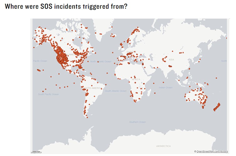
The largest percentage of SOS triggers this year came from adventurers who were out hiking or backpacking. The next highest number of SOS triggers came from driving and motorcycling incidents. This emphasizes the importance of having an inReach on hand for everyday “just in case” situations, such as witnessing or being involved in a motor vehicle accident, experiencing mechanical issues outside of cellphone service or encountering adverse weather while driving.
In 2023, we saw the biggest increases in driving-related SOS incidents, followed by climbing/mountaineering and fishing. Other common activities include boating, snowmobiling, camping, hunting, skiing/snowboarding, off-roading and more. READ MORE
Staying connected, informed and safe — regardless of geographical location — has become an essential and expected part of our lives. So what makes inReach® satellite communicators stand out? Below are some of the top reasons why it’s advantageous to keep a device with inReach technology active and available1.
The Iridium® satellite network, the world’s largest commercial satellite constellation, is the system that allows inReach devices to work globally. Its low orbit satellites enable inReach satellite communicators to relay messages, provide weather forecasts, navigate and trigger SOS alerts — even when you and your device are well out of range of cellular coverage. Plus, the multidirectional, purpose-built antennas in inReach devices help ensure a prompt connection, which is especially important in an emergency when every second counts.
With an inReach device and an active subscription, you can trigger an SOS message and connect directly to the Garmin ResponseSM team. When an SOS alert is received, team members pinpoint the incident location. Then, via two-way messaging, team members gather information from the user, coordinate the rescue response and connect with emergency contacts.
A unique part of the inReach experience is that SOS activations are managed by Garmin’s in-house emergency monitoring team and incident response coordination center, Garmin Response. Operating since 2007, Garmin Response is staffed by trained professionals. They use proprietary emergency handling software to manage each SOS alert and work with a private global database of local first responders. The Garmin Response team has handled more than 10,000 inReach SOS alerts.
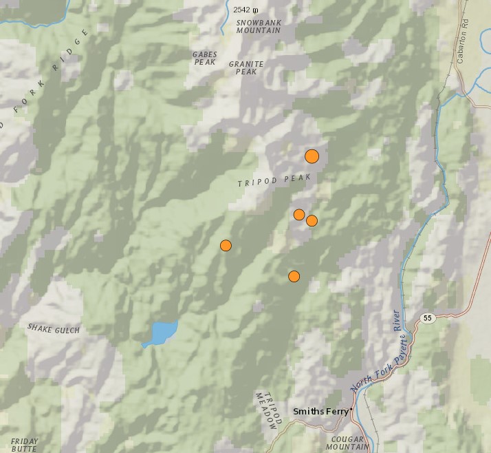
Did you feel yesterday morning’s earthquake?
According to the United States Geological Survey, there were several. The first one, and the strongest, hit at 10:25 a.m. and had a magnitude of 4.9. It registered about six miles North of Smiths Ferry with light shaking reported in the Treasure Valley.
USGS recorded an aftershock of 2.7 magnitude at 10:45 a.m. about five miles Northwest of Smiths Ferry. Another aftershock of 2.8 magnitude about three miles Northwest of Smiths Ferry was recorded at noon.
The Idaho Transportation Department said there was rockfall in the roadway near where the earthquakes occurred but there is no indication of damage. To be sure, ITD said its crews are assessing roads, culverts, and bridges, including Rainbow Bridge, in the area.
“In the event of any damage resulting from the earthquake, ITD will provide prompt notification to the public,” ITD said in a news release. “ITD wants to reassure the community that every measure is being taken to assess and address potential safety risks from this earthquake, demonstrating our unwavering dedication to maintaining a secure transportation network for all.”
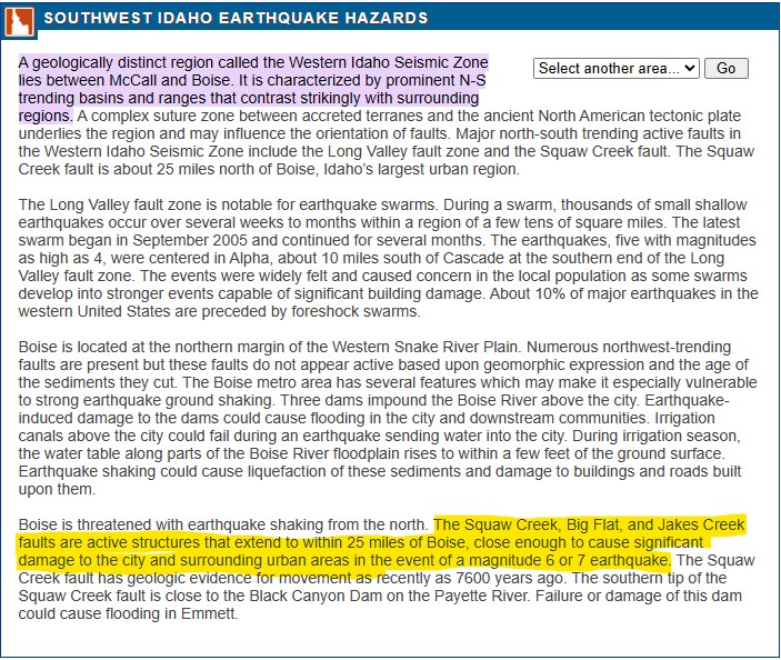
Monday’s quakes occurred in the Western Idaho Seismic Zone, which lies between Boise and McCall. The zone includes active faults such as the Long Valley fault zone and the Squaw Creek fault.
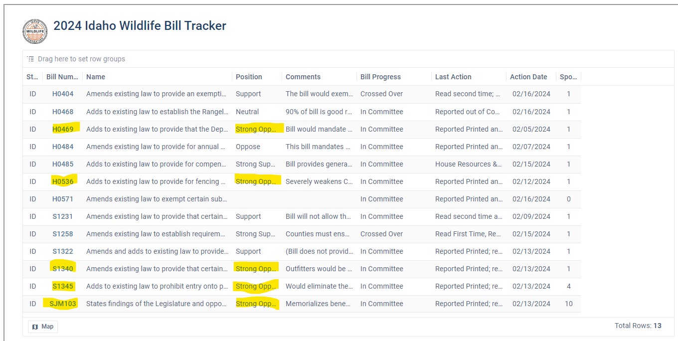
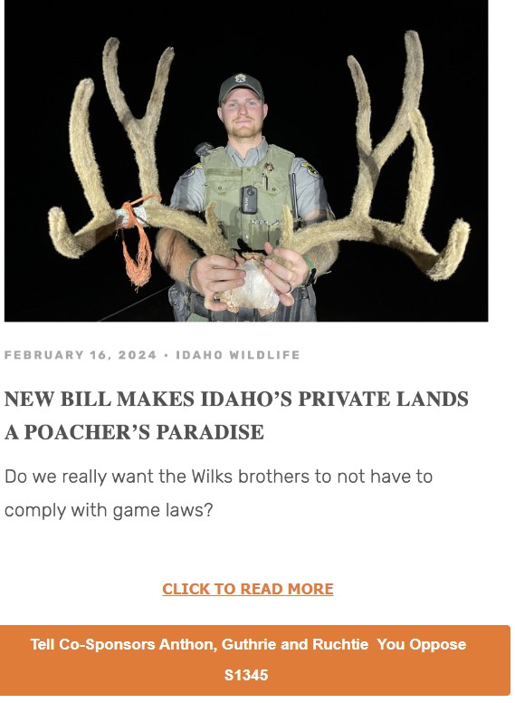
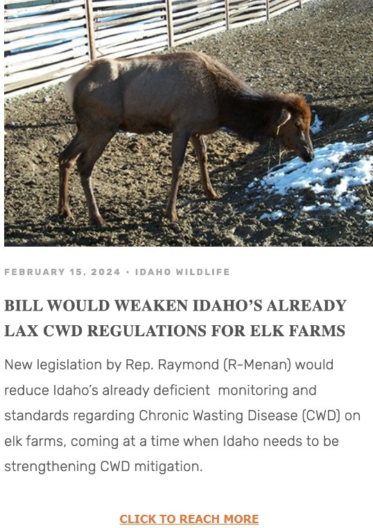
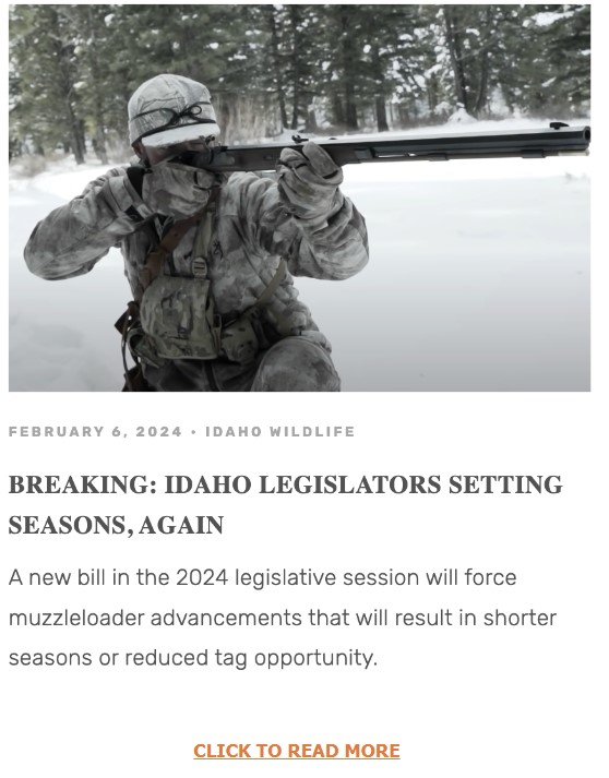
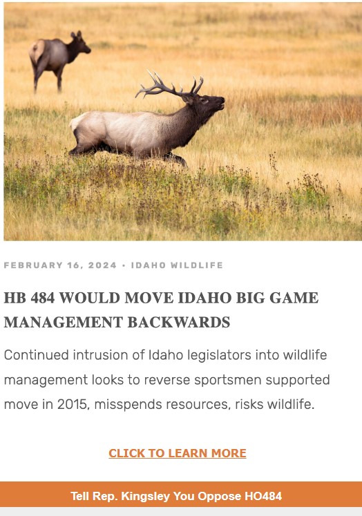
Below that, will be a series of five bills we are asking you, hunters, anglers and public land advocates of Idaho, to help IWF defeat.
From potentially increasing poaching, reducing already deficient protections from chronic wasting disease, continued encroachment of the legislature on our wildlife management agency’s autonomy, trading once-inn-a-lifetime tags for wolves, we struggled to think of a sportsman in our state that wouldn’t be negatively impacted if these came to pass.
IWF respects that our subscribers have different interests, and work hard to serve you with the information most important to you.

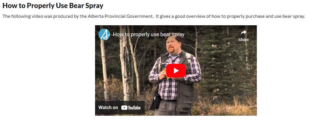
Do NOT use Bear spray from your saddle, getting it in your stocks eyes will lead to a wreck!
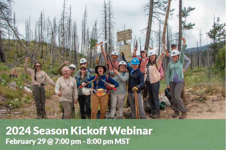 Dust off your boots and get ready for trail season! Join us the evening before our volunteer schedule launches to learn about this year’s best projects and how you can join. Hear this season’s highlights from our Trail Projects Director Alex Cravener and Board Member and Crew Leader Tom Dabrowski. We’ll have some fun trails trivia sprinkled throughout and tips for what to expect if this is your first time out on the trail. SIGN UP HERE
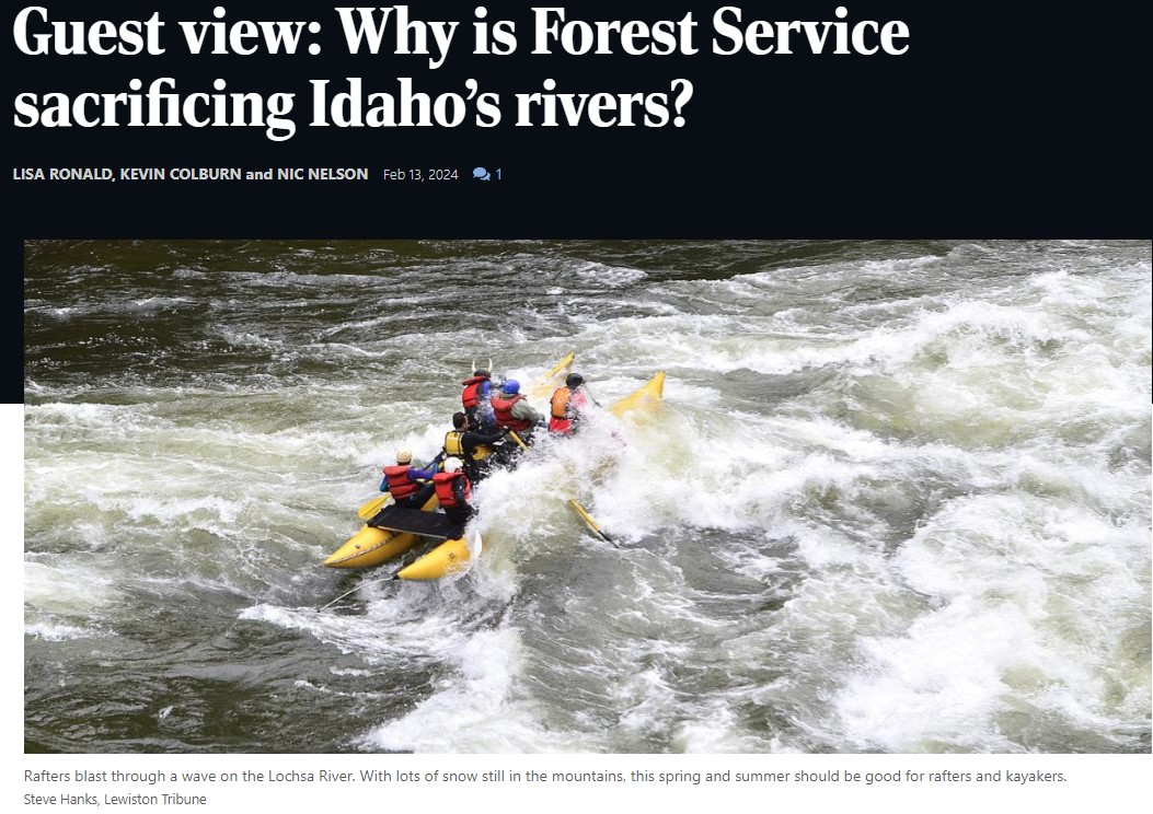
The Lochsa, Selway, and Clearwater watersheds just over Lolo Pass are home to some of the finest rivers in the United States. They offer world-class paddling and fishing, provide vital spawning grounds for salmon and steelhead, and are sources of clear, cold water in a rapidly warming world.
It’s the job of the Forest Service to protect these special values based on the streams’ eligibility for Wild and Scenic River designation.
The Nez Perce-Clearwater National Forest is instead gutting protections for Idaho’s rivers. In its recently revised forest plan, it stripped safeguards from 86 percent of rivers worthy of preserving. Across 4 million acres in central Idaho, the Forest Service is recommending just 12 streams for protection. Since Forest Plans routinely last for decades, the detrimental decisions made now by the Nez Perce-Clearwater National Forest will allow unacceptable and unnecessary impacts to rivers for generations.
In all, the new forest plan would remove protections from nearly 700 stream miles. That’s more than the length of the Clark Fork, Flathead, and Bitterroot rivers — combined. Among the waterways that would lose protections are tributaries to the Lochsa River and the North and South forks of the Clearwater River. These are the kinds of rivers the Wild and Scenic Rivers Act was designed to conserve.
The North Fork Clearwater River, which is losing protections it has had for more than 30 years, provides nearly 80 contiguous boatable miles and unsurpassed habitat for bull trout and west slope cutthroat trout. The South Fork Clearwater River, renowned for its unmatched B-run steelhead fishing, miles of walk-and-wade shoreline, and robust whitewater, is also on the chopping block. READ MORE
The current forest plans were signed in 1987. Since that time, much has changed regarding resource management of the National Forests and we are currently in the process of revising the Forest Plan under the direction of the 2012 Planning Rule to incorporate changed conditions, best available science, and new public issues.
Please select the link in the header above or any of the following links for more information about the Forest Plan Revision process, the ongoing collaborative effort, and how you can get involved.
Drive high enough into western Montana’s Lolo National Forest, up a succession of dirt tracks that parallel glittering creeks and twist through stands of fir and spruce, and eventually you’ll come to a clearing. At first glance it’s unremarkable, a grassy, sunlit hillside scattered with bleached tree trunks, as though a windstorm had opened the canopy.
It would be a pleasant spot to sit with your back against a lodgepole pine and watch chickadees bounce from branch to branch. What makes this clearing extraordinary isn’t what’s there now, but what once was—a road.
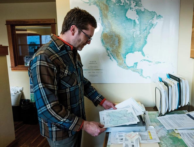
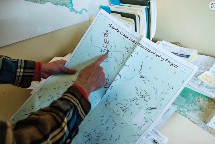
I visited the clearing one summer afternoon with an ecologist named Adam Switalski. Years ago, Switalski explained, large tracts of this land belonged to a private timber company, which had etched the forest with dirt roads to haul out wood. Eventually the logging operations ceased, and the company transferred its holdings to the U.S. Forest Service, which did little to deal with the derelict roads it inherited. The neglected roads plagued the forest, bleeding silt into streams and funneling disruptive humans into critical habitat for grizzlies, lynx and other sensitive species. Switalski held up his phone to display a map of the forest, across which the black lines of obsolete roads squirmed like parasites in a gut. “This is the kind of thing we’re dealing with,” he said with dismay.
The map is hardly unique. Roads, with their deadly traffic, noise pollution, chronic erosion and attendant humans, are among the most ubiquitous and powerful forces threatening our public lands and the wildlife and fragile ecosystems they contain. They point like “dagger[s] at the heart of any wilderness,” former Supreme Court Justice William O. Douglas wrote in his 1965 environmental treatise A Wilderness Bill of Rights. Today America’s roadless areas sustain more than 200 threatened and endangered species; elsewhere, they furnish strongholds for creatures like Amur tigers and African elephants. Yet these refuges are tragically scarce. In the contiguous United States, it’s impossible to get farther than 22 miles from the nearest road.
The Montana hillside on which Switalski and I now stood was a prime example of an unglamorous yet powerful tool for protecting our biodiversity—road removal, commonly known as road decommissioning. In the early 2000s, the Forest Service brought heavy machinery to this old logging road, ripping it up to permit new grasses, shrubs and trees to sprout from the stirred earth. Waist-high thimbleberry bushes now covered the slope, and Douglas fir seedlings plunged roots deep into the loosened soil. It seemed improbable that 30-ton logging trucks had ever trundled through here along a ribbon of asphalt-hard dirt. “One time, I was skiing with a buddy of mine around here and we passed an old road,” Switalski said as we wandered through the clearing. “He didn’t believe there had ever been one there. That’s the ultimate sign of success.”
Few people have seen more success than Switalski, who serves as project manager at a Montana-based nonprofit called the Clark Fork Coalition, named for the river whose watershed it serves. Over the last two decades, Switalski has guided road restoration’s best practices and demonstrated its value for species as diverse as black bears and cutthroat trout. For most of that period, however, his work, and the work of other would-be road removers, has been hampered by shoestring budgets and politicians ideologically opposed to road destruction. But a recent wave of federal legislation and programs has sparked a boom period for road decommissioning—one that could reshape America’s national forests.
“It is just the most exciting time in my career right now,” Switalski told me. “It’s a generational opportunity, if not the opportunity of a lifetime.” Road networks, like many cancers, tend toward exponential growth; today it finally seems possible that ours is about to shrink.
Homo sapiens, the legal scholar Jedediah Britton-Purdy once observed, is an “infrastructure species”—a creature defined by what it builds. And what we build, most of all, are roads. Some 40 million miles of roadways girdle our planet, four million of which enfold the United States. America’s interstate highways might be its grandest and most-trafficked routes, yet the country’s largest road network, and likely the world’s, is managed by the U.S. Forest Service, the federal agency that administers more than 190 million acres of public land. The Forest Service calls itself the Land of Many Uses—national forests are stomping grounds for timber companies, rangelands for ranchers, playgrounds for hunters and fishers—but it might be more apt to call it the Land of Many Roads. Around 370,000 road miles, the vast majority unpaved, lattice our national forests, enough to encircle Earth 15 times. READ MORE
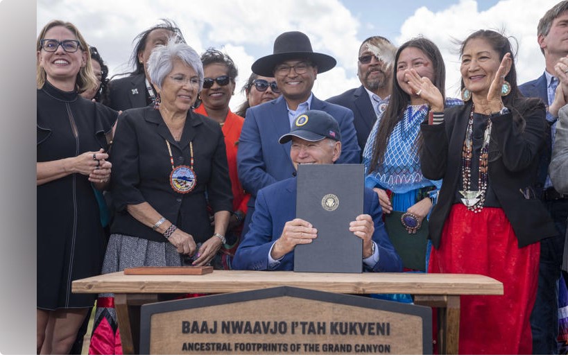
On August 9, 2023, the Southwestern Region was honored to host President Biden and USDA Deputy Secretary Xochitl Torres Small for the presidential designation of the Baaj Nwaavjo I’tah Kukveni—Ancestral Footprints of the Grand Canyon National Monument in northern Arizona.
The national monument designation (watch the C-SPAN video) builds upon decades of effort from tribal nations, state and local officials, advocates for outdoor recreation and conservation, local business owners and members of Congress. The new national monument consists of three distinct areas to the north and south of Grand Canyon National Park, totaling approximately 917,599 acres of federal lands which will be recognized and preserved in perpetuity.
These lands are at the heart of many tribes in the region, including the Havasupai Tribe, Hopi Tribe, Hualapai Tribe, Kaibab Band of Paiute Indians, Las Vegas Paiute Tribe, Moapa Band of Paiutes, Paiute Indian Tribe of Utah, Navajo Nation, San Juan Southern Paiute Tribe, Yavapai-Apache Nation, Yavapai Prescott, Pueblo of Zuni and the Colorado River Indian Tribes. The Havasupai call the land Baaj Nwaavjo, which means “where Indigenous peoples roam,” and the Hopi call it I’tah Kukveni, which means “our ancestral footprints.”
The monument area is replete with evidence of thousands of years of human habitation, including dwelling sites, pottery and lithic sites containing stone tools. Indigenous peoples continue to practice their traditional lifeways within this area, including religious ceremonies and gathering and utilizing natural resources, including those unique and exclusive to this region. READ MORE
The Arizona Legislature’s top two Republicans have challenged Democratic President Joe Biden’s creation of a new national monument last summer just outside Grand Canyon National Park, alleging he exceeded his legal authority in making that designation under a century-old law that lets presidents protect sites considered historically or culturally important. In a lawsuit filed Monday against Biden, Arizona Senate President Warren Petersen and House Speaker Ben Toma alleged Biden’s decision to designate the new monument under the 1906 Antiquities Act wasn’t limited to preserving objects of historic or scientific value and isn’t confined to the “the smallest area compatible with the proper care and management of the objects to be protected.”
The monument designation will help preserve 1,562 square miles (4,046 square kilometers) just to the north and south of Grand Canyon National Park. The monument, called Baaj Nwaavjo I’tah Kukveni, turned a decadeslong vision for Native American tribes and environmentalists into a reality. Republican lawmakers and the uranium mining industry that operates in the area had opposed the designation, touting the economic benefits for the region while arguing that the mining efforts are a matter of national security. READ MORE
Comment period for the Boise National Forest’s Sage Hen project is open up to February 20.
Follow the first link below then click on the “Comment/Object” link on the right side of the page to enter or upload your comments.
Sage Hen has a limited amount of Recreation proposals in the Plan as-written, but the opportunity is still open to get on-record with suggestions.
Specifically, the district ranger has offered to consider ideas that can fit well into the existing plan scope. For instance, there could be an opportunity to utilize some of the proposed closures of road spurs for parking and walking trails. If you have any specific ideas, please comment and provide details.
Please note: This Plan is not at the final Decision Notice stage, so this is the time to get your comment in if you want to be eligible to participate during the subsequent Objection phase of the process.
Basic Analysis:
• https://www.fs.usda.gov/project/boise/?project=56701
• Map centered on Project Area: https://arcg.is/iXv0y0
• Groomed OSV routes may be plowed during veg activities, coordination with Valley Co. grooming and IDPR is in the plan.
• 8.2 mi of currently-open primitive road are proposed to be closed to public motorized use. An appropriate comment would be to suggesting conversion to recreational trail particularly if such routes create loops (see maps at Project site).
• 1.0 mi Tr389 of <50″ trail is proposed to be decommissioned: Let FS know why you object or if you have an idea for a replacement trail to offset the loss.
• 5.6mi of routes are proposed to change from open-year-round to seasonal public access.
• Renwyck Creek Trailhead is proposed to be redeveloped and CXT toilet added. See https://arcg.is/5benz
• A reduction of available Authorized Dispersed Camping is proposed along NFR614.
• Fun fact: Sage Hen is home to the KYAOTT Trail. KYAOTT means “Keep Your ATV On The Trail.”
• Sage Hen Area Recreation Brochure: https://www.fs.usda.gov/Internet/FSE_DOCUMENTS/stelprdb5286976.pdf
Notable excepts from the Revised Environmental Assessment & Finding of No Significant Impact statement for the Plan (emphasis added):
Pg 11
Existing conditions are also negatively affecting areas within and between habitat patches for wildlife. Species sensitive to motorized vehicle disturbance or vulnerable to road-associated mortality are most impacted. Impacts from the spread of noxious weeds along these corridors and erosion on bare ground are other consequences of unauthorized use (see Figure 14).
Pg 12
Purpose 3: Recreation Use
[There is a need to …] Enhance recreational experiences while reducing potential for resource degradation and manage dispersed and motorized recreation to reduce user conflicts.
Need for Management Actions
The project area is one of the more popular recreation destinations on the Emmett Ranger District. As the population in the greater Treasure Valley has increased, the recreation facilities around the Sage Hen Reservoir are often at capacity. Some dispersed camp sites along National Forest System Road 614 have been encroaching into designated campground developed sites around Sage Hen Reservoir, which has been causing conflicts between users. Other types of recreational use include both motorized and non-motorized trails.
To contribute to the accomplishment of these objectives, as informed by the Forest Plan (USDA USFS 2010a, pp. III-318, III-319), there is a need to enhance existing trails and reduce impacts to other resources through re-routes and to provide safe trailhead locations. Additionally, there is a need to reconstruct the Renwyck trailhead to meet current Forest Service standards, replacing and installing information kiosks, installing vault toilet, installing barrier rock around the trailhead parking area, and placement of aggregate throughout the trailhead parking area.
To reduce user conflicts, there is a need to change dispersed camping designations between Hollywood Campground and Antelope Campground on the Motor Vehicle Use Map.
Pgs 16-17
National Forest System Road Construction
Permanent roads would be constructed on existing unauthorized routes needed for management and administrative use. Such use would provide long-term access to Forest Service lands for safe and efficient travel and for administration, use, and protection of Forest Service lands.
Road Reconstruction
Road reconstruction through realignments and aggregate surfacing would occur on approximately 6.0 miles. Such work would occur on either new road prisms or existing/abandoned road prisms to restore the original road template. Reconstruction would improve the road conditions and make them suitable for timber haul, recreational access, and/or permitted uses. The Forest Road Inventory would be updated to reflect any changes.
Road Maintenance
Roads would be maintained to implement management activities and improve existing road conditions. Road maintenance includes road prism blading and shaping, roadway vegetation clearing, roadway ditch and culvert cleaning, drainage culvert replacement and installation, water bar removal and installation, road aggregate resurfacing, dust abatement and surface repair including spot aggregate placement. Commercial users would maintain the roads commensurate with use.
Conversion of Unauthorized Routes to Forest System Roads
Approximately 0.3 miles of unauthorized routes would be added to the Boise National Forest transportation system to implement management activities and increase dispersed recreational opportunities. The addition of other unauthorized routes is associated with other proposed road realignments.
Road and Trail Decommissioning
Unauthorized roads and trails and/or abandoned templates could be decommissioned. Such work would minimize illegal motorized use, restore the road or trail area to a more natural state and minimize sedimentation and impacts to aquatic and wildlife habitat. Unauthorized routes discovered during project preparation or implementation could be decommissioned. Some unauthorized routes may be used as temporary roads during timber harvest implementation and then decommissioned. For unauthorized routes not associated with a timber sale area, routes could be decommissioned through other mechanisms.
Road Storage
Up to 3.2 miles of National Forest System roads may be placed into a state of storage or non-use status (i.e., closed to motorized public use) for an extended period to preserve the road’s integrity and protect resources. Such roads may be needed for future management use. These roads are currently open to the public; changes to their use would be reflected on the Forest Motor Vehicle Use Map.
Aquatic Organism Passage Improvement
Culverts on Pole Creek and Cold Springs Creek are immediately adjacent to critical bull trout occupied habitat. These culverts would be removed and replaced with structures and/or larger culverts to restore connectivity for aquatic organism passage.
Snowplowing
Snowplowing would occur to facilitate winter logging operations. Such work could occur on groomed routes, effectively closing them to snowmobilers, including National Forest System roads 618, 625, 653, 607, 609, 614, 626 and 644. Prior to planning and implementing project activities on groomed snowmobile routes, the Forest Service would coordinate with Gem and Valley County commissioners, the Valley County snow groomer, the Idaho Department of Parks and Recreation, and snowmobile user groups before temporarily closing any routes.
Pg 20
Recreation Management Activities
Activities proposed under this category are identical between both Alternatives A and B.
Renwyck Creek Trailhead Reconstruction and Improvement
The current trailhead is not currently well-defined. As such, unauthorized use and encroachment into the adjacent Snowbank Inventoried Roadless Area (IRA) is occurring. The trailhead would be reconstructed on the 609G road near the 609 road, clearly outside the IRA. The Forest Service proposes to reconstruct the trailhead to meet current standards, re-route the 609G road and decommission the original route, re-route the existing trail to the new trailhead, replace/install trailhead kiosks, install barrier rock around the trailhead parking area to block access to the nearby creek and IRA, place aggregate material and compact surfaces throughout the trailhead parking area, and install a vault toilet.
Kiosks may be installed at other select trailheads and access points to provide information on motorized use opportunities and responsible recreational vehicle use.
Rehabilitation of Dispersed Camping Impacts
Authorized dispersed camping along National Forest System Road 614 adjacent to and between the Hollywood Campground and Antelope Campground would be removed and the Motor Vehicle Use Map would be updated. This work would be done in response to conflicts occurring between developed and dispersed campers along this section of road.
Please inquire with any questions.
Alex Ernst IDPR – Recreation Bureau 208-832-8412
 The Wallowa Mountains Hells Canyon Trails Association are a dedicated group of hikers and outdoor enthusiasts who monitor and help maintain our local trails in Hells Canyon and the Wallowa Mountains.
We coordinate with the US Forest Service and organize volunteer work parties to clear downed trees, cut back brush, and do whatever else is necessary to keep our local hiking trails open and accessible.
Check the trail conditions before you hike…
(Please note that trail conditions on the below web pages may not be up-to-date)
Starting with a USFS-sponsored meeting on April 26, 2016, a group of individuals in Wallowa County, Oregon, began meeting weekly to work toward forming a volunteer organization to address community concerns about the condition of trails and cultural resources in the area. These meetings eventually led to the creation of a membership-based non-profit organization, the Wallowa Mountains Hells Canyon Trails Association (WMHCTA), which was officially launched on February 13, 2017.
Currently there are over 100 members of WMHCTA. In five years of field operations, we have clocked over 11,000 hours of volunteer time while putting in 244 days in the field. We’ve cleared 479 miles of trail, removing approximately 3,500 trees in the process. And we’ve had fun doing it, with no serious injuries.
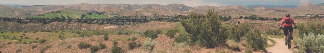
In the fall of 2023, Boise Parks and Recreation launched a 16-question online survey to gather feedback on the Boise Foothills trail system. The Ridge to Rivers partnership, led by the City of Boise, received more than 3,400 responses to the trail user survey that closed on November 3, 2023. Thank you to those who participated in the survey – we appreciate the feedback you shared and are now working to incorporate many suggestions into our practices!
Overall, feedback received shows appreciation for the Ridge to Rivers Trail System. Comments about muddy trail etiquette, dog waste issues, and interactions between differing user groups were common. Our goal is to continue educating users about wet weather and winter trail use throughout the year, both on the Ridge to Rivers Facebook page and the interactive map. We also want to remind people to always carry mutt mitts to pick up their pet’s waste. Finally, we encourage all trail users to revisit the Happy Trails pledge to ensure that everyone has a positive experience while recreating in the Boise Foothills.
Some other ways we are using your feedback and implementing recommendations:
Thank you again for your participation and feedback. The annual survey helps us continue to learn about user experiences on the trails and improve management of the Ridge to Rivers Trail System.

Monday, January 8, 2024 – 5:51 AM MST
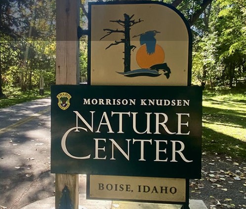
Idaho Fish and Game’s MK Nature Center will host evening lectures for adults each month through May 2024. All lectures will be held at the MK Nature Center at 600 S. Walnut Street in Boise and will begin at 6:30 p.m. No registration is necessary; these events are free and open to the adult public. If you have questions, contact sara.focht@idfg.idaho.gov.
Upcoming lectures include:
Jan. 17 – Outdoor Photography
Outdoor photographer Patrick Stoll will share a wealth of tips and techniques for taking advantage of the capabilities of your digital camera. Whether you are using an adjustable camera with many functions or a smart phone, there will be something for everyone.
Feb. 22 – Hunting as Conservation
Eric Keren will present the history and concept of hunting as an act of conservation. Look back in time to understand how hunting plays a key role in today’s conservation landscape.
March 14 – The Role of Nonprofits in the Protection of Idaho Rivers
Rob Tiedemann from the Boise River Enhancement Network will be explaining the efforts of nonprofits, volunteers and citizen scientists in conserving the Boise River.
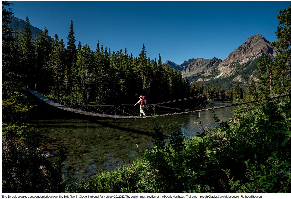
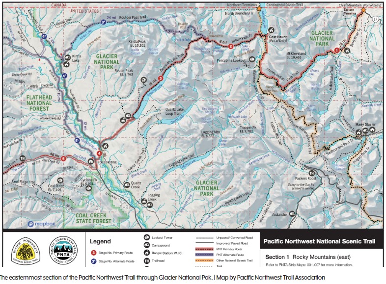
From the Chief Mountain port of entry on the Montana-Canada border, a dedicated hiker can follow a series of backcountry trails, bike paths, old rail beds, paved roads, bushwhacks, and cow paths, all the way to the beach of Cape Alava, Wash., the westernmost point in the continental United States.
This stitched-together route connecting Glacier National Park and Olympic National Park, known as the Pacific Northwest Trail (PNT), stretches 1,200 miles, “from the Rockies to the sea,” crossing seven National Forests, six wilderness areas, and three national parks, as well as tribal, municipal, and private lands in Montana, Idaho and Washington.
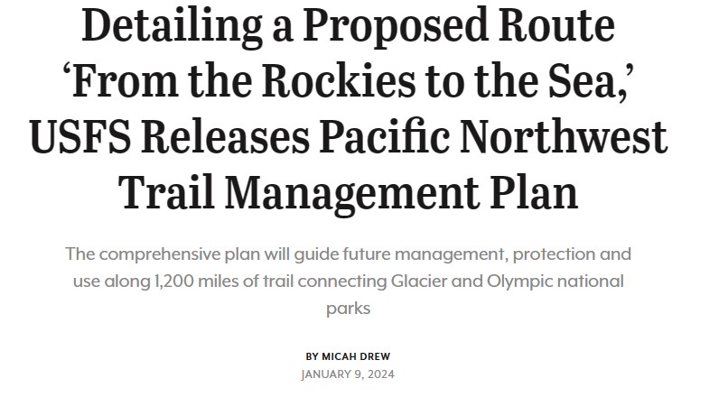
In December, the U.S. Forest Service released the final version of the PNT comprehensive plan, a document which outlines a vision for the non-motorized trail and provides guideposts for management, conservation and use into the future. The trail has only existed in its official capacity for 15 years, and like other early national scenic trails “much more work is needed to complete the optimal route from end to end,” the plan states.
“With the comprehensive plan in place, new trail locations can be studied, and new trail segments will be constructed as conditions allow,” Pacific Northwest Acting Regional Forester Liz Berger said in a press release. “This will enable the trail to evolve and adapt to changing needs and environmental considerations, ensuring its sustainability for future generations.”
The PNT was first proposed and completed in the 1970s but wasn’t officially designated as a National Scenic Trail by Congress until 2009, joining other long-distance hiking staples like the Pacific Crest Trail, the Appalachian Trail and the Continental Divide Trail, the latter of which also has a terminus on the Montana-Canada border in Glacier Park.
There are dozens of political arenas throughout state and federal government frameworks where fish, wildlife, and outdoor opportunities can be enhanced or put on the chopping block. We monitor and work with all individuals, agencies, processes and levels of government that can impact our outdoor heritage and let you know when and how you need to speak up.
We are at the state house every time sportsmen interests are under attack. We facilitate strategic legislative planning for sportsmen groups, professionally represent their interests in the legislature, promptly disseminate action alerts to our groups and supporters, and maintain close contact with the press. With a wealth of knowledge of natural resource policy, we operate by anticipating bad bills to efficiently defeat them, authoring proactive wildlife and sportsmen legislation, testifying in committee, and utilizing our state of the art communication and outreach system.
Sign up here for news, legislative updates, and action alerts for the legislative session.
Click this link to find your local legislators https://legislature.idaho.gov/legislators/whosmylegislator/
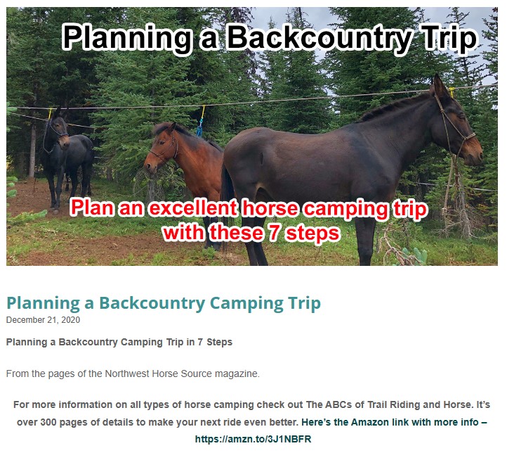
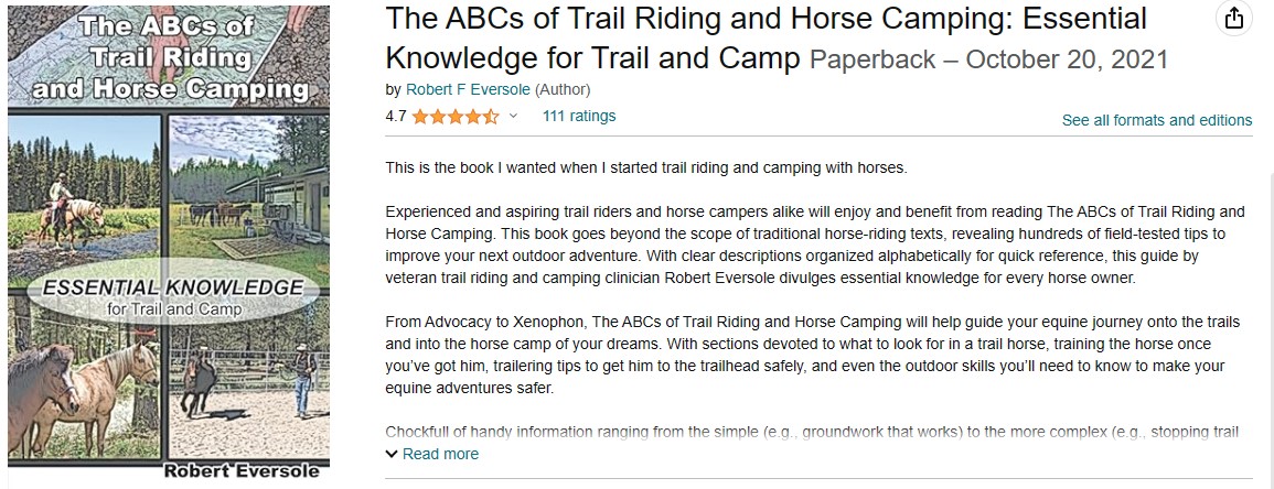
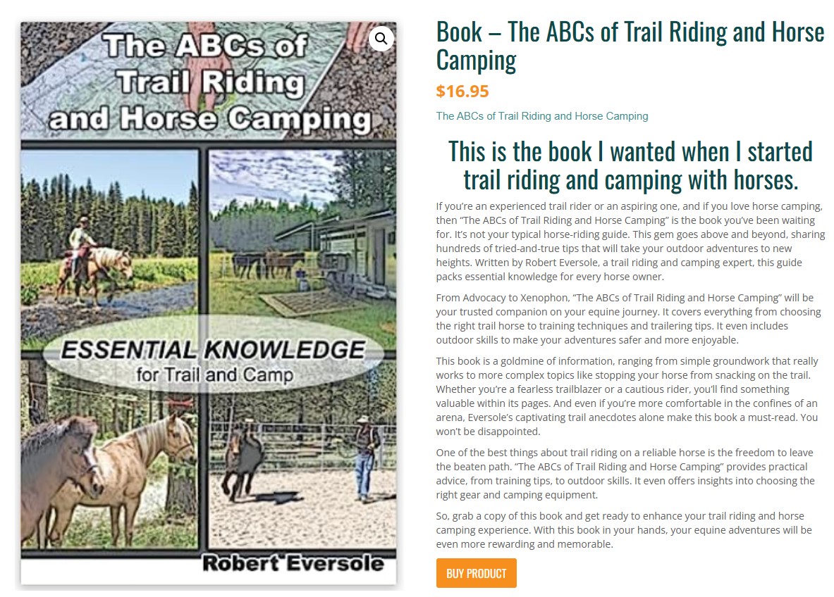
READ MORE: Planning a horse camping trip-TrailMeister
Note: as proposed in the following PDF, this idea as outlined is in violation of Idaho Law because it involves paying for services on public lands which is illegal’s unless you are a licensed “Outfitter & Guide” which BCHI is not. It would also likely provoke a civil suite from the Outfitters & Guides Association.
Proposal to create income and new memberships to grow the BCHI organization
Sunday January 7, 2024 @ 15:00 (3 PM)
Join the team helping to pick next years calendar pictures lead by Marjaliisa & Dan Waugh
Topic: IHC Trails BCHI Calendar Meeting
Time: Jan 7, 2024 03:00 PM Mountain Time (US and Canada)
Join Zoom Meeting
https://us02web.zoom.us/j/89722040707?pwd=bURVRTdKNVM5YU9BSTZWb2Nza3paZz09
Meeting ID: 897 2204 0707
Passcode: 765217
—
One tap mobile
+17193594580,,89722040707#,,,,*765217# US
+12532050468,,89722040707#,,,,*765217# US
—
Dial by your location
• +1 719 359 4580 US
• +1 253 205 0468 US
• +1 253 215 8782 US (Tacoma)
• +1 346 248 7799 US (Houston)
• +1 669 444 9171 US
• +1 669 900 9128 US (San Jose)
• +1 646 931 3860 US
• +1 689 278 1000 US
• +1 301 715 8592 US (Washington DC)
• +1 305 224 1968 US
• +1 309 205 3325 US
• +1 312 626 6799 US (Chicago)
• +1 360 209 5623 US
• +1 386 347 5053 US
• +1 507 473 4847 US
• +1 564 217 2000 US
• +1 646 558 8656 US (New York)
Meeting ID: 897 2204 0707
Passcode: 765217


Sweet, Idaho/Price, Utah – Leon E. Berggren, 80, passed away on Christmas Day 2023 in Boise, Idaho. Dad is finally free! Leon was born on February 8, 1943, to Alta Marie and Carl S. Berggren of Imperial Nebraska, he was the second child of three children.
Leon moved around a lot with his family before graduating from Socorro High School. There, he met the love of his life Margaret Scott. They were married on February 2, 1964. Leon went on to New Mexico State University, where he earned his Bachelor of Science Degree in Wild Life Management.
In 1966, Leon and Margaret welcomed a son Scotty, and in 1970, they welcomed another son, Eric. Leon enjoyed spending time with his sons, hunting, fishing, camping, boating, running rivers, and bucking hay, just
to name a few. He was an avid outdoors man.
Leon’s job took him to many states, working in New Mexico, California, Utah, and retiring in Idaho in 1999. Leon loved retirement having cattle of his own in Sweet, Idaho. Leon enjoyed working his cattle with Margaret by his side. There, he had many happy memories with his children and grandchildren, who he loved with his whole heart.
Leon will always be remembered as a BLM man, firefighter, husband, dad, grandpa, papa, and great grandpa. Leon will be dearly missed by his family and many friends.
He is survived by his wife Margaret, son Scott, and wife Stacy, son Eric, and wife Ralynn. Five grandchildren, Carl Russell, Brian (Aspyn) Berggren, Tiffanie Perkins, Cassie (Brady) Moore and Taylor Berggren. Four great grandchildren, Jackson, Gentry, Leah, and Carl Judson. Other surviving relatives include sister Anita Little, and husband Jack, nieces Arlene and Janice along with their families, cousin Walt, and many more cousins. Preceeded in death by his parents Carl S. and Alta Berggren, brother Carl Thomas, grandparents, aunts, uncles, cousins and friends.
Per Leon’s wishes, cremation has taken place by Bowman Funeral Parlor, Garden city. A memorial service/celebration of life will take place at a later date this spring in Sweet, Idaho, with an interment at the Sweet Idaho Cemetery.
Leon & Margaret Berggren
PO 126
Sweet, ID 83670
Margaret, Lorraine & Chick at Wilson Creek
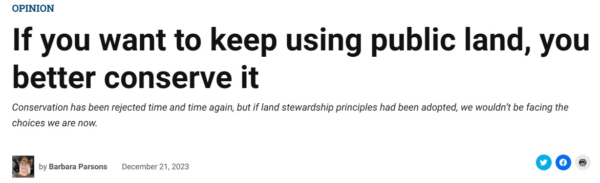
Those who lament they never have enough places to drill and scrape have a narrative about the huggers that love trees more than people. They can get vicious with their accusations. A local publisher castigated me for depriving our children of education dollars and the hospital of revenue because I legally opposed an exemption for a Williams project on a Bureau of Land Management Area of Critical Environmental Concern west of Rawlins.
The concept of stewardship using the best available technology has been rejected time and again. If those principles had been adopted, we would not be facing the choices we are now.
Our governor recently spoke against rules limiting methane releases, even though the producers in our state have egregiously spewed it into our atmosphere for years.
When the Atlantic Rim coal-bed methane area was developed, Yellowstone-like mud pots bubbled throughout the riparian areas there. But, that was only a small stream of the methane that sniffer technology found gushing into the atmosphere there. In fact, some joked that there could be a geyser of fire if a match was struck. Ironically, those seeps had been happening for years, and yet developers and regulators ignored the fractured geology of the area as they maximized drilling. READ MORE
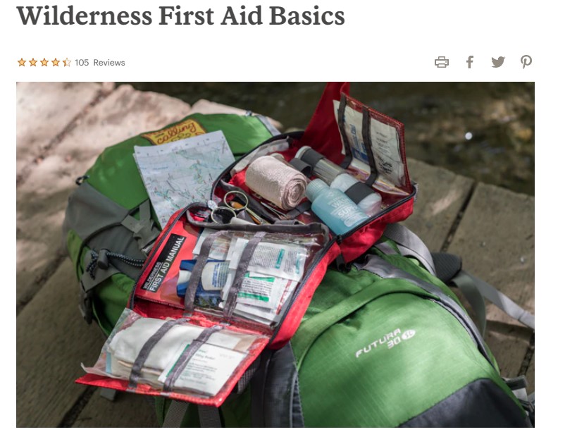
If you’re headed outdoors, you should always carry either a prepackaged first-aid kit or a DIY kit that you can create using our list as a guide. Knowing how to use the items in a first-aid kit is as important as having them, so consider taking a training course.
This list is a good starting point. It also includes emergency essentials that you might carry separately from a kit. You’ll also need to include any prescription medications your group needs, as well as additional supplies you might need for where you’re going and how long you will be out.
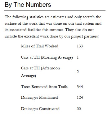
2023-Project-Report-ICT 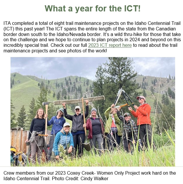
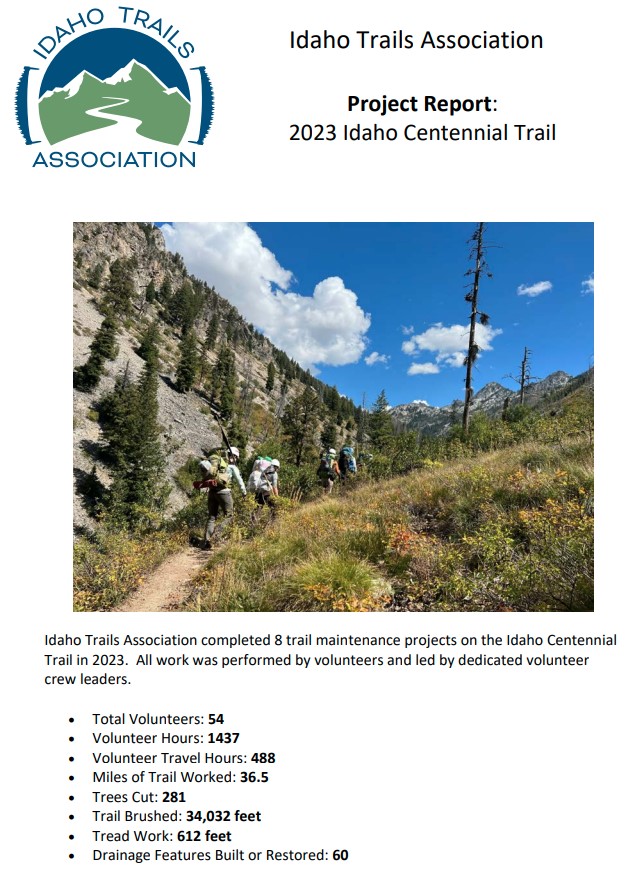 READ FULL REPORT: 2023-Project-Report-ICT

Recently, I wrote about the dark side of CPR. Despite a common misperception that CPR can rescue almost anyone from the brink of death, most people that receive it don’t survive. Of those that do, many sustain devastating neurological injury and may never wake up. CPR often causes additional injuries that can add pain and indignity to the final moments of life, and can sometimes be traumatizing to the healthcare providers that deliver it.
I heard from many nurses, doctors, EMTs, and paramedics who were grateful that I had brought attention to the difficult reality that CPR may often cause more harm than good.
But I also heard from people who owed their lives to CPR. Nick Sakes, an avid cyclist from Minneapolis, was 58 when he collapsed on a ride at a busy intersection. A nurse in a nearby car saw him go down. He didn’t have a pulse, and she performed CPR until paramedics arrived. Using a defibrillator, they found that he was in an abnormal heart rhythm called ventricular fibrillation, a common cause of cardiac arrest that is often responsive to electric shocks.
For many, a ‘natural death’ may be preferable to enduring CPR
After three shocks, Sakes’ heart reverted to a normal rhythm. He had a pulse again. He regained consciousness the next day, and was startled to find a team of doctors looking down at him. Apart from sore ribs, he suffered no significant injuries from his cardiac arrest, or from his resuscitation. “I haven’t had any problems,” he told me. He still rides his bike just as much as before. “I feel exactly the same,” he said. READ MORE

“Nurse refuses to perform CPR,” read the caption on an ABC newscast in California. “911 dispatcher’s pleas ignored.” Several days earlier, an elderly woman at a senior living facility had gone into cardiac arrest. The dispatcher instructed an employee to perform CPR, or cardiopulmonary resuscitation. But the employee refused.
“Is there anybody there that’s willing to help this lady and not let her die?” the dispatcher said. It made the local news, which elicited a national outcry and prompted a police investigation. But the woman was already dead — her heart had stopped. And according to family, the woman had wished to “die naturally and without any kind of life-prolonging intervention.”
So why the controversy? It comes down to a widespread misconception of what CPR can, and can’t, do. CPR can sometimes save lives, but it also has a dark side. READ MORE
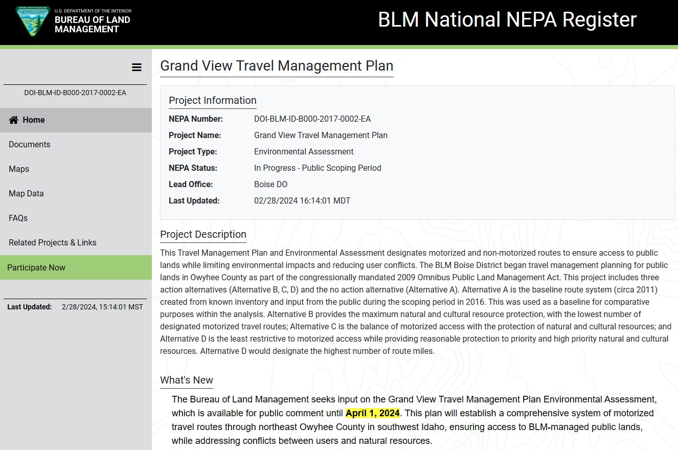
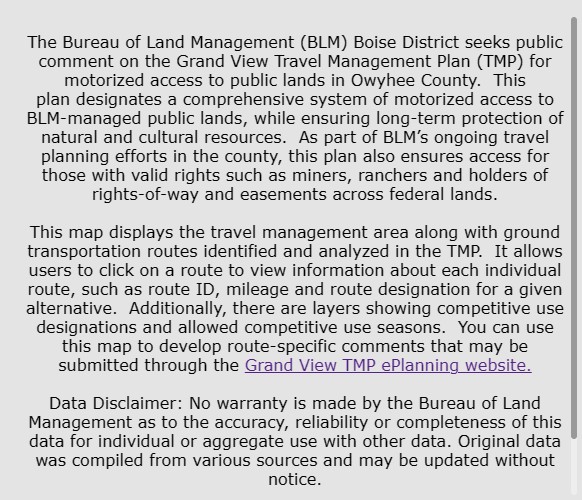
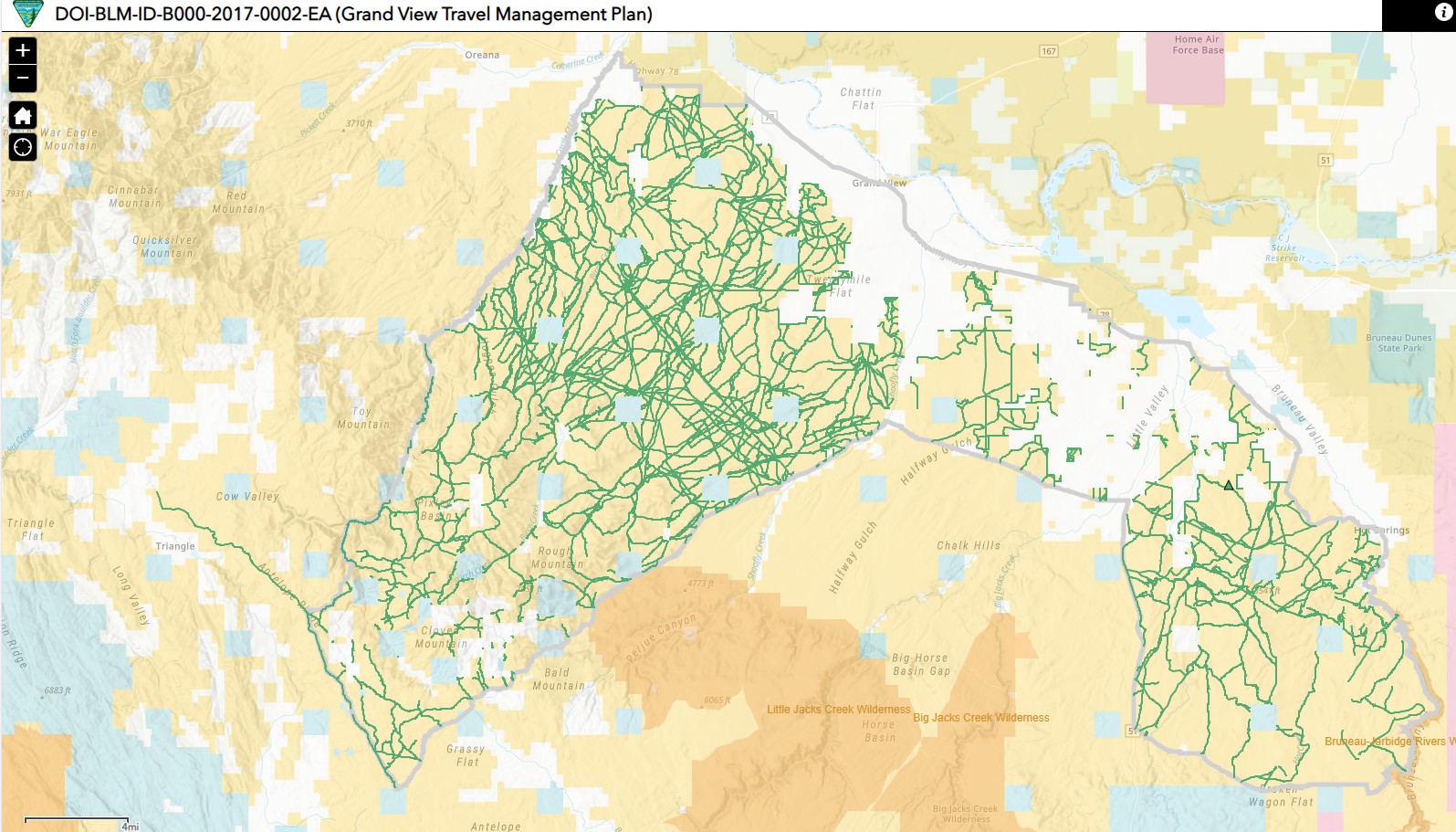
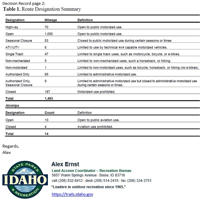
Updated on 02/28/2024 BLM Owyhee Travel Management Update 02-28-2024
BLM Issues Decision for Silver City Travel Management Plan March 25, 2024
# * # * # * # * #
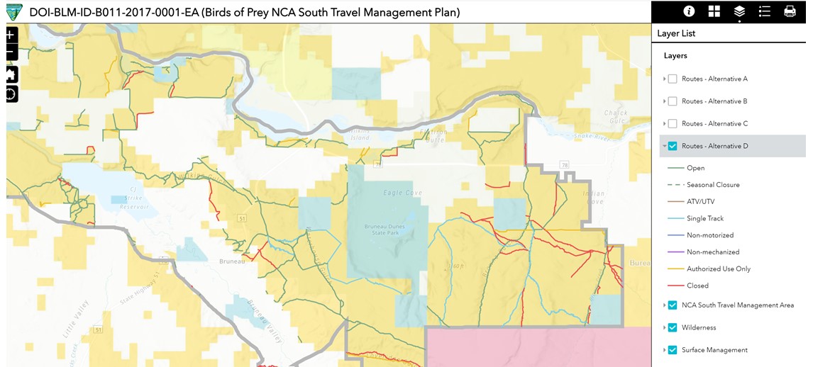
The 3rd of the five Owyhee Travel Management Plan (TMP) draft Environmental Assessments (EAs) is now open for public comment. Area covered is the Morley Nelson Birds of Prey National Conservation Area, South (or just NCA).
The first and second TMP processes resulted in “Alternative D+” Decisions: Canyonlands East; Canyonlands West. Silver City and Grand View areas are expected to enter the draft EA process and be completed by March 2024.
Comments will be accepted for NCA until January 8, 2024, through BLMs web portal (see “Participate now”) at the E-panning page for NCA South.
(Please do not submit comments to any BLM email address, they will tend to go into a black hole– use the Portal linked above.)
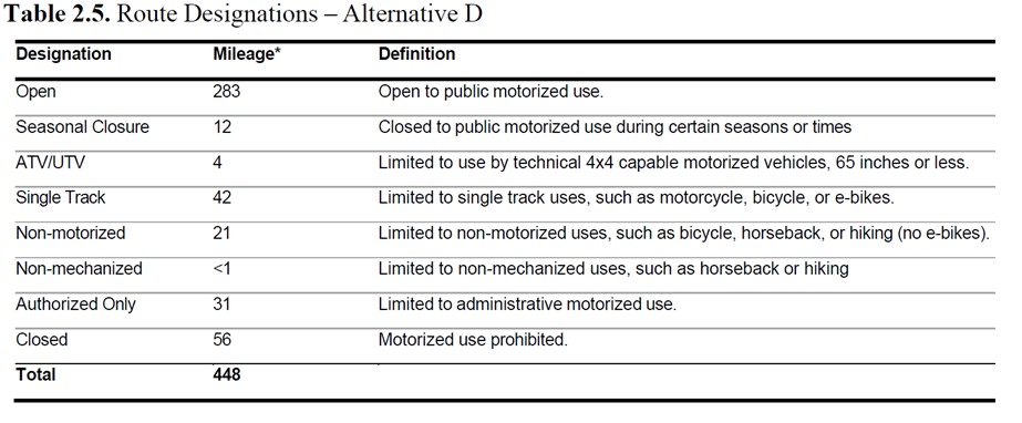
Using the BLM NCA South Alternatives map (see special instructions further down) and your knowledge of the ground, form your comments advocating for the most possible access (Alt D), siting route numbers and reasons to support keeping a route open such as looping opportunities. Alt A will not be selected; it is for showing “existing condition” based on the inventory BLM arrived at during previous process in 2016-7 and IDPR and stakeholder feedback. (Click on routes on the BLM map to get #s.)
Compared to IDPR’s current map for the area, access to several singletrack trails is proposed to be added under Alt D, fewer under Alt C. (Off-designated-route travel has been prohibited since passage of the 2009 OPLM Act.)
The NCA South Travel Plan covers approximately 112,087 acres of BLM-managed lands, the portion of the Birds of Prey NCA south of the Snake River. It analyzes 448 miles of routes inventoried by the BLM pursuant to the 2009 OPLM Act which requires travel management planning to be completed for all BLM ground in Owyhee County. The range of action Alternatives being considered (B, C, D) would designate between 154 miles (Alt B) to 341 miles (Alt D) of motorized routes for public use.
Access would include routes near or across Highway 78 from existing Rabbit Cr and Fossil Cr OHV trailheads, and other routes north of the Canyonlands East and West travel management areas.
Anyone interested in a GeoPDF map of NCA with Alternative D Routes added, please reply with that request. We will work to produce these if requested.
The most motorized access option, Alternative D, proposes the following route mileages per Draft EA page 17:
(Note “Open” = full-width, and there will be no 50″ or under designations.)
BLM NCA web map https://blm-egis.maps.arcgis.com/apps/webappviewer/index.html?id=255cd29a2da448a4b18639af92cbb029
Pull down the Layer List, UNCHECK “Routes – Alternative A” and check “Routes – Alternative D”. Expand by clicking the small arrow to see the Legend symbology colors.
Leaving “D” checked, you can toggle the boxes for “C” or “B” to show the differences between the Alternatives by route type and whether proposed to be Open or Closed.
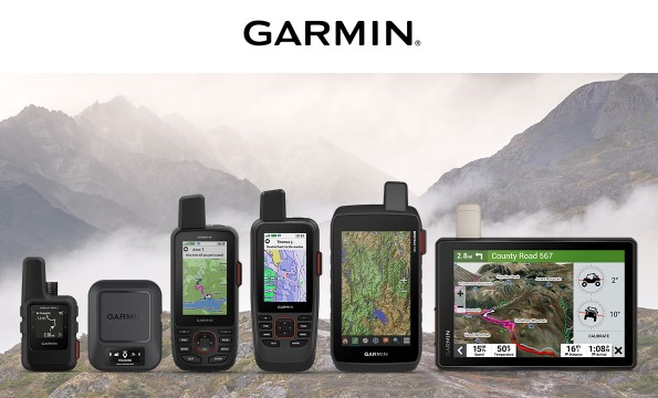
Which inReach Device is Right for You?
Giving the gift of inReach® this holiday season? Planning to invest in a new device for yourself? To help you choose from the growing inReach product line, we’ve put together an overview of our current devices and the best activities to use them for.
|
Good Afternoon,
I just wanted to reach out on two things.
First a reminder for our monthly meeting. The zoom instructions are below. This is the same link as always as this is a recurring link.
Second is pretty exciting. We have been working hard at exploring other funding source options and we think we found a better way forward. I know I have spoken to many on this and our meeting will cover more in detail.
After some discussions with Parks and Rec, we believe rebranding the State Parks Pass to a Idaho Parks and Trails pass. This would be 100% optional but we would want to spread the word that this would be both a pass for state parks as well as a funding source for trails. I think we can get people to buy this and support the passport who normally wouldn’t.
We are requesting a fee increase for both a funding source for non-motorized trails as well as increased revenue to state parks to increase State Park opportunities in the future. Using the current model we could generate between $1.4M and over $2M as well as increase funding for state parks based on sales. The current proposal is to charge $25 for the annual parks pass. $5 would be for trails with $20 for parks.
I will break this bill down in our meeting for those I haven’t discussed this with, however we are getting a lot of support as we discuss this.
Respectfully,
Dan Waugh
Idaho Horse Board
Idaho Horse Council Trails Chairman
Back Country Horsemen of Idaho Vice Chairman
360-791-1591
Off-roading groups and the State of Utah have filed legal challenges to keep Moab trails open to vehicles after federal officials announced large-scale closures in September.
Written by Andrew McLemore” November 1, 2023
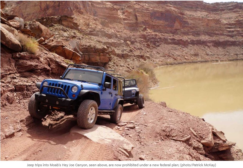
For decades, the precipitous trail through Hey Joe Canyon offered Moab off roaders an iconic experience of the area’s world-famous rock formations. But now it’s one of many classic trails closed to motorized recreation by federal officials. While some environmental groups laud the closures, opponents say they make access more difficult for everyone.
“For someone to access that now is severely limited,” said Joe Risi, Senior PR Manager for onX Offroad. “It limits those that are healthy and able, not just the young, old and disabled. Where I park my car, where I unload my bike, how much water I need to bring: It’s all been rocked by this.”
The mapping engineers at onX know better than most just how quickly land access in Moab is changing. They’ve spent the last several weeks updating the onX Offroad app as quickly as possible after the U.S. Bureau of Land Management announced a plan on Sept. 28 to close about 317 miles of Moab trails to motorized vehicles.
That decision led to widespread outrage from the off-roading community. In terms of density, it’s the largest single closure on the onX Offroad app since it was released in 2019. Roads in Hey Joe Canyon, 10-Mile Wash, Dead Cow, and Hell Roaring Canyon are now closed to anything with a motor, including e-bikes. The changes affect not only motorists, but also hikers and mountain bikers who will have a harder time reaching trailheads.
“Moab has become an iconic off-roading mecca. These trails are loved by this community, and that’s where it hits home,” said Risi. “But it also creates access problems for everyone. Many people don’t understand that.”
Environmentalists cheered the closures as a win for Utah wilderness. But legal challenges filed this week will attempt to stop federal authorities from moving forward with the plan. One thing is certain: The battle over the future of Utah land access is just getting started.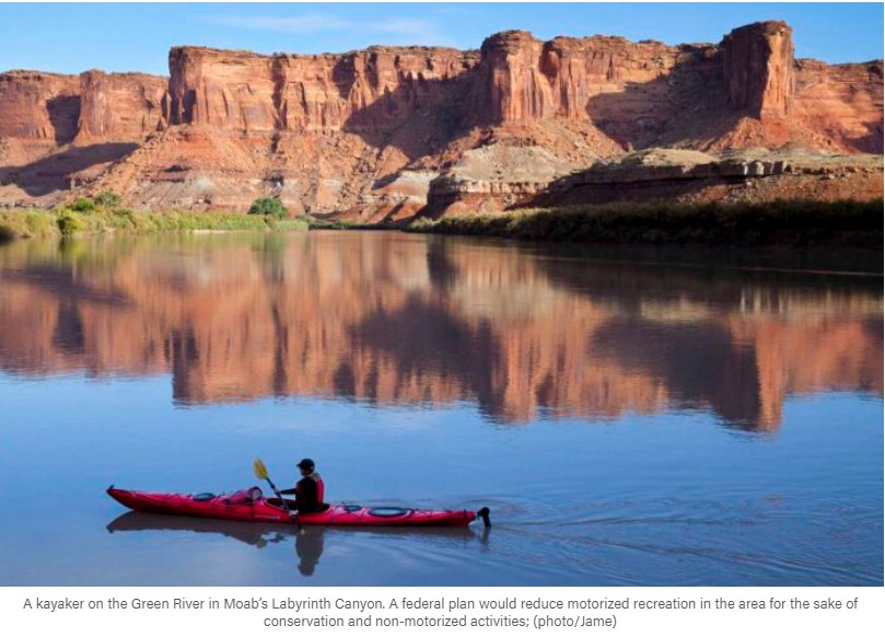
A Win for Wilderness Advocates
When the Bureau of Land Management (BLM) announced the trail closures, environmental advocates immediately welcomed the news. The closures will protect cultural sites, river habitats, and the “experience” of non-motorized recreationists, the Southern Utah Wilderness Alliance (SUWA) said in a news release on Sept. 28.
“Visitors will finally be able to experience stunning Labyrinth Canyon without the noise, dust, and damage that accompanies motorized recreation,” said Laura Peterson, SUWA’s staff attorney. “For too long, the BLM has prioritized off-road vehicle use at the expense of Utah’s incredible natural and cultural resources. The Labyrinth Canyon plan represents an important step forward to guide the management of Utah’s public lands and reduce the impacts of off-road vehicle routes in this area.” READ MORE
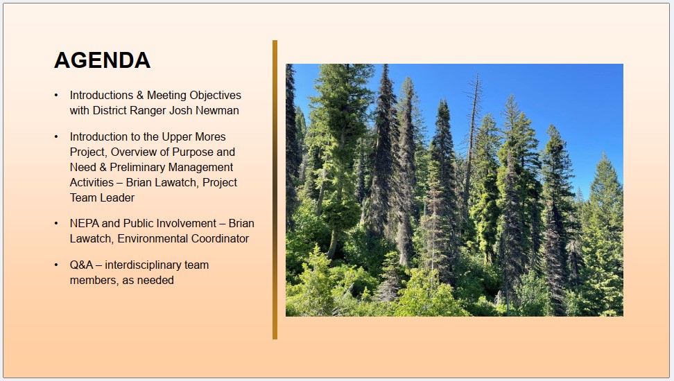
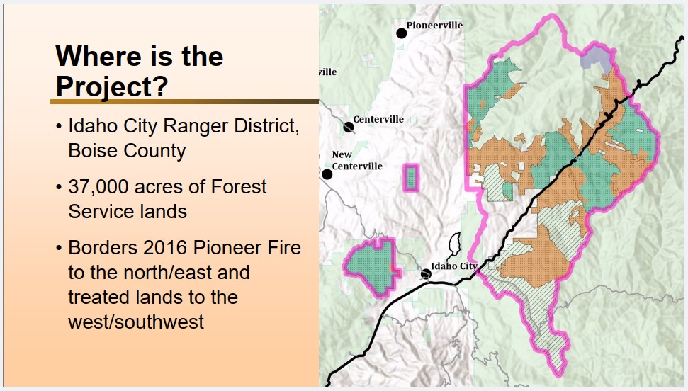 READ FULL DOCUMENT: 2023-08-03_UpperMores_CommunityMeetingPresentation
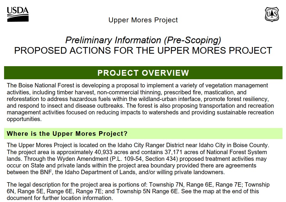 READ FULL DOCUMENT: 2023-06-16_UpperMores_PreScoping_ProposedActionReport
~~~ ~~~ ~~~ ~~~
NEPA Public Scoping period underway. https://www.fs.usda.gov/project/boise/?project=64242
Comment period closes November 20.
Recreation proposals have been split out to another yet-to-be-named and detailed NEPA scop, so the remaining Proposed Action (PA) for Upper Mores project is now almost exclusively a vegetation-management action under Emergency Authority.
It does not address trails improvement proposals that clubs and IDPR have worked on with the Forest Service prior to and during the pre-scoping period.
However, we do look forward to working with FS on what is tentatively named Highway 21 Recreation EA to address Recreation improvements in a separate but concurrent process. Happily, the new project scope may be on a wider scale than the initial project area boundary the Upper Mores proposal.
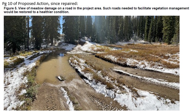
There is one particular item in the PA that is worth commenting on, which is the picture on page 10: It is no longer an applicable example of need to remediate a legal route as specific problem no longer exists.
In coordination with IDC Ranger District, IDPR’s Trail Cat Program has repaired all trouble spots on NFR314 from top at NFR380 down to near Idaho City.
Alex Ernst
Land Access Coordinator
IDPR – Recreation Bureau
208-832-8412
The first of five related Environmental Assessments (EAs) for Owyhee County Travel Management Areas (TMAs) has been finalized by the BLM.
Alternative D has been chosen in a Decision Record for Canyonlands East Travel Management Plan (TMP). Released October 25, a 30-day objection period has begun. Alt. D yields the most motorized access proposed of any of the Action Alternatives (B, C, D).
Decision Record and related documents here: https://eplanning.blm.gov/eplanning-ui/project/12503/570
While a map has been issued within the Decision Record (page 11), it should be considered preliminary since adjustment could occur during Implementation of the EA. Implementation will occur after all five related Owyhee TMPs have been decided, anticipated to be wrapped-up in March 2024. Publishing of finalized travel maps will follow the Implementation phase.
Decisions on EAs are still to come for four TMAs: Canyonlands West (comment period closed 10/23), Grand View, Silver City, and Birds of Prey NCA South (last three EAs not yet opened for comment).
The Frank Church River of No Return Wilderness is the most remote and largest contiguous wilderness in the Lower 48. That’s why it’s no surprise someone seeking a life of self-efficiency and solitude – would choose to live there.
Along with other homesteaders, like Polly Bemis – mountain man Sylvan Ambrose Hart – commonly referred to as ‘Buckskin Bill’ – made a home on the bank of the Salmon River and lived there starting in 1932 up until his death in 1980. The area is so remote, that today the only way to get to it is by jetboat or plane.
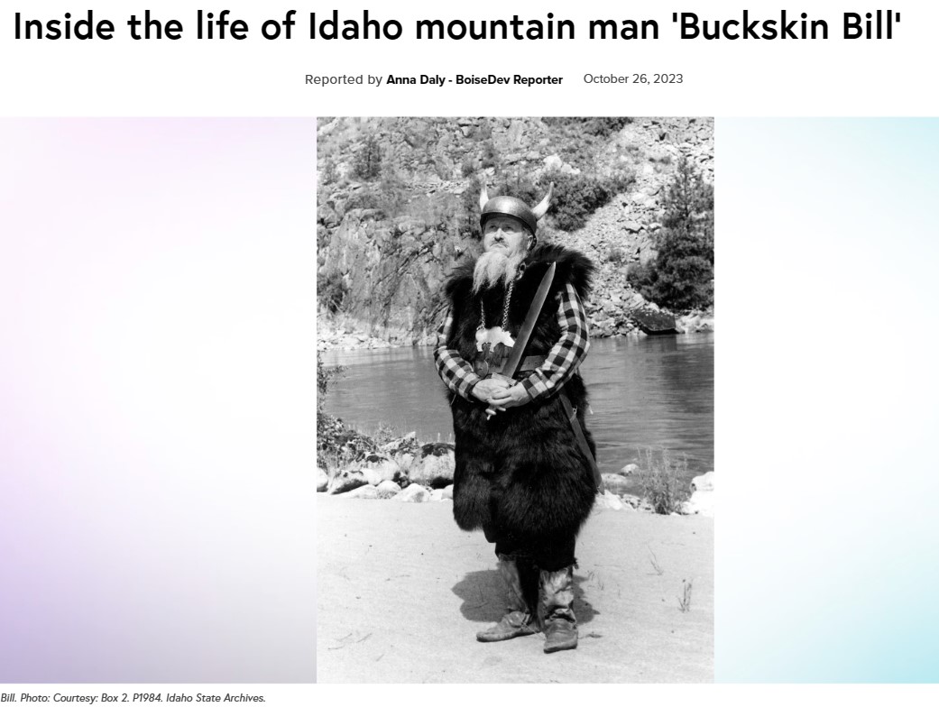
Hart, who was born in Oklahoma, not only earned a degree in English and attended a graduate program in petroleum engineering, but he also studied and could speak many languages including German, Russian, Swahili, Portuguese, Latin, Greek, French, Spanish, and Norwegian.
When Hart first came to Idaho, he bought 50 acres of land at Five Mile Bar. Here he survived and lived off the land by by fishing, hunting, growing a garden, and making his own tools like guns and knives, and clothes.
“Forest Service rangers who encountered Hart nicknamed him “Buckskin Bill” because Hart dressed in deerskin clothing,” Hells Canyon Tour’s website notes. “Although he tanned the hides, he allegedly wore the deerskin with the hair against his skin.”
Hart’s compound consisted of a two-story cabin, a blacksmithing shop, and a bomb shelter that he built himself. As rafting became more popular on the Salmon, Hart began to see visitors who would stop and say hello.
 Reported by Margaret Carmel – BoiseDev Sr. Reporter
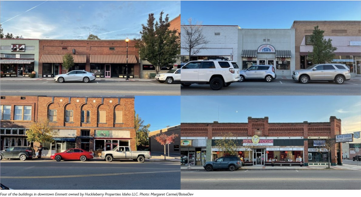
Like the rest of the Treasure Valley, Emmett is drawing in new residents for its mountain setting and small-town feel.
But, you might not necessarily pick up on that by taking a stroll down the few blocks of Main Street near Washington Avenue.
Thirteen storefronts across 10 buildings in downtown Emmett are all owned by the same Boise company, Huckleberry Properties Idaho LLC, according to public records obtained by BoiseDev. This company purchased all of the buildings at once in December of 2018 and has owned them ever since, leaving six spaces empty. READ MORE
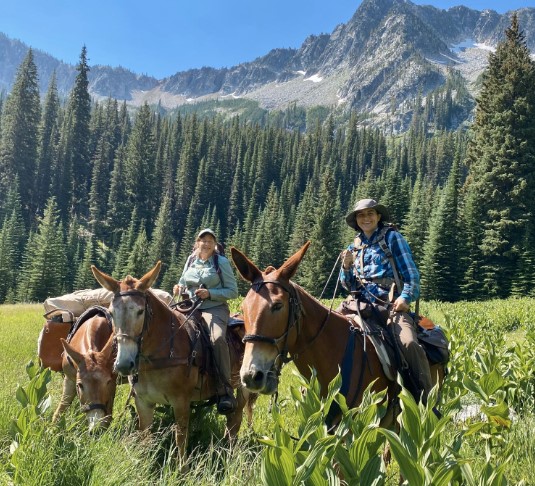
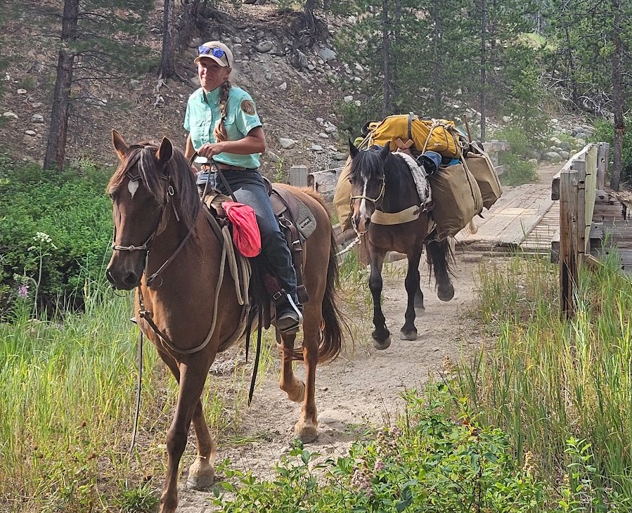
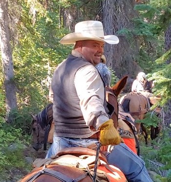
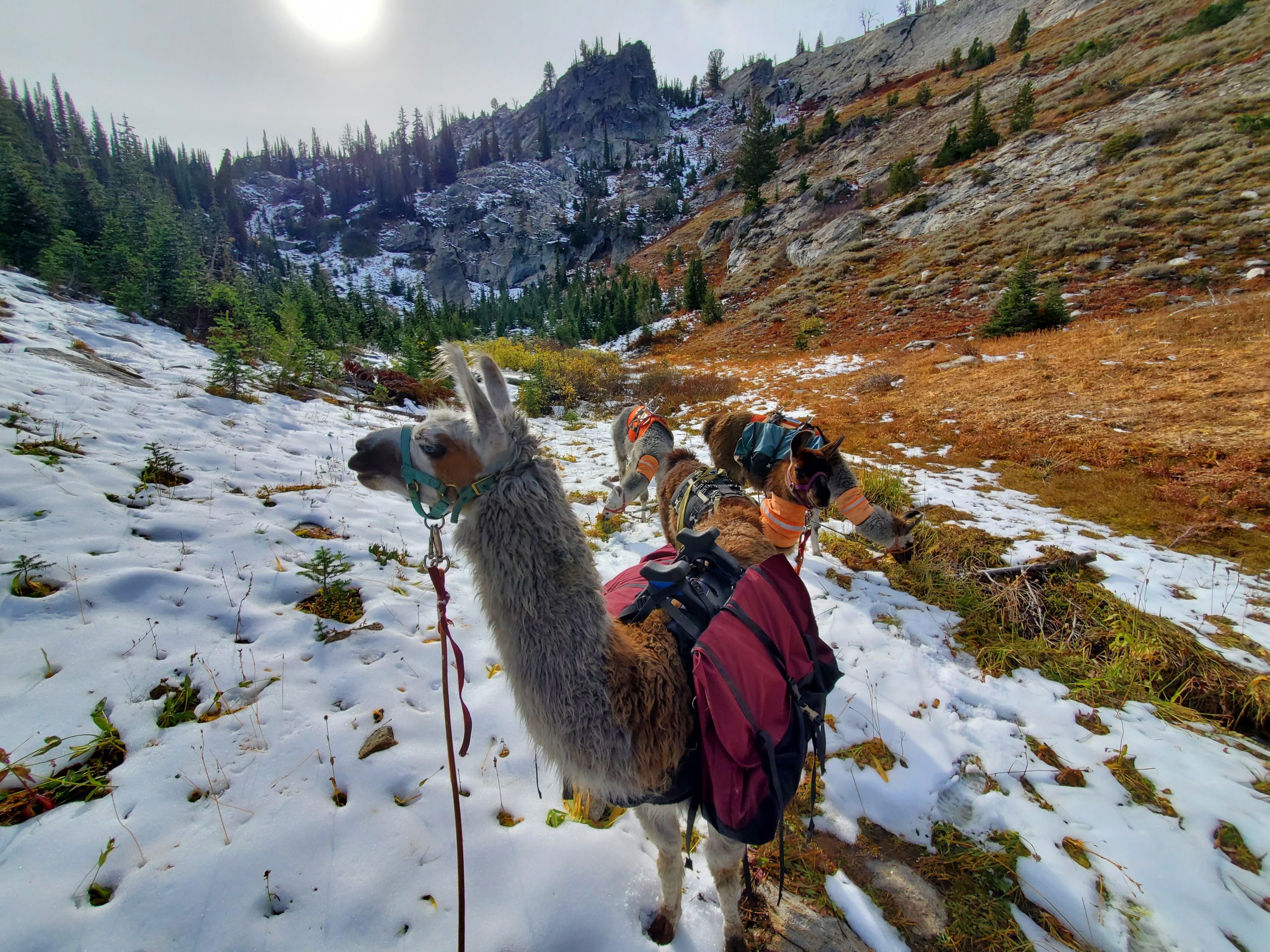 Pack Animals:
Pack animals have been helping humans for thousands of years carry heavy payloads from one destination to another. Here in North America the most common pack animals are undoubtedly horses & mules. They have become a staple for most hunters, ranchers and outdoorsmen that live near the Rocky Mountains.
Chances are if you have, hiked, camped or hunted the backcountry in the western states you have most certainly had some kind of interaction with horses or mules. When it comes to llamas not many sportsmen can say they have crossed paths with one and if you have; you were probably too shocked to remember much about the experience.
Llamas are often called the Beast of Burden. In ancient times llamas were key to the success and survival of the Inca culture. Today we use llamas to carry the weight we cannot carry ourselves. We love the backcountry of the Western United States and our llamas carry our camp, food, water and gear to each destination we seek. When you pack with trail hardened pack llamas for the first time you begin to understand why people have been packing with them for centuries, it’s just in in their DNA.
Llamas balance 65-70% of their body weight on their front legs. Their feet have a leather pad similar to that of a dog, and a split toe that allows for larger surface area and gripping ability. When it comes to rocky, steep, and tough to navigate terrain llamas excel where some pack stock might fall short. They are smaller than horses and thus they eat and drink much less in comparison. READ MORE / FOR SALE

 Listen