


HISTORY
The Montana Conservation Corps grew out of great ideas, great people, and a great legacy. Stories of men joining and serving in the Civilian Conservation Corps during the Great Depression can be heard at coffee counters across Montana. Tales of their accomplishments to improve the landscape – including the development of Montana’s first state park at the Lewis and Clark Caverns – and the spirit of the young people who joined are numerous and verging on mythical, in the best tradition of Montana.
In 1990, Human Resource Development Council agencies from Billings, Bozeman, and Kalispell established the Montana Conservation Corps. Our first Executive Director, Steve Nelsen, tells of starting MCC with nothing but a desk, a phone, and a box of Kleenex.
The first MCC crews were fielded in the summer of 1991 through the cooperation of the HRDC and sponsoring agencies such as the City of Billings, Montana Fish, Wildlife and Parks, and the U.S. Forest Service. In 1993, MCC successfully obtained AmeriCorps funding, which doubled the budget and established regional offices.
Now MCC has a multimillion-dollar budget and has matured into a leader in the national corps movement. We are proud of our humble roots and thankful for all those that have contributed to the development of MCC over the years. To all of our alumni, staff, board volunteers, and community champions—thank you for being a part of the Montana Conservation Corps.
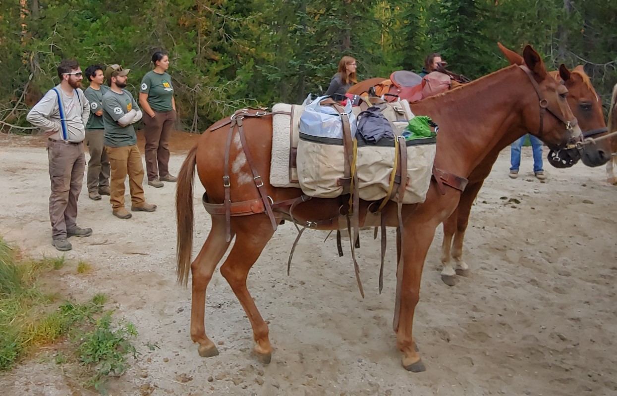
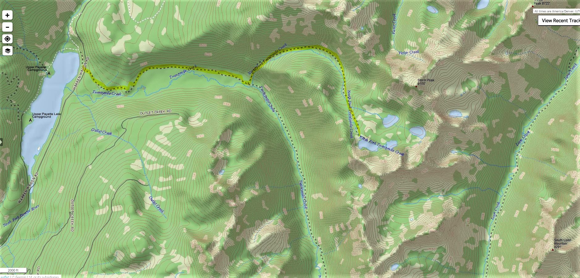
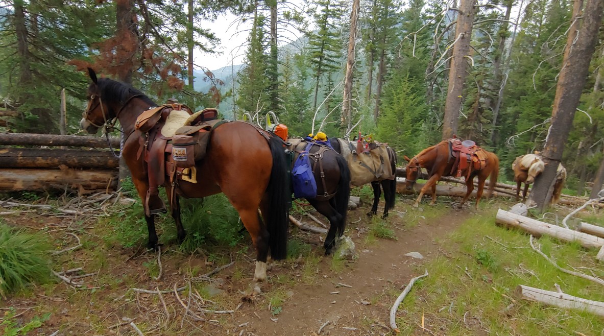
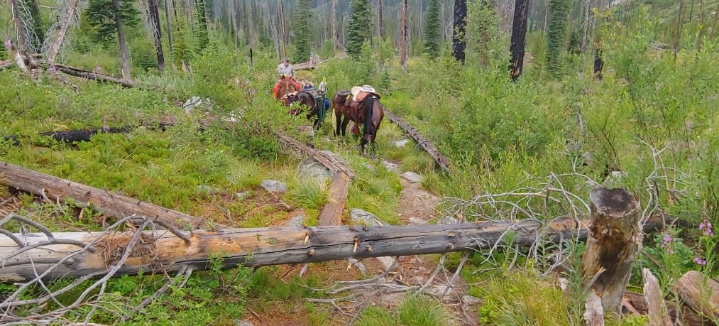
In Mid-July, Adam Larson PNF Trails Supervisor contacted Squaw Butte and ask if they would consider doing a drop camp for an MCC crew working on the Twenty Mile Creek trail near upper Payette Lake. The pack-in date would be August 3rd and pack-out on August 24. This crew of 6 would be working from this base camp for two weeks so need quite a bit of food and had over 90 pounds of hand tools and a chainsaw and support gear. Rob Adams and Phil Ryan met MCC crew Leads Eve Hickey and Dylan Barker and the rest of the team at the Twenty Mile trail head on Tuesday morning at 07:30. The five pack stock were saddled and once the gear was unloaded from their truck, a quick briefing on load building was followed by the MCC crew helping build and hang loads. The biggest challenge was the large pile of hand tools including sledgehammers, picks, Pulaski’s and a rock bar they would need. The tools were distributed between two canvas mantie that once lashed up weighted in at 46 and 47 pounds and were basket hitched to one of Rob pack horses.
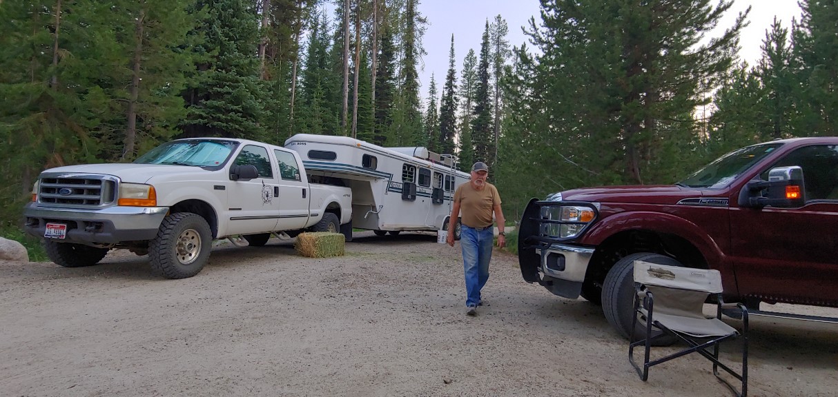
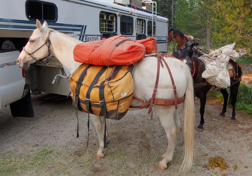
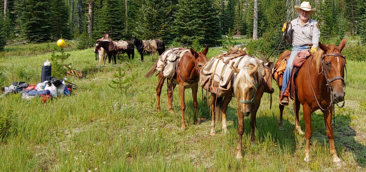
 By 08:30 everything was loaded and Rob and Phil were heading down the trail for a bit over 6 miles to a meadow that was their planned camp site. We made good time averaging a bit over 3 mph and were at the camp site by 10:30 and had the stock unloaded and were heading back to the trail head by 11:00.

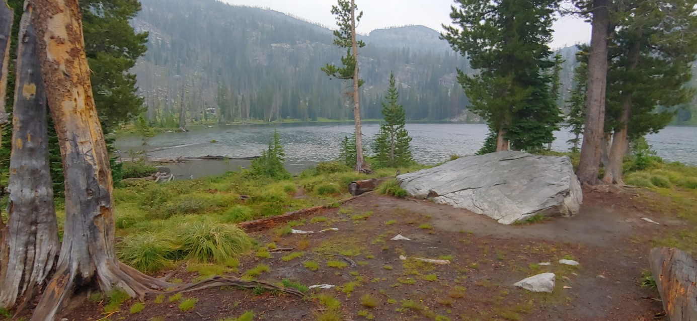
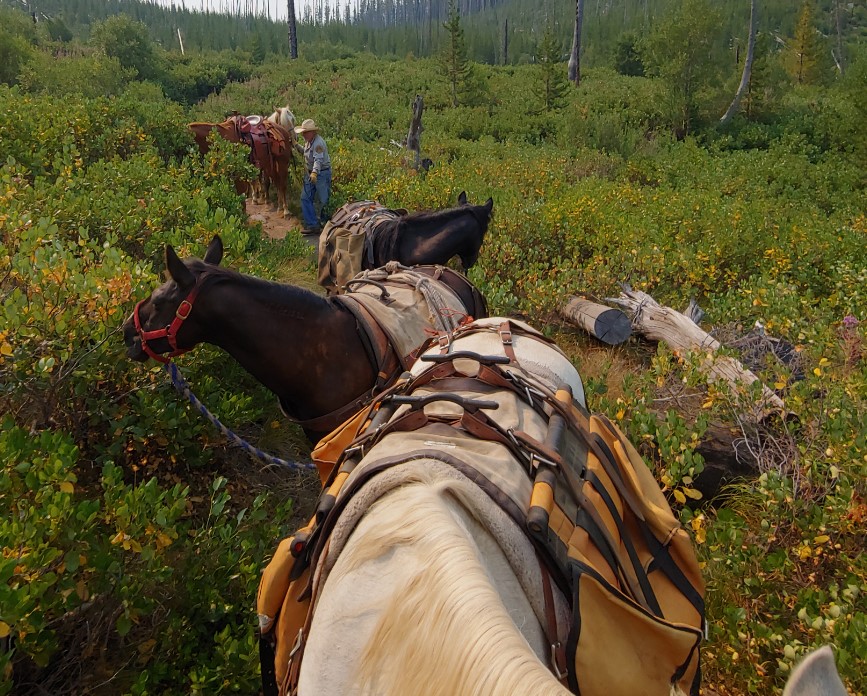 The site we left the gear is going to be a great camp with dry, level ground for their tents, easy access to water and two nice pools for a dip after a hard day of trail work. While on the trail we met three dirt bike rider, two back packers that had been camping up at the Twenty Mile Lakes and two couples and a toddler in a back pack.
See planned work PDF: MCC 2021 Twenty Mile Projects

As part of the deal to use the 4-H building to hold chapter meeting during the Covid-19 lockdown Squaw Butte agreed to do a presentation at the 2021 Gem County Fair for the 4-H. This presentation was scheduled by the fair for Saturday July 31, at 13:00 in the 4-H building. Phil Ryan and Rob Adams agreed to do a talk on BCHAI and stock camping on Public Lands. Both arrived at 11:00 to get the lay of the land and to make sure they were set up and ready to go at 13:00. After wandering around for while looking for an Information booth or schedule they tried the fair office and were in luck, someone was there and said yes, we were scheduled for 13:00 at the 4-H build, but they were sorry to say they didn’t do event schedules this year an oversite and as the steer, lamb and hog sale was going on it was unlikely we would have many show up. They were right, we had three, a couple enjoying the AC for a few minutes and a young girl who told us about her rabbit. If interested the high steer went for 7,500, the average steer went between 5 & 6 K and prime sheep between 1,500 and 2,000. They had not gotten to hogs before we left.
From the bidding pen to your freezer
So, to summarize: A 1200 steer, ½ inch fat, average muscling, yields a 750 pound carcass. The 750 pound carcass yields approximately:
- 490 pounds boneless trimmed beef
- 150 pounds fat trim
- 110 pounds bone
A specific example of how the 490 pounds of boneless, trimmed beef could break out includes:
- 185 pounds lean trim, or ground beef
- 85 pounds round roasts and steaks
- 90 pounds chuck roasts and steaks
- 80 pounds rib and loin steaks
- 50 pounds other cuts (brisket, flank, short ribs, skirt steak)
Maybe this helps explain how the products from a 1200 pound steer to fit in your freezer!
MINIMUM & MAXIMUM WEIGHTS FOR 4-H MARKET LAMBS FOR THE COUNTY FAIR 4-H MARKET ANIMAL SALE ARE MINIMUM: 100 MAXIMUM: 160, THESE WEIGHTS REFLECT THE STANDARDS IN TODAY’S MARKET. ANY LAMB WEIGHING OVER 160 POUNDS WILL SELL AT 160 POUNDS.
4-H’ers must own or manage their lamb at least 60 days prior to our County Fair. Lambs should weigh somewhere
around 65 – 70 pounds by June 1, in order to reach the minimum weight of 100 pounds by fair. If the lamb is wormed,
proper genetics have been followed and good feed has been given they should gain at least .6 pounds a day. A 100 pound lamb will yield around 40 pounds of meet in your freezer.
If we do this again in the future Saturday at 13:00 is not a prime time to generate interest in BCHI!

xxx


Picture this
A cow elk gives birth to a calf in the mountains of Idaho.
The calf spends the next six months in its lush summer range before following a well-worn migratory path to a neighboring valley to spend the winter.
That critical winter habitat includes property owned by a family who manages the land to benefit their ranching operation.
The calf, a bull, returns winter after winter to that same ranch in the valley.
Years later a hunter hears the shrill bugle of a bull elk high on a mountain one September morning. Slowly the hunter inches closer. Finally within shooting range, they shoot, their arrow finding it’s target, the bull providing a year’s worth of meat to the hunter’s family.
The story of the hunter and the bull, one common across Idaho, was made possible thanks to the benefits private land provided to that animal during its lifetime.
Private lands in Idaho
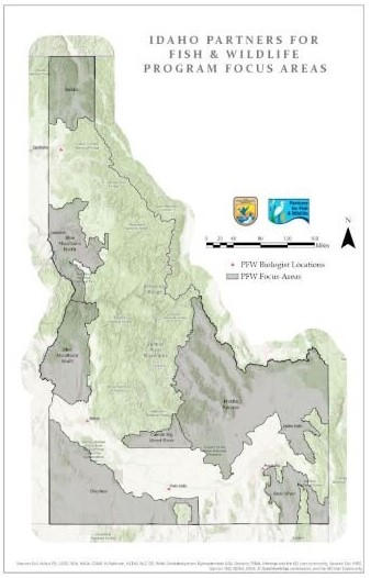
Roughly 31% of the land in Idaho is privately owned. Wildlife, of course, does not adhere to the same property boundaries as humans. Migratory species especially rely on a patchwork of land ownership to survive from year to year, whether that land is someone’s private ranch, farm, or expansive BLM-managed sagebrush steppe.
So shouldn’t habitat conservation efforts be just as diverse?
This is where the US Fish and Wildlife’s Partners for Fish and Wildlife Program (Partners Program) comes into play.
Working alongside willing landowners and within designated priority landscapes, the Partners Program began in 2006 and has become a shining example of the possibilities for habitat conservation on private land.
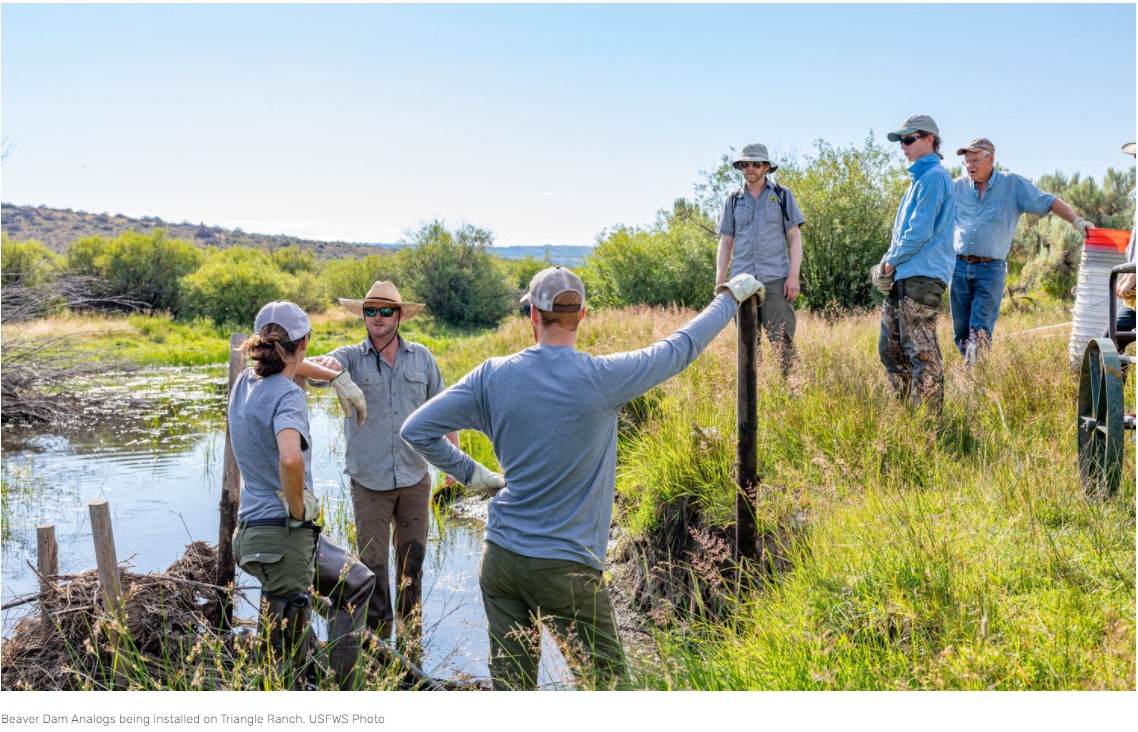
“These lands have to have three foundational components to ensure they’re viable: looking through economic, ecological and social lenses”, said Jason Pyron, a wildlife biologist with USFWS who oversees Idaho’s Partners for Fish and Wildlife Program.
Landowners tend to focus on the economic lens, while balancing that alongside social and ecological lenses. Idaho’s hunting and fishing community will keep the ecological lens at the forefront. This overlap offers many opportunities to collaborate and provide benefits to all stakeholders.
“We have some highly migratory species in Idaho, and due to the way our landscape is dissected by private lands in valley bottoms, we are at a high risk of losing significant proportions of these populations if we don’t incentivize landowners to keep these lands open. I hope the hunting and fishing community fully appreciates what these landscapes do”, added Pyron.
Where the needs of wildlife and the needs of private landowners collide is where the Partners Program comes into play. READ MORE
Posted by Dan Waugh ( tacpdan@gmail.com)
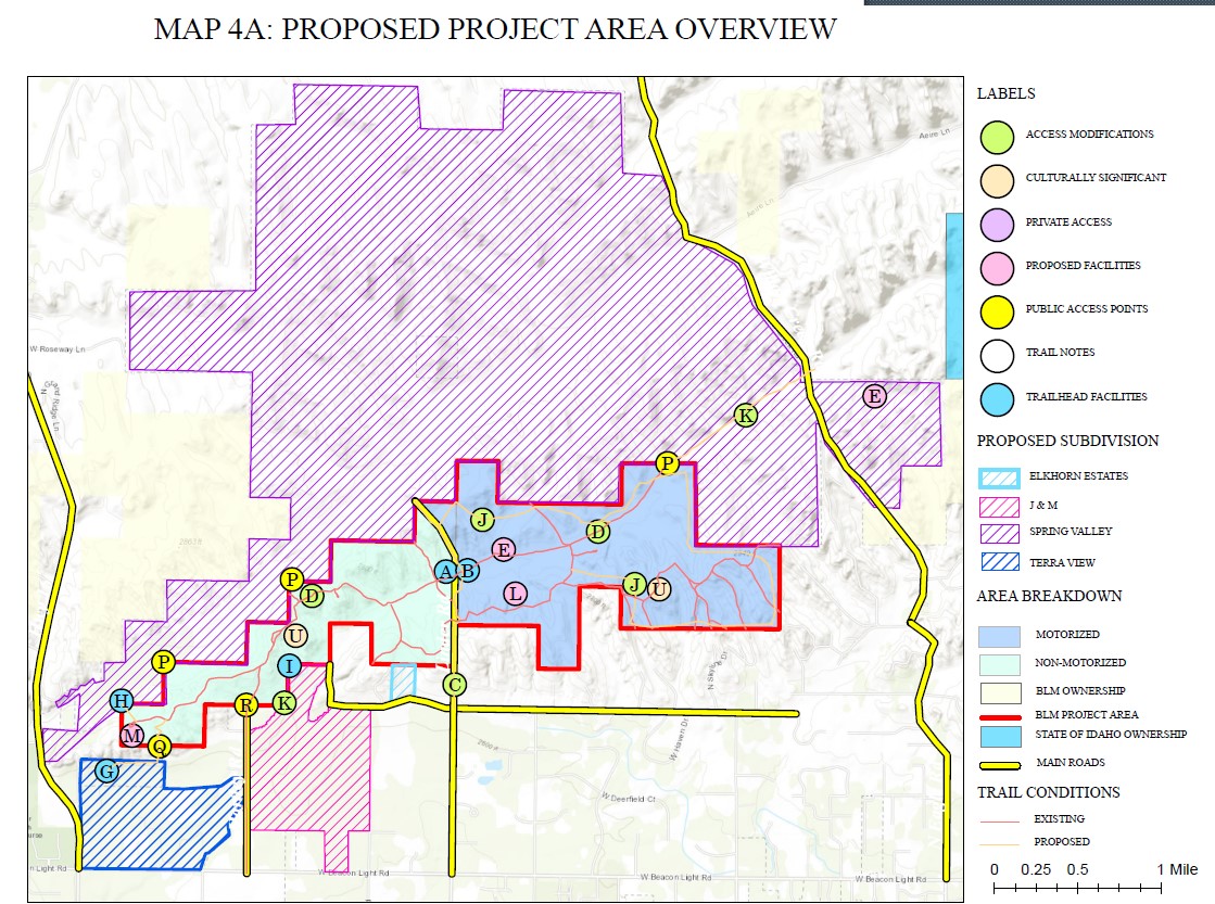
The city of Eagle is looking for inputs from trail users (Equestrians) for an ongoing project of over 1,600 acres in the northwest corner of eagle with a possibility to expand to 2,200. The city will be developing a trail system in the eagle foothills on BLM land. But, the city of eagle will run the trail system. Over 1200 citizens have been engaging so far and the city staff members are looking for more input.
Marja (360-791-1591), Arlynn (208-249-2091), and I are actively working with the project manager as the IHC Trails and Urban Spaces Committee. But, we would love to get additional views and feedback from other equestrians who will likely use this trail system. Feel free to disseminate to any and all equestrians!
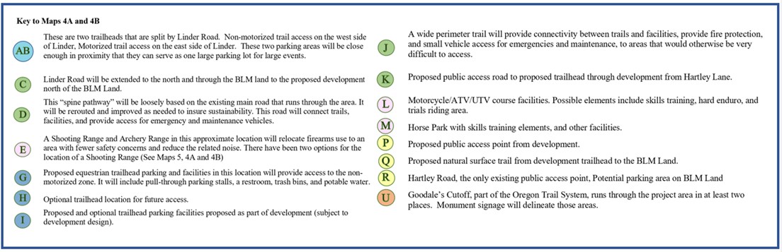

PDF: Foothills_Recreation_Plan_20_July2021_202107220914014507
Link to the Eagle Foothills Concept Plan: New Submission (cityofeagle.org)
Leave comments at the link above!
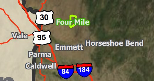
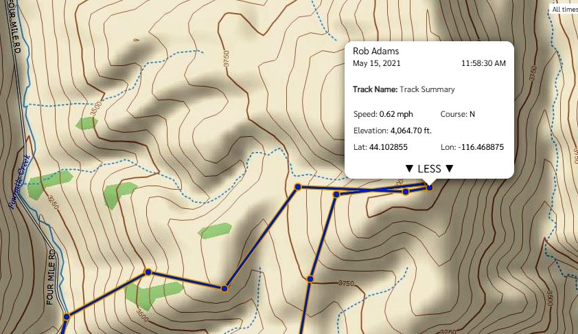
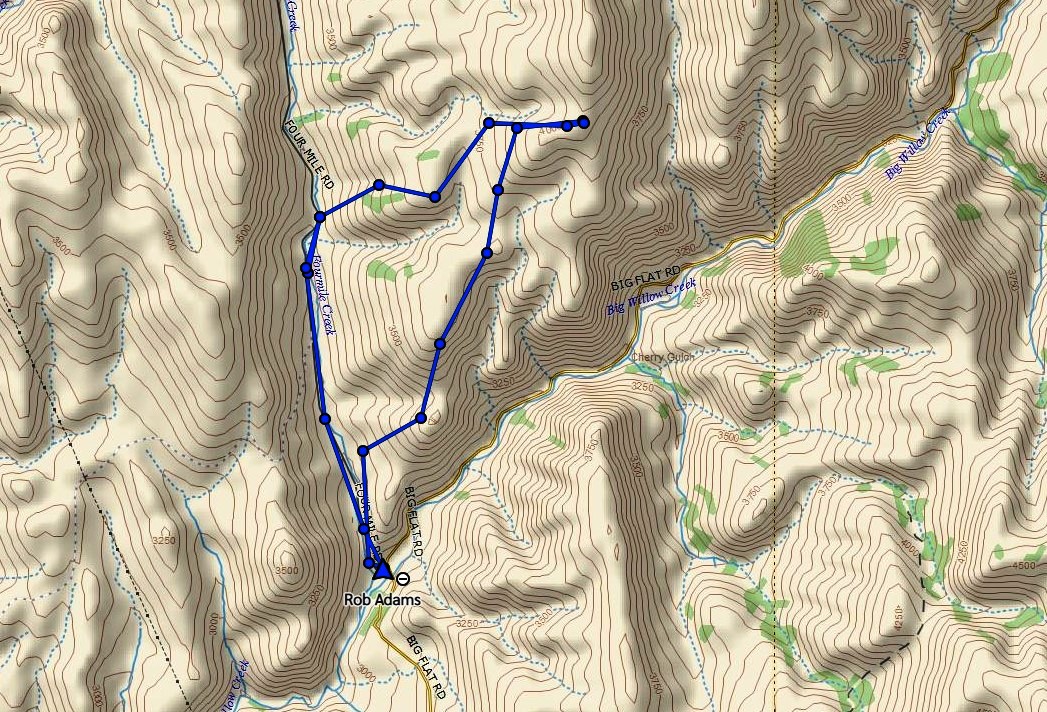
 Lat: 45.133938 Lon: -116.010818
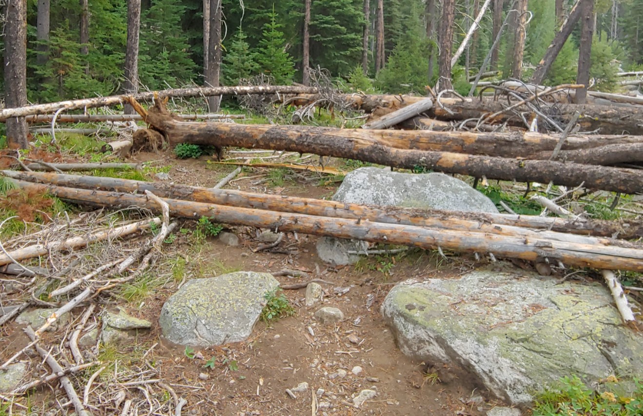
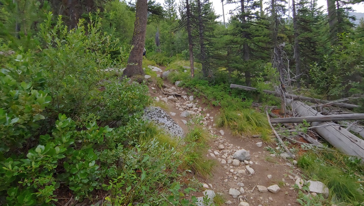
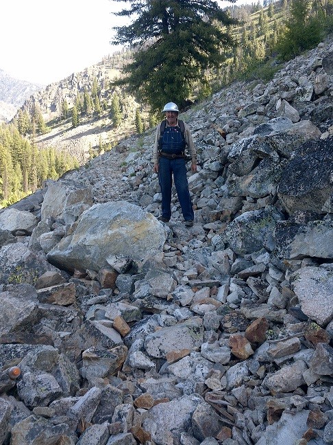
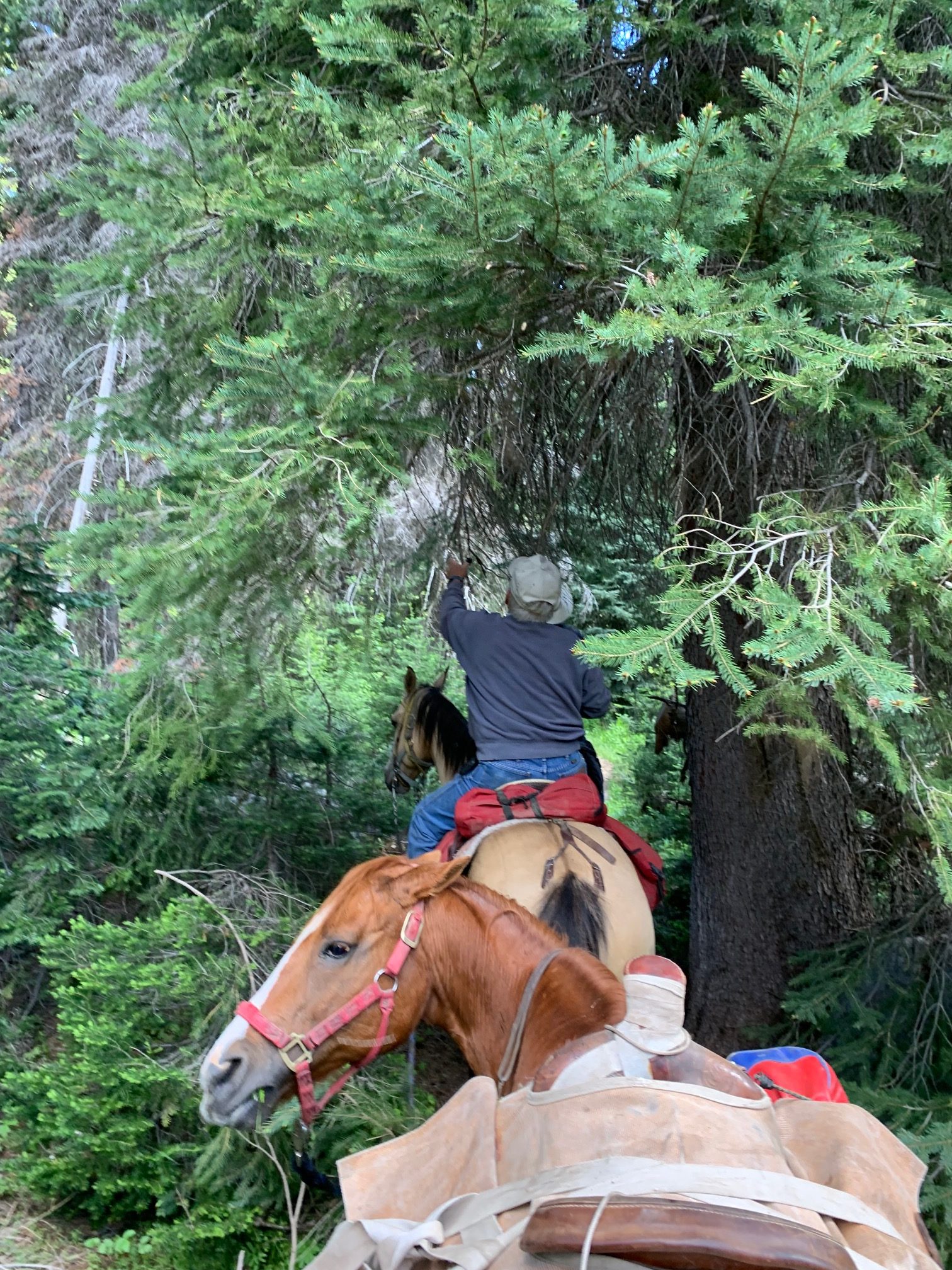
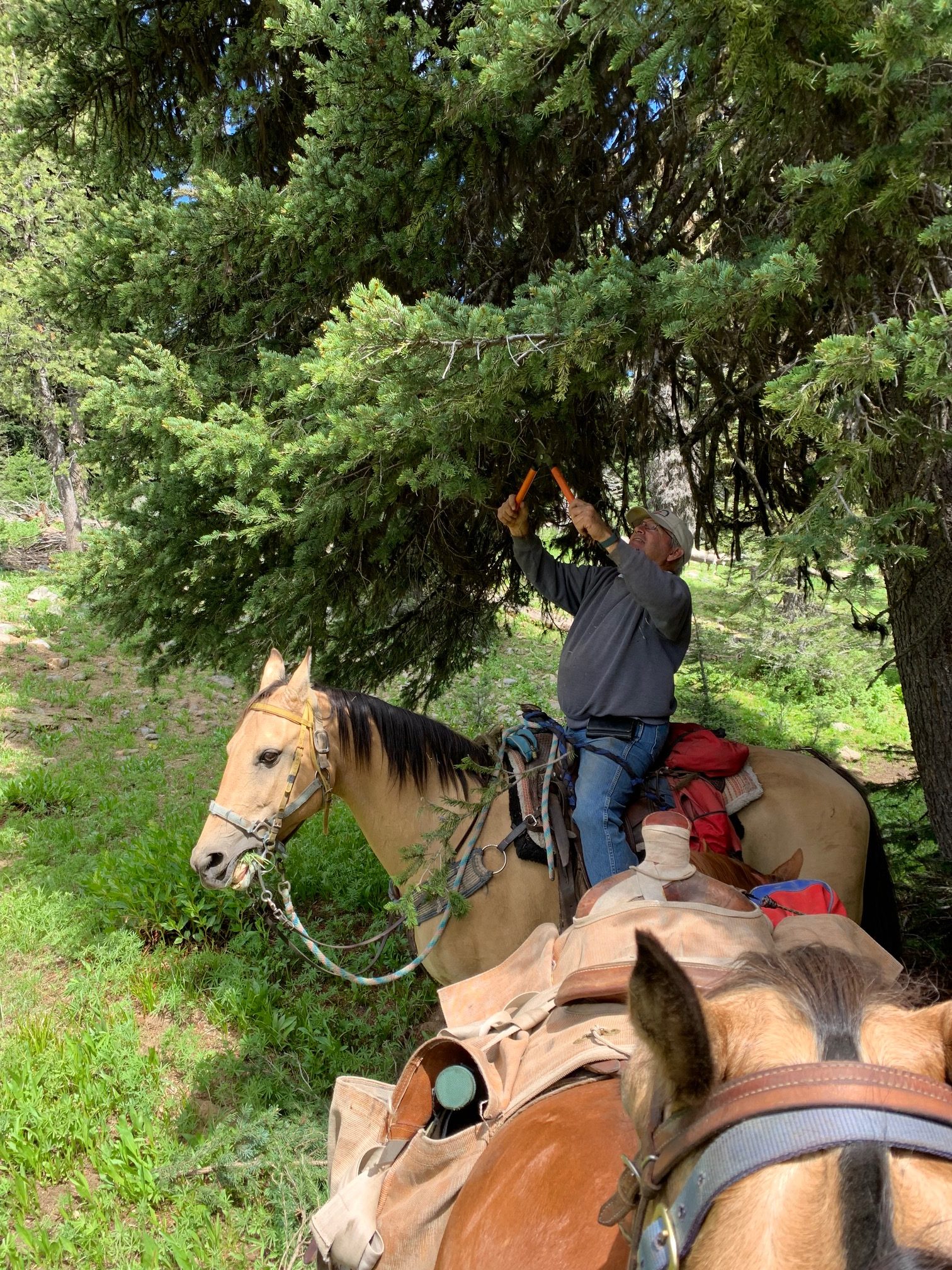
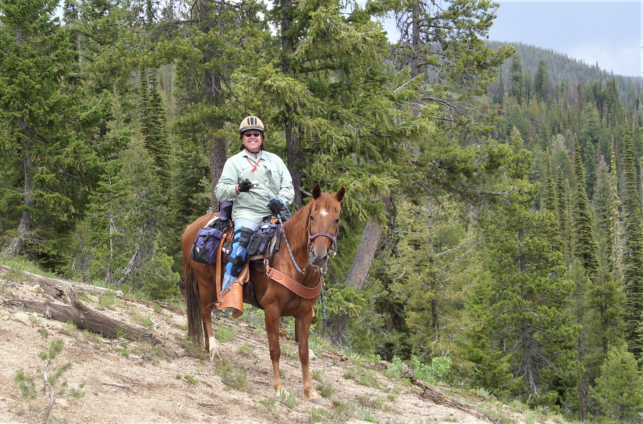
Tuesday July 20, 2021 dawned cool and damp at the Twenty Mile Creek trail head, the rain from the day before had cooled the air as well as the 5,819 foot altitude. Phil Ryan and Rob Adams had driven up the night before to work on a project on the Twenty Miles lake Trail. They were joined by Shelly Duff and Lisa Griffith who were on vacation and camped near the trailhead. Phil and Rob were on the trail be 08:45 and made good time on the Twenty Mile Creek trail which was in excellent shape. Once they turned on to the Lakes trail they started encountering heavy brush and down fall.
Before

After

Around 10:00 it started to mist, which felt pretty good as we had now soaked our shirts with sweat cutting out down trees and nipping brush. The brush was also wet so the rain made little difference in how wet we became. Lisa and Shelly who left the trail head after us, caught up and took over brushing allowing Phil and I to push on concentrating on down trees.
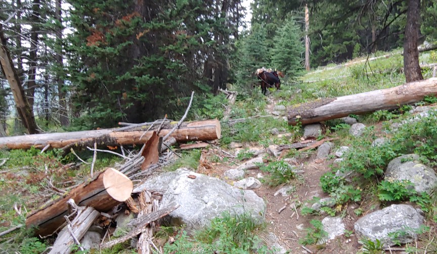
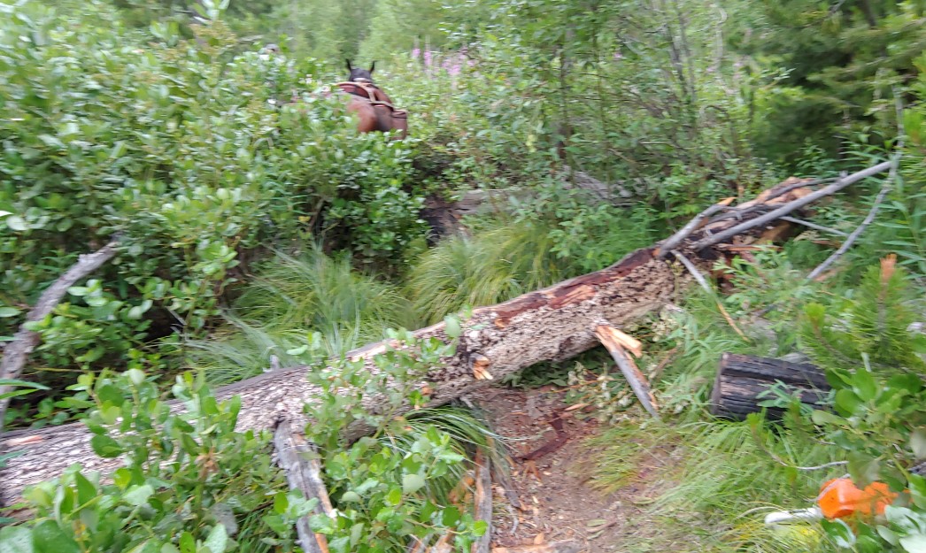
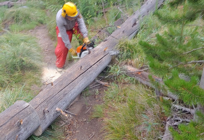
We reached the first lake by 13:30, it was raining and we were soaked and tired, behind us were 35 trees we had remove and large sections of brush cut back. After a quick break we started the ride back to the trail head, arriving at 14:30. The sun came out during the ride back for a short time.
The lakes trail climbs from 6050 feet to 7,719 in three miles, with most of the altitude gain in two sections of steep, rocky switch backs. But the lakes and beauty of the area make it worth the effort.
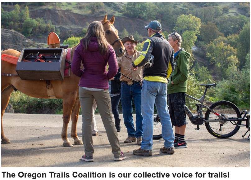
The Oregon Trails Coalition BLOG is a great source of information for all things trails and is worth checking out and getting on their mailing list.
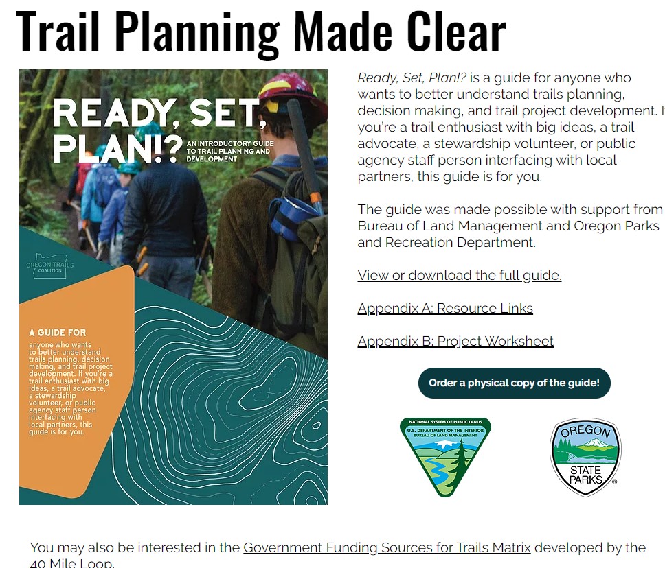
An example is their piece on Trail Planning
Submitted by: Robbin Schindele
Crater Lake Wilderness Campaign Coordinator
539 SE Main Street
Roseburg, OR 97443
208.365.1789

Did you attend a chapter event, project or ride, and take some photo’s that you would like to share with the rest of the chapter. After an album has been created and posted, you can upload your photo’s from your computer. The photo’s will be tagged with who uploaded them.
 Joe on the “new” trail, beside bypassed rock with others below left
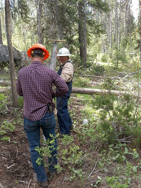 Bart and Joe on a “practice” tree
 Brian, Bart, Lew & Joe with a big tree, Dagger Creek Campground in background, river below
Hi,
Just wanted to forward some info re trail clearing. Joe Williams packed 5 FS volunteers upriver from Dagger Falls on June 9th, then on the 10th, Bill Bell & myself (Steve Sanderson) joined Joe, Lewis Herrington, Bart Baer (Joe’s neighbor) and Brian (? a pharmacist from Meridian I think) and we all rode up trail 2013 about 3 miles to clear a large boulder that had slid down and blocked the trail in the middle of a rock slide area.
On the way, we cleared several smaller trees and on rather large one that was blocking the trail.
The rock and several others as large, were too big to move or break up so we relocated the trail by building a ramp to the upper part of the rock and around it, then a ramp back down to the trail. Quite a chore but we got it done. Here are a few pictures from the trip. I thought you would like to know since I think Joe, Bart & Brian are SB chapter members.
I hope you had a great father’s day weekend–the weather was amazing.
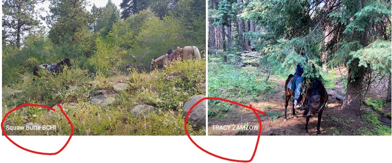
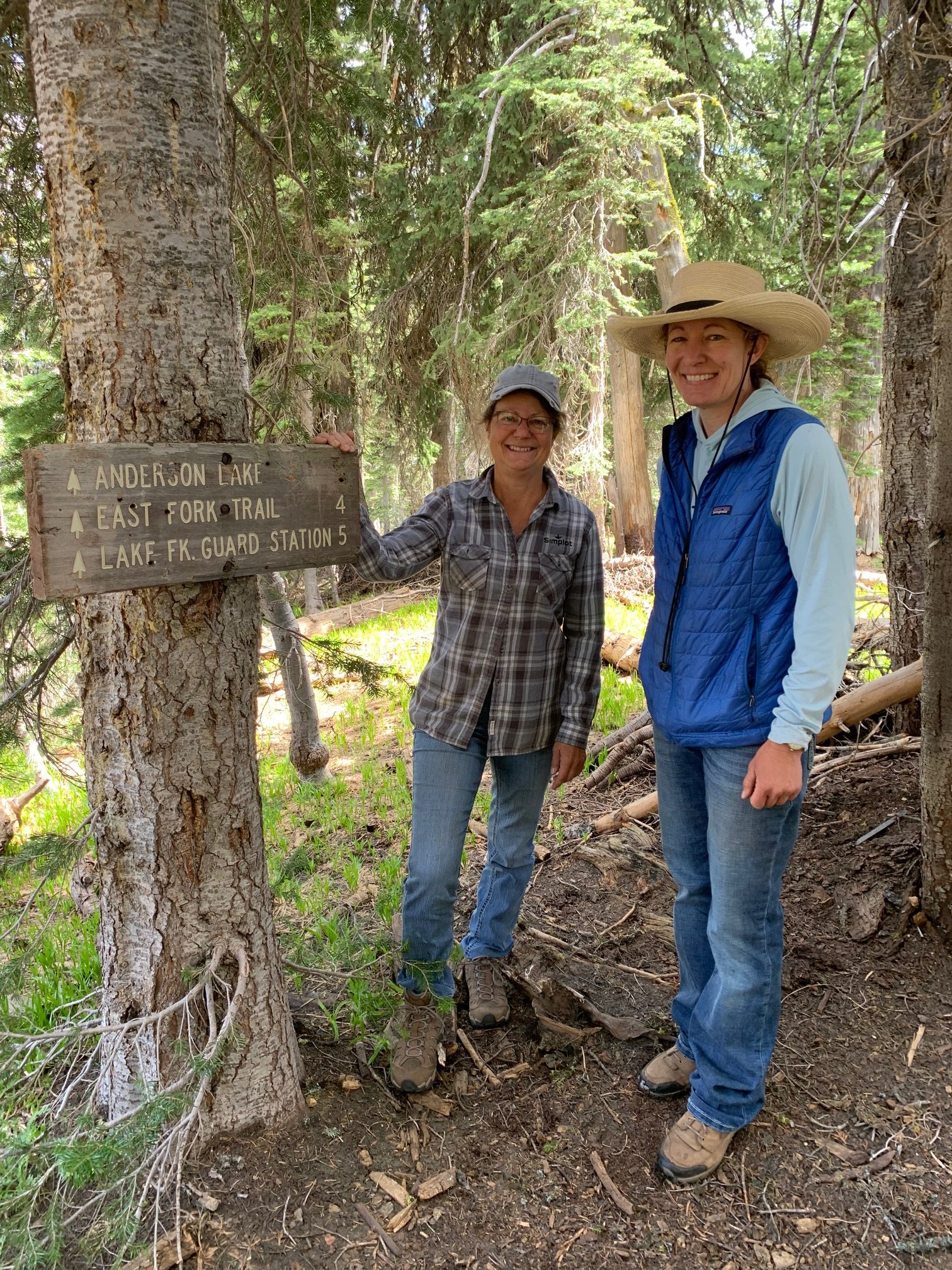
Tom asked me to send you some photos of our trail clearing activities up on the Rapid Creek Trail near Donnelly off of the Paddy Flat Road. Bart, Tom, Tracy Z and I did some much-needed overhead brushing for the first 5 miles of the trail north of the trailhead on Saturday and Sunday. Most of the trail was cut out but there are at least 3 or 4 short, wooden bridges over boggy spots that are rotting out badly, are uneven, broken, and are already dangerous for horses and hikers. The worst bridges are within the first 2 miles of the TH. We made it into Rapid Lake, Boulder Lake and Anderson Lake. The Rapid and Anderson Lake Trail spurs had some pretty serious logs that still need to be cut out (we did not take a chainsaw on that part of the trail). Trails are threading around those spots.
We also had some time for fun brook trout fishing at several of the lakes and Tracy Z played her new mini banjo one night and there was good food and salmon on the barbie.
We are looking forward to our Kennally Creek trip with you in a few weeks! Sharie

The Pulaski Users Group (PUG) organizes volunteer trips focused on trail maintenance, trail reclamation, and invasive species monitoring. Volunteers receive related training which equips them with the skills and knowledge to complete a variety of trail restoration projects. We aim to inspire community members to be stewards and advocates for our public lands.
Posted: 19 Jun 2021 06:57 PM PDT by Laurie Bryan (The Sage Writer)
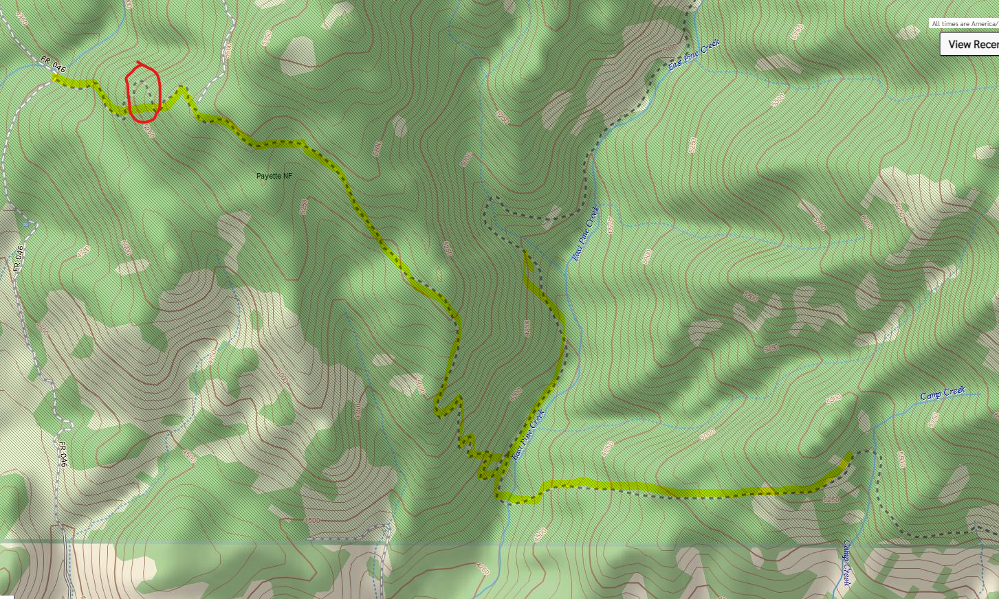
Trail: Boundary – E. Pine Creek
Miles: 10.5
Riders: Laurie – Rob – Bill – Linda – Brandy
Horses: Jack – Payette – Tucker – Misty – Moosely -? -?
Dogs: Poor Hank was not happy hanging out in the trailer.
Notes: I took a break from fence building and joined the SBBCH for a trail cleaning project on Boundary. This area was one of the first projects we did when I joined SBBCH years ago. At that time, we built up a boggy section of trail by pulling out the old boardwalk, hauling in gravel from the creek and creating a drain/culvert for the water to pass without making a huge bog. We were surprised to see it in great shape after all these years.
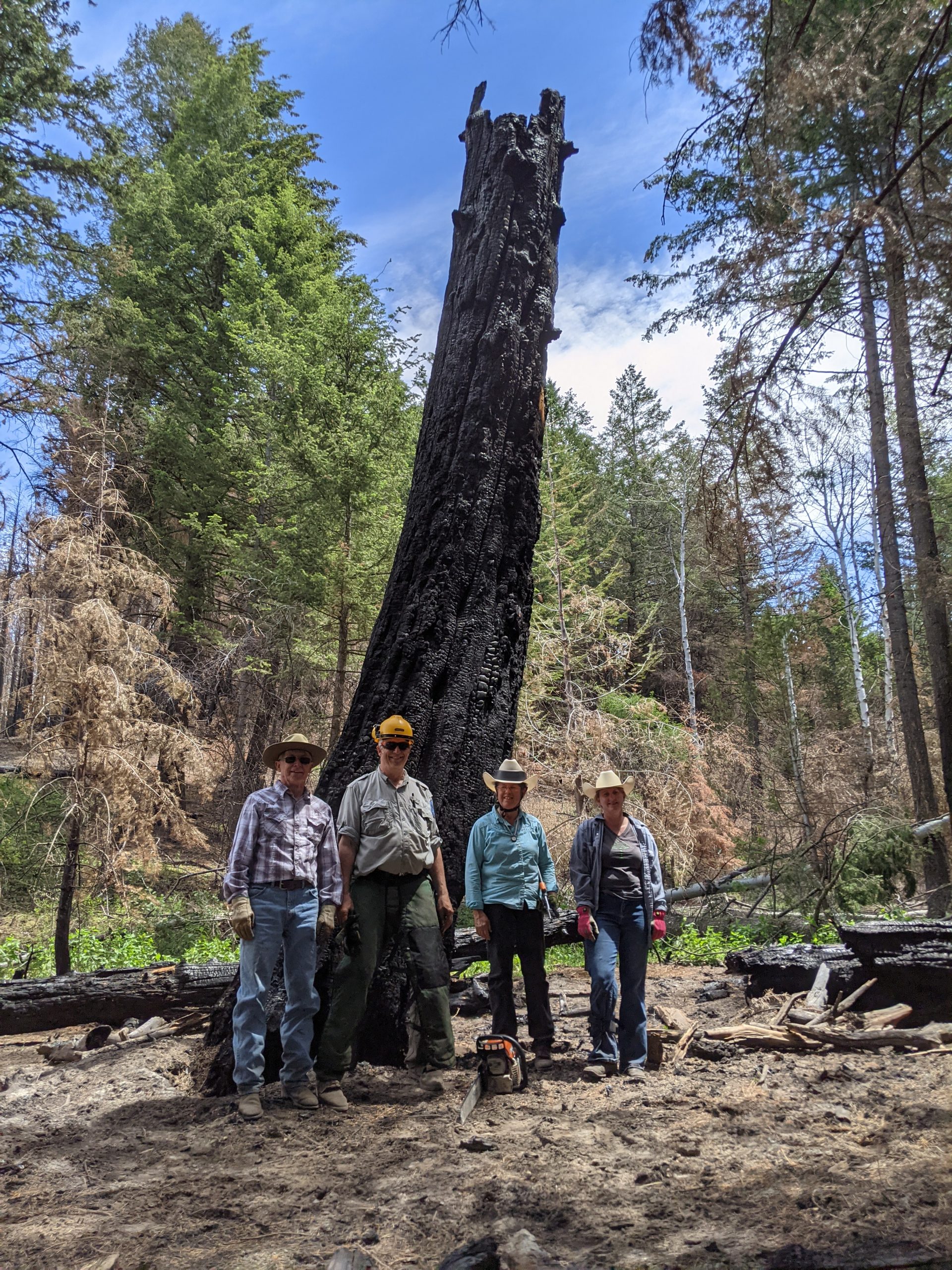
Much of the trail had already been cleared by another group (presumably a dirt bike group) – We did a little brush clearing and weed pulling. We did remove a few logs while diverting the trail around a dangerous section too close to a burned out log. The roots were burned away leaving treacherous holes…some of which you can’t see until your horse looses a leg in one.
Mother and daughter team: Linda and Brandy – joined us from the Heartland Chapter.
Great day with some old friends I haven’t hung out with in while. Hope to do it again before too long.


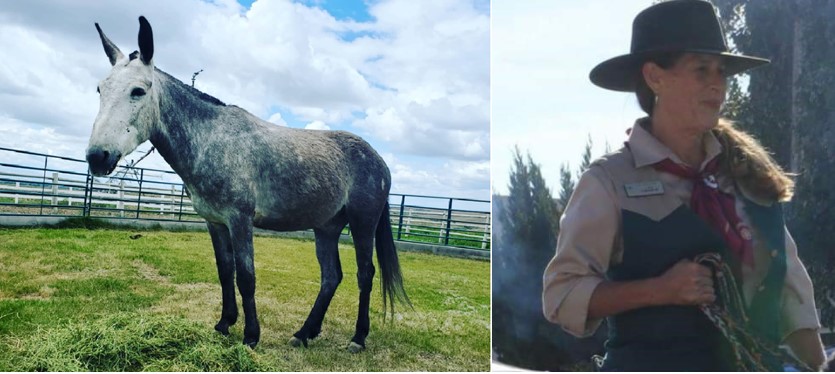
I bought a new 8-year-old mule this weekend at the 4D Select Ranch Auction. He is bonding with me and super sweet. He has been packing in Hells Canyon for the past 4 years, so he needs some saddle time before I take him out of trails but boy am I ready! Lisa Deas

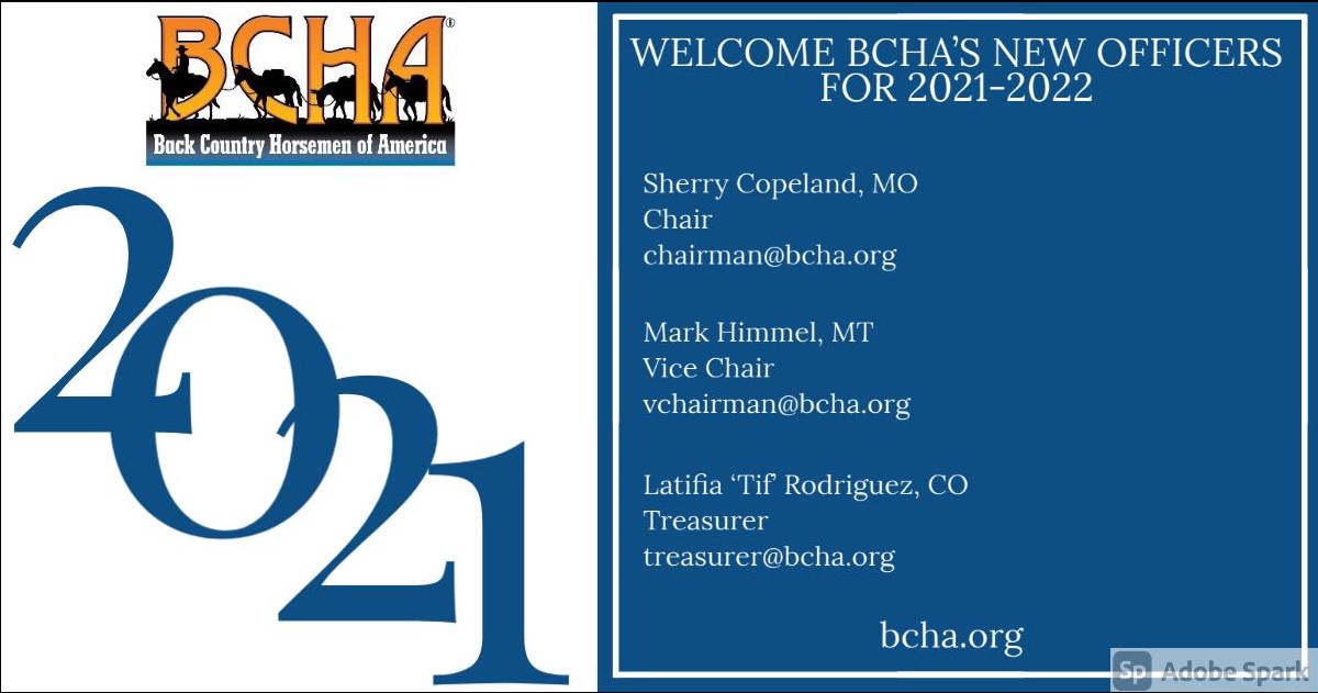
[Back Country Horsemen of America] | [360-443-6996] | [michellewade@bcha.org] | [www.bcha.org]
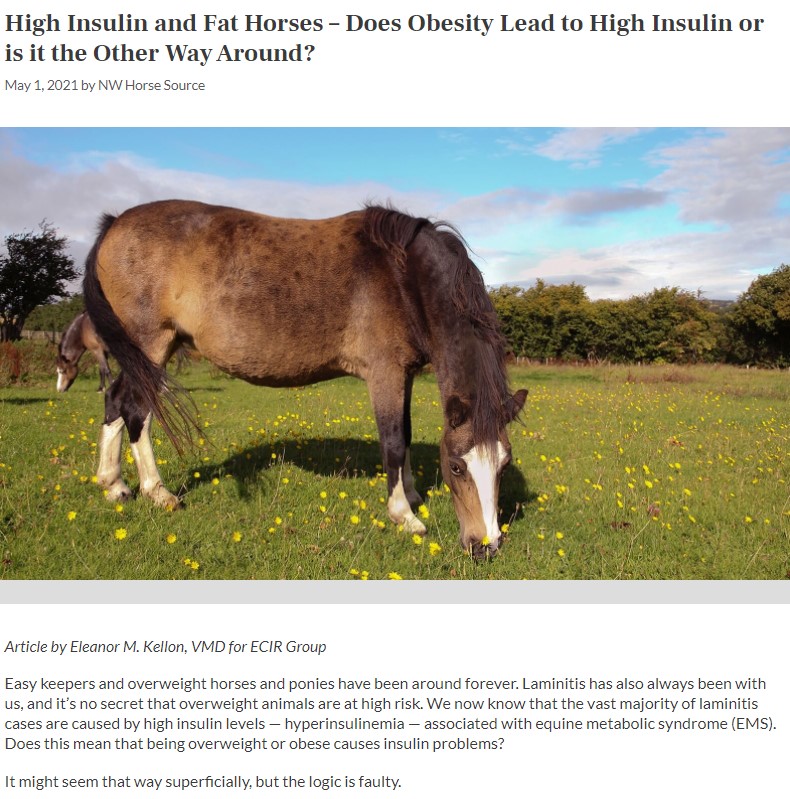
Many horses that develop laminitis are overweight or obese. We know that the vast majority of laminitis cases are caused by high insulin levels. The correlation has always been obvious, and it didn’t take long for an assumption to arise that obesity is a laminitis risk factor and causes elevated insulin. There’s just one thing: it’s not true.
Relationships between diet, obesity and insulin dysregulation in horses and ponies
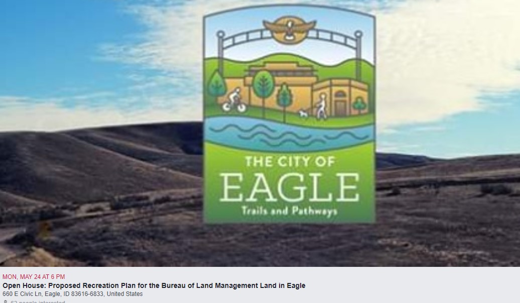

CALLING ALL EQUESTRIANS (especially those who ride in the Eagle Area)
Please attend the open house to review Eagle’s recreation plan for BLM land. Ultimately the plan is to connect this area of public land to trails accessible from Big Gulch and Little Gulch. Spread the word! This may be our last opportunity to save equestrian trails north of Eagle
Open House: Proposed Recreation Plan for the BLM Land in Eagle
Monday, May 24, 2021
Join us for an open house to review the City of Eagle’s Proposed Recreation Plan for the 2,200-acres of Bureau of Land Management land within the limits of the City of Eagle.
Date: May 24, 2021
Time: 6:00 PM - 8:00 PM
Location: Council Chambers
Address: 660 E Civic Ln, Eagle, ID 83616
Karen Steenhof karensteenhof@gmail.com
 To find out about this area CLICK HERE
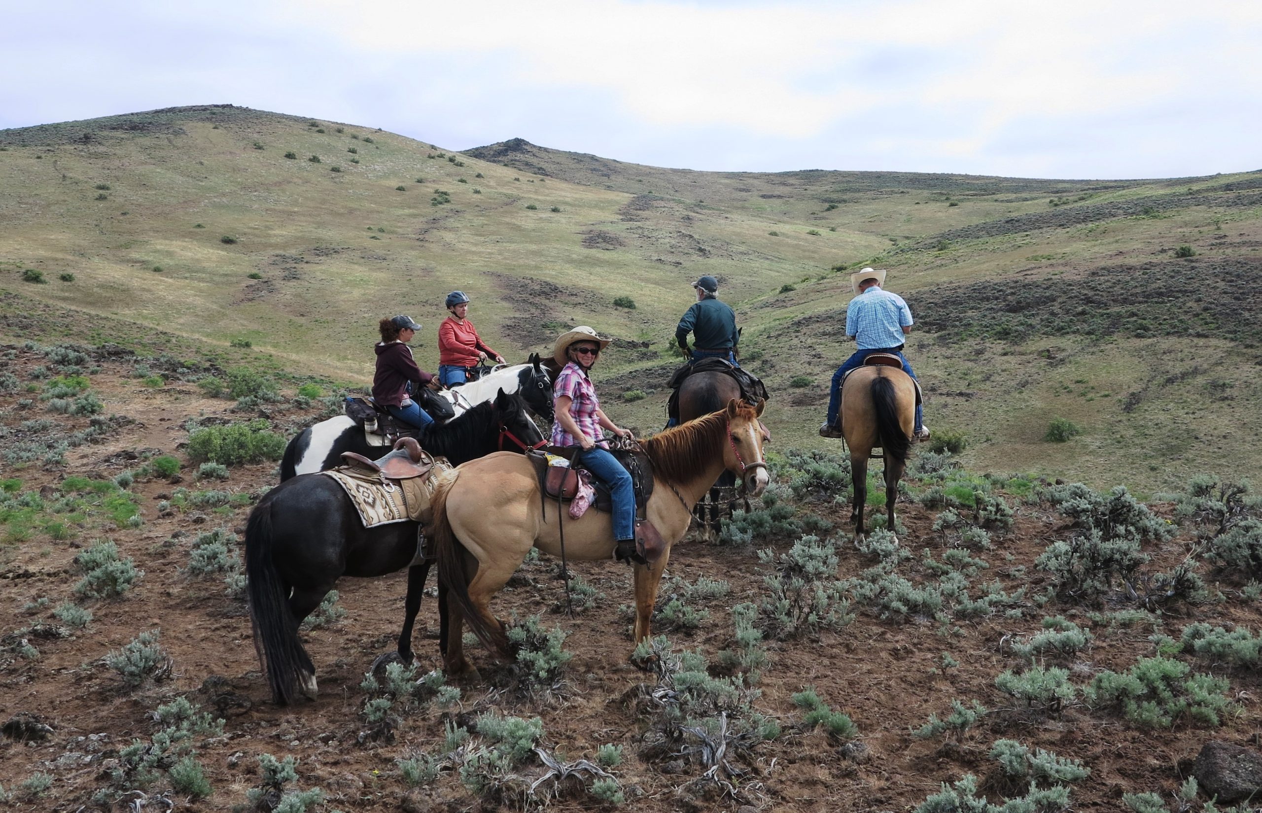
Ellen Knapp’s horse “Chet” (January)
Terry MacDonald’s horse “Scout” (April)

Bill Holt’s mule “Billy Bob” (May)
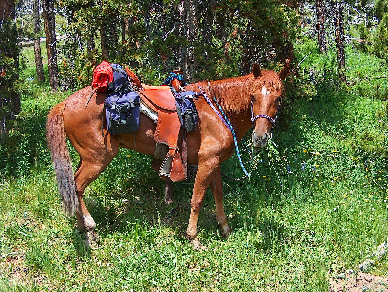
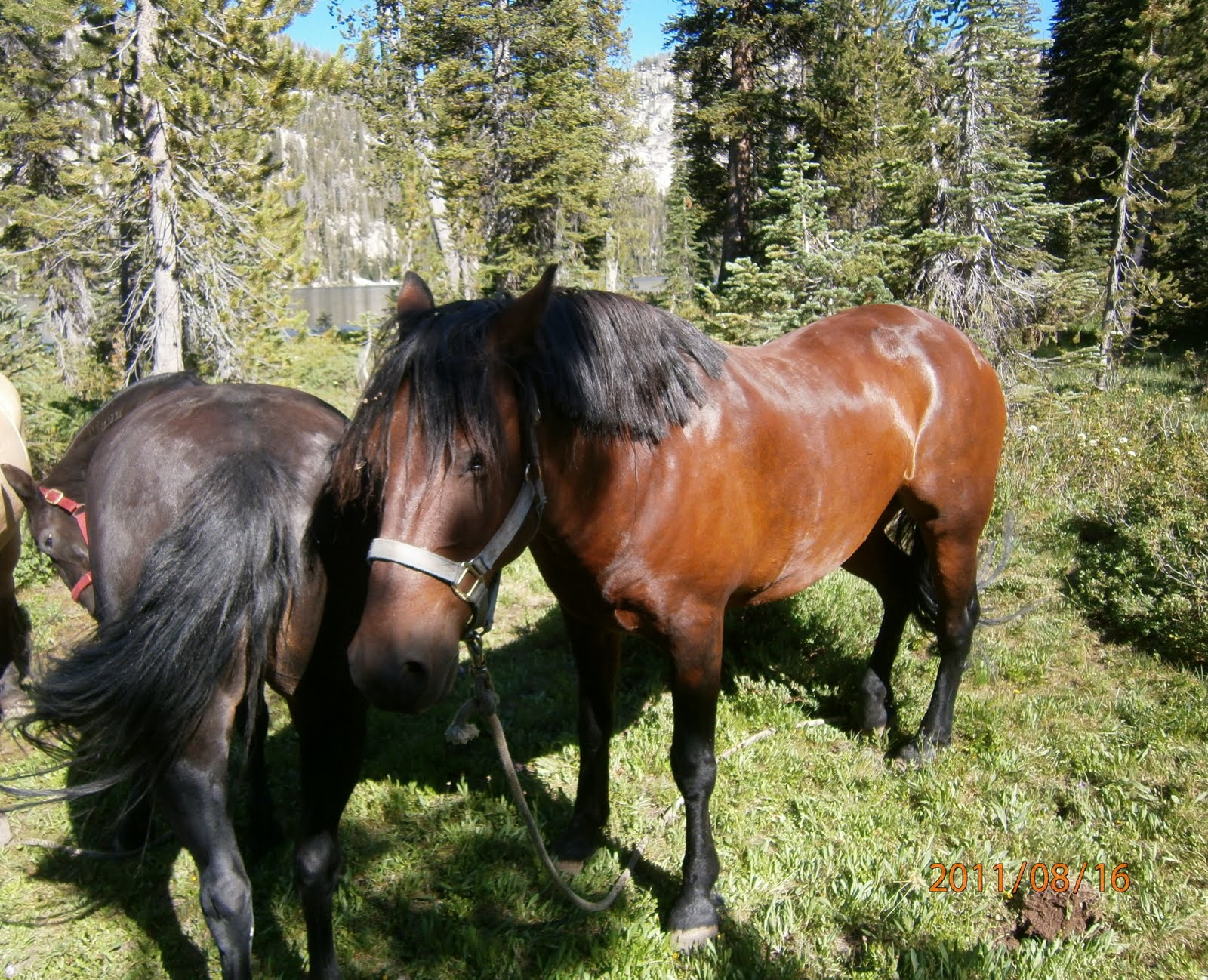
Rob Adams mustang “Kestrel” (May)
Charles Lox horse “Brio” (June)


At 09:00 on a clear, cool and windy day USFS employees, William Rockhill (Sawyer Training Coordinator for South Western Idaho), Savannah Steel (BNF Recreation Supervisor) and Caitlyn Rice (BNF North Trail crew lead) joined Tracy Zamzow, Rob Adams & Charles Chick from Squaw Butte, and Mark Nebeker for the classroom part of the USFS Sawyer Certification Workshop.
 Savannah, Caitlyn, Tracy and Mark wanted to work on Saw certification and William wanted to meet us as he with be signing this years sawyer cards after we finish the training. The classroom part of the training takes between 7 and 8 hours depending on how many questions are ask and stories told. After a class like this every is ready to get into the back country and cut up some downed trees!
 Humans have a long history of digging wells, but we’re not the only species to tap the earth for water: New research reveals wild horses and donkeys, also known as burros, can as well.
As described in a paper published April 29 in the journal Science, the animals use their hooves to dig more than six feet deep to reach groundwater for themselves, in turn creating oases that serve as a boon to wildlife—American badgers, black bears, and an array of birds, including some declining species such as elf owls.
Horses and burros, introduced into the wild over the centuries, have taken up residence in scattered populations throughout much of the American West. The wells they dig transform into “hotbeds of animal activity,” says Erick Lundgren, a postdoctoral researcher at Aarhus University in Denmark and the study’s first author. READ MORE
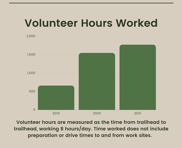
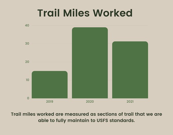
This year, SBFC is celebrating 16 years of stewarding the Selway-Bitterroot and Frank Church-River of No Return Wilderness areas. Each summer we get our boots on the ground and hands in the dirt to maintain, monitor, and protect these beloved public lands.
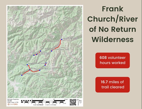
In 2020 the Frank celebrated its 40th anniversary as a designated Wilderness area. Spanning over 2.3 million acres, the Frank is a place that is close to our hearts (and our boots!) To celebrate this wild and scenic place, we are kicking off our 2021 Outdoor Conversations speaker series with a three-part virtual series all about the Frank. https://www.selwaybitterroot.org/outdoor-conversations-2021
APRIL 15TH 6:30PM – 7:30PM MST
CONGRESS, CONSERVATION, AND COMPROMISE: CHAMPIONS OF THE FRANK WITH SPECIAL GUESTS LARRY LAROCCO AND ROB MASON
APRIL 22ND 6:30PM – 7:30PM MST
PORTALS TO THE PAST FEATURING AUTHORS AND WILDLIFE BIOLOGISTS JIM & HOLLY AKENSON
APRIL 29TH 6:30PM – 7:30PM MST
THRU-HIKING THE ICT: 982 MILES OF SOLITUDE

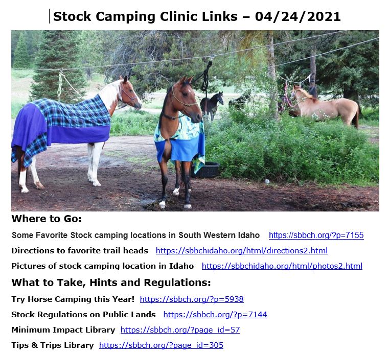
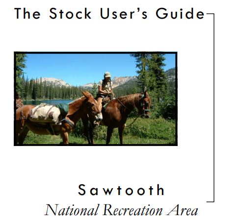
2021 Stock Camping Clinic Links
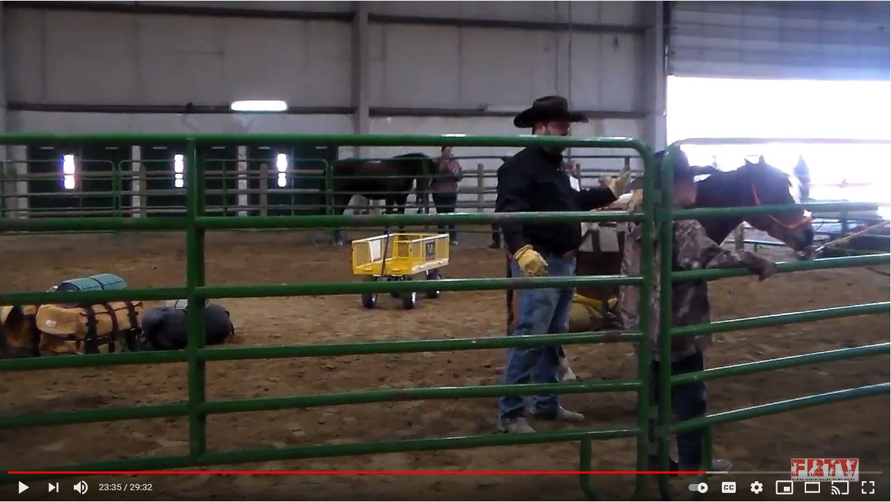
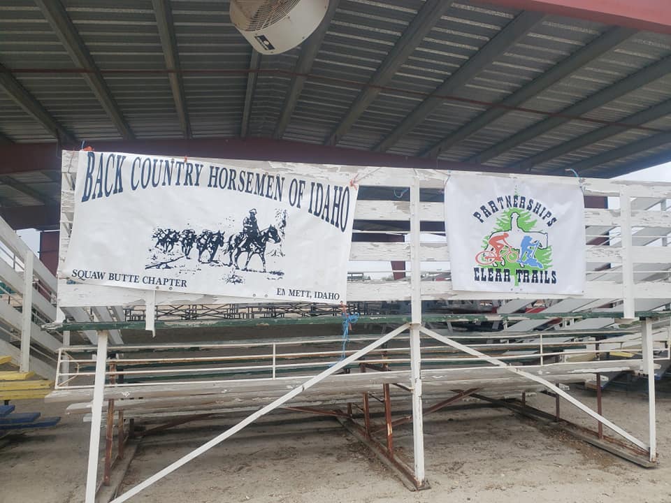
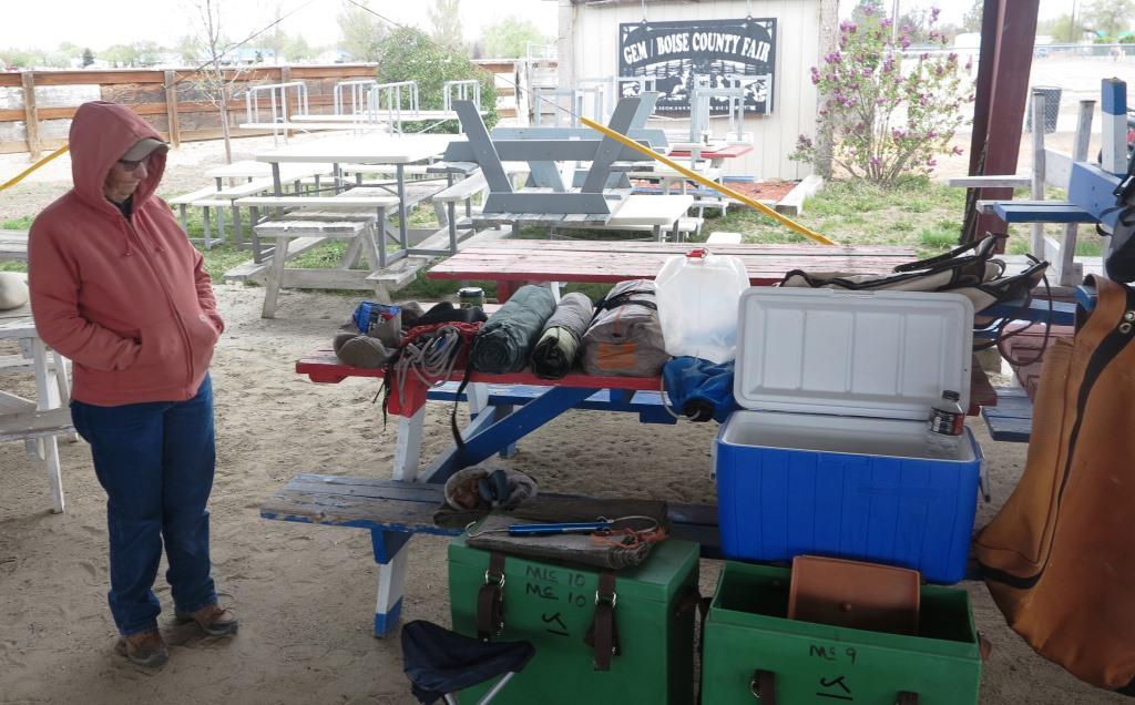
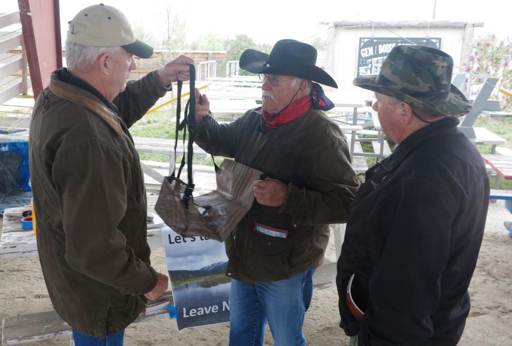
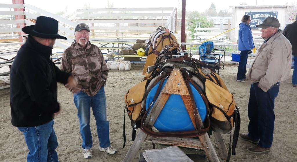
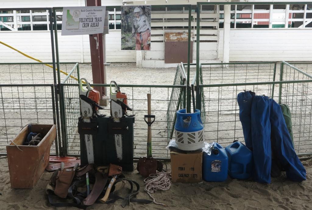
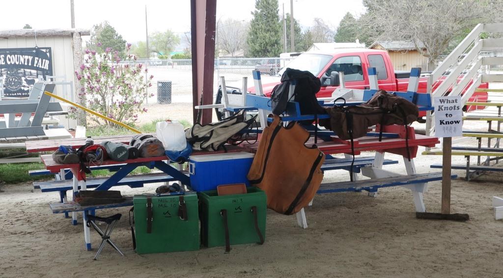
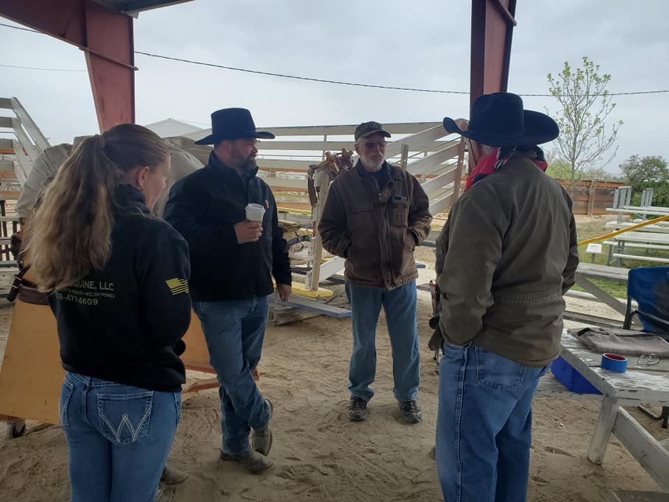
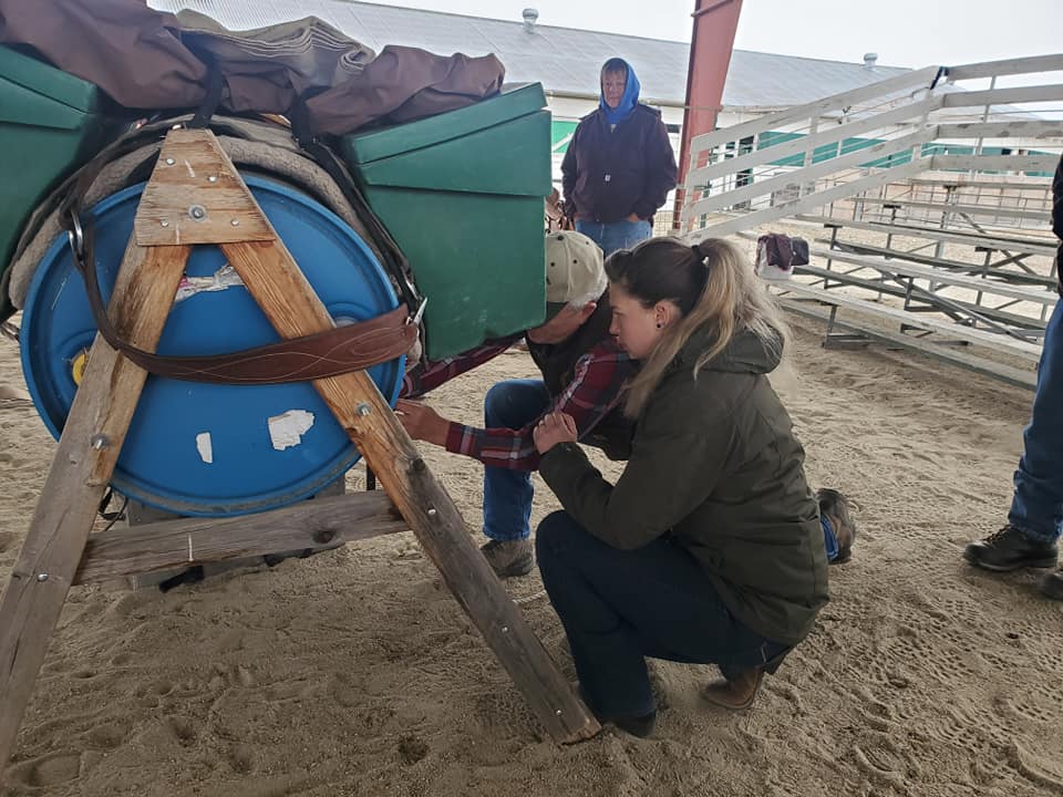
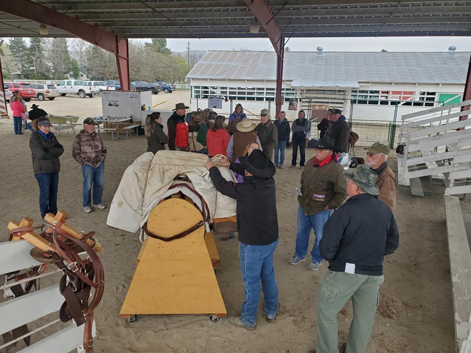
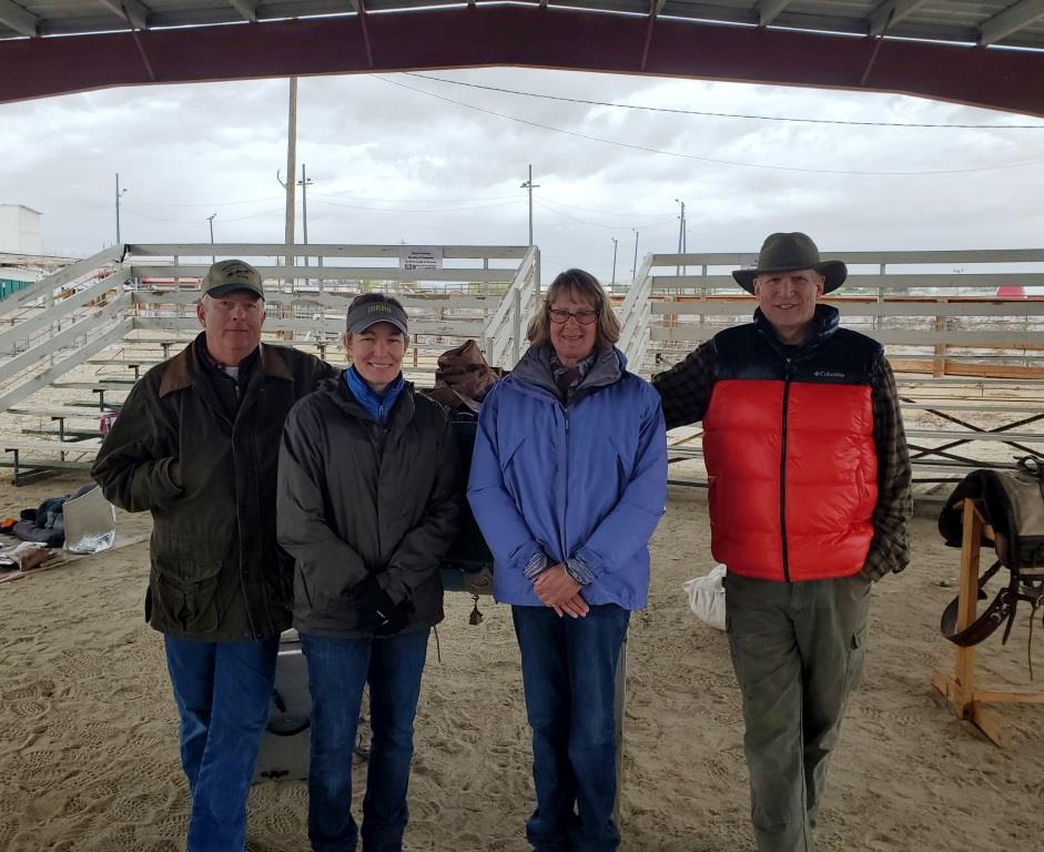
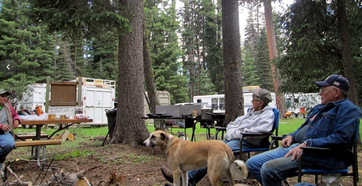
Twelve member and 26 guest spent, at times, a windy and rainy day under the 4-H shelter at the Gem Country Fair ground. The chapter had prepared over the last couple of months a number of information and hands on stations to pickup information and skills necessary to safely camp with stock both at a trail head and in the back country.
Lisa Griffith led this effort and all who participated put in a lot of hours getting ready before the first guest arrived. A majority of the pictures were taken before most of the guests arrived, because afterwards we were just to busy! We also picked up a number of new members who enjoyed the clinic and want to learn more and help with our mission. We also promised them some amazing food after a great day on the trail.


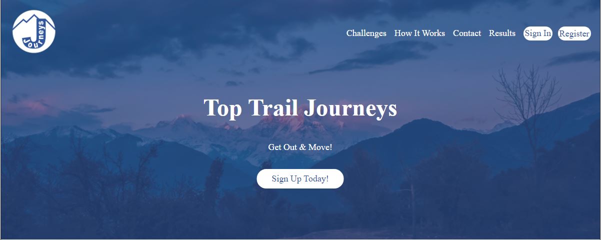
Top Trail Journeys are Virtual Challenges open to all — riders and non-riders, who wish to participate with their non-motorized miles tracked via GPS app or device. Miles tracked can be ridden (horse, bicycle), on foot (hiking, jogging, walking) — you can even log your miles swimming in the pool. The objective is to get out and move — and earn a medal for your efforts.
Join the Top Trail Journeys Facebook Group to connect with other participants and share your journey with us. What’s your “why” — how is it going? We love to see the photos of your journey along the way. Do you walk, horseback ride or drive (equine), hike, bike, swim— to get outside, to stay fit, to alleviate stress, something else? Do your dogs tag along? Do you walk your horse, mule, mini, or Llama?

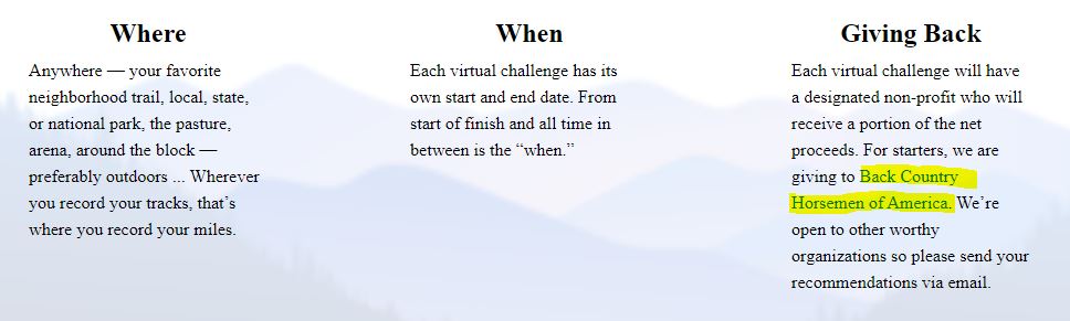
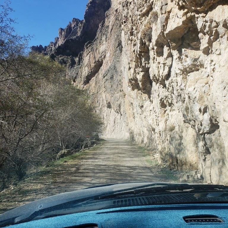
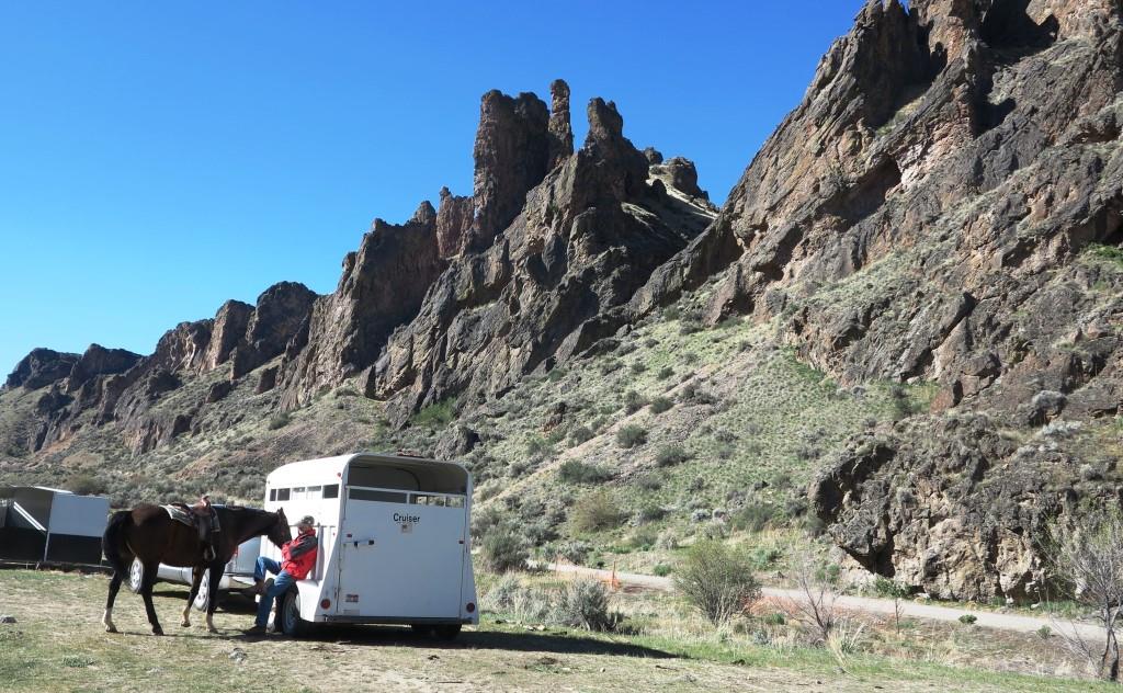
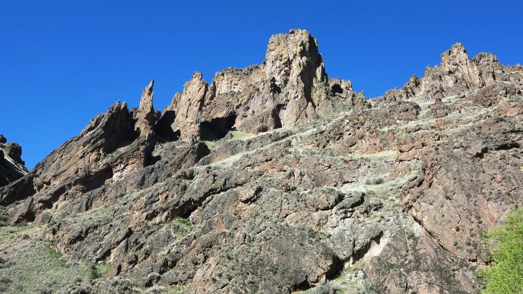
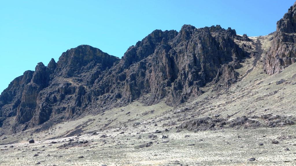
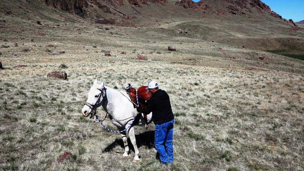
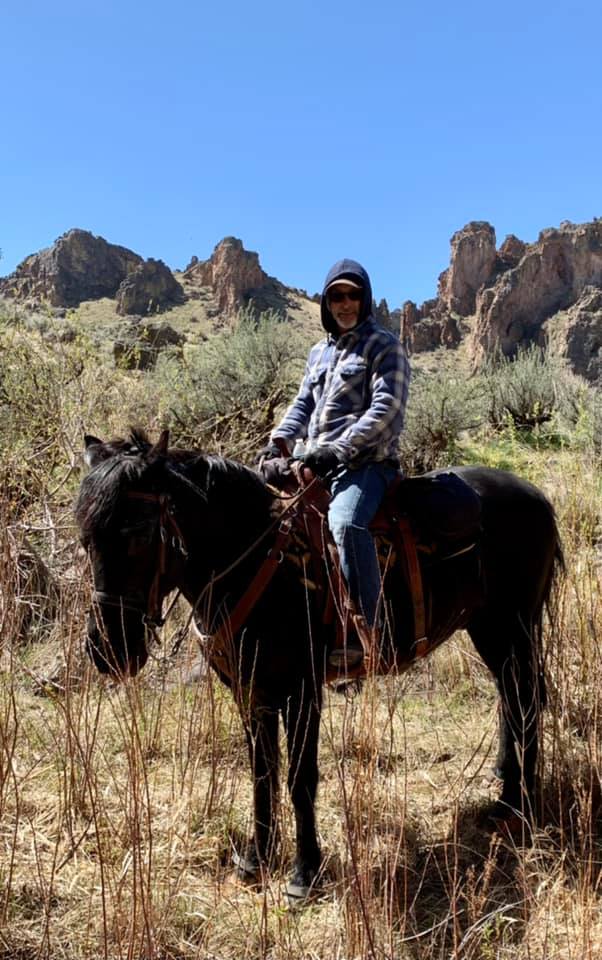
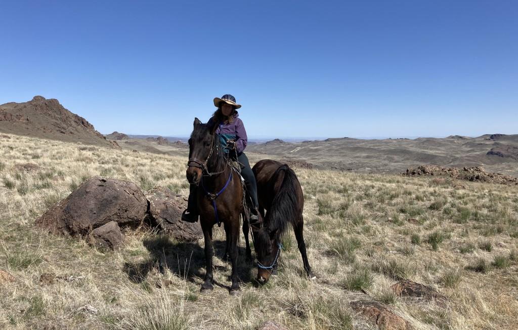
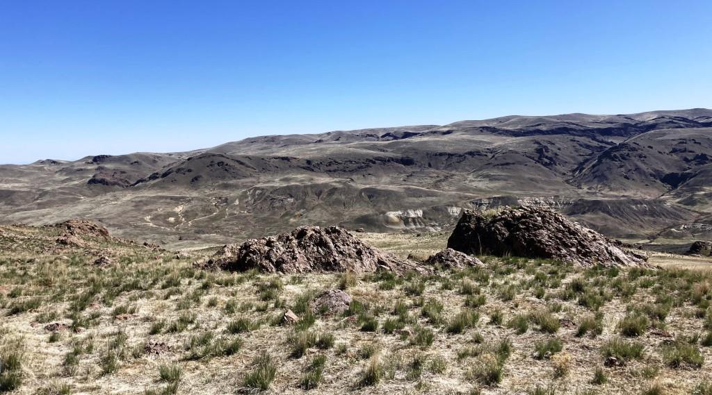
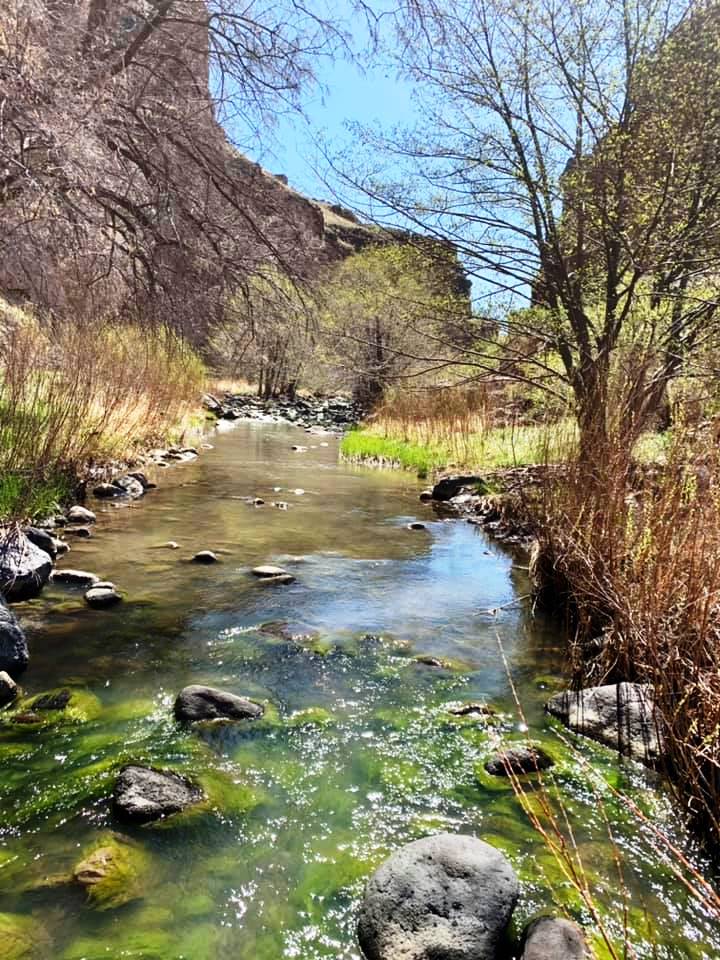
 Succor Creek State Natural Area lies in a deep, rocky canyon and is a remote haven for rock hounds and wildlife watchers. Limited souvenir collecting by rock hounds is permitted in the park. A rough 15 mile dirt road leads from Oregon 201 to the park, which has primitive camping and day-use areas along both side of the creek. No water is available.
The Succor Creek Bridge is open to vehicles for access to the campsites on the east side of the creek (right/south of the bridge). The road to the left/north of the bridge is not safe for vehicular travel. Staff and Staff Volunteers are not stationed at this site. This is a remote recreational experience, please prepare accordingly.
History
The land was obtained between 1966 and 1969 by a grant from the U. S. Government (Bureau of Land Management), and by purchase and litigation with private owners. The name Succor Creek is said to refer to early travelers in the Snake River Basin who, having been saved by the creek’s fresh water, applied the name as a corruption of the Spanish word socorro, meaning help or aid.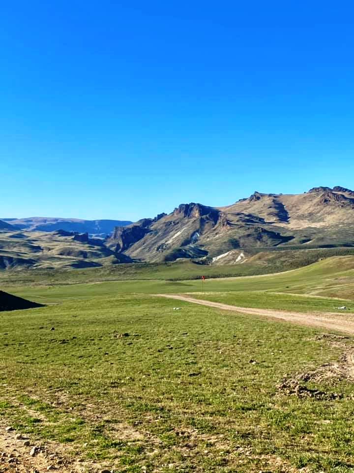
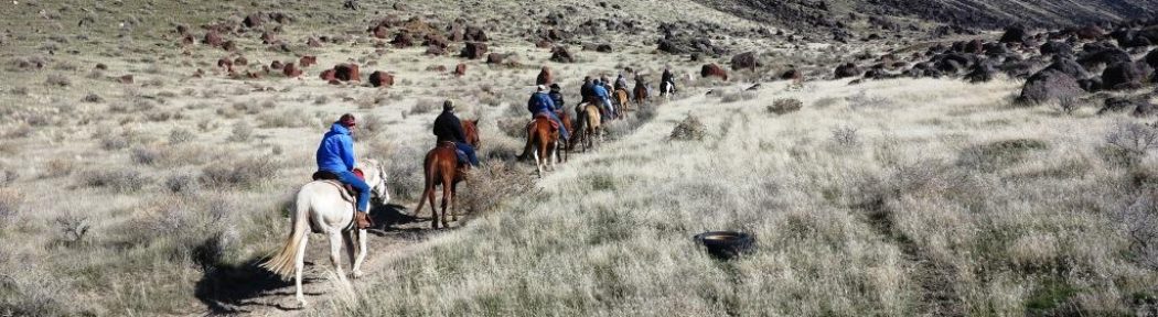
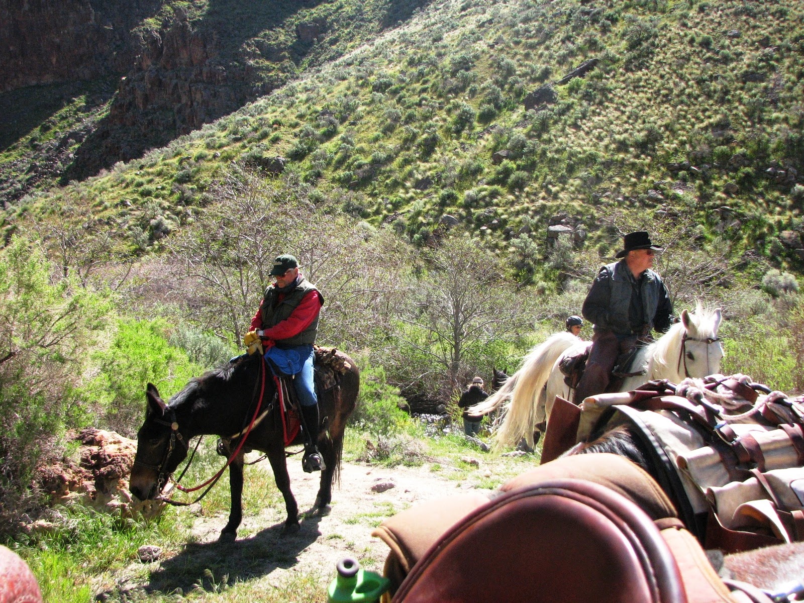
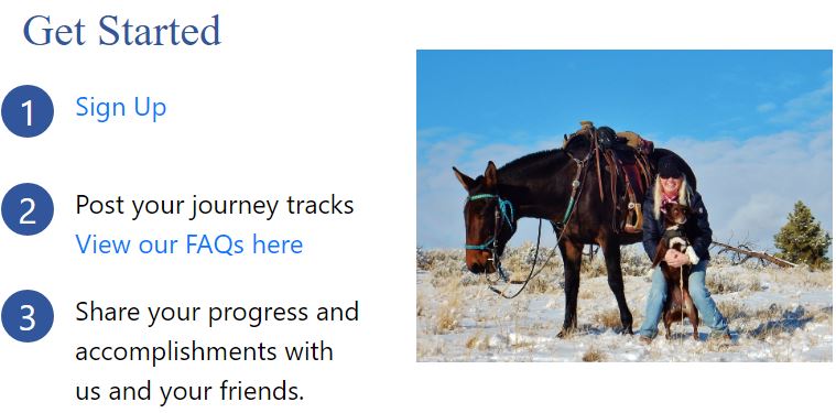
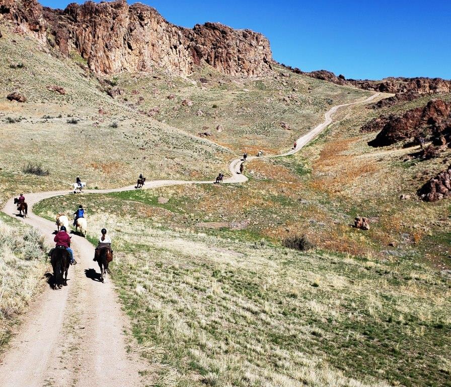
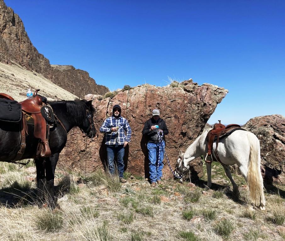
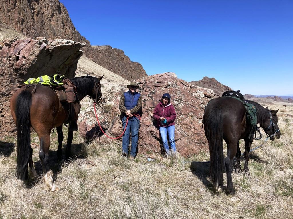
 On a brisk and sunny Sunday Morning, 14 members met at the Homedale High School parking lot and then convoyed to the state park trail head. Succor Creek road is 15 miles of gravel that was for the most part in excellent shape with a few sections of washboard.
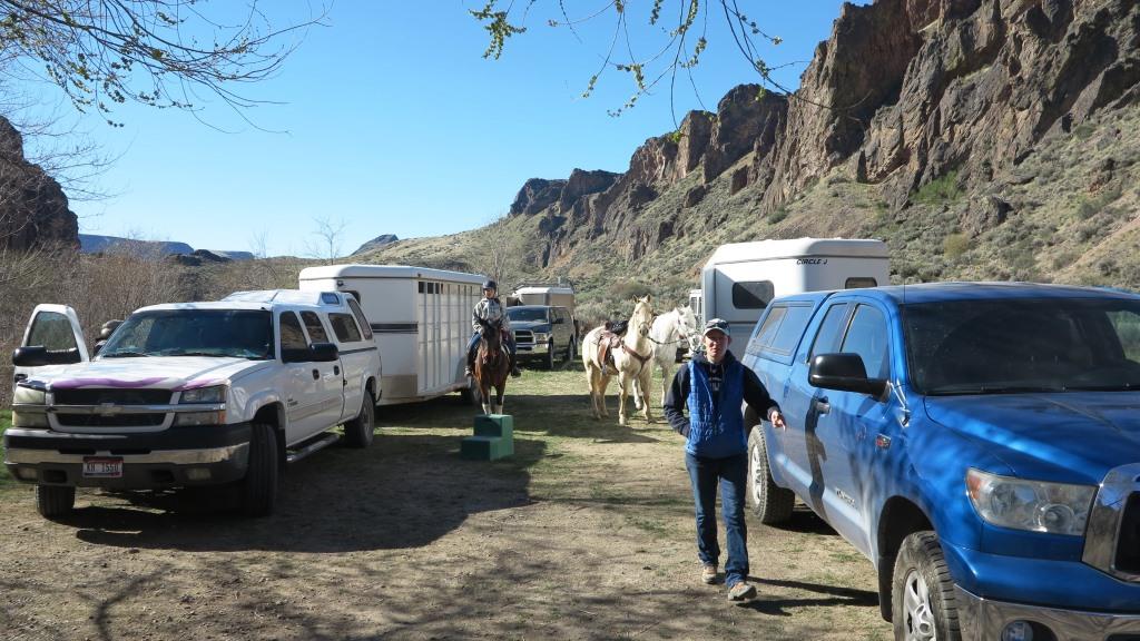

 By 10:45 we were all saddled and ready to go, the air had warmed a bit and the wind was still lite.
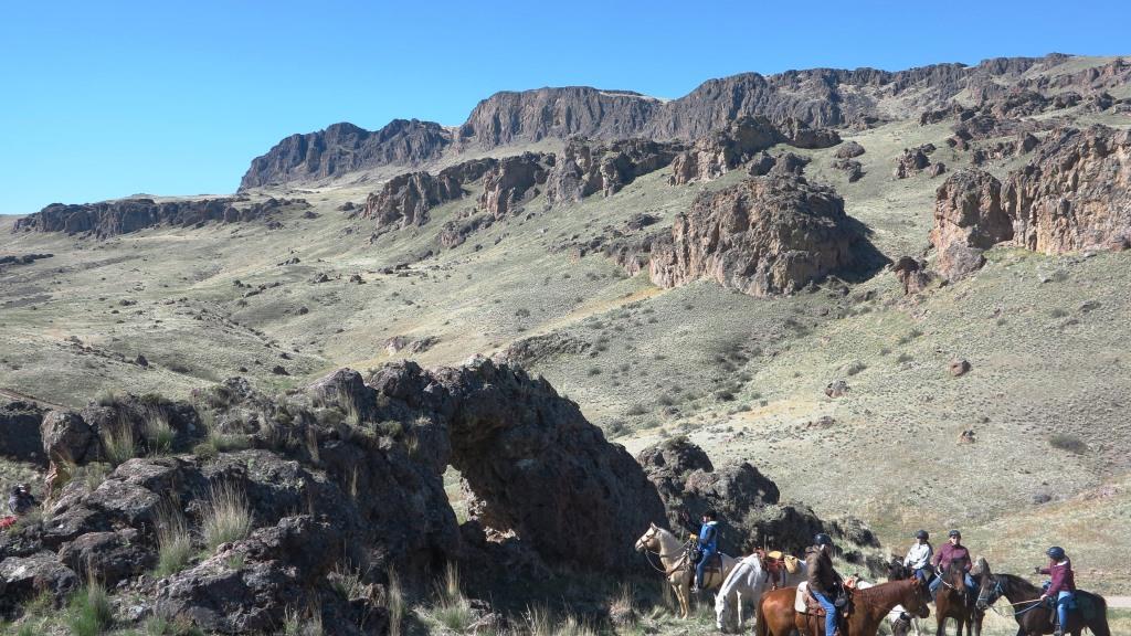
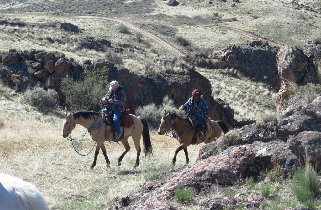

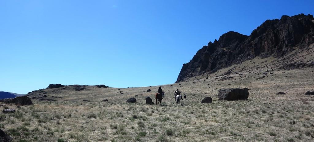
Tom and Sherry noticed a bridge rock formation that we all rode up a hill to view closer. After a number of pictures were taken we continued up to a bench. The wind was picking up so we rode near the rocked, which acted as a poor windbreak.


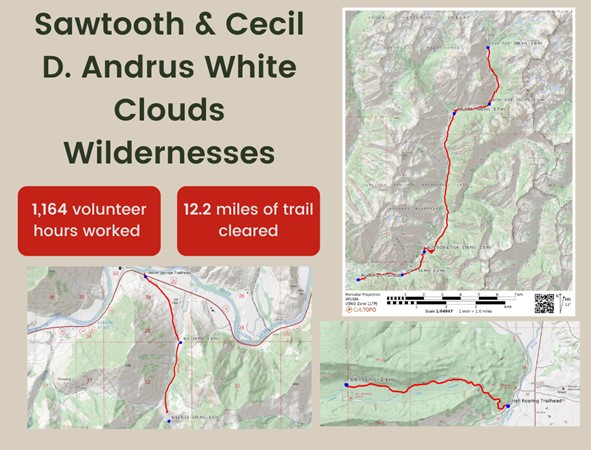
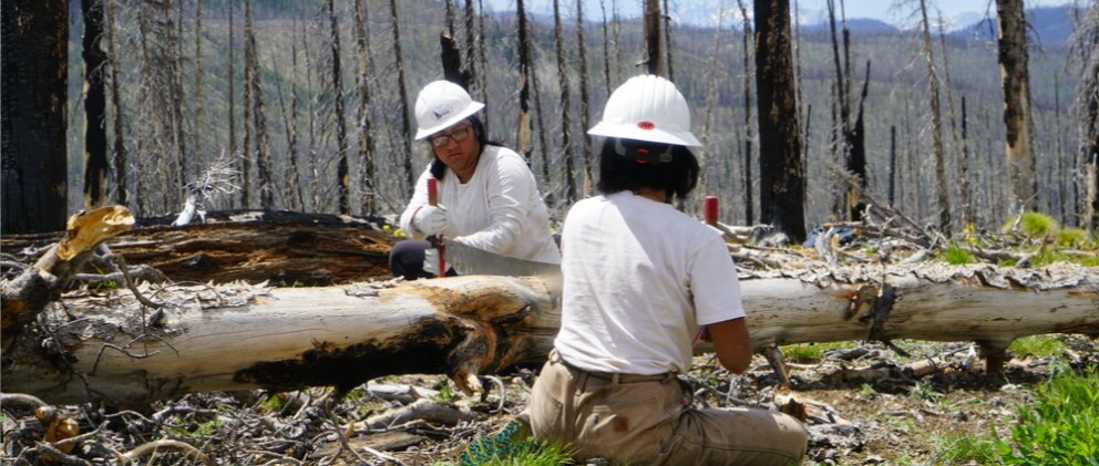
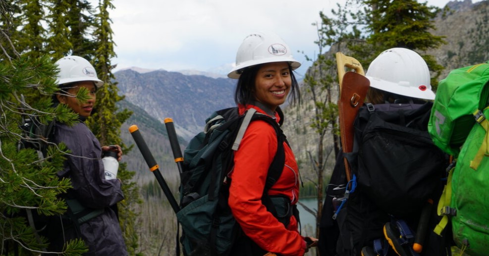
The Compassionate Leaders Program with the Flourish Foundation cleared 30 miles of trail, and hundreds of logs in the Frank Church wilderness, Sawtooth National Forest, and White Clouds Wilderness in the Summer of 2020 in partnership with PUG.
To find out more about the program visit www.flourishfoundation.org
Pulaski Users Group, Inc
GREG TRAVELSTEAD PO BOX 4921 HAILEY, ID 83333-4921
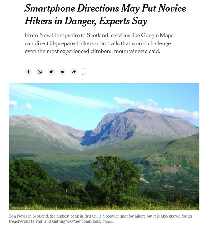
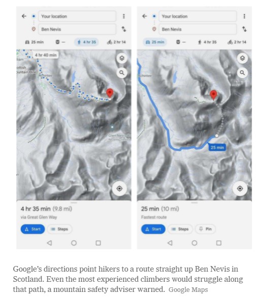
NYT – April 7, 2021 by Ali Watkins
Inexperienced adventurers have flooded remote areas like Wyoming’s Sublette County during the pandemic. When they call for help, the task is left to an overwhelmed network of volunteers. LINK to Audio
PINEDALE, Wyo. — Kenna Tanner and her team can list the cases from memory: There was the woman who got tired and did not feel like finishing her hike; the campers, in shorts during a blizzard; the base jumper, misjudging his leap from a treacherous granite cliff face; the ill-equipped snowmobiler, buried up to his neck in an avalanche.
All of them were pulled by Ms. Tanner and the Tip Top Search and Rescue crew from the rugged Wind River mountain range in the last year, in this sprawling, remote pocket of western Wyoming. And all of them, their rescuers said, were wildly unprepared for the brutal backcountry in which they were traveling.
“It is super frustrating,” said Ms. Tanner, Tip Top’s director. “We just wish that people respected the risk.”
In the throes of a pandemic that has made the indoors inherently dangerous, tens of thousands more Americans than usual have flocked outdoors, fleeing crowded cities for national parks and the public lands around them. But as these hordes of inexperienced adventurers explore the treacherous terrain of the backcountry, many inevitably call for help. It has strained the patchwork, volunteer-based search-and-rescue system in America’s West.
Such operations within the parks are handled by the National Park Service. Outside those boundaries, search-and-rescue missions fall to volunteer groups like Tip Top, which since 1980 has policed the harrowing Wind River mountain range, about an hour southeast of Jackson. After decades as a well-kept wilderness secret, reserved for only the most experienced outdoor enthusiasts, a pandemic-era mainstream has now discovered this rugged stretch of Wyoming.
“They come here and they’re like, ‘It’s beautiful, it’s a big open space.’ And it is,” Lesta Erickson, a Tip Top volunteer, said. “But it’s also dangerous.” READ MORE
Instructed by Air Saint Luke’s Crewman & AHA Instructor Cheryl Bice (Treasure Valley BCH)
& Scott Morgan EMT-B Certification, BLS/CPR Instructor, and Advanced Cardiac Lifesaver.
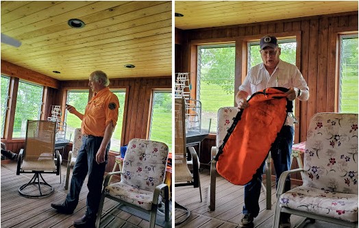
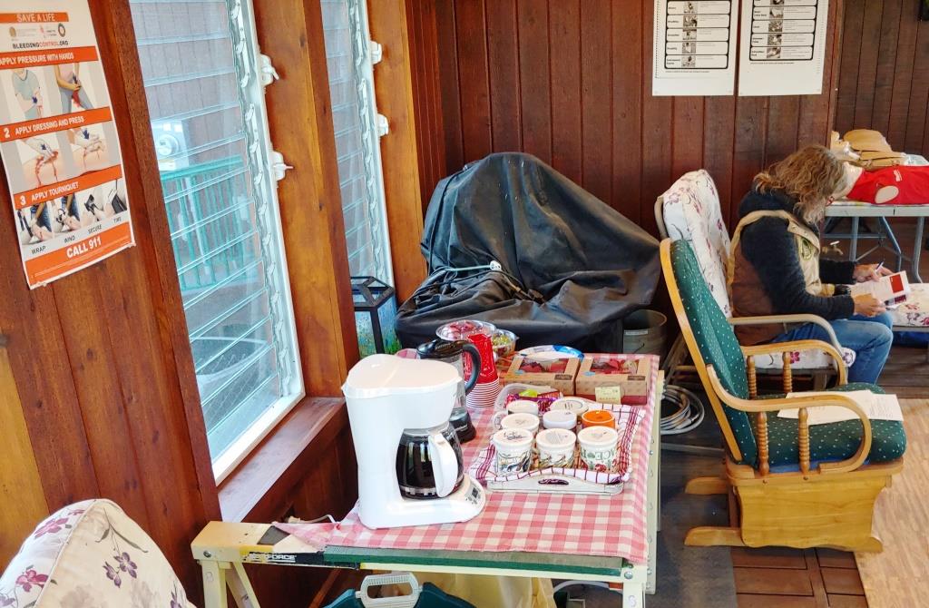
On Saturday morning 8 students, 2 auditors and 2 instructors met at the poarch classroom at Rob & Linda Adams home in Sweet. This room has all the advantages of being out side with louvered windows on three sides and fans for excellent air flow, plus a 55 inch monitor for watching video’s and other training material.
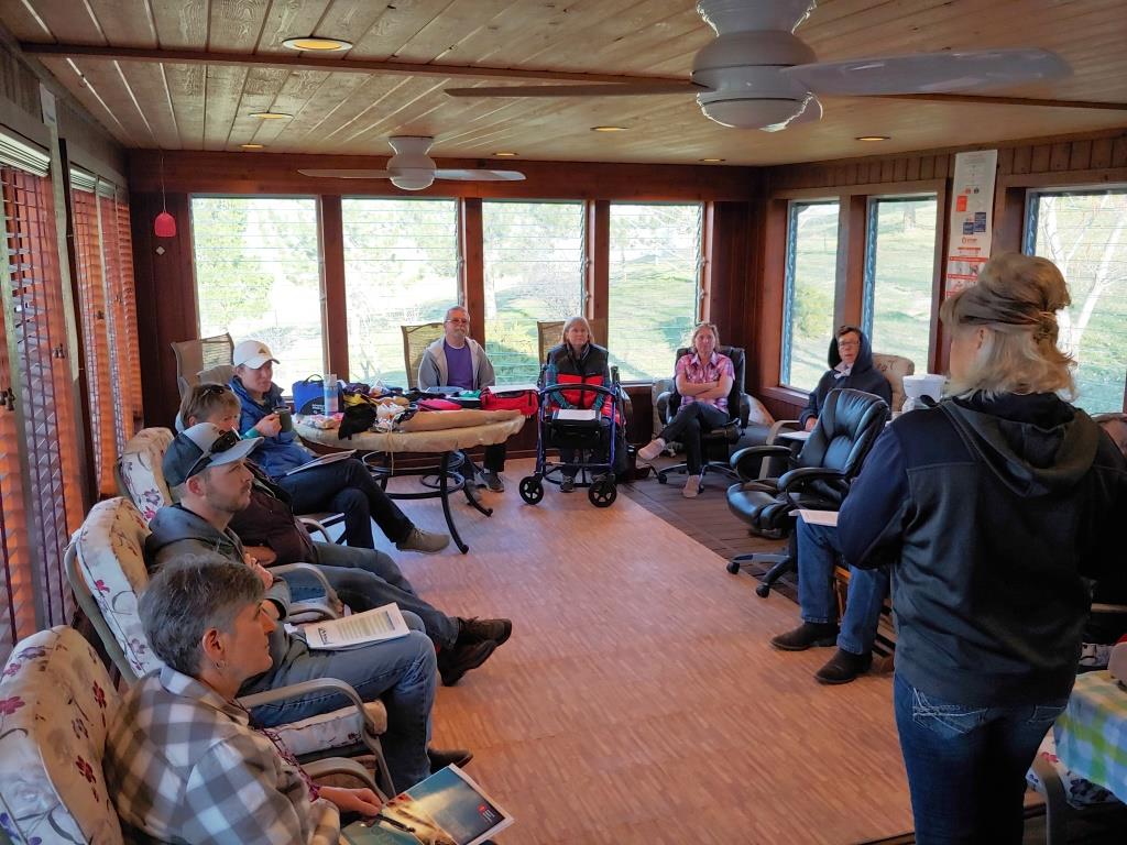 Cheryl led the class which was a mix of the structured instruction of the American Heart Association and lots of personal experience from her many years as a trauma technician on both Life Flight and Air St.Luke’s services.
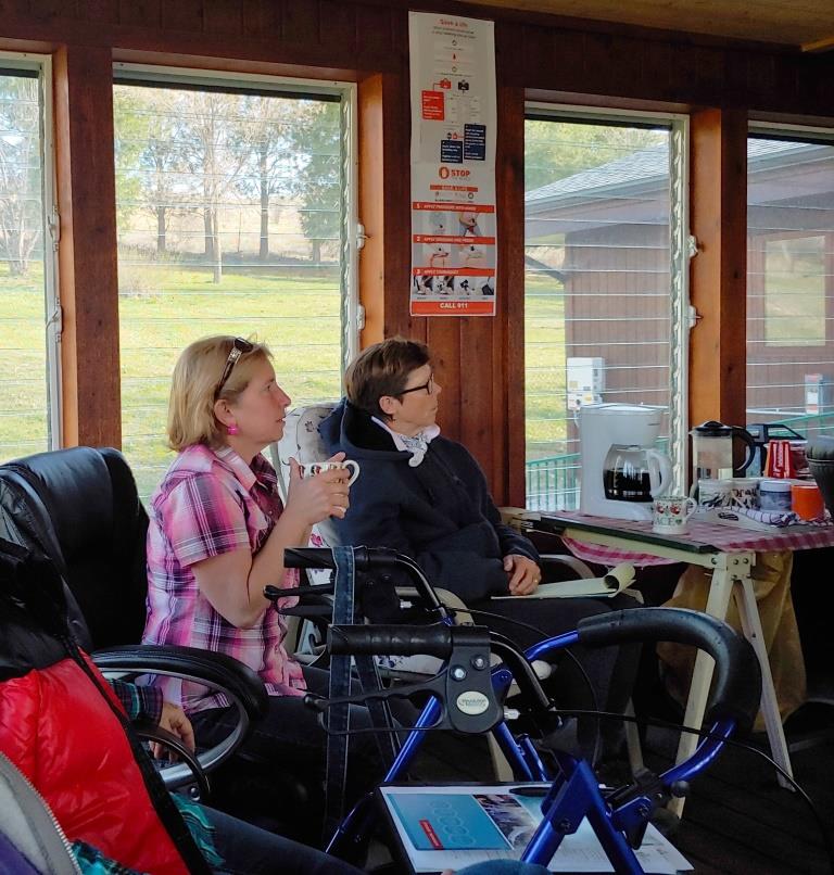
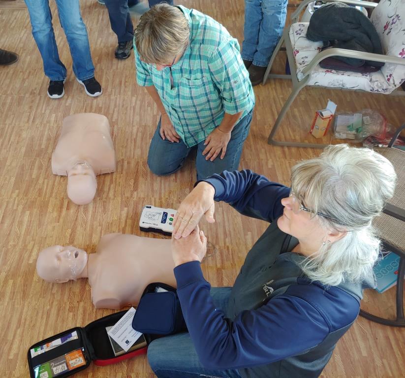
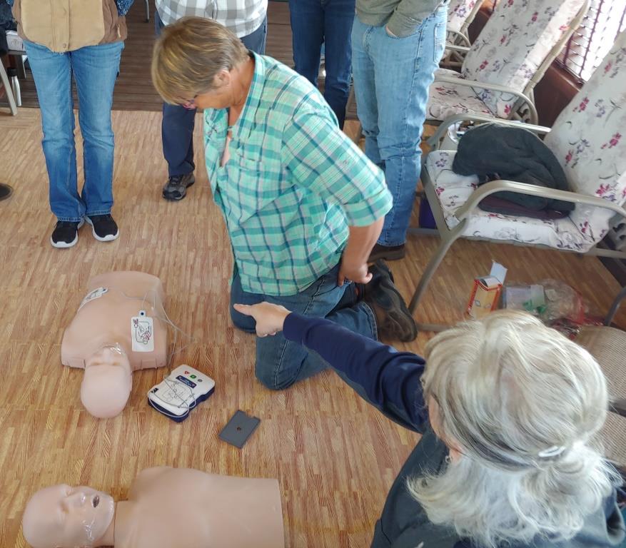
 Cheryl brought a lot of training material that was used throughout the class to demonstrate and practice on.
 A number of video’s were shown, followed by demonstrations and practice.
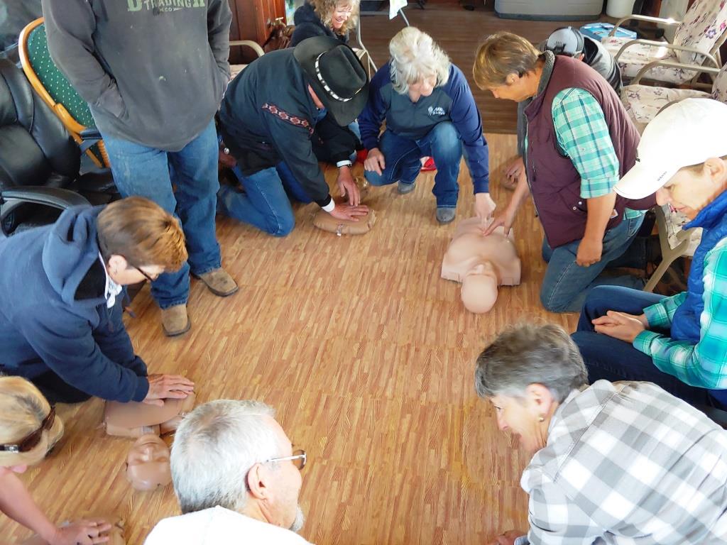
Cheryl is not a big fan of the song “Staying a Live” so others were used to keep track of CPR pace.
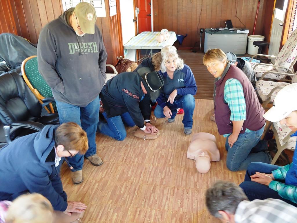
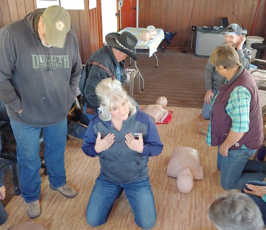
 The foam tiles on the floor were appreciated by all as it was much easier on our old knees
 No manikins were harmed during the training. A follow on field day is being planned for June where members of this class and anyone else who want to improve and practice their first aid skills will get a chance.
RSVP – Sign up for one or all of the events
April 15th 6:30PM – 7:30PM MST
CONGRESS, CONSERVATION, AND COMPROMISE: CHAMPIONS OF THE FRANK WITH SPECIAL GUESTS LARRY LAROCCO AND ROB MASON
Join SBFC as we talk with former Congressman Larry LaRocco and Central Idaho Representative for The Wilderness Society Rob Mason about the establishment of the Frank Church-River of No Return Wilderness. Many people know the Frank as a beloved wilderness area, but not as many know the history behind championing this Wilderness designation. Learn about the legislative leg work to advance the Wilderness proposal into law during the 1970’s and 80’s, and the compromises that were made to accomplish such a feat. Senator Frank Church’s legacy lives on in these wild lands, and it is thanks to the hard work of many to ensure that the legacy of Wilderness lives on for generations to come.
Larry LaRocco is the former Director of Senator Frank Church’s North Idaho office, former two-term US House representative (1991-1995), and board member of the Frank Church Institute.
Rob Mason joined The Wilderness Society in September 2013 as the Central Idaho Representative and works on land protection efforts with communities and local stakeholders in the state.
April 22nd 6:30PM – 7:30PM MST
PORTALS TO THE PAST FEATURING AUTHORS AND WILDLIFE BIOLOGISTS JIM & HOLLY AKENSON
Jim & Holly Akenson spent 21 years living in the remote wilds of the Frank Church Wilderness area at Taylor Ranch, and will give us an intimate view of the people who have lived, loved, and survived in the wild Frank. Hear firsthand about the Akenson’s experiences while living in this remote place and how their archaeological and biological research painted a rich tapestry of the deep and unyielding history of the Frank. From the Indigenous peoples who stewarded these lands for millennia, to homesteaders and modern research stations, learn something new about the ever-changing landscapes and communities that reside within these 2.3 million acres.
April 29th 6:30PM – 7:30PM MST
THRU-HIKING THE ICT: 982 MILES OF SOLITUDE
Lisa and Jeremy Johnson spent 51 days hiking the 982 miles of the Idaho Centennial Trail through some of the most remote terrain in the lower 48, including a 200-mile section of the Frank! Hear their tales from the trails—through the Frank and beyond—and learn how they survived trekking the length of Idaho. Throughout these 982 miles Lisa and Jeremy crossed through some of the most treacherous landscapes, including a challenging corridor called Marble Creek, a narrow canyon trail where trails disappear into the creek and bushwhacking is a fact of life. It also happens to be SBFC Executive Director Sally Ferguson’s favorite trail in the Frank, and a portion of the ICT that SBFC has worked to steward since 2012. Sally will give you the scoop on the work we do to protect and preserve these portions of the ICT for those brave enough to get out there!
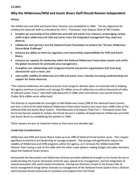
Heather Provencio will serve as acting Director, Wilderness and Wild and Scenic Rivers. She is currently the Forest Supervisor of the Kaibab National Forest in Kaibab, Arizona, serving in this capacity since 2015. Heather brings more than 15 years of leadership experience as a line officer serving as deputy forest supervisor of the White River National Forest in Colorado; district ranger on the Red Rock Ranger District, Coconino National Forest in Arizona; and various acting positions as deputy forest supervisor or district ranger. Heather works across boundaries and identifies opportunities thru improving and enhancing land management planning, promoting wild and scenic river stewardship, and cultivating wilderness ethic and leave no trace. Heather’s formalized training started as an archaeologist and she joined the Forest Service as a co-op student in 1999. Heather earned a Bachelor of Science and a Master of Science in Anthropology from Northern Arizona University.
NWSA and other Wilderness, Wild and Scenic River Organizations Support Permanently Filling the Wilderness Director position
View our Letter of Support for permanently filling this critical position.