As an organization that cares about Idaho’s wild places, we want to let you know about an opportunity to speak up for a special area of Idaho.
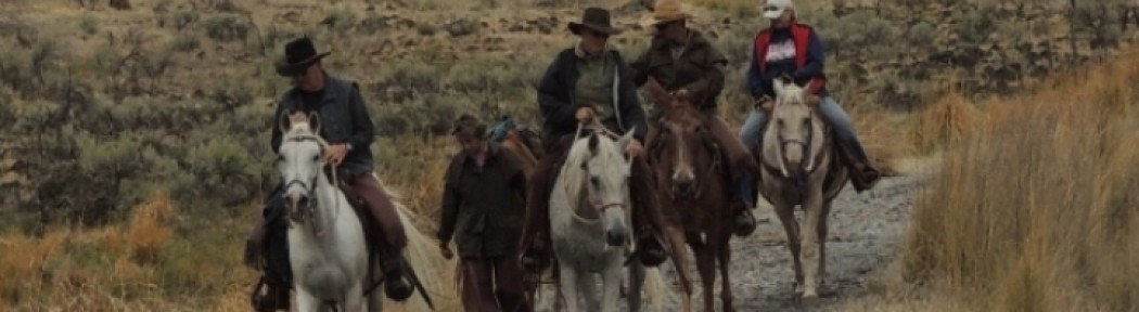
The Payette National Forest is seeking comment on a travel management plan for Rapid River, which includes the Rapid River Wild and Scenic River corridor that is popular with hikers because of its incredible views and unique plant life. A description of the area from the Forest Service’s website states “The absence of roads and other development has helped keep this river one of the clearest and cleanest in the area.” A gateway to the Seven Devils, ITA routinely has projects in this incredible place.
The proposal being considered by the Forest Service would allow motorized and mechanized use on certain trails to the boundary of the Wild and Scenic River corridor. At the boundary, signs would be installed in turnaround areas stating that non-motorized use only is allowed in the corridor itself.
As advocates of non-motorized trail use, we at ITA believe this proposal is not in the best interest of the hiking community and that the Payette National Forest should consider an additional alternative in this project that designates all trails in this area as non-motorized. The Forest Service is looking for public feedback regarding this new plan. You can read the full plan here. If you recreate in this beautiful area, please consider making your voice heard about this issue by leaving your comments for the Forest Service.
Thank you for supporting ITA as we advocate for Idaho’s trails. We believe that YOUR voice matters when it comes to the management of public lands!
What is the purpose of and need for this project? Payette National Forest
We propose this project to review the designated use1 of sections of National Forest System trails 177,
183, 184, 187, 188, and 362 within and immediately adjacent to the Rapid River Wild River corridor, and
to update the forest’s summer motor vehicle use map (“MVUM”; USDA Forest Service 2020)
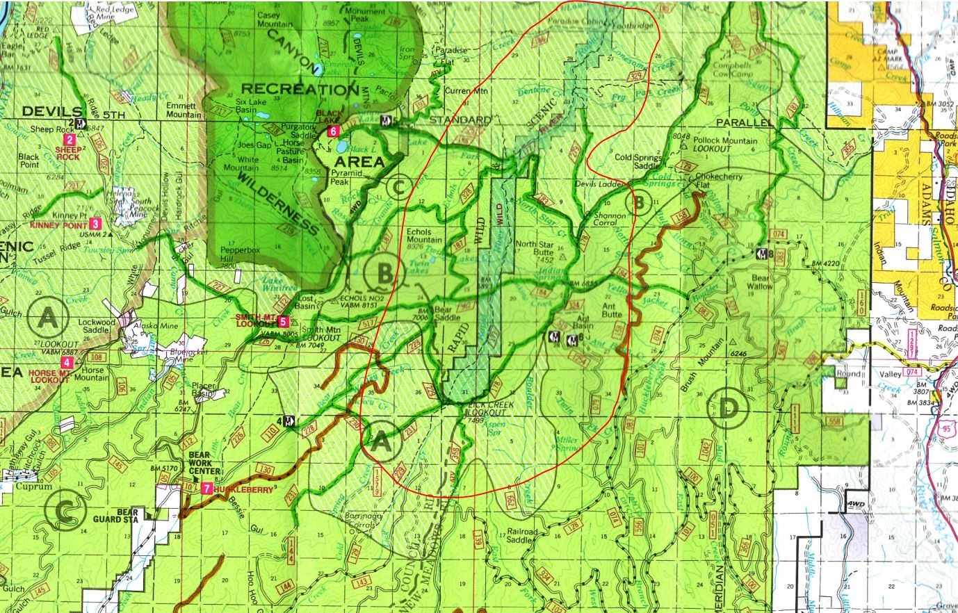
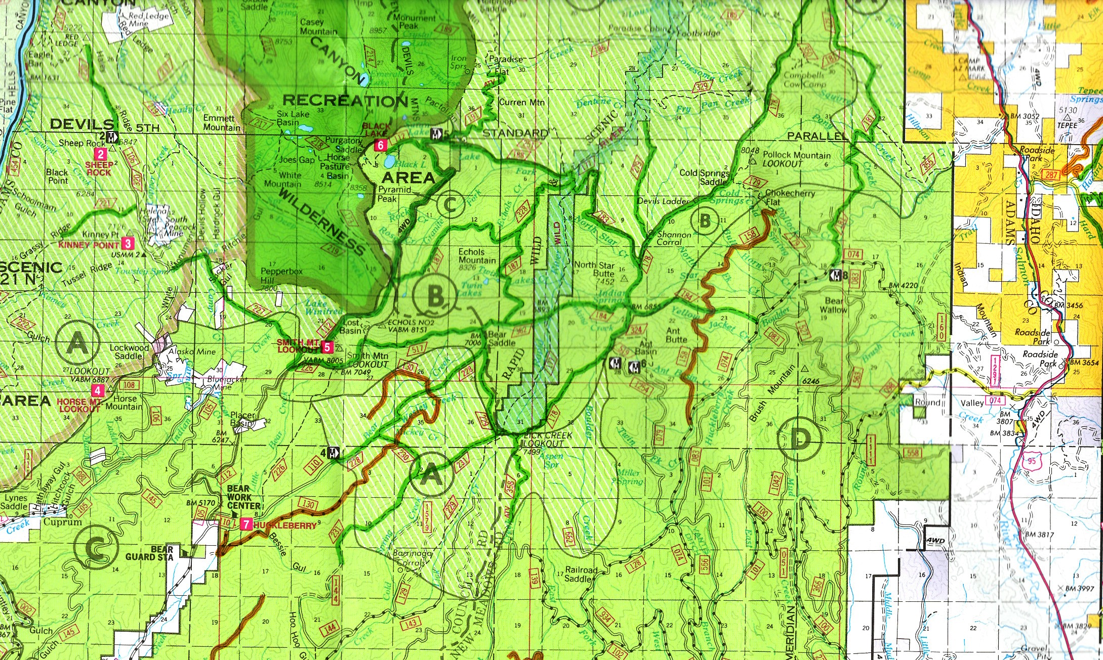
accordingly. The 23 miles of trail under review of this project include (figure 1 on page 7):
• Rapid River Trail 177: From the junction with trail 229 in Township 21 North, Range 1 West,
Section 31, then northeast approximately 12 miles to the forest boundary in Township 22 North,
Range 1 West, Section 11.
• North Star Trail 183: From the junction with trail 178 in Township 21 North, Range 1 West,
Section 16, then northwest approximately three miles to the junction with trail 177 in Township
21 North, Range 1 West, Section 5.
• Indian Spring Trail 184: From the junction with trail 178 in Township 21 North, Range 1 West,
Section 21, then west approximately two miles to the junction with trail 177 in Township 21
North, Range 1 West, Section 20.
• Echols Ridge Trail 187: From the junction with trail 328 in Township 21 North, Range 1 West,
Section 7, then northeast approximately two miles to the junction with trail 177 in Township 21
North, Range 1 West, Section 5.
• Black Lake Creek Trail 188: From the junction with trail 191 in Township 21 North, Range 2
West, Section 2, then southeast approximately three miles to the junction with trail 177 in
Township 21 North, Range 1 West, Section 5.
• Cub Creek Trail 362: From the junction with trails 328 and 517, located within Township 21
North, Range 1 West, Section 19; then easterly approximately one mile to the junction with trail
177, located within Township 21 North, Range 1 West, Section 20.