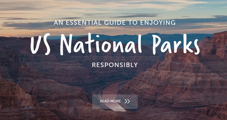
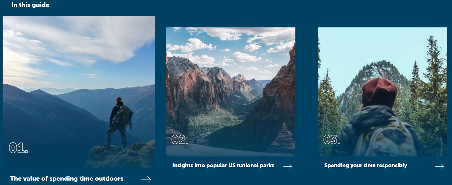
So you want to spend more time outdoors?
Whether you’re a local or a visitor, the US is home to 62 national parks. Yellowstone became the world’s first national park in 1872. And in the years that followed, numerous other areas became national parks and, as part of the Organic Act 1916, the US National Park Service (NPS) was created in 1916 to:
“conserve the scenery and the natural and historic objects and wildlife therein, and to provide for the enjoyment of the same in such manner and by such means as will leave them unimpaired for the enjoyment of future generations.”
NPS is now responsible for more than 400 separate areas making up about 85 million acres, including national parks, national preserves, monuments, recreation areas, seashores, lakeshores, historic parks and sites, parkways, scenic trails, and battlefields.
Within the system, 62 sites are designated as national parks. The selection criteria for national parks includes aspects like unique geological features or unusual ecosystems, recreational opportunities, and, of course, natural beauty. READ MORE
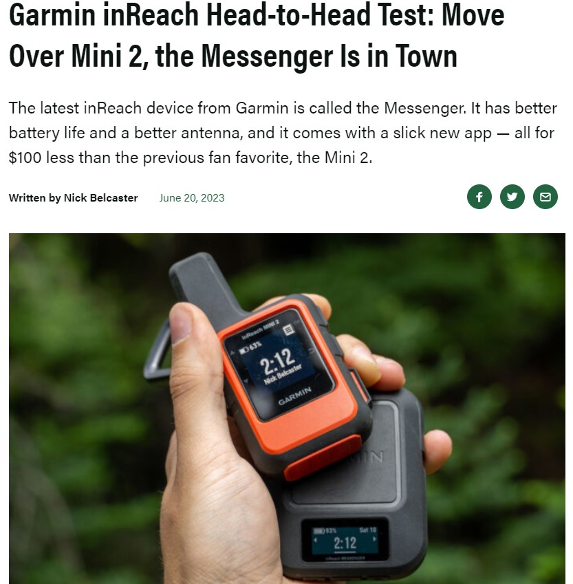
The inReach has long been Garmin’s de-facto line of satellite communication devices. So, when Garmin rolled out the second generation of the inReach Mini, long-time users were excited. The inReach Mini 2 was juiced up with nearly everything on the wishlist: Support for four additional global satellite systems, a new higher-fidelity screen with a quicker refresh rate, and a longer battery life with USB-C charging, to name a few.
But Garmin wasn’t about to stop its inReach innovations there.
The inReach Messenger hit the scene this year, and it did so with a splash. Not so much because the inReach Messenger was built on the devices before it, but because the inReach Messenger is so vastly different from previous iterations. The square black form factor was one obvious diversion from the original design. However, Garmin also changed the way its new device sends and receives messages by adding cell service and Wi-Fi to the mix.
Both devices have the big red button to call in the cavalry if you need help. But most often, you’ll probably be using them to check in with friends and family members, to chat about post-hike dinner plans, or the particular voraciousness of the mosquitos at your camp last night.
As a long-time user of the inReach Mini series, my interest was piqued by the Garmin inReach Messenger. But the question stuck around — Who is this thing for?
In short: After numerous tromps in the hills recently testing both the inReach Min2 and the newer Messenger head-to-head, I’ve come to understand the niche that Garmin has carved out for the Messenger. This is the average person’s satellite messenger device. The Messenger makes messaging easier, it has a longer battery life and a better antenna, and it’s cheaper than other inReach devices. And because it taps into Wi-Fi and cell service when it can, users save those allotted satellite messages for when they really need them.
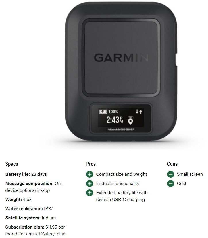
If you’re one who likes to have backups to your backups, then the inReach Mini 2 is probably a better device for you. The baked-in navigation abilities are only heightened by the accompanying Explore app, but can make it all on their own if push comes to shove.
Fourteen hours of “On” time is also generally going to be enough for most people, especially for those who bring some type of battery bank along on their outdoor adventures.
But for most folks, most of the time, the Garmin inReach Messenger just makes things easier. Your trade-off for the nav tools is an extended burn time, a slightly better antenna, and $100 still nestled in your wallet. And with the new Messenger app, communication is as easy as texting directly from your phone. If things turn ugly and you do need to hit that SOS button, simplicity is your best friend.
The Best Satellite Messengers of 2023
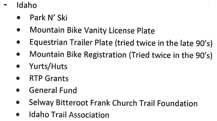
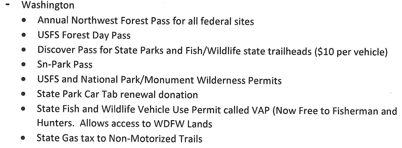
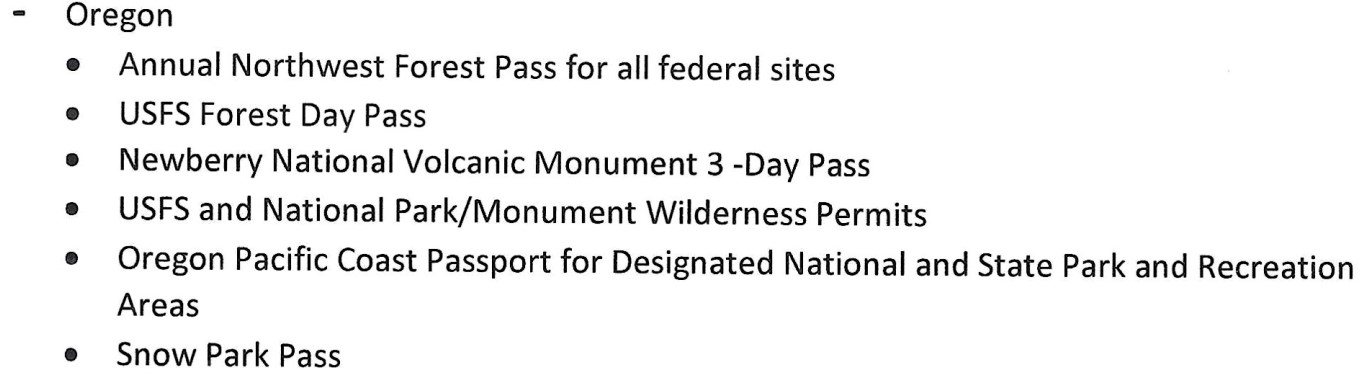
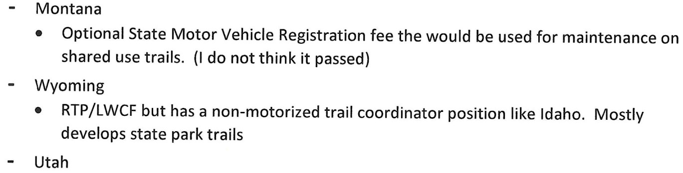
Non-Motorized funding by State
Idaho Horse Council Administrator is inviting you to a scheduled Zoom meeting.
Topic: IHC Non-Motorized Trails Initiative Meeting
Time: Jun 20, 2023 10:00 AM Mountain Time (US and Canada)
Join Zoom Meeting
https://us02web.zoom.us/j/87256562289?pwd=eTUvZE1aa0k1aTFNa0pFSjRRQUVuQT09
Meeting ID: 872 5656 2289
Passcode: 895117
—
One tap mobile
+16694449171,,87256562289#,,,,*895117# US
+16699009128,,87256562289#,,,,*895117# US (San Jose)
Idaho Non-Motorized Trails Poll
Non-Motorized Funding by State
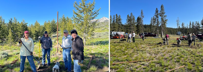
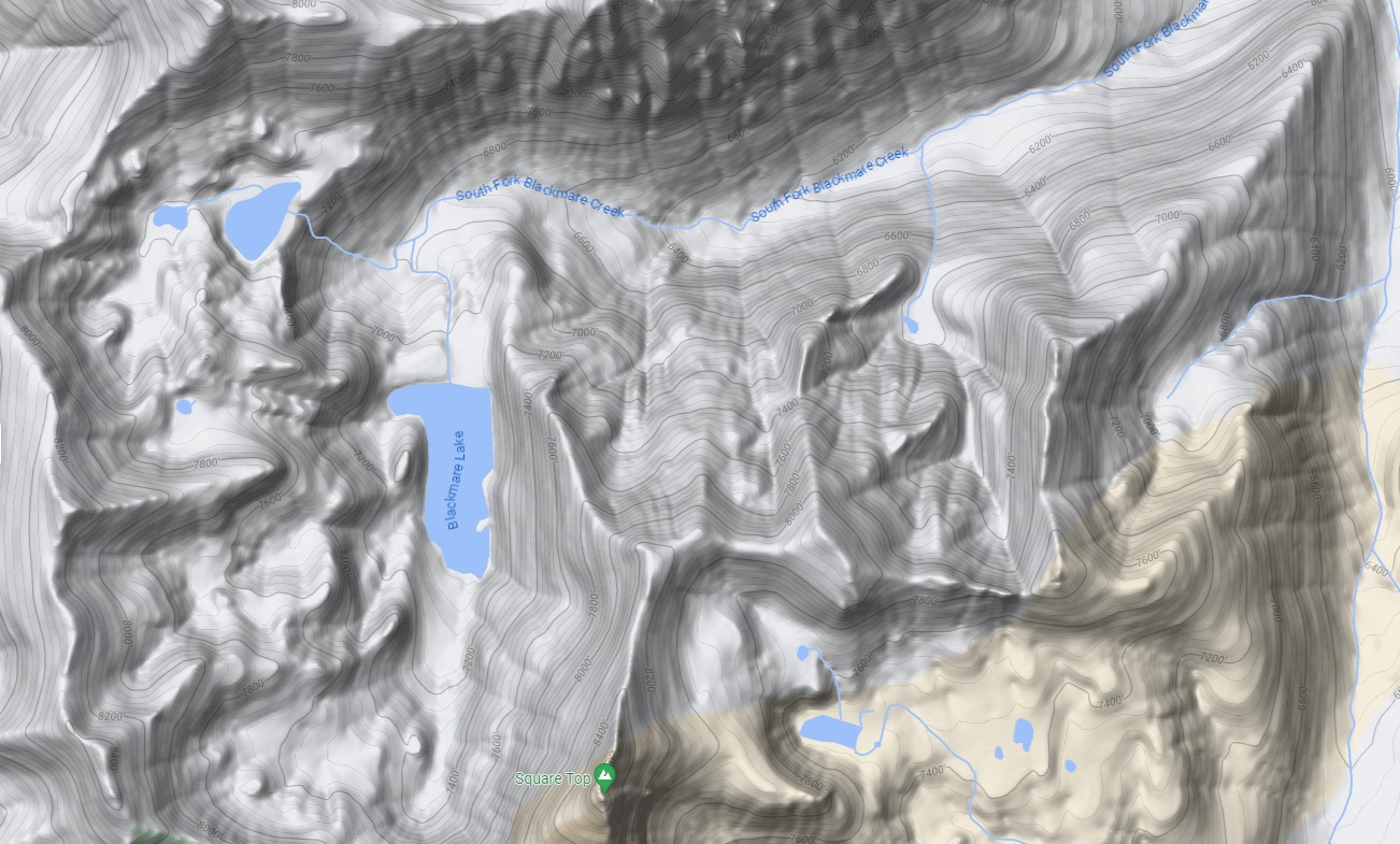
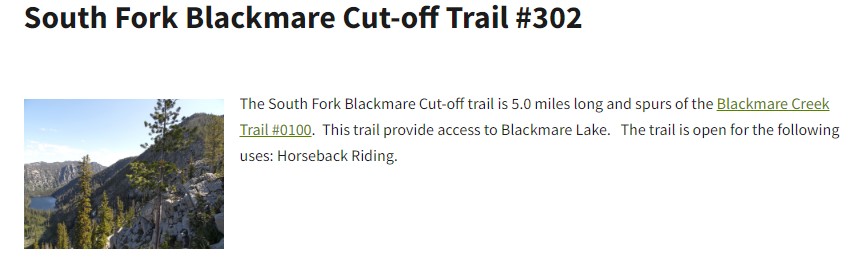
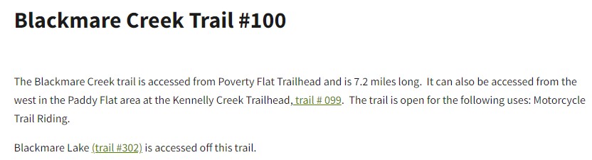
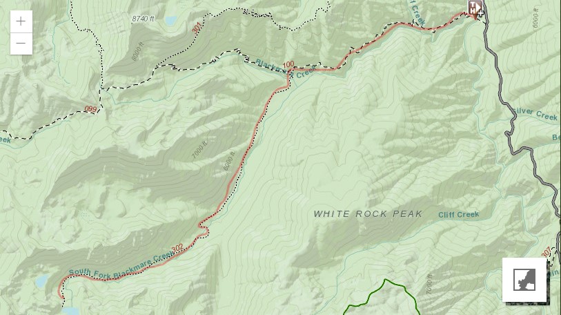
A short update on the Idaho Trails Association South Blackmare Trail trip June 11-17
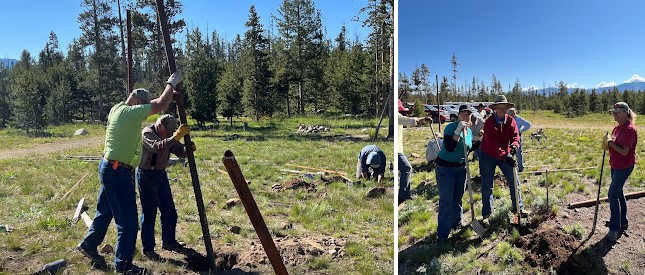
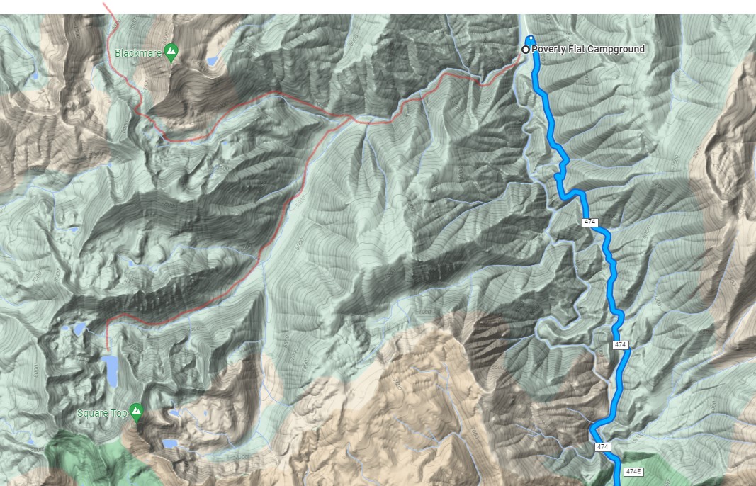
We had a good trip last week. Due to imclimate weather we had a few mid afternoon stops earlier in the week, but ended the week with some nicer weather. We worked mainly on Trail 302, but also did some logging and brushing along Trail 100 as we went in and out to better accommodate stock. The 8 participants removed approximately 379 trees from the trails – either cut out or moved, as well as performed brushing along the majority of the approximately 1.6+ miles of trail 302 we were able to cover. We also did tread work in a number of areas.
More details and stats to come, but I wanted to give you an overview. The attached KMZ has the trail from near where we camped (perhaps the southside of Blackmare creek) to where we turned around. Work was also done from camp up to the junction with Trail 100.
Please let us know if you have any questions we can address in our more detailed report.
Kirsten Severud
ITA Crew Leader
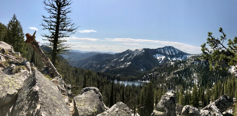
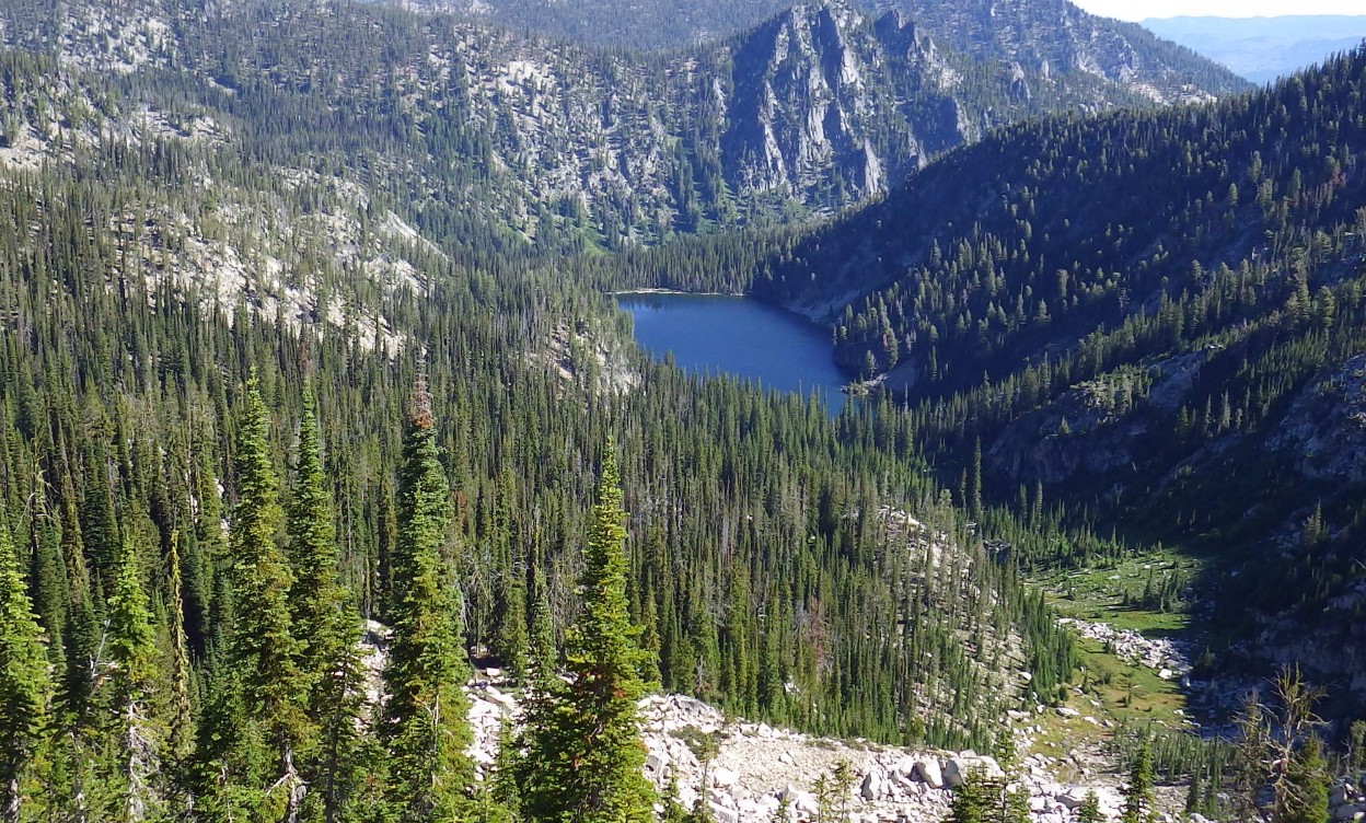
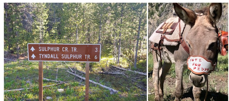
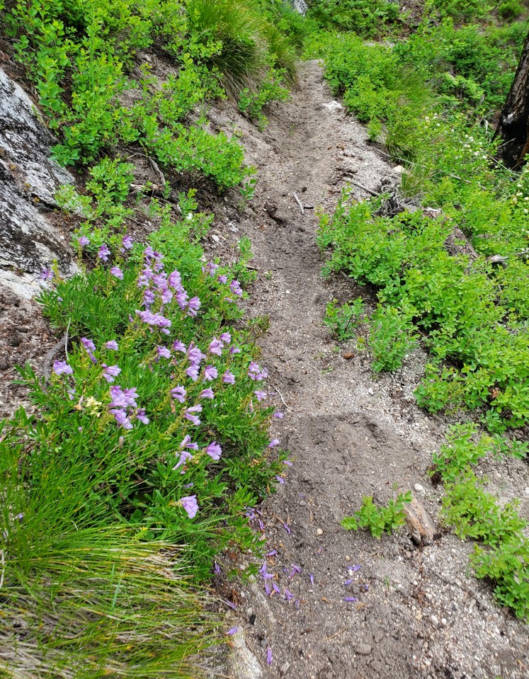
I packed them in and snapped just a couple photos bc it was raining much of the ride. I will send more pics of the work the crew got done (about 2 miles past where Blackmare and SF Blackmare split) over the week when I get them. This was truly a “lost trails found” effort, as the trail was almost entirely overgrown and even required scouting to find it, and some tread reestablishment. A good effort by the crew and one more hitch would probably be enough to get to the lake but we won’t get to it until next year.
The first mile or so is the most exposed trail- like Jeff said, steep granite slopes. The rest is mellower.
Melanie Vining, Executive Director Idaho Trails Association
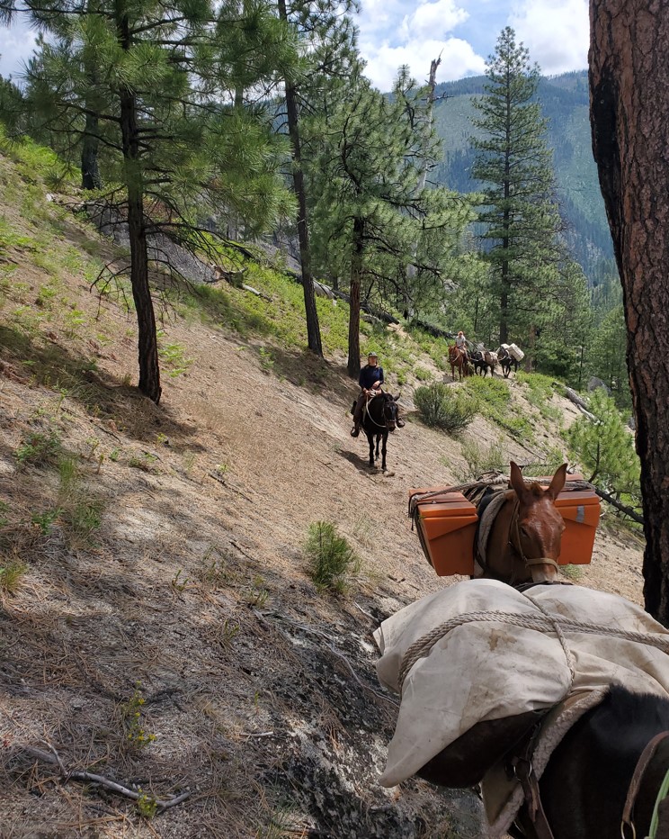
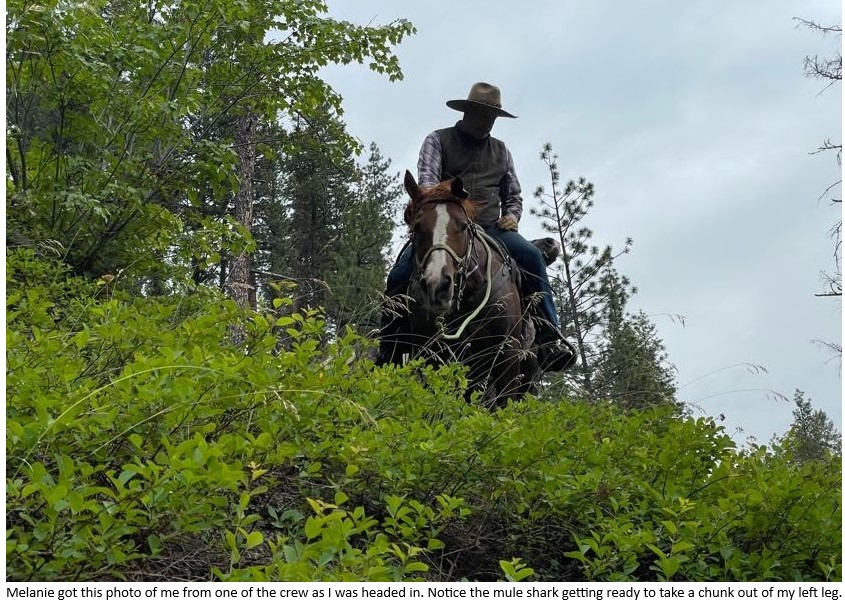
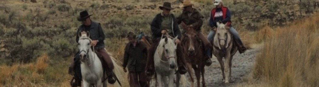
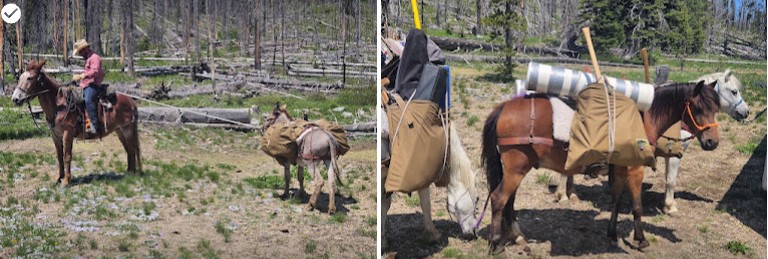
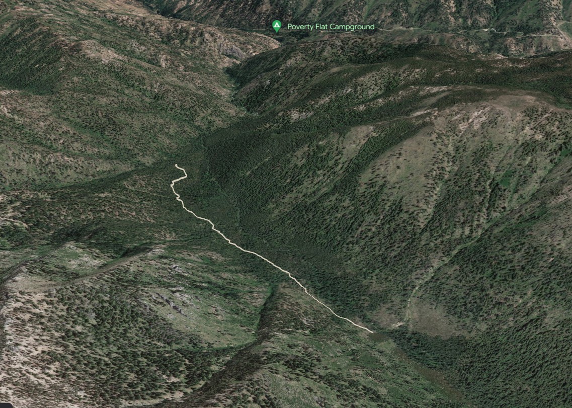
So yesterday was the ITA pack out from Blackmare lake in the south fork of the salmon. The trip went well, weather forecast was sunny and 70 degrees. The high I saw was was 59 and rain most of the trip. The trail was in great shape though the elevation gain and loss was about 2000 feet and most of the 4.5 miles in you are hanging on granite outcroppings that are sticking out of 70 degree side slopes of sand. The crew of six people made for big loads on 3 mules. Everything went well and got to spend the day in a beautiful canyon on horseback. Jeff Halligan BCHI
Executive Director

In this illuminating book, brain scientist and horsewoman Janet Jones describes human and equine brains working together. Using plain language, she explores the differences and similarities between equine and human ways of negotiating the world. Mental abilities—like seeing, learning, fearing, trusting, and focusing—are discussed from both human and horse perspectives. Throughout, true stories of horses and handlers attempting to understand each other—sometimes successfully, sometimes not—help to illustrate the principles.
Horsemanship of every kind depends on mutual interaction between equine and human brains. When we understand the function of both, we can learn to communicate with horses on their terms instead of ours. By meeting horses halfway, we achieve many goals.
We improve performance.
We save valuable training time.
We develop much deeper bonds with our horses.
We handle them with insight and kindness instead of force or command.
We comprehend their misbehavior in ways that allow solutions.
We reduce the human mistakes we often make while working with them.
Instead of working against the horse’s brain, expecting him to function in unnatural and counterproductive ways, this book provides the information needed to ride with the horse’s brain. Each principle is applied to real everyday issues in the arena or on the trail, often illustrated with true stories from the author’s horse training experience. Horse Brain, Human Brain offers revolutionary ideas that should be considered by anyone who works with horses.
![]() Background:
Background:
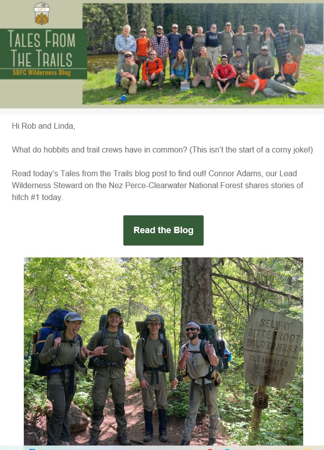
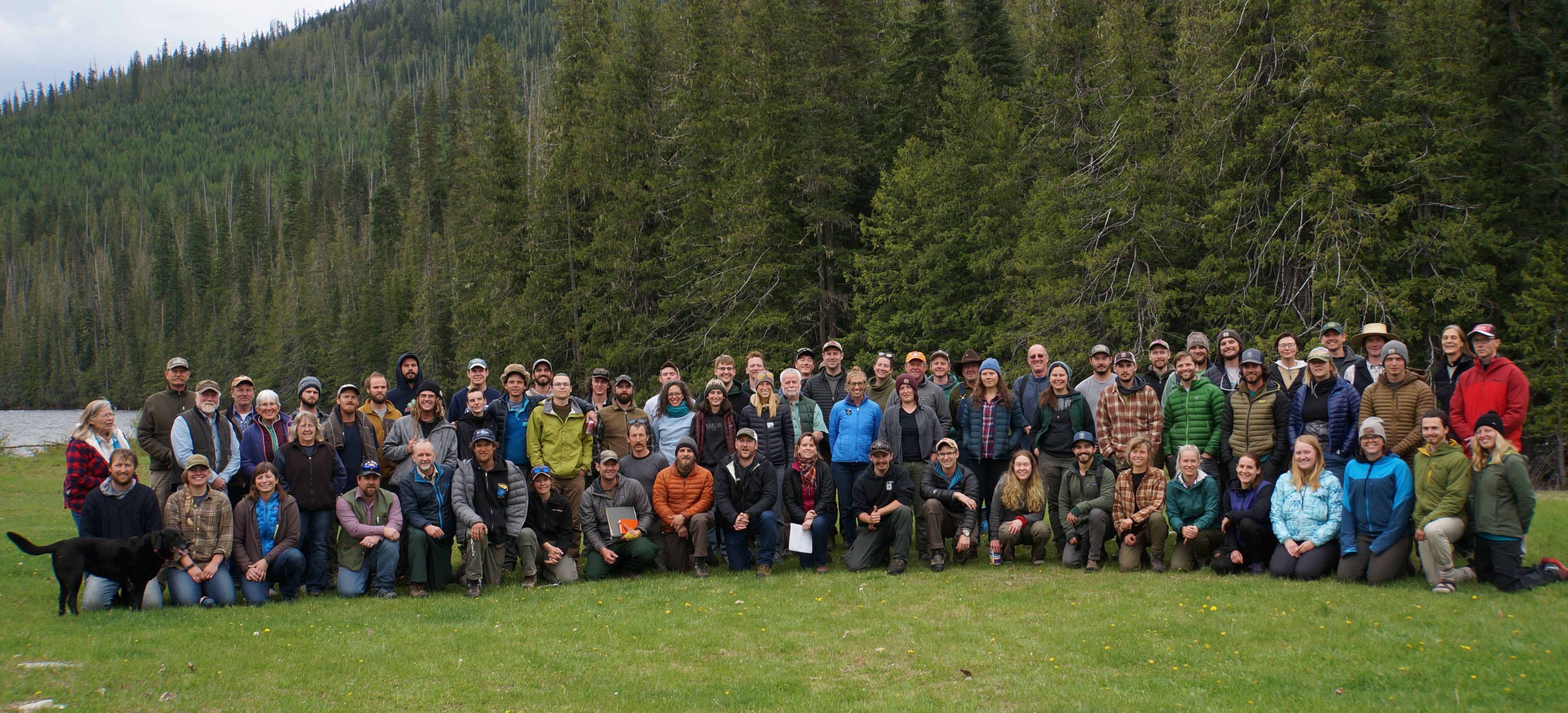
In 2018 Forest Service staff and partners developed a week long training program with the vision of “providing the highest quality Wilderness training program in the Northern Rockies that will educate, support, and cultivate a community of present and future wilderness and wildland stewards through the cooperation of the Forest Service, partners, and volunteers.”
The Northern Rockies Wilderness Skills Institute (NRWSI) is a training partnership between multiple partners that include the Selway-Bitterroot Frank Church Foundation, Society for Wilderness Stewardship, United States Forest Service, and the Ninemile Wildlands Training Center. The Institute currently features one week of training hosted each year. NRWSI has been put on hold for the last three years but now we are ready to bring practitioners back together again in person in 2023.
The 2023 Northern Rockies Wilderness Skills Institute will be held from May 22 – 26, 2023 in Powell, ID. It will start at 1pm PT on Monday and conclude at 3pm PT on Friday. All participants are expected to sign up for the entire week. The planning team is currently pulling together the training sessions and the application process will open up in March with a deadline to register no later than April 7th.
COST: There is no cost to attend.
FOOD: On your own – no food provided. Participants will handle their own meals. Cooking facilities may be provided – more information will be provided ahead of the event.
CLICK HERE FOR SESSION DESCRIPTIONS
APPLICATION WINDOW CLOSED (If interested contact them about a place in the 2024 workshop)
Please contact Jimmy Gaudry (jimmy.gaudry@usda.gov) or Carol Hennessey (carol.hennessey@usda.gov) for more information.
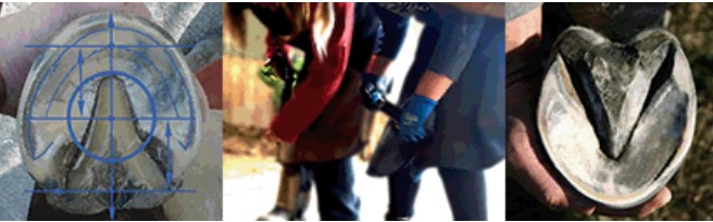
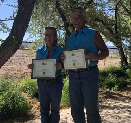
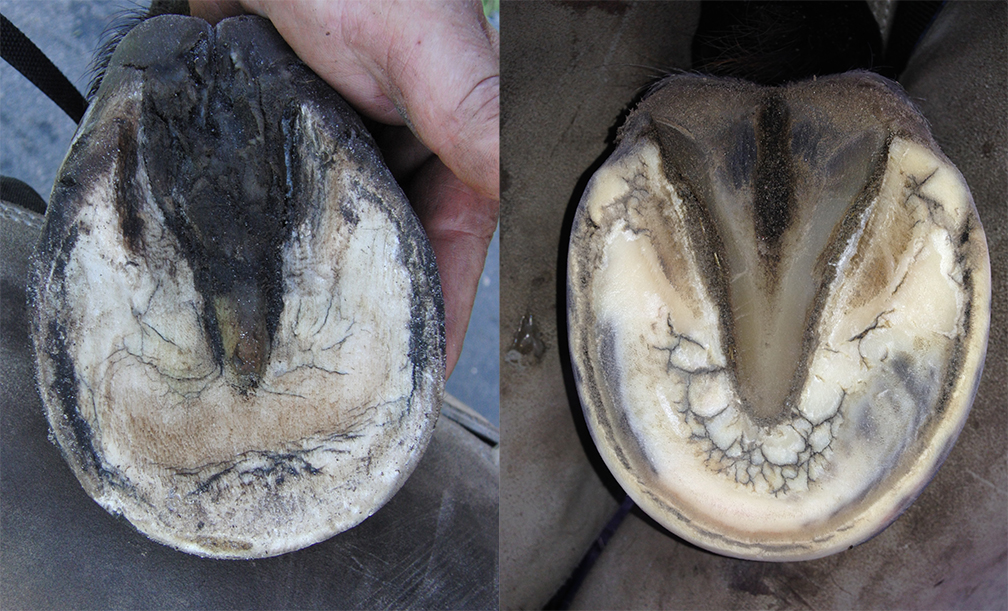
Congratulations to Lisa Griffith and Shelly Duff

Thank you for your participation and a special thanks to our presenters!
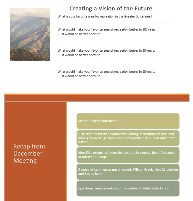
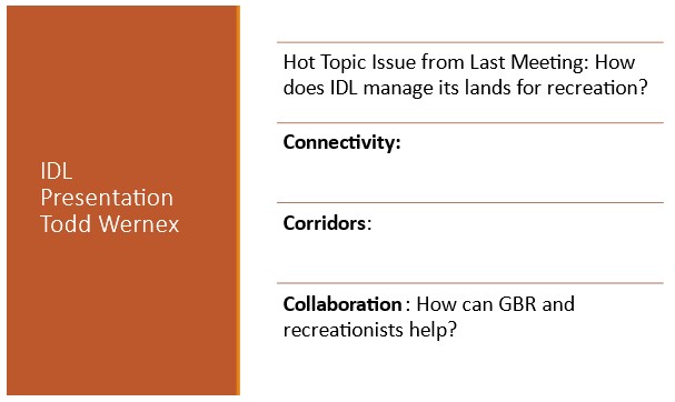
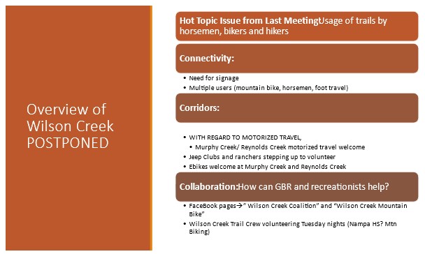
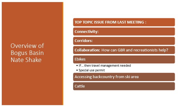
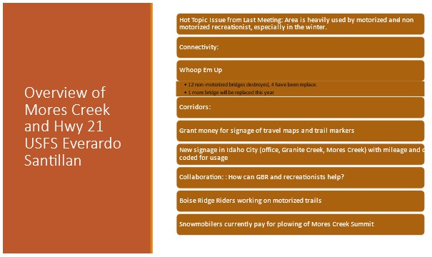
If you weren’t able to join us please find the highlights attached. If you would like to participate in our “Vision of Recreation for the Future,” complete and return the first slide in the attachment and return to me.
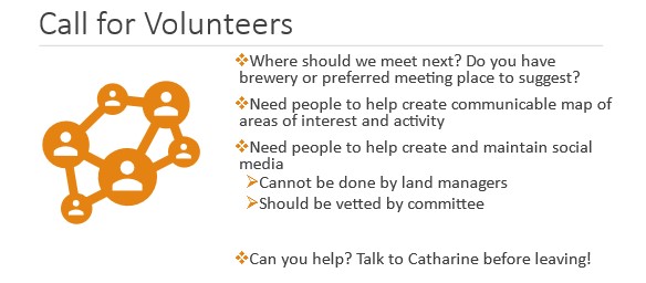
If you are interested in volunteering space or refreshments for future meetings, web communications, or other ideas, please reach out to me via email.
We are coordinating our next meeting for August at the Bogus Basin Downtown Office. More details to come.
Best,
Catharine
Catharine Beverly-Bishop
Recreation Management Specialist
Forest Service
Boise National Forest
catharine.beverly-bishop@usda.gov
1857 HWY 16
Emmett, ID 83617