31. January 2018 · Comments Off on Utah’s approach to public lands won’t work · Categories: Public Lands

New Mexico exemplifies the risk of managing lands at the whim of local interests.

by Tom Ribe  Link to online Posting

Tom Ribe is a contributor to Writers on the Range, the opinion service of High Country News. He writes from his office in the wildland-urban interface in Santa Fe, New Mexico.

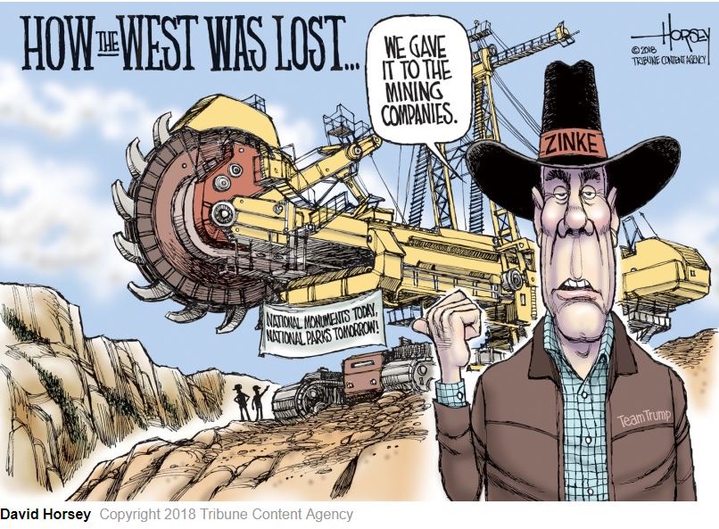
Two days after President Donald Trump signed an executive order reducing Grand Staircase-Escalante National Monument by half, Utah Republican Rep. Chris Stewart introduced a bill in the House that would put local politicians in charge of the public lands cut away from the monument.

One tenet of conservative public-land policy orthodoxy is that local control of public lands will improve the wellbeing of local residents. Yet the movement to auction off federal lands or transfer them to state or county control has repeatedly run aground because public lands are overwhelming popular among Americans. Other conservative efforts have been sought to neutralize federal agencies.

Stewart’s Grand Staircase-Escalante Enhancement Act is one of these new approaches. If passed by the House, it would create a ‘management council’ made up of seven local county commissioners and state legislators appointed by the president of the United States. One member would come from the Department of the Interior. The management council would set policy for two small Bureau of Land Management national monuments and one new national park and preserve under the jurisdiction of the National Park Service. The three areas lie within what once was the Grand Staircase-Escalante National Monument created by President Bill Clinton and managed by the BLM.

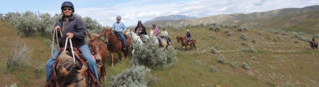
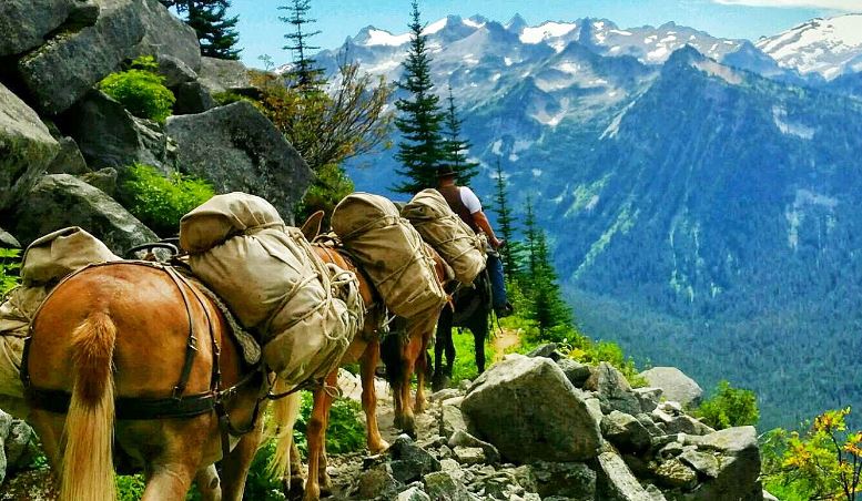
Stewart’s legislation states that federal land managers “shall adhere” to management plans created by the management council. If recent experience with a similar scheme at the Valles Caldera National Preserve in northern New Mexico is any guide, this approach is doomed to failure. Valles Caldera: About 1.25 million years ago, a spectacular volcanic eruption created the 13-mile wide circular depression now known as the Valles Caldera.  The preserve is known for its huge mountain meadows, abundant wildlife, and meandering streams. The area also preserves the homeland of ancestral native peoples and embraces a rich ranching history.

In 2000, after a 100,000-acre private parcel surrounded by Forest Service and National Park Service land came up for sale near Santa Fe, public pressure encouraged the New Mexico congressional delegation to buy it for the public. But Sen. Pete Domenici, R-N.M., insisted that a presidentially appointed, mostly private-sector board of trustees set policy for the new preserve as an “experiment” in management. Federal employees would carry out the board’s policy.

Problems dogged the experiment from the start. Having the president appoint board members politicized the board. When Republicans controlled the House of Representatives, ranching-oriented board members were selected; when Democrats controlled the House, conservationists and academics ran the board. The federal staff had to answer to nine ever-changing bosses whose edicts sometimes conflicted with the federal laws that apply to public lands.

Stewart’s bill would ensure that only Republicans would be appointed to the management board — unless some seismic shift were to happen in Utah politics. Lands owned by all Americans would be governed by local people with local interests, and if the management council mandated policies that violated federal laws, the federal staff would have a choice of either violating the law or disobeying their local bosses. One can imagine the lawsuits likely to follow.

Stewart would clearly prefer to transfer these lands to county ownership. But that would run counter to strong public support for federal land management, and it would upset the tourism-oriented businesses that have thrived ever since Grand Staircase-Escalante National Monument began drawing tourists and boosting property values.

Stewart is hoping to mollify these business interests by creating a new little national park. Yet this so-called park mandates livestock grazing and hunting and trapping, and it would be controlled by state game officials and members of the management council. The mandates could force the National Park Service to violate its own Organic Act, opening up both the management council and the federal government to lawsuits.

Stewart’s bill, which has three co-sponsors from Utah, mandates livestock grazing “in perpetuity” on all the lands in question, but makes no mention of administrative costs or the collateral damage of livestock grazing in a rocky desert where little forage grows. Grazing can be mandated, but what happens when there’s a drought?

The public in New Mexico, after 15 years, was frustrated with the “seat of the pants” decision-making by the board of trustees at the Valles Caldera National Preserve. In 2015, Congress transferred the preserve to the National Park Service, which imposed its standard management structure.

Stewart’s bill, combined with Trump’s evisceration of the Grand Staircase-Escalante National Monument, may advance conservative public-lands ideology. But neither action advances the interests of the public, and both create far more problems than they pretend to solve.

31. January 2018 · Comments Off on 2018 Tow Ratings · Categories: Around The Campfire


TrailerLifeTowGuide2018.pdf


29. January 2018 · Comments Off on What are Public Lands · Categories: Public Lands

There has been a lot of attention recently about Public Lands and where America is headed with the management of those lands. Further, anyone who recreates on Americas public lands is often exposed to unfamiliar terms and may not understand the differences. Following is a brief description to give you a working understanding of the differences and what that means to you.

First, what are “Public Lands”? These are the lands that are owned “equally” by all Americans. There are 618 million acres of public land across the U.S., with a significant portion in Alaska and the western U.S. The total U.S. land base is 2.27 billion acres in size. These federal public lands are managed in trust for us, (citizens of the U.S.) by the Forest Service, Bureau of Land Management, Park Service and the Wildlife Refuge System for current and future generations.

“Front country” is not a commonly used term, but is generally any public lands that are relatively accessible by means such as motor vehicles, boats, bicycles, hiking, horseback and aircraft and are usually within a short distance of roads. Generally, these lands provide a multitude of recreational activities. Camping may be in developed or dispersed/undeveloped areas. Logging, grazing and mining are often permitted on these lands as well. These are often highly used areas where it is common to see other people and activities.

“Backcountry” is generally the area beyond what is Front country. Pretty vague, but accurate. There is no specific line or map designation where this starts or ends. Access is more challenging and is usually by a trail or cross-country travel and at a further distance from roads and trailheads. Access may be allowed by the same list as above, but with greater responsibility on the user as trails receive less maintenance. In addition, the safety and welfare of each recreationist to care for themselves is increased. Camping is usually in dispersed sites. You would expect to see fewer people and activities than in the Front country.

“Roadless Areas” had their beginnings when Primitive Areas were established in the 1920’s. The idea was to preserve some lands in a roadless condition at a time when automobiles and road building was rapidly expanding. As time progressed, Roadless Areas have been challenged legally and politically as to which lands should remain or be opened. Currently, there is about 58 million acres of unroaded forests. There is about 380,000 miles of roads on Forest Service lands. In comparison, the Interstate Highway system has about 47,000 miles of road.

Unlike Front country and Backcountry, “Wilderness” is defined and receives that highest level of land protection. While some may get a “wilderness experience” in the Front country or Backcountry or a Park, true Wilderness is a specific geographic area and can only be established or “Designated” by an act of Congress. The Wilderness Act of 1964 put into law what is required to be a “Designated Wilderness”. It states how it will be managed and what modes of access or travel are acceptable. The Act requires that it be managed to protect its natural condition, where it is untrammeled by man. It is to maintain its primeval character, shaped by the forces of nature with man’s work substantially unnoticeable. The purposes will be to provide solitude, and escape from mechanized use and maintain historic uses.

Three more terms that you may hear. “Recommended Wilderness” is generally lands identified on Forest Plans or agency plans that recommend specific areas for Wilderness Designation by Congress. “Proposed Wilderness” is generally lands that have been submitted to Congress for Wilderness consideration, a step closer than recommended. However, these two terms can mean the same thing depending on the agency. Finally, “Wilderness Study Areas” or WSA’s are areas that are inventoried and undergoing the Wilderness review process. They are lands that should be managed to preserve the character or special attributes that made them a WSA.

Parks generally have defined geographic areas which are indicated on maps. The recreational uses within a Park are often highly regulated due to a significant amount of visitor use. There are 58 National Parks, and most are associated with a specific national treasure. Interestingly, some iconic National Parks like Yellowstone, Grand Teton and Glacier and others are NOT designated Wilderness. They are “recommended wilderness” but to date, Congress has not given them the additional level of protection.

Parks can be managed by a city, state, private or federal entity. The simplest definition comes from Wikipedia: A “Park” is an area of natural, semi-natural or planted space set aside for human enjoyment and recreation or for the protection of wildlife or natural habitats. It may consist of grassy areas, rocks, soil and trees, but may also contain buildings and other artifacts such as monuments, fountains or playground structures.

The vast majority of our public lands are managed under the multi-use designation that includes both the Front country and Backcountry. This allows for a multitude of activities to be offered on the majority of our Public Lands. Only about 3% of the lower 48 states land base is designated Wilderness.

Submitted by: Mack Long
Mission Valley BCH, BCH Montana, Education Chairman BCH of America

23. January 2018 · Comments Off on IWF – Currently, Your Right To Access Public Areas is Not Protected · Categories: Public Lands


You read that right! There currently exists no Idaho law protecting your right to access public areas that you pay for. That means anyone can barricade a public tract and prevent your horse, ATV, or motorcycle from passage without fear of repercussion.  And even more common, Idaho sportsmen are running into “NO TRESPASSING” signs on public lands and waters that they have every right to access.  Don’t believe it?  Check out this news story and the video of an encounter with an armed security guard patrolling a Forest Service road.

Right now, for instance, public funds can be used to purchase and maintain permanent, motorized public access on a road.  Anyone can physically obstruct that road and block your access without fear of repercussion. Imagine your disappointment when you draw a coveted elk tag only to show up on opening day to find a locked gate across a public road.  Sure you can call the local sheriff.  But with extremely limited funding, and perpetrators with deep pocketbooks, local law enforcement simply can’t prioritize prosecuting these types of cases.

The scenarios are endless, but one thing is for sure, your right to access public property is not secure.  IWF has been working with legislators, motorized recreation groups, and sportsman groups to close this loophole and create a succinct amendment to an existing law that will put the power of protecting public access in the people’s hands. To review the most updated version of the proposed legislation click here.

Have you ever seen signs or physical barriers to impeding access your public lands? Submit your story below and we will deliver your comments to our legislators.  Link to IWF website

Rep. Labrador Co-Sponsors Bill To Cease Creation of New Salmon Recovery Plans
Federal Bill Will Block Idaho Salmon and Steelhead Recovery
With D.C. Vote, Idaho’s Rep. Labrador Reveals Intentions With Public Lands
16. January 2018 · Comments Off on Trail Bridge Catalog – USFS/BLM · Categories: Public Lands, Work Parties and Projects

Standard Trail Bridge Drawings and Design Aids

The Forest Service has standard drawings and design aids for the construction of trail bridges. The standard drawings/design aids have been designed and developed in accordance with Forest Service Manual and Forest Service Handbook directions. The following information is provided FOR REFERENCE ONLY.

All bridge drawings should be approved for each specific bridge by a qualified engineer with trail bridge design experience. Drawings are intended to provide ideas for layout and detailing. No drawing or detail should be used for construction without design review by a qualified engineer. Forest Service bridges must be approved and/or designed by the Forest Service engineer or manager responsible for engineering.

The drawings are not meant to be used as individual sheets and should not be used by themselves. A complete drawing package should be downloaded so that the designer has all the required information for reference. All drawings are in PDF format and can be viewed with Adobe Acrobat Reader.

Currently, only four regions within the Forest Service have standard drawings/design aids. These are Northern Rockies Region (R1), R6 Pacific Northwest Region (R6), Eastern Region (R9), and Alaska Region (R10).

There are two different ways to download the standard drawings/design aids.

The first way is to download a complete set of drawings in a single PDF. This method should only be used with a high-speed Internet connection.

The second way is to download each individual drawing in PDF. This method is recommended for dial-up connections.

Additional Trail Bridge Resources

The following resources give additional information on planning, siting, designing, constructing, inspecting and maintaining trail bridges. All of these items should be included in the decision process to select the best structure for aesthetic design, sustainability and longevity.

15. January 2018 · Comments Off on 2018 is on target to be a fun and educational year for interested Back Country Horseman of Idaho (BCHI) members · Categories: Around The Campfire, Education

By Education Chair Marybeth Conger


If you are still thinking about attending the Back Country Horseman of Idaho 2018 Directors meeting and Annual convention, please consider that chapter member education has been added to this amazing event. On Saturday March 10, the first ever, BCHI chapter training will be held in the afternoon. Presented by various volunteers, these educational workshops and presentations are open for all members to attend. What a great way to learn more about your current chapter position, or find out details about something you may be interested in the future. Some workshops even cover topics to help us better understand things and help BCHI grow in both numbers and membership development. With your attendance and feedback, we can make this training an annual BCHI event and improve, meeting your educational needs. Get your registration form completed and experience some fun learnings and comradery in additional to all of the other fantastic activities scheduled at the 2018 convention. Hope to see you all there!

April 13 – 15 marks the date for the 2018 Idaho Horse Expo held at the Ford Idaho Park. SBBCH members Bill and Marybeth Conger are some of the clinicians at this year’s event. Their pretentions will cover lightweight recreational packing and camping techniques. In addition, local BCH chapters will again man a BCHI booth. These types of public outreach events help the BCHI organization to grow and educate the public on the wise and sustaining use of our backcountry resource. So come join us if you can!

Karen Kimball graciously volunteered to be a BCHI education co-chair to help coordinate education efforts up north. Making sure chapter education chairs are familiar with all of the relevant education materials maintained by BCHA and its member states is one way for her to accomplish this. Thank you Karen!

Please let the education team know what you plan to accomplish in 2018 so we can spotlight more chapter activities. Education updates on the BCHI website are starting to happen and expect to see more once Marybeth successfully completes the Master Educator course. Well this covers the first quarter and then some. Happy Trails!

13. January 2018 · Comments Off on Basic Trail Maintenance · Categories: Public Lands

Watch Video

13. January 2018 · Comments Off on Interactive: Tracking Trump’s anti-public lands crusade · Categories: Public Lands

Wilderness Society
Interactive: Tracking Trump’s anti-public lands crusade
After a chaotic first year, the Trump administration has made it abundantly clear that one goal is to systematically sell out America’s public lands to the fossil fuel industry.

This interactive timeline examines all the actions taken by President Trump and Interior Secretary Ryan Zinke to give away our nation’s heritage to energy companies for unfettered drilling, fracking and mining.

How to use the timeline:
Use the bar at the bottom of this page to scroll through our timeline then click on each box for more info.

08. January 2018 · Comments Off on CPR – 2017 Guidelines · Categories: Education

2017 Guideline for CPR – American Heart Association

06. January 2018 · Comments Off on Zinke’s World View · Categories: Current Events, Public Lands

We’re not long into our hike along the snowy shoreline of Glacier National Park’s Lake McDonald when I pop the question I’ve been wanting to ask Ryan Zinke since he was confirmed as Secretary of the Interior back in March. The way I intended to frame the question had both reach and context, even if it was a little wordy:

“You consistently identify yourself as somebody who models himself on Theodore Roosevelt,” was how I had written the query in my notebook. “You’ve repeatedly called yourself a ‘Teddy Roosevelt guy.’ Roosevelt’s legacy is based on his use of the structure and authority of the federal government to protect landscapes for future generations and to promote multiple use of our public lands. So far in your administration, you’ve made headlines for rolling back protections of federal land under your jurisdiction, most recently national monuments in Utah. Can we expect to see initiatives modeled around Roosevelt’s conservation ethic in the future?”

But what came out of my mouth was: “So, when does TR show up?”  READ MORE

05. January 2018 · Comments Off on How the West was Lost · Categories: Public Lands

05. January 2018 · Comments Off on Selway Bitterroot Frank Church Foundation Fall Round-up · Categories: Current Events, Public Lands

SBFC News Fall 2017

05. January 2018 · Comments Off on Highway 52 Cleanup along Black Canyon · Categories: Around The Campfire


04. January 2018 · Comments Off on Idaho Wildlife Federation 2017 Year in Review · Categories: Current Events, Public Lands


IWF-2017-Holiday-Letter-Final