
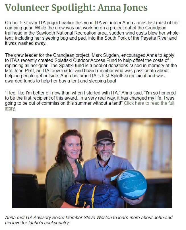
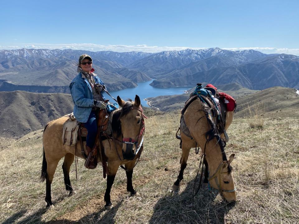
Squaw Butte did pack support for Anna’s project
SALMON-CHALLIS INFORMATION
Salmon-Challis National Forest:
Salmon-Challis National Forest – Home (usda.gov) Salmon-Challis National Forest – Recreation (usda.gov)
Salmon-Challis National Forest – About the Forest (usda.gov)
Salmon Community: https://www.cityofsalmon.com/
On The River | Visit Salmon Valley, Idaho
Salmon, Idaho Experience – Bing video
One Of The Most Unique Towns, Salmon Is Perfect For A Day Trip In Idaho (onlyinyourstate.com)
Challis Community: https://challischamber.com/
Mackay Community: http://mackayidaho-city.com/
Submit the attached form and a brief resume to Gina Knudson at the email below.
Interested applicants or those desiring further information may contact Gina Knudson, Partnership Coordinator at gina.knduson@usda.gov or 208-756-5551.

Stock use rules in BLM and USFS-managed wilderness.
One of the most common categories of rules in wilderness is rules associated with stock use. Stock rules can include feed requirements, party size limits, camping setbacks from water and/or trails, grazing restrictions, as well as stock restrictions to certain trails or outright prohibition of stock. This research describes the frequency of stock rules in wilderness areas managed by the BLM and USFS. Additionally, the differences associated with the rules that are included in Wilderness Character reports as well as how they are weighted are also explored.
C. “Griff” Griff is a Professor in the Biology Department at Grand Valley State University. Her research focuses on unconfined recreation in the National Wilderness Preservation System.
Randy Rasmussen, Public Lands Policy Expert for the Back Country Horsemen of America will also participate in this discussion with a horseman’s perspective.
National Wilderness Stewardship Alliance
One of the most common categories of rules in wilderness is rules associated with stock use. Stock rules can include feed requirements, party size limits, camping setbacks from water and/or trails, grazing restrictions, as well as stock restrictions to certain trails or outright prohibition of stock. This research describes the frequency of stock rules in wilderness areas managed by the BLM and USFS. Additionally, the differences associated with the rules that are included in Wilderness Character reports as well as how they are weighted are also explored.
C. “Griff” Griff is a Professor in the Biology Department at Grand Valley State University. Her research focuses on unconfined recreation in the National Wilderness Preservation System.
Randy Rasmussen, Public Lands Policy Expert for the Back Country Horsemen of America will also participate in this discussion with a horseman’s perspective.
Contact Lisa Ronald lisa@wilderness.net if you have a question.
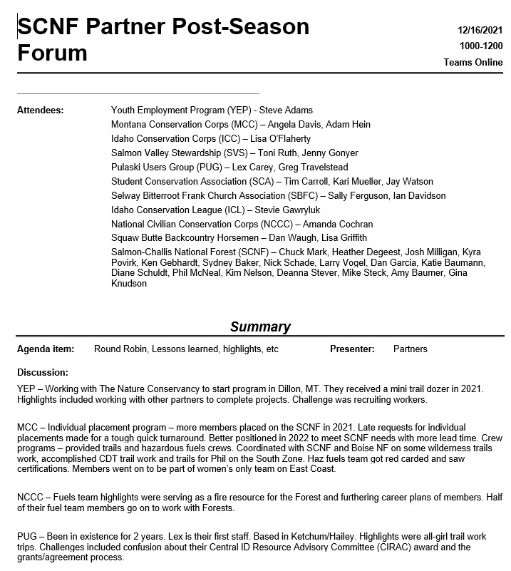

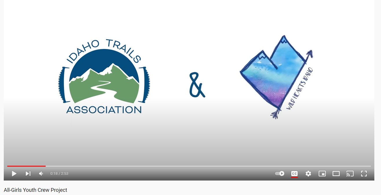
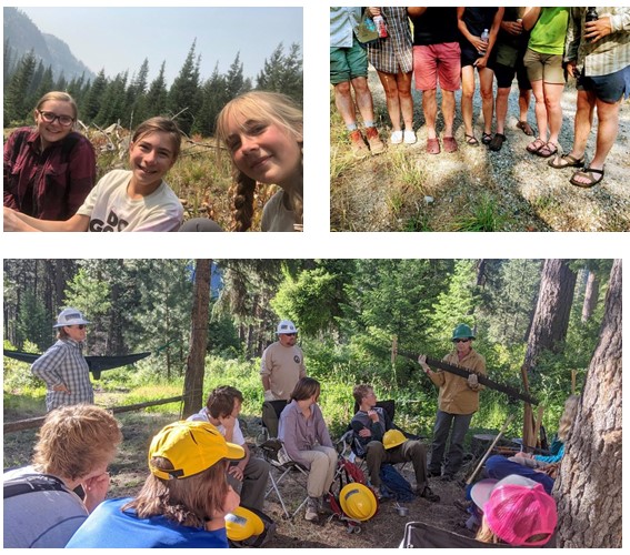
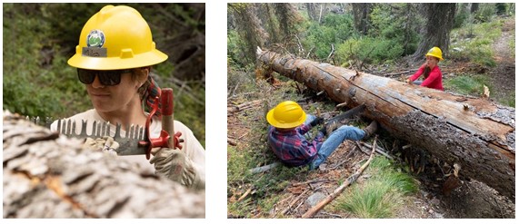
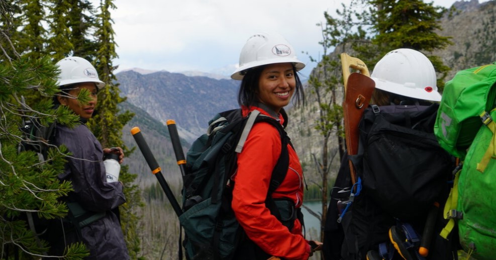
ITA partnered with Wild Hearts Idaho this year for an all-girls youth trail maintenance trip in the Gospel Hump Wilderness! From a thrilling (and wet!) jet boat ride up the Salmon River to living out of their backpacks for a week, these girls had quite the adventure in Idaho’s backcountry.
Thank you to the Nez Perce-Clearwater National Forest, the Sawtooth National Forest, and Mackay Bar Outfitters for your support on this project.


HISTORY
The Montana Conservation Corps grew out of great ideas, great people, and a great legacy. Stories of men joining and serving in the Civilian Conservation Corps during the Great Depression can be heard at coffee counters across Montana. Tales of their accomplishments to improve the landscape – including the development of Montana’s first state park at the Lewis and Clark Caverns – and the spirit of the young people who joined are numerous and verging on mythical, in the best tradition of Montana.
In 1990, Human Resource Development Council agencies from Billings, Bozeman, and Kalispell established the Montana Conservation Corps. Our first Executive Director, Steve Nelsen, tells of starting MCC with nothing but a desk, a phone, and a box of Kleenex.
The first MCC crews were fielded in the summer of 1991 through the cooperation of the HRDC and sponsoring agencies such as the City of Billings, Montana Fish, Wildlife and Parks, and the U.S. Forest Service. In 1993, MCC successfully obtained AmeriCorps funding, which doubled the budget and established regional offices.
Now MCC has a multimillion-dollar budget and has matured into a leader in the national corps movement. We are proud of our humble roots and thankful for all those that have contributed to the development of MCC over the years. To all of our alumni, staff, board volunteers, and community champions—thank you for being a part of the Montana Conservation Corps.
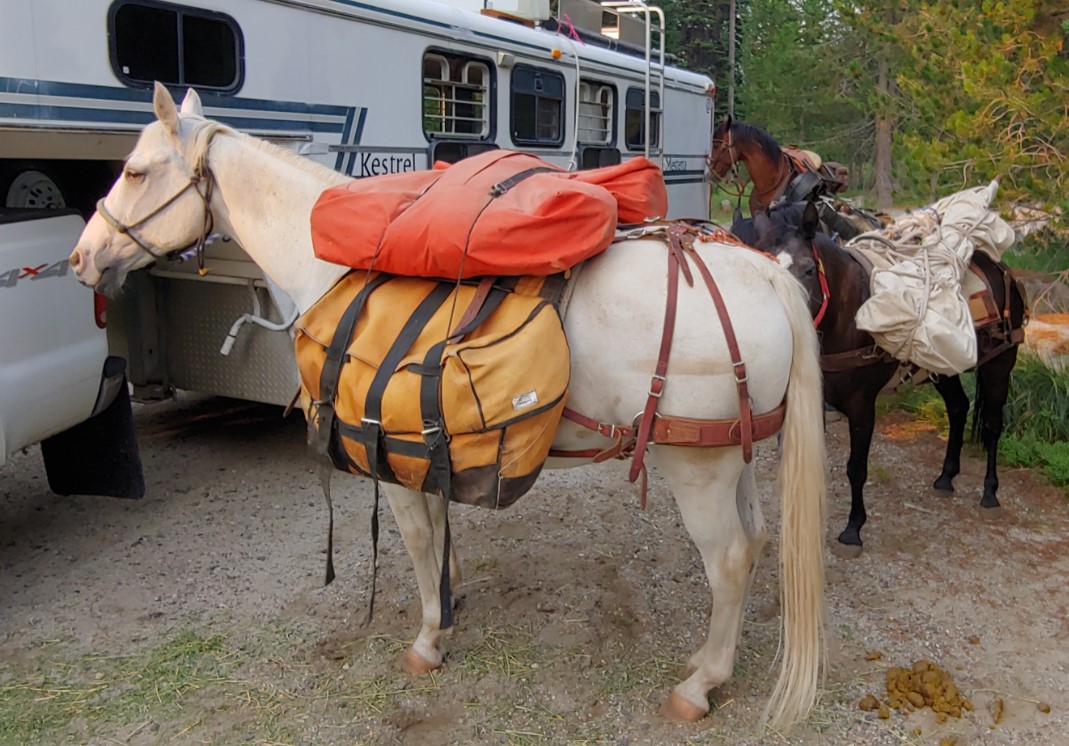
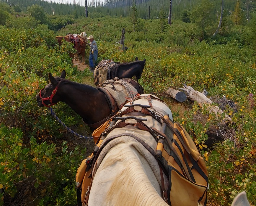
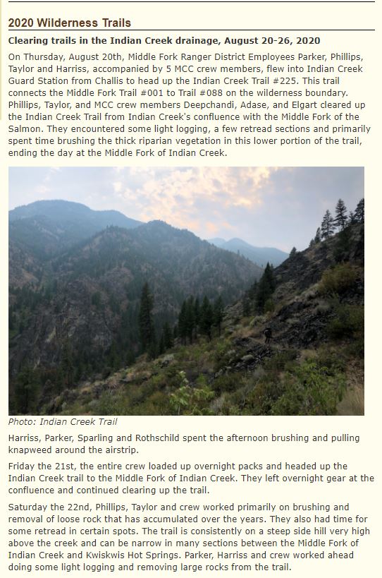
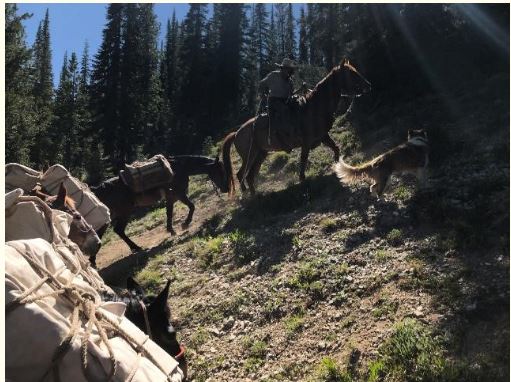
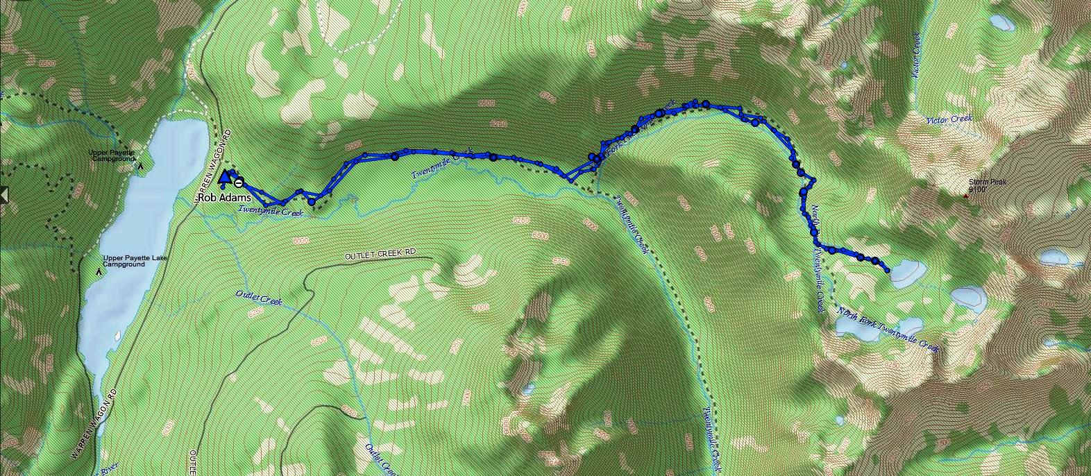
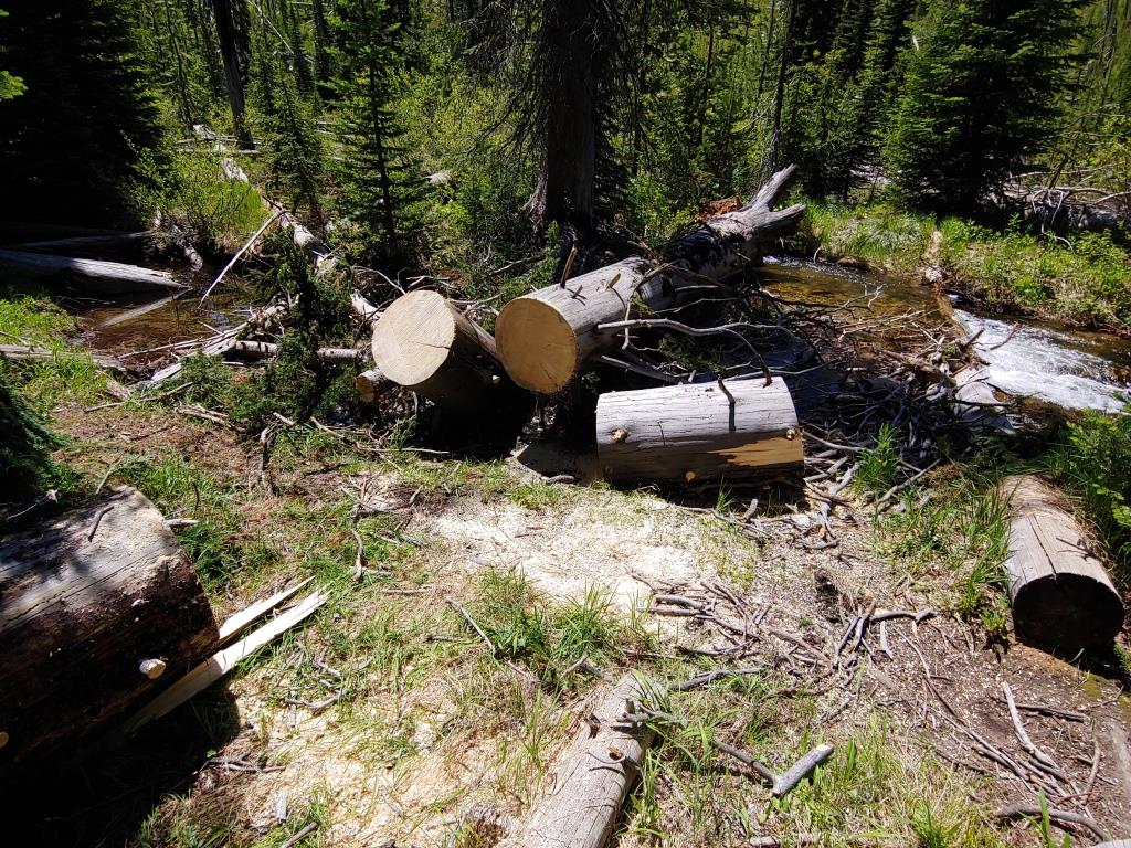
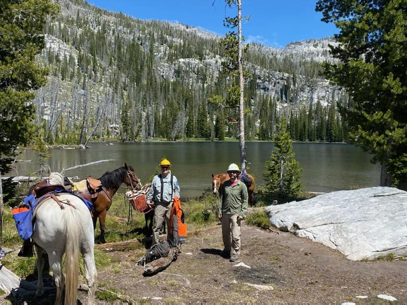
In Mid-July, Adam Larson PNF Trails Supervisor contacted Squaw Butte and ask if they would consider doing a drop camp for an MCC crew working on the Twenty Mile Creek trail near upper Payette Lake. The pack-in date would be August 3rd and pack-out on August 24. This crew of 6 would be working from this base camp for two weeks so need quite a bit of food and had over 90 pounds of hand tools and a chainsaw and support gear. Rob Adams and Phil Ryan met MCC crew Leads Eve Hickey and Dylan Barker and the rest of the team at the Twenty Mile trail head on Tuesday morning at 07:30. The five pack stock were saddled and once the gear was unloaded from their truck, a quick briefing on load building was followed by the MCC crew helping build and hang loads. The biggest challenge was the large pile of hand tools including sledgehammers, picks, Pulaski’s and a rock bar they would need. The tools were distributed between two canvas mantie that once lashed up weighted in at 46 and 47 pounds and were basket hitched to one of Rob pack horses.
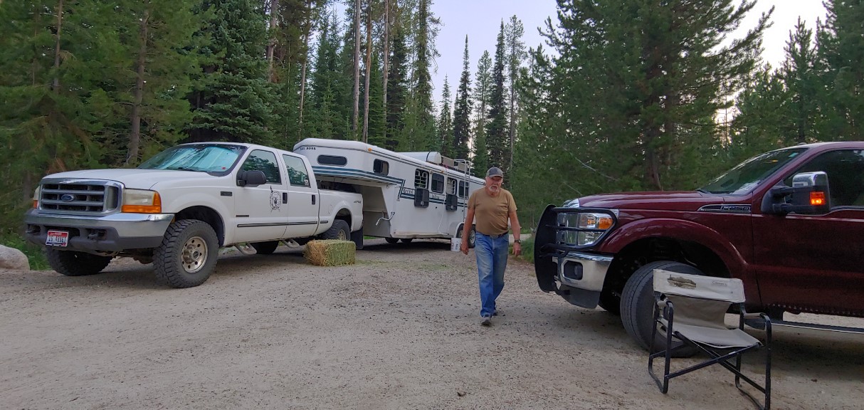
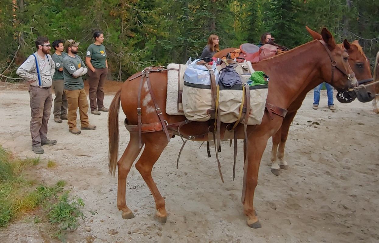 By 08:30 everything was loaded and Rob and Phil were heading down the trail for a bit over 6 miles to a meadow that was their planned camp site. We made good time averaging a bit over 3 mph and were at the camp site by 10:30 and had the stock unloaded and were heading back to the trail head by 11:00.

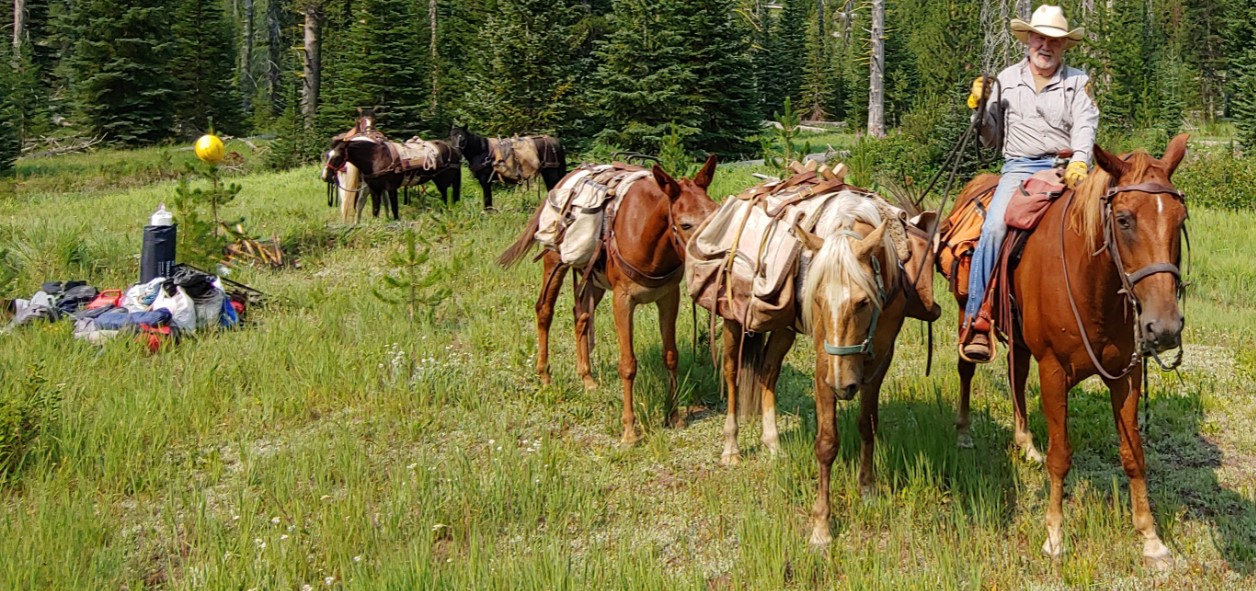
 The site we left the gear is going to be a great camp with dry, level ground for their tents, easy access to water and two nice pools for a dip after a hard day of trail work. While on the trail we met three dirt bike rider, two back packers that had been camping up at the Twenty Mile Lakes and two couples and a toddler in a back pack.
See planned work PDF: MCC 2021 Twenty Mile Projects
 Joe on the “new” trail, beside bypassed rock with others below left
 Bart and Joe on a “practice” tree
 Brian, Bart, Lew & Joe with a big tree, Dagger Creek Campground in background, river below
Hi,
Just wanted to forward some info re trail clearing. Joe Williams packed 5 FS volunteers upriver from Dagger Falls on June 9th, then on the 10th, Bill Bell & myself (Steve Sanderson) joined Joe, Lewis Herrington, Bart Baer (Joe’s neighbor) and Brian (? a pharmacist from Meridian I think) and we all rode up trail 2013 about 3 miles to clear a large boulder that had slid down and blocked the trail in the middle of a rock slide area.
On the way, we cleared several smaller trees and on rather large one that was blocking the trail.
The rock and several others as large, were too big to move or break up so we relocated the trail by building a ramp to the upper part of the rock and around it, then a ramp back down to the trail. Quite a chore but we got it done. Here are a few pictures from the trip. I thought you would like to know since I think Joe, Bart & Brian are SB chapter members.

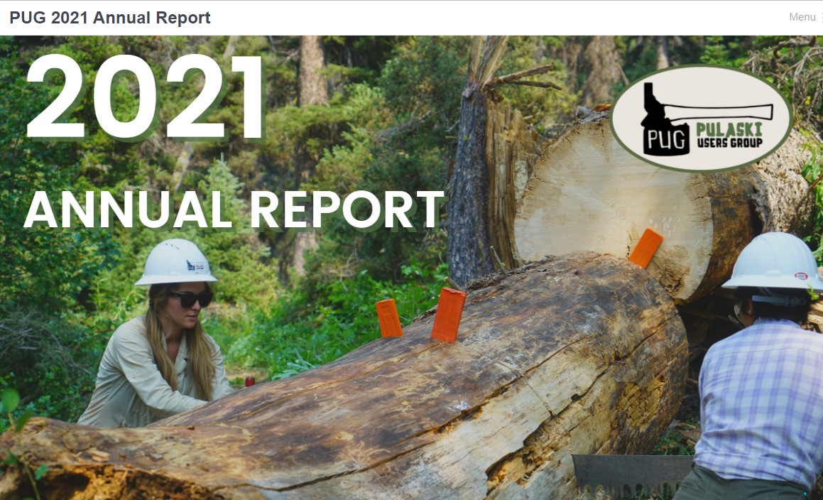
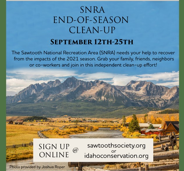
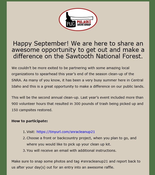
The Pulaski Users Group (PUG) organizes volunteer trips focused on trail maintenance, trail reclamation, and invasive species monitoring. Volunteers receive related training which equips them with the skills and knowledge to complete a variety of trail restoration projects. We aim to inspire community members to be stewards and advocates for our public lands.
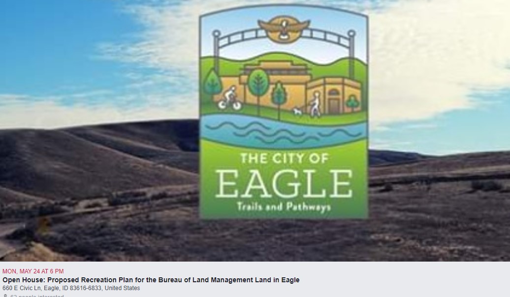

CALLING ALL EQUESTRIANS (especially those who ride in the Eagle Area)
Please attend the open house to review Eagle’s recreation plan for BLM land. Ultimately the plan is to connect this area of public land to trails accessible from Big Gulch and Little Gulch. Spread the word! This may be our last opportunity to save equestrian trails north of Eagle
Open House: Proposed Recreation Plan for the BLM Land in Eagle
Monday, May 24, 2021
Join us for an open house to review the City of Eagle’s Proposed Recreation Plan for the 2,200-acres of Bureau of Land Management land within the limits of the City of Eagle.
Date: May 24, 2021
Time: 6:00 PM - 8:00 PM
Location: Council Chambers
Address: 660 E Civic Ln, Eagle, ID 83616
Karen Steenhof karensteenhof@gmail.com
 Humans have a long history of digging wells, but we’re not the only species to tap the earth for water: New research reveals wild horses and donkeys, also known as burros, can as well.
As described in a paper published April 29 in the journal Science, the animals use their hooves to dig more than six feet deep to reach groundwater for themselves, in turn creating oases that serve as a boon to wildlife—American badgers, black bears, and an array of birds, including some declining species such as elf owls.
Horses and burros, introduced into the wild over the centuries, have taken up residence in scattered populations throughout much of the American West. The wells they dig transform into “hotbeds of animal activity,” says Erick Lundgren, a postdoctoral researcher at Aarhus University in Denmark and the study’s first author. READ MORE
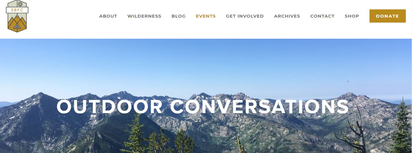
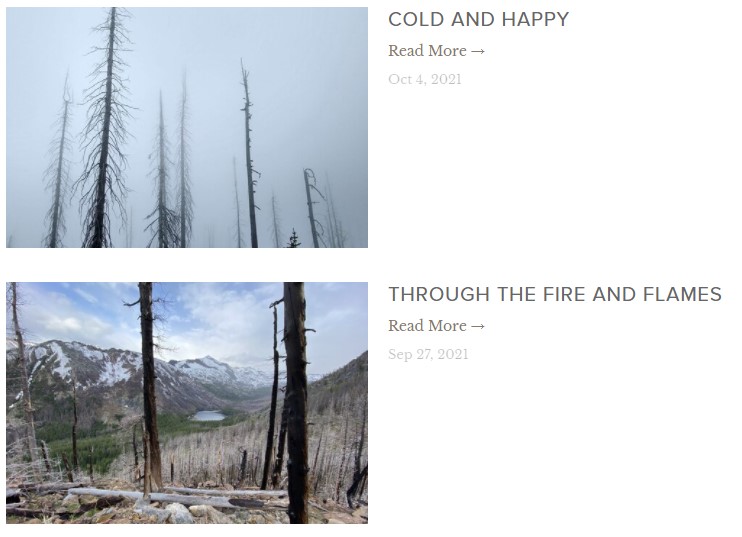
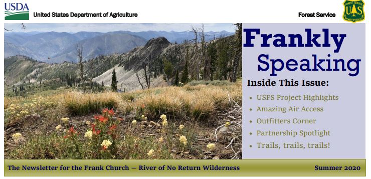
This year, SBFC is celebrating 16 years of stewarding the Selway-Bitterroot and Frank Church-River of No Return Wilderness areas. Each summer we get our boots on the ground and hands in the dirt to maintain, monitor, and protect these beloved public lands.
In 2020 the Frank celebrated its 40th anniversary as a designated Wilderness area. Spanning over 2.3 million acres, the Frank is a place that is close to our hearts (and our boots!) To celebrate this wild and scenic place, we are kicking off our 2021 Outdoor Conversations speaker series with a three-part virtual series all about the Frank. https://www.selwaybitterroot.org/outdoor-conversations-2021
APRIL 15TH 6:30PM – 7:30PM MST
CONGRESS, CONSERVATION, AND COMPROMISE: CHAMPIONS OF THE FRANK WITH SPECIAL GUESTS LARRY LAROCCO AND ROB MASON
APRIL 22ND 6:30PM – 7:30PM MST
PORTALS TO THE PAST FEATURING AUTHORS AND WILDLIFE BIOLOGISTS JIM & HOLLY AKENSON
APRIL 29TH 6:30PM – 7:30PM MST
THRU-HIKING THE ICT: 982 MILES OF SOLITUDE
The Compassionate Leaders Program with the Flourish Foundation cleared 30 miles of trail, and hundreds of logs in the Frank Church wilderness, Sawtooth National Forest, and White Clouds Wilderness in the Summer of 2020 in partnership with PUG.
To find out more about the program visit www.flourishfoundation.org
Pulaski Users Group, Inc
GREG TRAVELSTEAD PO BOX 4921 HAILEY, ID 83333-4921
As an organization that cares about Idaho’s wild places, we want to let you know about an opportunity to speak up for a special area of Idaho.
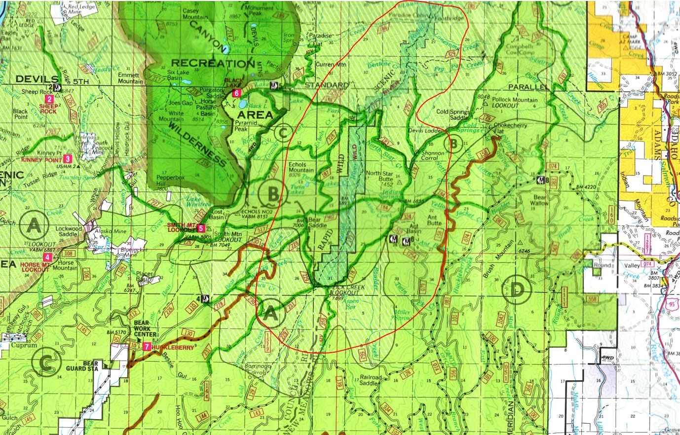
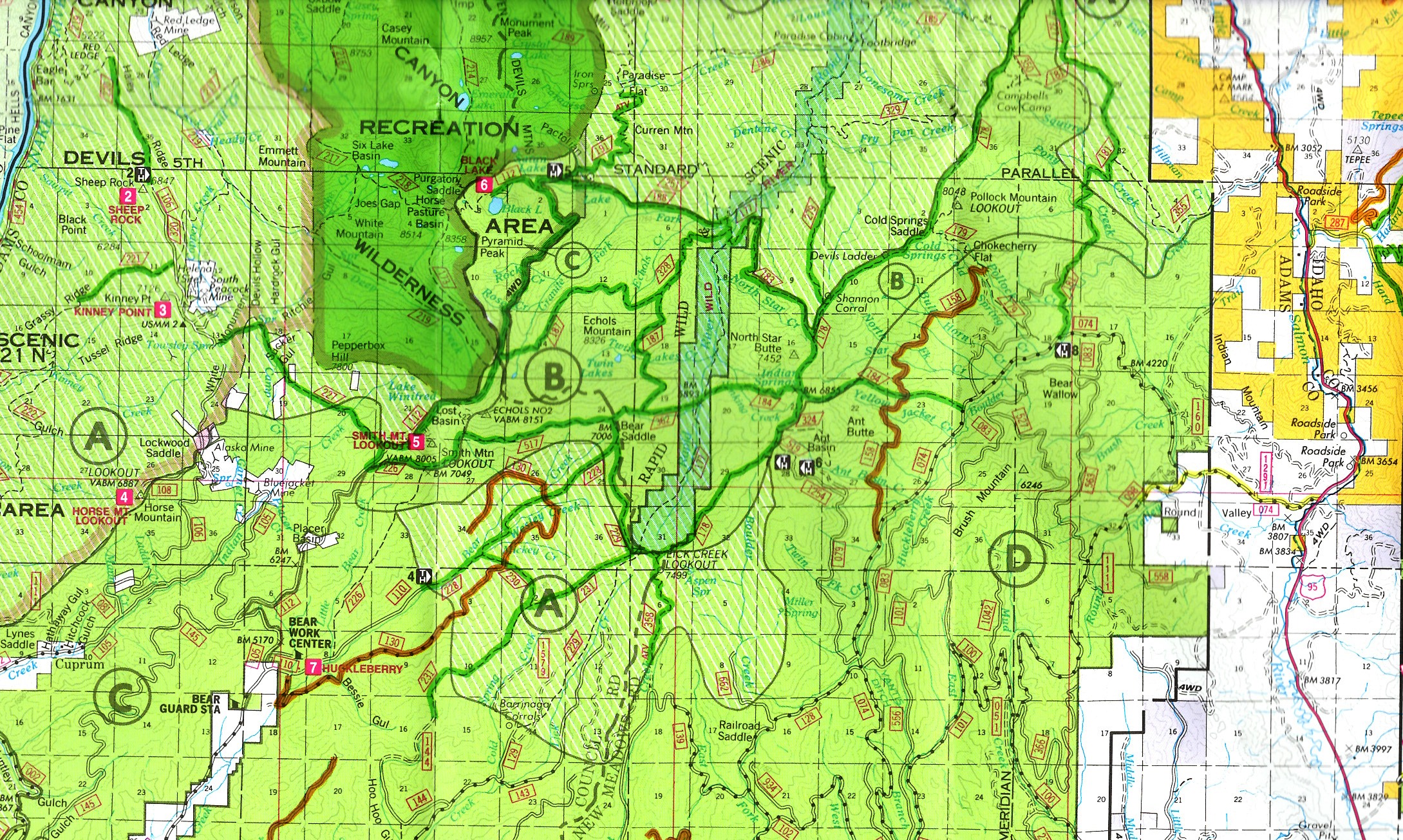
The Payette National Forest is seeking comment on a travel management plan for Rapid River, which includes the Rapid River Wild and Scenic River corridor that is popular with hikers because of its incredible views and unique plant life. A description of the area from the Forest Service’s website states “The absence of roads and other development has helped keep this river one of the clearest and cleanest in the area.” A gateway to the Seven Devils, ITA routinely has projects in this incredible place.
The proposal being considered by the Forest Service would allow motorized and mechanized use on certain trails to the boundary of the Wild and Scenic River corridor. At the boundary, signs would be installed in turnaround areas stating that non-motorized use only is allowed in the corridor itself.
As advocates of non-motorized trail use, we at ITA believe this proposal is not in the best interest of the hiking community and that the Payette National Forest should consider an additional alternative in this project that designates all trails in this area as non-motorized. The Forest Service is looking for public feedback regarding this new plan. You can read the full plan here. If you recreate in this beautiful area, please consider making your voice heard about this issue by leaving your comments for the Forest Service.
Thank you for supporting ITA as we advocate for Idaho’s trails. We believe that YOUR voice matters when it comes to the management of public lands!
What is the purpose of and need for this project? Payette National Forest
We propose this project to review the designated use1 of sections of National Forest System trails 177,
183, 184, 187, 188, and 362 within and immediately adjacent to the Rapid River Wild River corridor, and
to update the forest’s summer motor vehicle use map (“MVUM”; USDA Forest Service 2020)
accordingly. The 23 miles of trail under review of this project include (figure 1 on page 7):
• Rapid River Trail 177: From the junction with trail 229 in Township 21 North, Range 1 West,
Section 31, then northeast approximately 12 miles to the forest boundary in Township 22 North,
Range 1 West, Section 11.
• North Star Trail 183: From the junction with trail 178 in Township 21 North, Range 1 West,
Section 16, then northwest approximately three miles to the junction with trail 177 in Township
21 North, Range 1 West, Section 5.
• Indian Spring Trail 184: From the junction with trail 178 in Township 21 North, Range 1 West,
Section 21, then west approximately two miles to the junction with trail 177 in Township 21
North, Range 1 West, Section 20.
• Echols Ridge Trail 187: From the junction with trail 328 in Township 21 North, Range 1 West,
Section 7, then northeast approximately two miles to the junction with trail 177 in Township 21
North, Range 1 West, Section 5.
• Black Lake Creek Trail 188: From the junction with trail 191 in Township 21 North, Range 2
West, Section 2, then southeast approximately three miles to the junction with trail 177 in
Township 21 North, Range 1 West, Section 5.
• Cub Creek Trail 362: From the junction with trails 328 and 517, located within Township 21
North, Range 1 West, Section 19; then easterly approximately one mile to the junction with trail
177, located within Township 21 North, Range 1 West, Section 20.
 The Blue Mountains Trail is an immersive adventure through the diverse interconnected eco-regions that comprise the Greater Hells Canyon Region. The trail will take you deep into the mountains, forests, rivers, ecosystems, and communities of northeast Oregon. It shares the living history of why the Blue Mountains are ecologically unique and more parts of it deserve permanent protection. LINK PDF

The Blue Mountains Trail is an immersive adventure through the diverse interconnected eco-regions that comprise the Greater Hells Canyon Region. The trail will take you deep into the mountains, forests, rivers, ecosystems, and communities of northeast Oregon. It shares the living history of why the Blue Mountains are ecologically unique and more parts of it deserve permanent protection.
trail stats
566 miles through northeast Oregon from Wallowa Lake State Park near Joseph to John Day
7 Wilderness Areas and 1 National Recreation Area in 3 National Forests
Ancestral lands of the Nez Perce, Confederated Tribes of the Umatilla, and Confederated Tribes of Warm Springs
3 Oregon State Parks
Connects with the communities of Joseph, Troy, Tollgate, La Grande, Sumpter, Austin Junction and John Day, with connection opportunities to more nearby towns
Trail connects approaches to notable Blue Mountain summits: Eagle Cap (Wallowas): 9,573 ft – Rock Creek Butte (Elkhorns): 9,106 ft – Strawberry Mountain: 9,042 ft – Vinegar Hill (Greenhorns) 8,131 ft.
It’s official! In November, 2020, Greater Hells Canyon Council launched Oregon’s newest long-distance trail – forming a 566-mile spiral. Contemplated, mapped, and dreamed of for more than half a century by conservationists, the trail is now tangible.
The route links all seven of Northeast Oregon’s wilderness areas, requires no new trails to be built, limits road walks and bushwhacks, and connects hikers to the communities of Joseph, Troy, Tollgate, La Grande, Sumpter, Austin Junction, and John Day with ties to more nearby towns.
The pace of the past year’s work is as breathtaking as the speed of the first four thru-hikers covering rough terrain, bushwhacking alternative paths, and reporting on conditions. News of the trail’s brilliant peaks, rivers, forests, and wildlife is rippling among long distance hikers, tourism groups, communities, businesses, and conservationists.
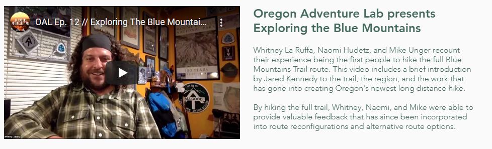 Watch Video
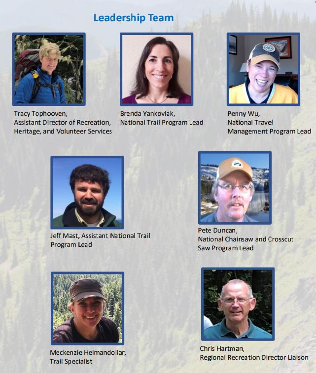
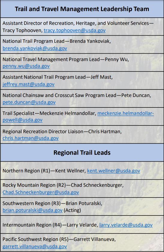
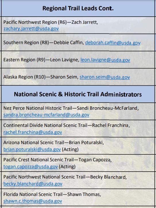
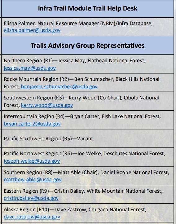
Forest Service Washington Office Trail and Travel Management Programs January 2021 We are a forward-thinking team of trail professionals who embrace innovation and collaboration. We take strategic actions to leverage resources and develop program efficiencies that increase capacity at the field level in order to best serve the public. We are collaborative and open communicators who strive to promote relevancy, efficiency, transparency, and equity throughout the national trail program.
Forest Service Trail Program Partner Meeting
Brenda Yankoviak, the new Forest Service Trails program manager held a Partner meeting recently to introduce the current Trails Team and share trails information..
National Wilderness Skills Training Survey
The Forest Service is looking at ways to host a virtual National Wilderness Skills Training this spring. Here are the results of a survey to assess interest, topics, and issues with such a training.

Schade, Nicholas E -FS <nicholas.schade@usda.gov>
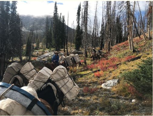
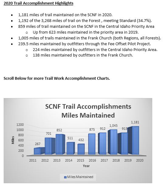
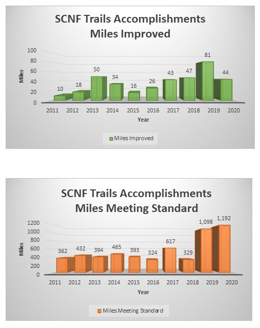
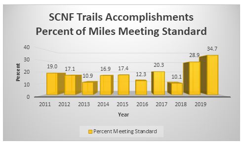
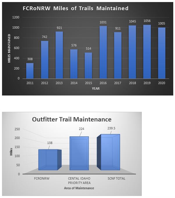
Hello – On behalf of the Salmon-Challis and our trails staff, I wanted to extend a sincere thank you to all of our partners and volunteers who helped ensure that 2020 was a successful trail work season on the Salmon-Challis! In spite of the challenges that 2020 presented us all, collectively we were able to increase the trail miles maintained on the Salmon-Challis as compared to the past several years. We were able to maintain 1,181 miles in 2020. This is in large part to work completed, organized, and championed by our partners and volunteers. As many of you know, we received a few substantial grants and earmarks from the State of Idaho and the Forest Service Washington and Regional offices in the last few years to help us maintain our trails infrastructure. In many cases your support helped secure this funding for the Salmon-Challis and for you, our partners, to complete this important trails maintenance. With the Great American Outdoors Act being past this year, the Trails Stewardship Act (2016) and other recent attention on improving trail conditions, we will continue to need your support and assistance to help solve our trails issues. Thanks again for all of your help and we look forward to working with you as we head into 2021 and beyond.
Please feel free to share with others who I may have missed.
Best,
Nick Schade
https://groups.google.com/g/salmon-area-trails-group/c/rD6J3jODmQs/m/CSB5xnP9AQAJ?pli=1
A Senate Bill (S. 1695) by Senator Mike Lee, Utah which would allow mountain bikes in designated wilderness was given a hearing in early December. NWSA and other groups wrote opposing this and other measures which would weaken wilderness protections. Read more….
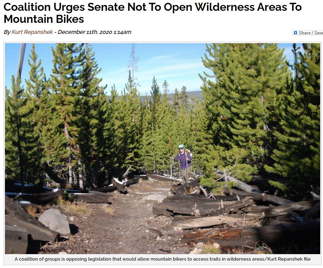
A coalition of groups is pushing to stop legislation in the U.S. Senate that would open wilderness areas to mountain bike use.
The coalition, which includes the American Hiking Society, Appalachian Trails Conservancy, National Wilderness Stewardship Alliance, and Pacific Crest Trail Association, maintains that there are enough trails open to mountain bikers without the need to allow them access to official wilderness.
“We strongly oppose S. 1695, and encourage subcommittee members to oppose this legislation as well,” the group said in a letter to U.S. Sens. Mike Lee, R-Utah, and Ron Wyden, D-Oregon, of the Senate Subcommittee on Public Lands, Forests and Mining, which has been considering the measure. “S. 1695 seeks to open federal wilderness areas to mountain biking, a clear violation of the 1964 Wilderness Act, the nation’s seminal conservation law. Most importantly, S. 1695 would threaten the character of the entire National Wilderness Preservation System by undermining our nation’s bedrock landscape conservation tool.”
Introduced by Lee in 2019, the Human-Powered Travel in Wilderness Areas Act would redefine “human travel” in official wilderness as that which does not involve a “propulsive internal or external motor with a nonliving power source.” When Lee introduced the measure, he said the access was needed to “enrich Americans’ enjoyment of the outdoors by expanding recreational opportunities in wilderness areas.”
Under the legislation, federal land managers — including the National Park Service — would be given the authority to decide whether to allow and how to regulate non-motorized travel in wilderness areas within their jurisdictions.
The Wilderness Act of 1964 prohibits the use of motor vehicles, motorized equipment, motorboats, and other forms of mechanical transport in officially designated wilderness.
In arguing againt the bill, the groups said the Wilderness Act “is more relevant today than ever before.”
“Our nation’s wilderness areas include only 5 percent of our nation’s public lands. In the lower 48 states, it’s merely 3 percent,” they noted. “The remaining 97 percent is open to motorized and mechanized recreation. Designated wilderness areas have a fundamentally different purpose than providing for motorized and mechanized access. In fact, that is the very purpose of the Wilderness Act – to provide for a few remote, pristine areas where nature prevails.”
They also pointed out that “(T)here remains a nearly inexhaustible supply of non-wilderness federal lands that are open to mountain biking and where additional mountain bike trails and opportunities continue to be created. In the last decade, new mountain biking trails have been developed at a historically rapid rate.” READ MORE
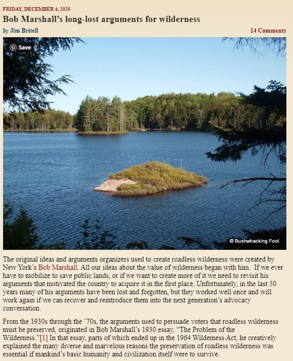
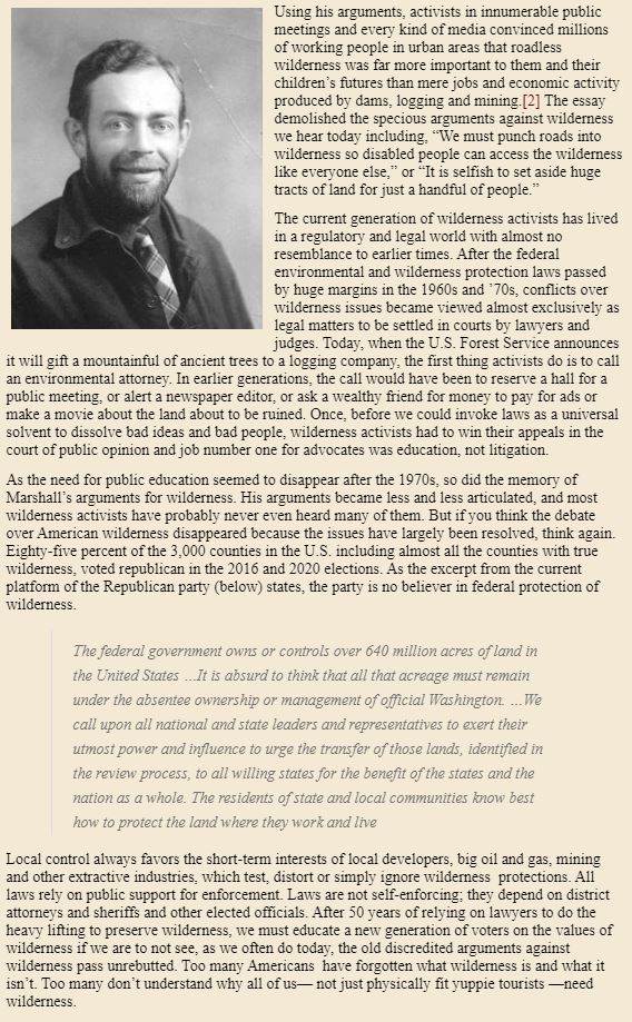
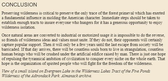
Bob Marshall: https://www.adirondackalmanack.com/2020/12/bob-marshalls-long-lost-arguments-for-wilderness.html
Boundary Waters: https://www.minnpost.com/community-voices/2020/12/saving-the-boundary-waters-is-key-to-solving-the-climate-and-extinction-crisis/
 Millions of Americans breathed a deep sigh of relief in early November when Joe Biden was elected the 46th president of the United States — not only because he signified a return to order and normalcy from the lawlessness of the Trump administration, but also because of his focus on tackling the climate change crisis. It is a gigantic task — as large an undertaking as any that mankind has faced. Opportunities have been missed and progress delayed because of political intransigence. One opportunity that we must not miss, which is before us right now, is the opportunity to protect the Boundary Waters Canoe Area Wilderness (BWCA) from the danger posed by sulfide-ore copper mining.
Banning this destructive mining from the headwaters of the Boundary Waters would deliver multiple benefits of the kind critical to addressing the climate and extinction crisis, including preserving carbon sequestration; avoiding the massive energy demand of large sulfide-ore copper mines and thus eliminating major new greenhouse gas sources; and preserving a 4.3-million-acre ecosystem that provides a refuge for species threatened by climate change.
The Boundary Waters region is vital for carbon sequestration.
The 4.3 million-acre Quetico-Superior region is primarily boreal forest. Boreal forests store more carbon than any other terrestrial ecosystem — almost twice as much per acre as tropical forests. Keeping carbon locked in these forests and out of the atmosphere is a vital part of the fight to keep warming below 2 degrees Celsius. According to a federal government report prepared for members and committees of Congress, each acre of terrestrial boreal forest stores on average about 180 tons of carbon in its vegetation and soils. Destruction of boreal forest for industrial mining is a double whammy — the release of much of that carbon into the atmosphere and the loss of the capacity of the land to take up carbon in the future. The loss is even greater if wetlands are destroyed. Soil carbon levels in wetlands are nearly double the level in the terrestrial boreal forest.
Mechanical destruction of vegetation and soil is not the only harm that would result from permitting copper mining; the carbon storage assets of the Boundary Waters region (surface vegetation, soils, wetlands, and peatlands) are incredibly vulnerable to acid mine drainage – the water pollution that inevitably results from sulfide-ore mining.
Protecting the Boundary Waters is critical for greenhouse gas emission avoidance.
A leading ally of Chilean mining conglomerate Antofagasta, which seeks to develop the Twin Metals copper mine, is Minnesota Power, a local utility that feeds a group of energy-devouring industrial customers. According to MinnPost, 74 percent of Minnesota Power’s electricity is sold to six taconite mines and four paper and pulp mills. Just one taconite mine alone needs roughly the same amount of energy as the City of Minneapolis. Minnesota Power is aggressively seeking to grow its industrial customer base with a Twin Metals copper mine next to the Boundary Waters. Although Minnesota Power has started to shift away from carbon, it has two coal-fired generators (Boswell plant), is seeking to build a $700 million gas plant, and may re-commission a coal-fired plant on the North Shore of Lake Superior.
An estimate of greenhouse gas emissions, based on a 2014 Prefeasibility Report for the proposed Twin Metals mine, is 23,444,730 metric tons of CO2 over a 20-year life of the mine. This is equal to greenhouse gas emissions from adding nearly 5 million passenger vehicles to the roads for one year.
The Boundary Waters is crucial for climate adaptation and resilience.
The Wilderness Society identified 74 places in the United States that are crucial to our ability to sustain biodiversity in the face of a changing climate. These areas have three essential characteristics: (1) an especially high degree of wildness; (2) connectivity to existing protected areas; and (3) diversity of unprotected species and ecosystem types. The analysis found that the Quetico-Superior region is one of the top places in the nation with this “Wildland Conservation Value.”
A recent study by The Nature Conservancy with similar findings underscores the necessity of keeping these areas intact and undeveloped. Consistent with this, The Nature Conservancy, The Conservation Fund, and The Trust for Public Land have acquired large swaths of land across northern Minnesota to keep them protected. Allowing the creation of an industrial mining zone in the watershed of the Boundary Waters would undermine the work that these and other organizations are doing to prepare us for the future.
The Boundary Waters — the heart of the Quetico-Superior region — is a vitally important regional and national asset. It is the most visited wilderness area in the United States. It is the largest wilderness area east of the Rocky Mountains and north of the Everglades. Sacrificing this unique and vital region to sulfide-ore copper mining would destroy not only an irreplaceable recreational and economic treasure, but what is also one of our best natural assets in the fight against climate change.
Becky Rom of Ely, Minnesota, is the national chair of the Campaign to Save the Boundary Waters.

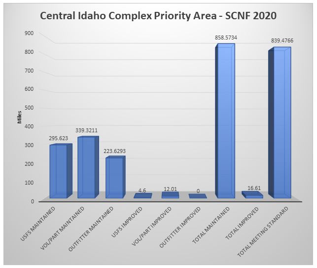
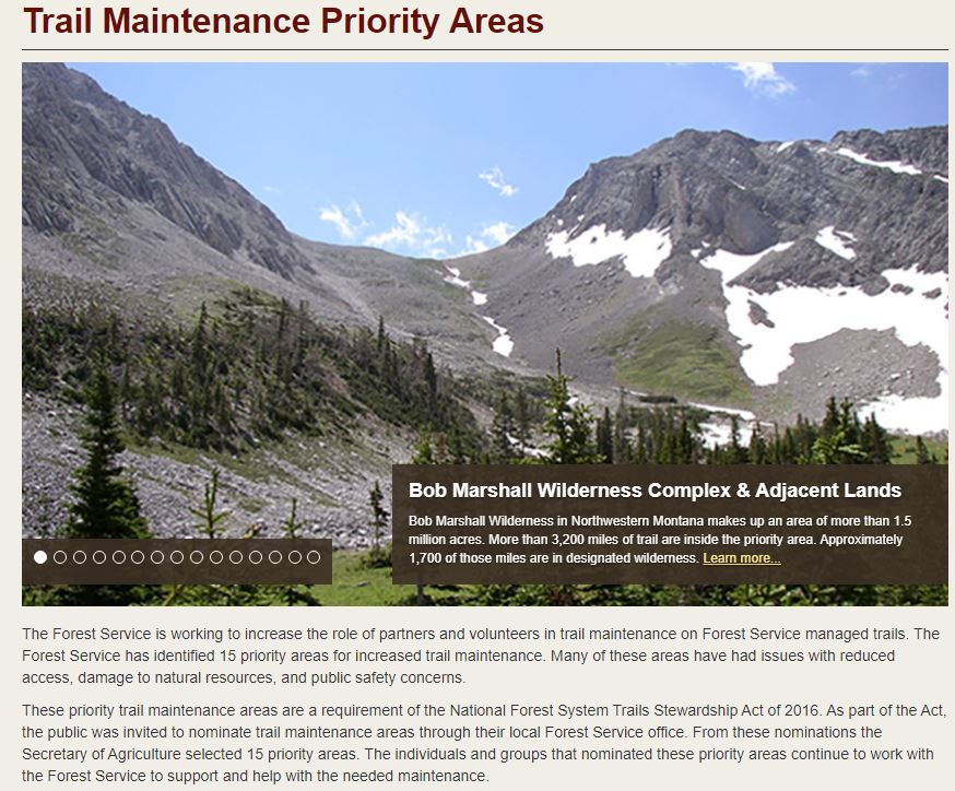
People visit this area to experience the serenity and solitude of wilderness in the largest complex of congressionally designated wilderness areas in the lower 48 states. The designated wilderness areas in this priority area include the Frank Church-River of No Return, Gospel Hump, and most of the Selway-Bitterroot wilderness.
The majority of the 9,200 miles of trails in the priority area are in remote locations that make access to conduct routine trail maintenance difficult. Portions of the trail are currently impassable due to substantial deadfall and landslides created by wildfires and wind events.
The trail maintenance backlog and the impacts of wildfires have inspired the cooperation of wide-ranging organizations and entities in support of the trail system to improve public access. Together, the Nez Perce-Clearwater, Bitterroot, Payette, Boise, and Salmon-Challis National Forests and partners are meeting challenging conditions by leveraging limited federal trail maintenance budgets.
Download a map of the trail maintenance priority area (PDF)
Examples of Trail Maintenance Needs
- Remove hazard trees and logs over the trail
- Remove overgrown brush
- Repair and replace drainage structures
- Conduct general trail maintenance
- Complete trail reconstruction and reroutes
Our Partners
Partners supporting this priority area include:
- Idaho State Trail Ranger Program (Idaho State Department of Parks and Recreation)
- RTP Grants (Idaho State Department of Parks and Recreation)
- Idaho Department of Fish and Game
- Idaho Conservation League
- Idaho Outfitters and Guides Association
- Licensed and Permitted National Forest Outfitters
- Boise Forest Coalition
- Selway-Bitterroot Frank Church Foundation
- Idaho Trails Association
- Clearwater Basin Collaborative
- Backcountry Horsemen of Idaho
- Idaho Aviation Association
- Conservation Corps
- Montana Conservation Corps
- Idaho Conservation Corps
- Motorized User Groups
- Dust Devils
- High Mountain Trail Association
- High Country Snowmobile Club
- Idaho Pathfinders Association
- Valley Cats Snowmobile/ATV Club
- Lewis and Clark ATV Club
- Public Land Access Year-Round, PLAY
Learn More & Get involved!
To know more about trail maintenance efforts in this priority area, contact:
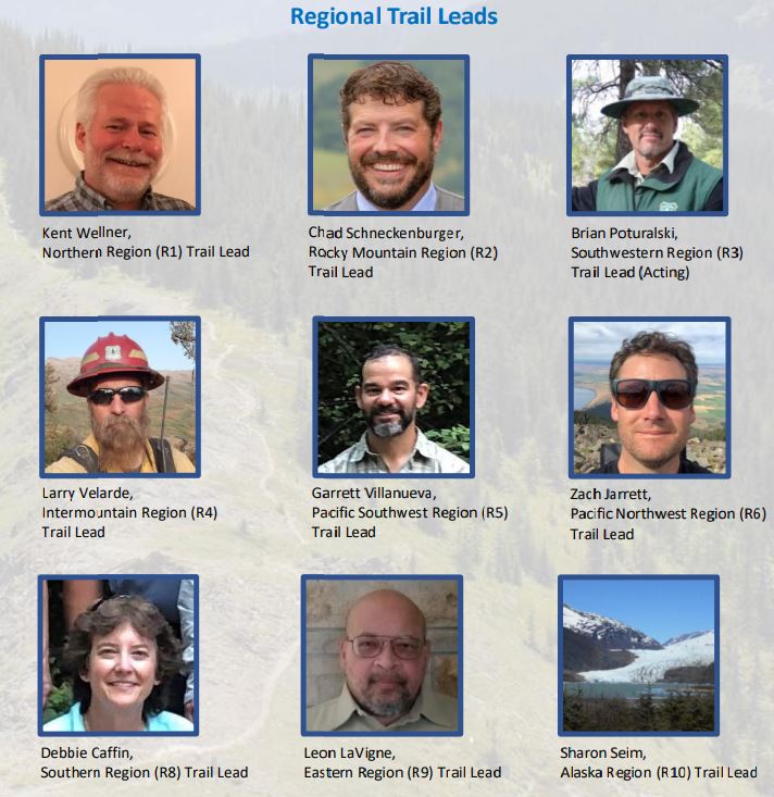
Kent Wellner, Regional Trail Leader
Email: kent.wellner@usda.gov
Phone: (406) 329-3150
Larry R. Velarde, Regional Trail Leader
Email: larry.velarde@usda.gov
Phone: (801) 625-5205
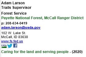
Adam Larson, Trails Supervisor
Payette National Forest, McCall Ranger District
p: 208-634-0419 adam.larson@usda.gov
Savannah Steele, Trail Supervisor
Boise National Forest, Lowman Ranger District
P: 208-259-3726 Savannah.Steele@usda.gov
Jascha Zeitlin, Recreation Specialist
Payette National Forest, West Zone
p: 208-549-4224 Weiser Ranger District
p: 208-253-0113 Council Ranger District
c: 801-831-9459 jascha.zeitlin@usda.gov
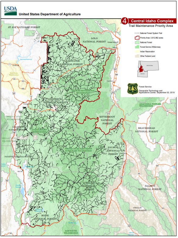
Great American Outdoors Act Virtual Sensing Opportunity
The USDA Forest Service is moving forward with implementation of the Great American Outdoors Act, which will enable federal land managers to take aggressive steps to address deferred maintenance and other infrastructure projects on national forests and grasslands through 2025.
The Forest Service will use these funds to maximize the benefits experienced by millions of Americans who visit and use their national forests. Projects funded by this act will focus on improving conditions on forest and rangelands, reducing wildfire risk, and increasing the resiliency of our nation’s forests for present and future generations.
The Forest Service is inviting the public to provide feedback on the projects that are under consideration to be prioritized for funding in Fiscal Year 2022. This opportunity is intended to serve only as a virtual listening session via solicitation of public feedback. Feedback provided will become part of the project record. A response to the feedback submitted during this opportunity will not be provided. Projects selected for funding will be compliant with the National Environmental Policy Act. Public notification and engagement on the selected projects will occur as required by regulation.
The following is a list of proposed projects for the Intermountain Region. Your feedback is requested by Nov. 30, 2020.
Please note that this project list includes projects submitted for funding consideration under the agency’s National Asset Management Program, which includes funding available under the Capital Improvement and Maintenance and Federal Land Transportation Program.
The public has until Nov. 30, 2020 to review and provide feedback on the proposed list. For more details on how to submit your feedback, visit: https://cara.ecosystem-management.org/Public/CommentInput?project=NP-2648.
News Release: USDA Forest Service Invites Public Feedback on Proposed List of Deferred Maintenance Projects for Fiscal Year 2022


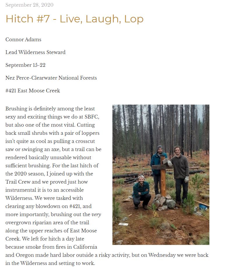
For the last hitch of the 2020 season, Lead Wilderness Steward Connor Adams – Nez Perce-Clearwater National Forests – joins up with the Trail Crew to untangle blowdowns and clear brush on the #421 trail. While exploring the headwaters of East Moose Creek, Connor and crew improvise tools and attest to the necessity of brushing for Wilderness accessibility.
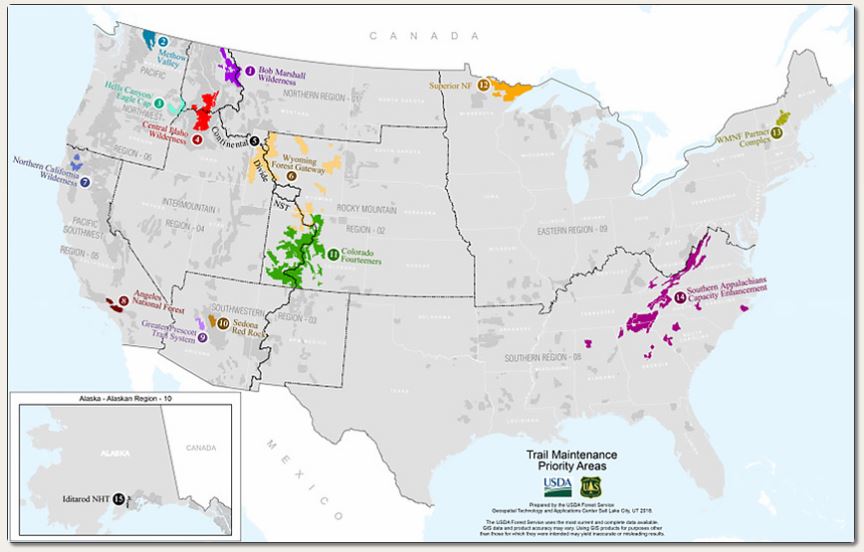
Priority Areas
Please check back for additional information and updates on each priority area.
- Bob Marshall Wilderness Complex & Adjacent Lands
- Methow Valley Ranger District
- Hells Canyon National Recreation Area/Eagle Cap Wilderness
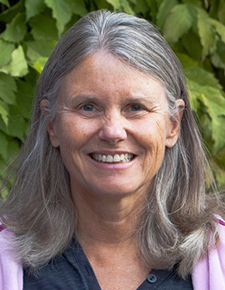
- Central Idaho Complex
- Continental Divide National Scenic Trail
- Wyoming “Forest Gateway Communities”
- Northern California Wilderness Areas: Marble Mountain & Trinity Alps
- Angeles National Forest
- Greater Prescott Trail System
- Sedona Red Rock Ranger District Trail System
- Colorado Fourteeners
- Superior National Forest Trails
- White Mountain National Forest Partner Complex: “200 Years of Community Trail Stewardship”
- Southern Appalachians Capacity Enhancement Model
- Iditarod National Historic Trail “Southern Trek”


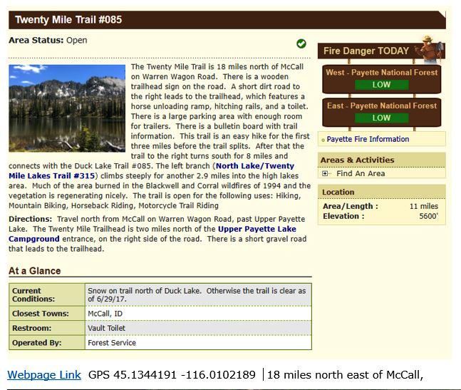
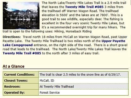
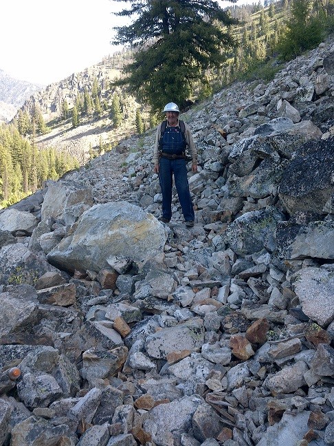
 On Tuesday afternoon July 7th Tom Zahradnicek, Mike & Karen Heilman and Rob Adams meet at the 20 mile creek trail head on the east end of upper Payette lake north east of McCall. The purpose of this project was to work on clearing the down fall on the trail that climbs to five mountain lakes that branches off trail 085. We were joined by Adam Larson from the McCall ranger district. Also working the trail out of this trail head were members of the Montana Conservation Corps that were working on the lower trail for the next 14 days.
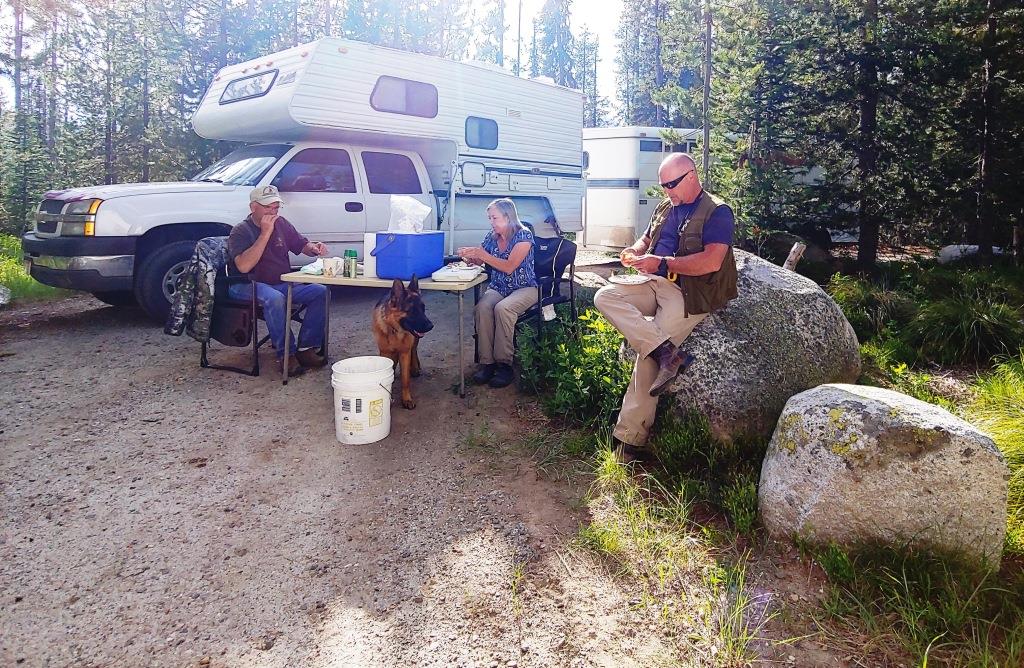
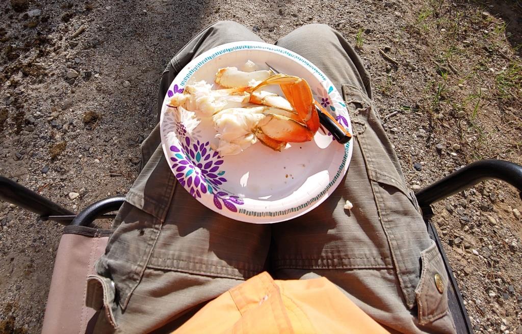
Due to covid-19 we planned to not do group food, but Tom had just come back from the coast with a cooler full of fresh dungeness crab which he generously shared with the group, this is ruffing it!
The plan was to meet Adam at the trail head at 08:00 Wednesday with the stock all saddled and packed and be on the trail by 08:30. We all know that this NEVER happens, but on this day it did! While Karen stayed with their dog the four of us headed up the trail. After scouting the lower trail, Mike turned back to get Karen to go on a ride and Tom, Adam and Rob continued to the cut-off for the lakes trail.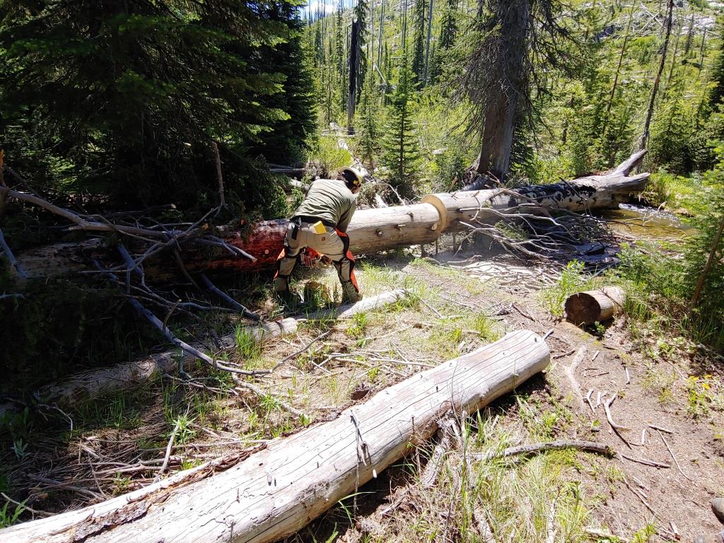

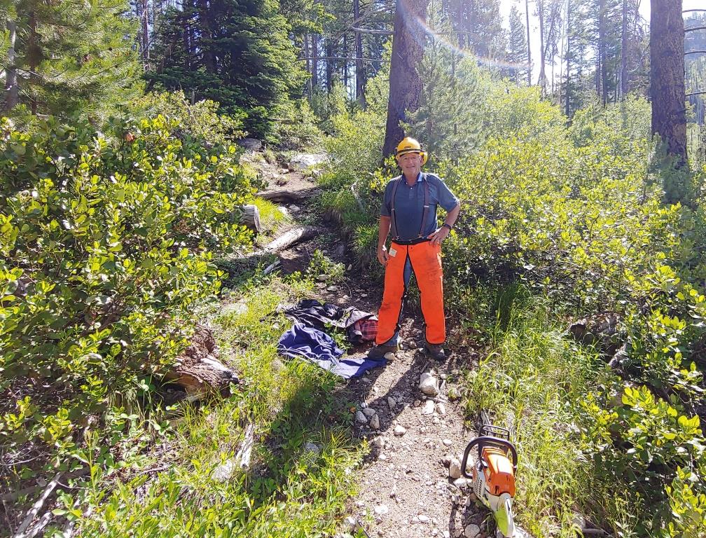


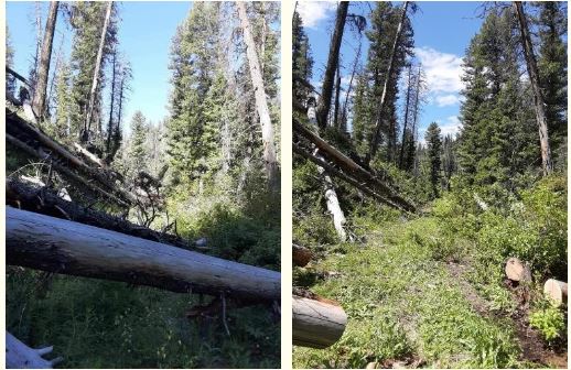
The minute we turned on that trail we encountered the first of over 50 downed trees that we removed during the 10 hours we were on the trail
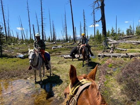

We rode out dead tired but completed the project and had a great time doing it!
Details: Min Alt 5,731 Max Alt 7,716 Miles on the trail 12 Time on the trail 9:48
From: Blake, Jennifer B -FS <jennifer.b.blake@usda.gov>
Squaw Butte members
Thanks so much for the work you and your crew did on the Twenty Mile Trail on the McCall Ranger District. This is a beautiful and high use area and your work will enable hundreds of people to enjoy this area. We certainly could not keep up with all the work without your help.
Thanks, Jenni Blake

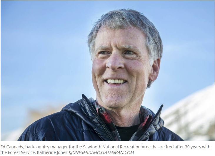
In March 2019, I retired after a 30-year career as a backcountry recreation manager for the Sawtooth National Recreation Area. In that position, I helped design and lay out many trails including, as my last major trails project, the Galena Summer Trails Network at Galena Lodge.
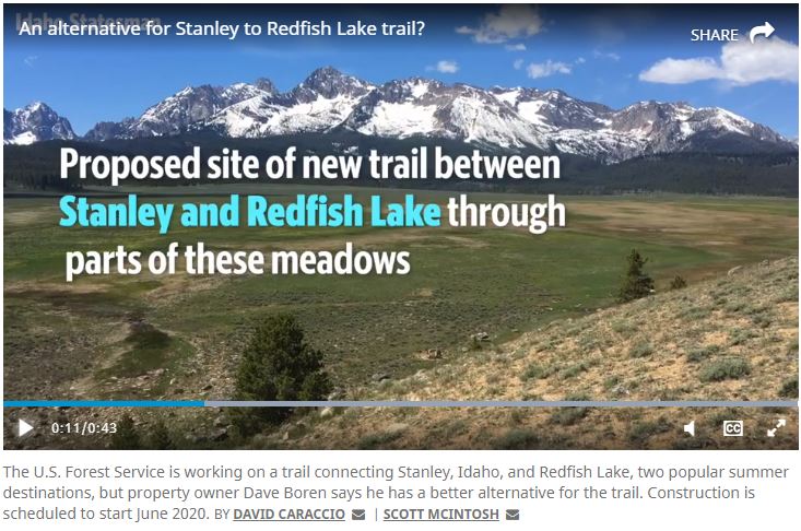
Based on that experience, I can guarantee that no competent trails designer and few incompetent ones would even consider the trail location along State Highway 75 proposed by Mr. David Boren in the June 14 article in the Idaho Statesman.
In 2005, the Sawtooth National Recreation Area purchased a trail easement across private land now owned by Mr. Boren in the location determined to provide the best recreation opportunity, emphasizing the world-class views of the Sawtooths and ease of trail construction. The trail on the easement is vastly preferable for recreationists who can enjoy the views of the Sawtooths for the entire length of this section of the trail rather than just a short portion of the Boren proposal.
The recreation opportunity provided by the highway trail would not even resemble a desirable experience, and construction of a trail on the extremely steep loose slopes above the highway is impractical in the extreme. The problems with the highway trail, for both construction and experiential reasons are too numerous to mention in the space I have here, but I would eagerly walk both routes with anyone who would like to discuss them.
As to the easement trail’s effects on sandhill crane nesting, the bench is not nesting habitat. Sandhill cranes prefer to nest in riparian areas, not open sagebrush areas. And while elk do use the bench, they are active in the early morning and late evening when use of the trail would be minimal.
The idea that Mr. Boren is concerned about the view of the Sawtooths is a bit confusing, considering that he is building a monster house directly front and center of that view. The few people who get married at the Sawtooth Meditation Chapel and would see the trail, as pointed out by Mr. Boren, pales in comparison to the hundreds of thousands who will have their view marred by his mansion. And I will point out that the land in the foreground of the chapel slopes away from the building and recedes from view quite quickly. And if Mr. Boren does really care about the view, how hard did he try to convince his brother to not build his own mansion, again, front and center of the view of the Sawtooths?
Mr. Boren’s excitement for the view of the Sawtooths that he felt as a child is exactly why the Forest Service is building the trail on the easement, not along the highway. I believe in the power of landscape to inspire people. To spend time immersed in awe can be transformative. I experienced it and over the course of my career in the Sawtooths I had contact with many many others who did, as well. That opportunity for awe is ever-present on the easement trail and is woefully absent from the highway trail.
There is wealth in this landscape. Not wealth that can be measured in dollars and cents, but wealth that fills people’s souls and moves them to greater heights. Science increasingly documents this, and the easement trail provides it; the highway trail decidedly does not. The American people paid for the right to build this trail where it provides the most benefit. Let’s not allow the wealth of “a Boise tech company success story” to deny them that.
Ed Cannady retired last year after working for the U.S. Forest Service for 30 years, many of them as backcountry manager for the Sawtooth National Recreation Area.
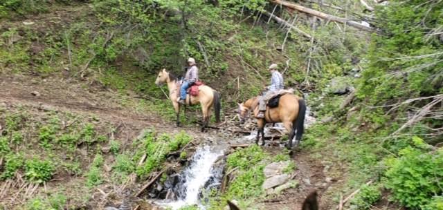
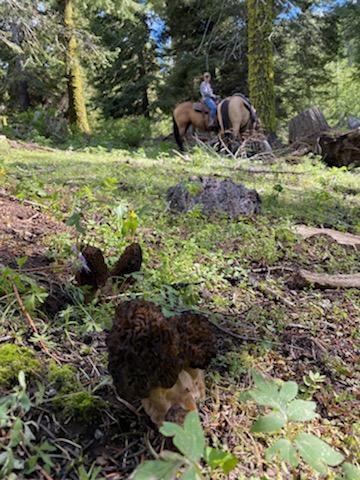
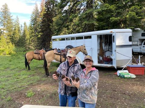 Nine members of Squaw Butte met at the Hitt Mountain Trail Head on Saturday morning June 20, 2020. This trail head is about 15 miles south west of Cambridge Idaho on the Idaho side of Hell’s Canyon. The purpose of this project was to do trail maintenance on a number of trails out of this trail head. Some of the members arrived on Friday and took a quick ride and discovered that the Morel’s were up and on this weekend after all the rain, big and plentiful. So morel hunting became the focus if there were no down trees in the way
How to Safely Identify and Harvest Morels
How to Preserve Morel Mushrooms
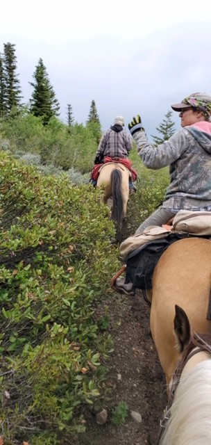
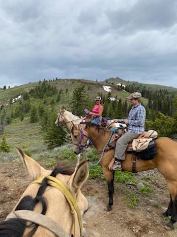

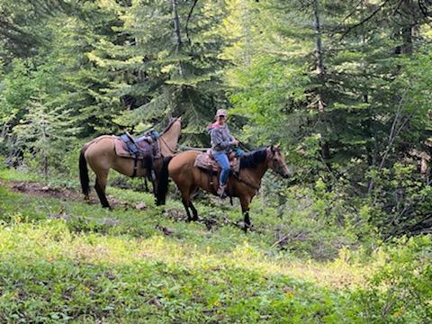
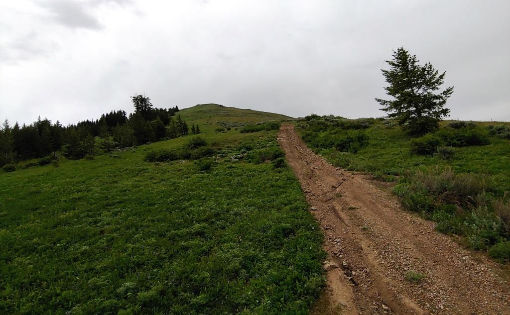
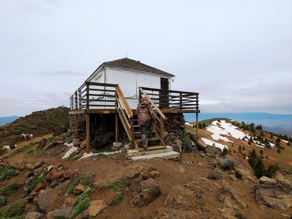
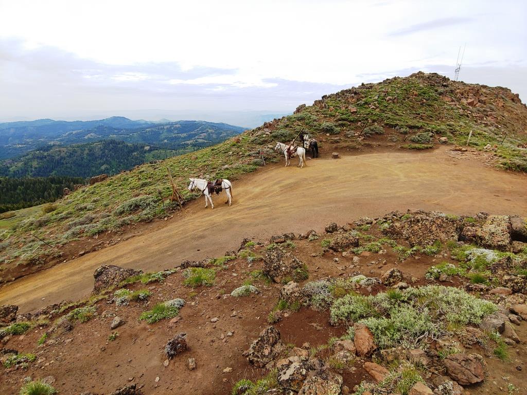
The trails we worked are highlighted in yellow. The total distance of this loop is 11.2 miles with a 4000 foot elevation change. The highlights of this ride are the great views, wild flowers, stream crossings and the fire lookout! We remove five trees during our ride and found more morel’s.
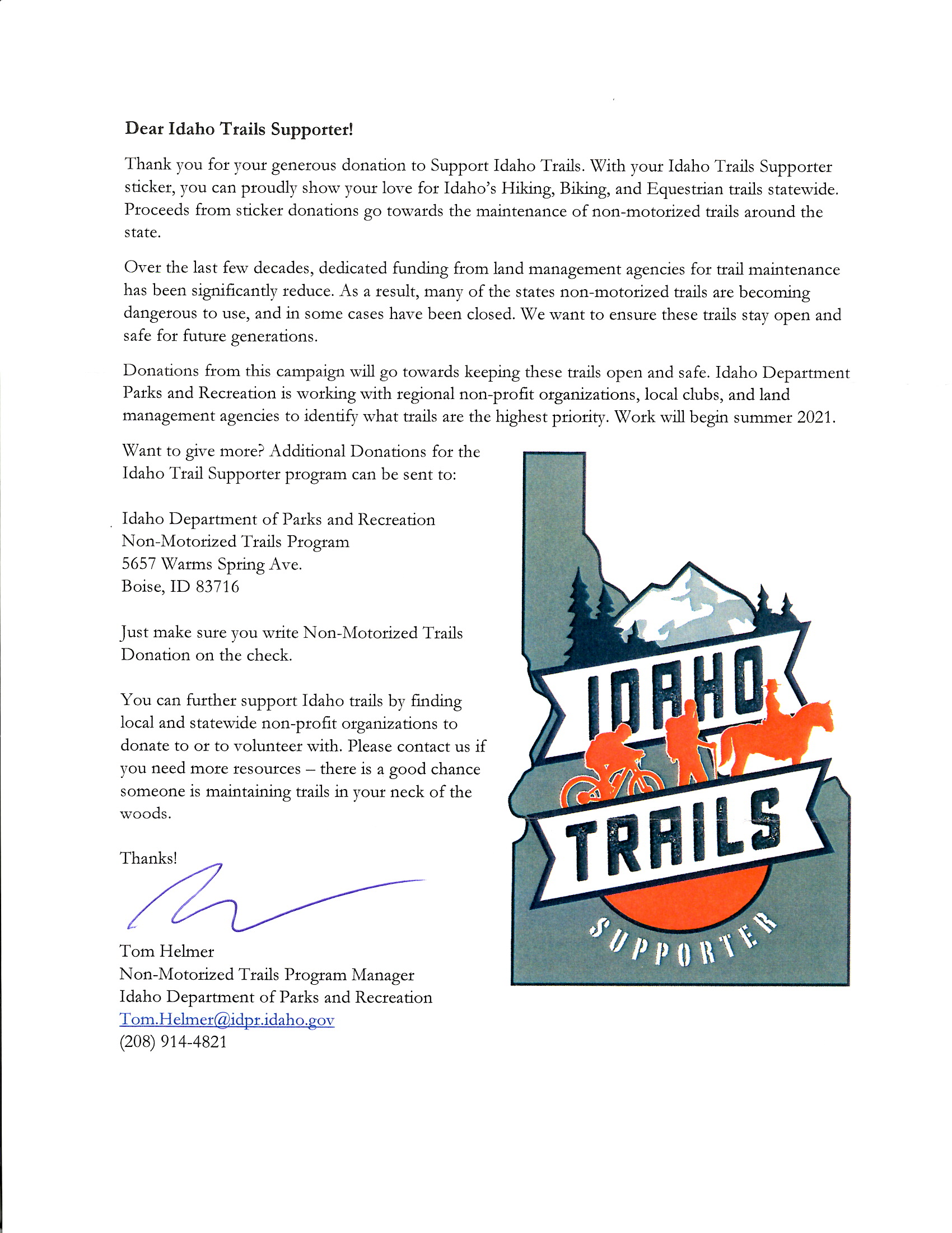
EPSON MFP image

Click on Picture or HERE to read
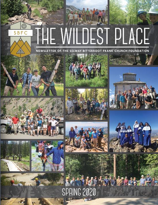
Hello Wilderness advocates!
I hope this note finds you and your loved ones healthy and enjoying the outdoors.
Once again, we are adapting to our circumstances. The printer we normally use to print/mail the newsletter remains closed.
We are delivering the Spring 2020 edition of the newsletter to your inbox rather than your mailbox. We’ve put the newsletter in a format that we hope you enjoy. You can electronically turn the pages as you would our printed newsletter. Just click on the side arrows to turn the pages! You can access the newsletter by clicking on the button below! I hope you enjoy reading it as much as we enjoyed putting it together.